Nearest Ranger Station: Gunflint Ranger Station, Grand Marias, MN
Portage Length from Parking Lot: None
Restroom at Entry Point: Yes (in the campground)
Entry Point 68 - Pine Lake
Gunflint Ranger District
Directions:
From Grand Marais, Minnesota, take MN-61 north for 19.0 miles.
Turn left onto the Arrowhead Trail (County Road 16)
Follow the Arrowhead Trail north for 18.0 miles to the McFarland Lake Campground. The BWCA Entry Point 68 parking lot is in the campground
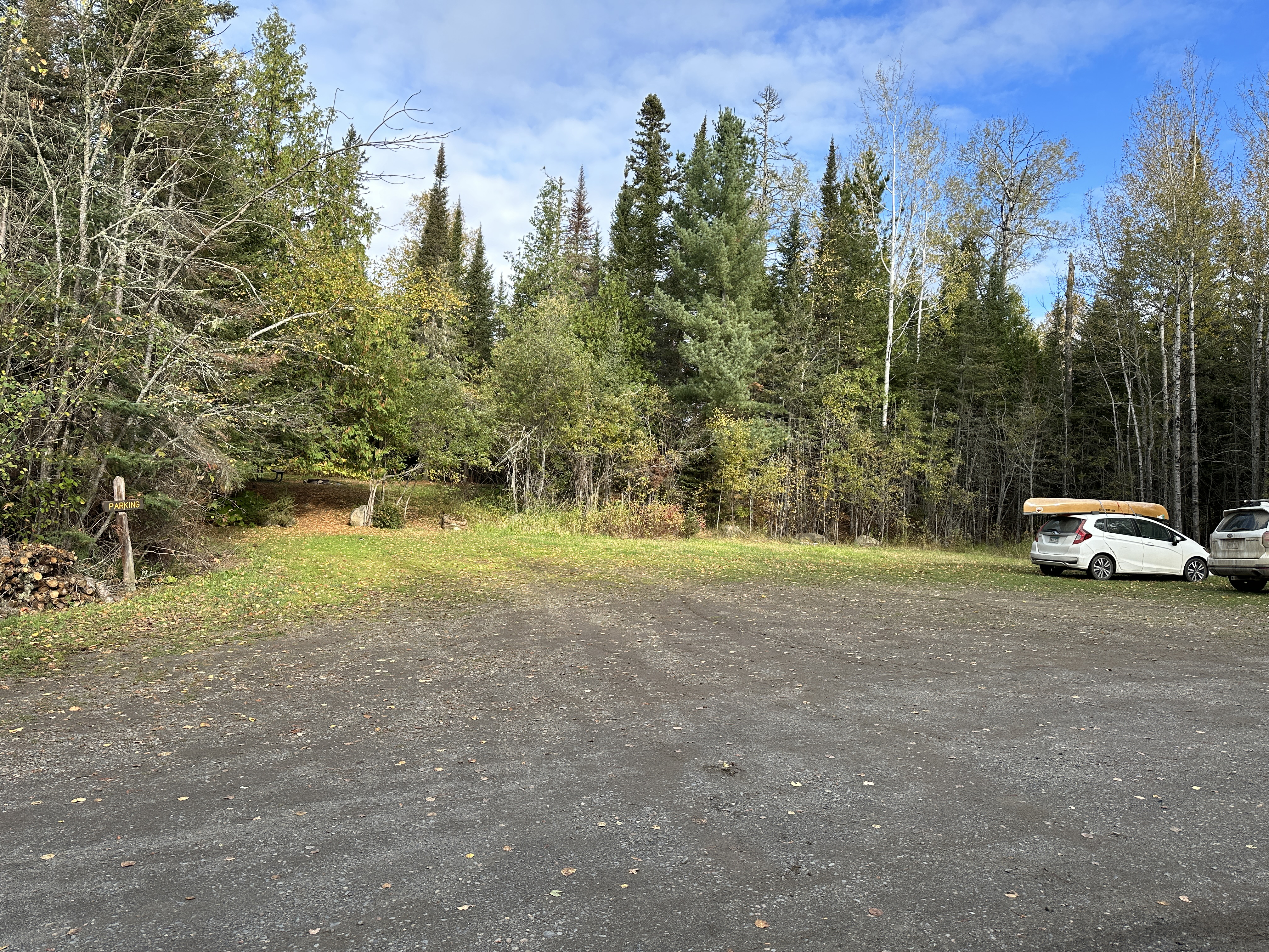
There are five BWCA entry points accessible from the McFarland Lake Campground. The parking area for BWCA Entry Point 68 - Pine Lake is right next to McFarland Lake and is within the actual campground. Where the Arrowhead Trail road splits, go left into the campground. For BWCA Entry Point 69 and 70, the parking lot is on Little John Lake just before the bridge. These two entry points share the same parking lot. Where the road splits, you would stay right to get to these two entry points (don't go into the campground). You can easily make a short walk through the campground area to get to any of the entry point landings. Note that BWCA Entry Point 83 - Border Route Trail (East) also shares this parking lot. Finally the parking lot is also used by people hiking the North Country National Scenic Trail. For those people hiking the North Country National Scenic Trail and doing a through hike of the BWCA (combined Border Route Trail and Kekekabic Trail), you need a BWCA Entry Point 90 - NCT - East (Thru-hike) permit.
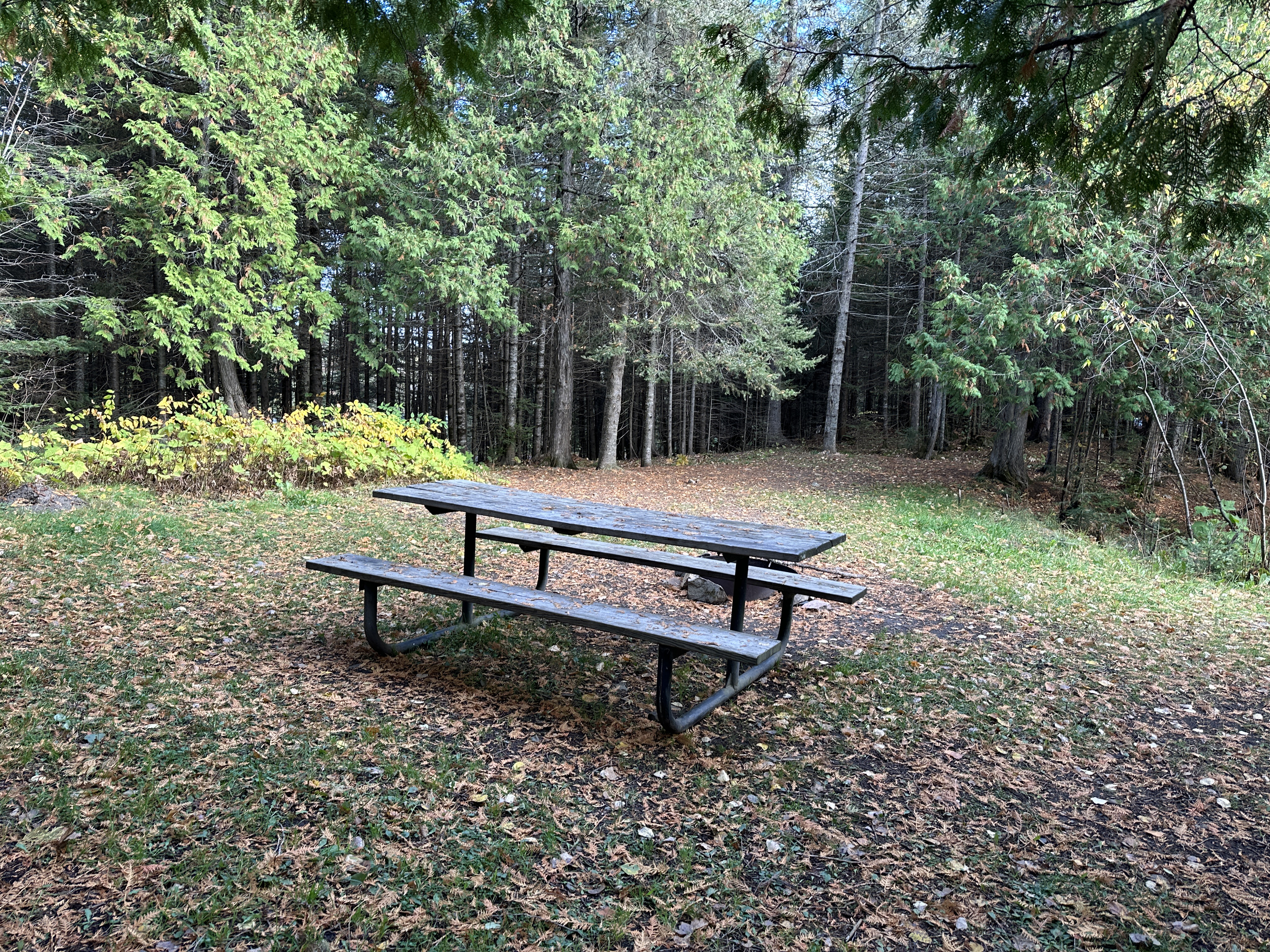
The McFarland Lake Campground has about eight campsites. This is a primitive campground with few amenities. There is a restroom. Each campsite has an open area with a fire ring and picnic table (trestle table). The campground sites are available on a first-come, first-served basis.
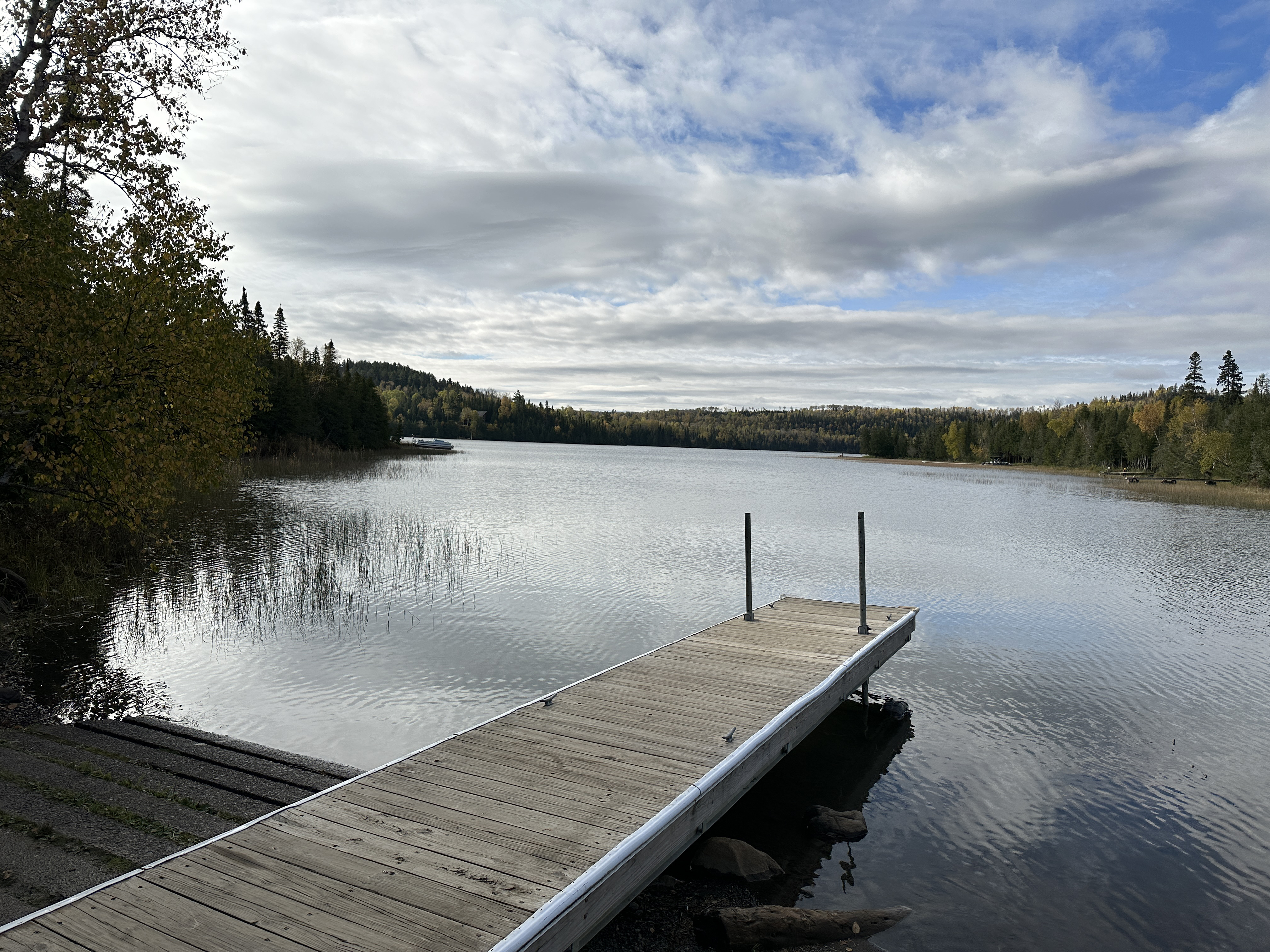
You can only go one direction with a BWCA Entry Point 68 permit and that is towards Pine Lake. To reach Pine Lake you must paddle most of the length of McFarland Lake. The distance is about 2.5-miles. McFarland is a scenic lake with a lot of cabins along its north shoreline. There is a liftover portage from McFarland Lake into Pine Lake. There is a campsite right next to this liftover (BWCA Campsite 754). Pine Lake is a large body of water. Be cautious on this lake, especially when it is windy or the water is cold. A strong west wind can really get the lake rolling.
Note that you cannot use a BWCA Entry Point 68 permit for Pine Lake to paddle north up through Little John Lake and John Lake. If you want to do a loop route and return to this entry point, you must head west across Pine Lake and then loop back through other lakes (i.e., Clearwater Lake, West Pike Lake, East Pike Lake, John Lake, Little John Lake).
There are a couple of nice loops you can make from this entry point.
Loop 1: McFarland Lake to Pine Lake to Little Caribou Lake to Caribou Lake to Clearwater Lake to West Pike Lake to East Pike Lake to John Lake to Little John Lake back to the entry point.
Loop 2: For a bit larger loop: McFarland Lake to Pine Lake to Little Caribou Lake to Caribou Lake to Clearwater Lake to Mountain Lake to Moose Lake to North Fowl Lake to the Royal River to John Lake to Little John Lake and back to the entry point.
Exploring the Entry Point
Click on the photos below to see the full resolution image - Use your browsers back button to close photo and return to this page.