Nearest Ranger Station: Gunflint Ranger Station, Grand Marais, MN
Portage Length from Parking Lot: None
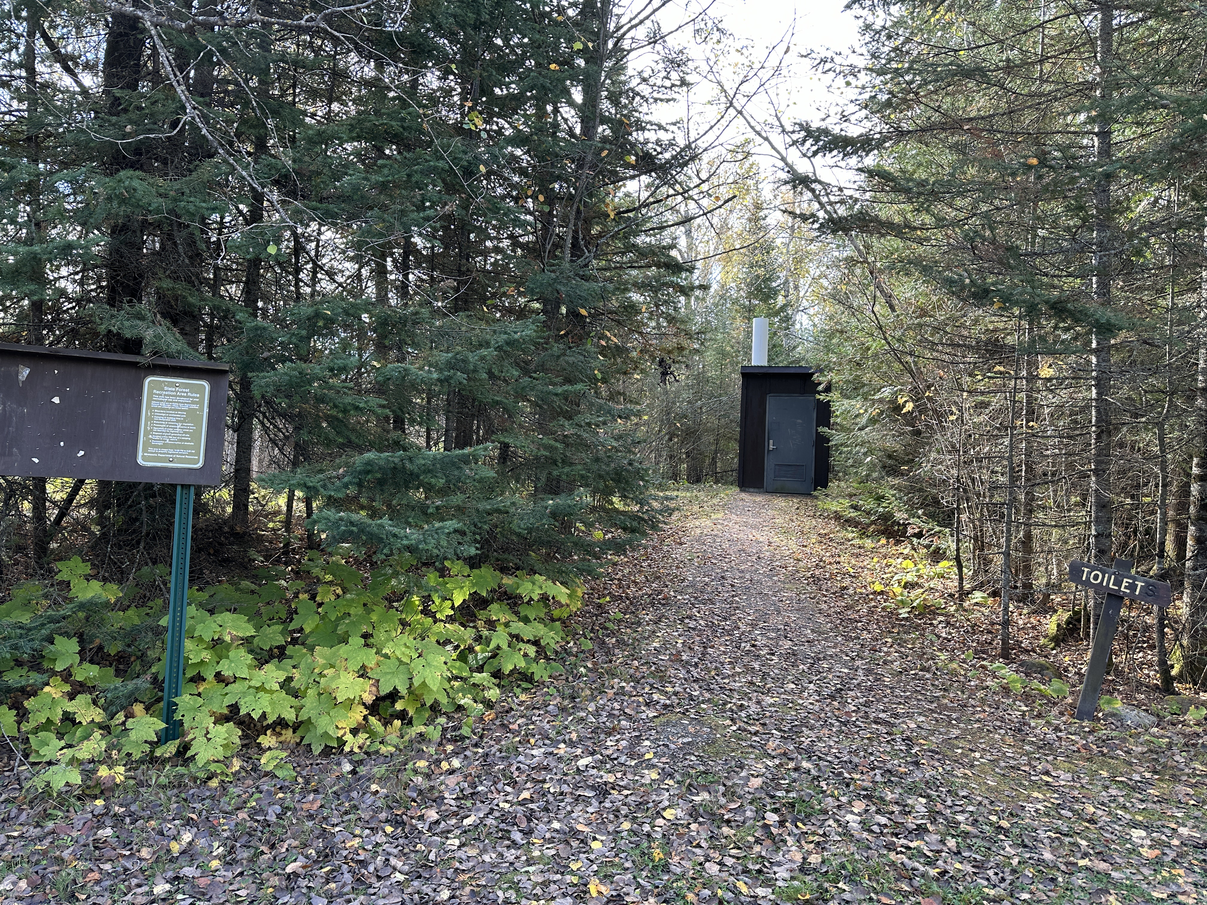
Restroom at Entry Point: Yes
Entry Point 70 - North Fowl Lake
Gunflint Ranger District
Directions:
From Grand Marais, Minnesota, take MN-61 north for 19.0 miles.
Turn left onto the Arrowhead Trail (County Road 16)
Follow the Arrowhead Trail north for 18.0 miles to the McFarland Lake Campground. Stay right at the split (don't go into the campground). The parking lot is just a few hundred feet further down the road on the right side.
There are five BWCA entry points accessible from the McFarland Lake Campground. The parking area for BWCA Entry Point 68 - Pine Lake is right next to McFarland Lake and is within the actual campground. Where the Arrowhead Trail road splits, go left into the campground to reach that entry point. For the other four entry points, stay to the right (and don't go into the campground).
For BWCA Entry Point 69 and 70, the parking lot is on Little John Lake just before the bridge. These two entry points share the same parking lot. Where the Arrowhead Trail road splits, you would stay right to get to these two entry points. You can easily make a short walk through the campground area to get to any of these entry point landings. Note that BWCA Entry Point 83 - Border Route Trail (East) also shares this parking lot. This entry point is used if you are going to hike the Border Route Trail. Finally the parking lot is also used by hikers who are hiking the North Country National Scenic Trail, of which the Border Route Trail is now a part of. For those people hiking the North Country National Scenic Trail and doing a through hike of the BWCA (combined Border Route Trail and Kekekabic Trail), you need a BWCA Entry Point 90 - NCT - East (Thru-hike) permit.
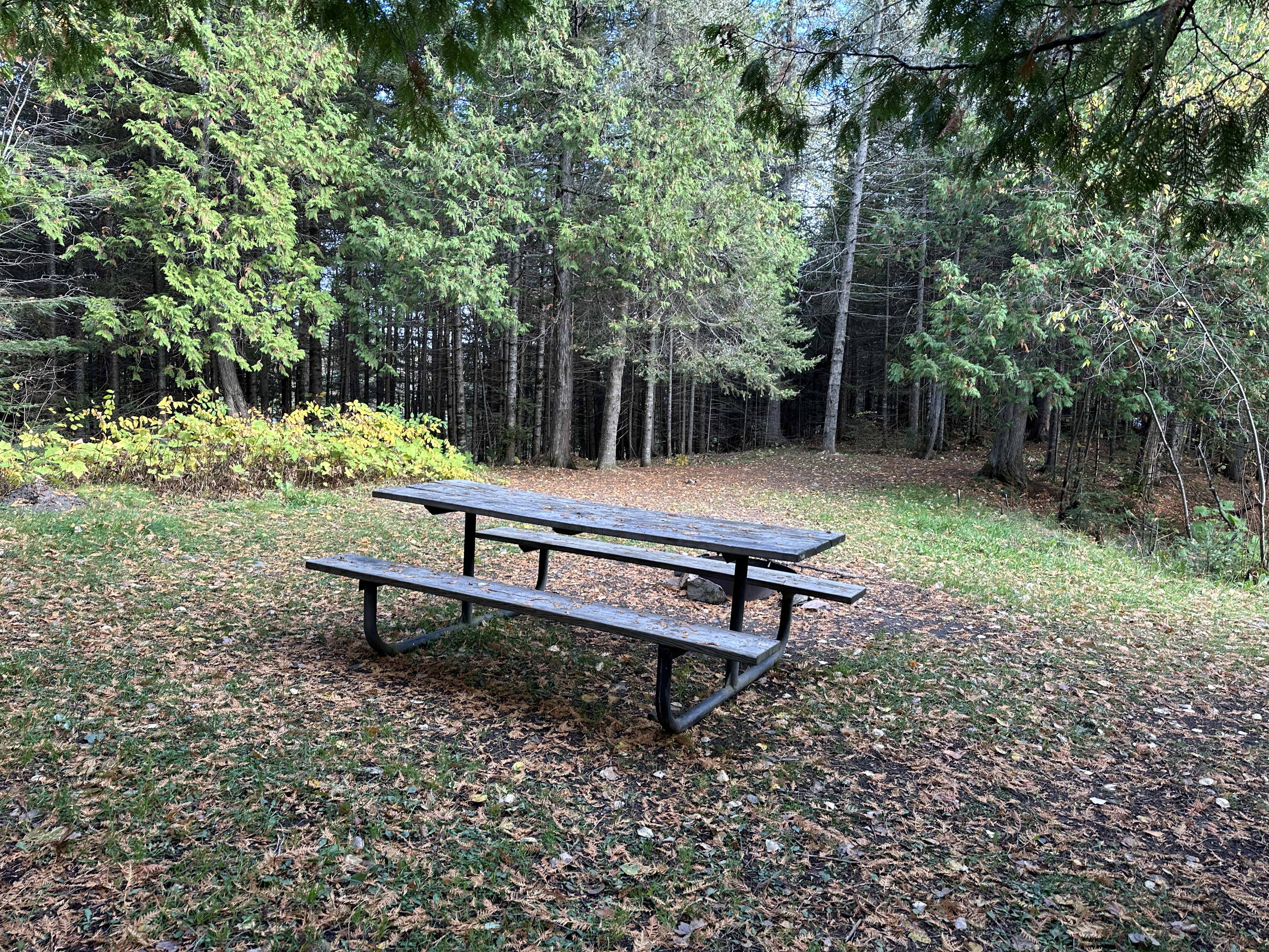
The McFarland Lake Campground has about eight campsites. This is a primitive campground with few amenities. There is a restroom. Each campsite has an open area with a fire ring and picnic table (trestle table). The campground sites are available on a first-come, first-served basis.
This permit requires that you head first to John Lake, then downstream along the Royal River until you reach it's mouth at North Fowl Lake. Upon arrival at that lake, you must turn left (north) with the only route option being the portage into Moose Lake. You cannot camp on John Lake.
Exploring the Entry Point
Click on the photos below to see the full resolution image - Use your browsers back button to close photo and return to this page.
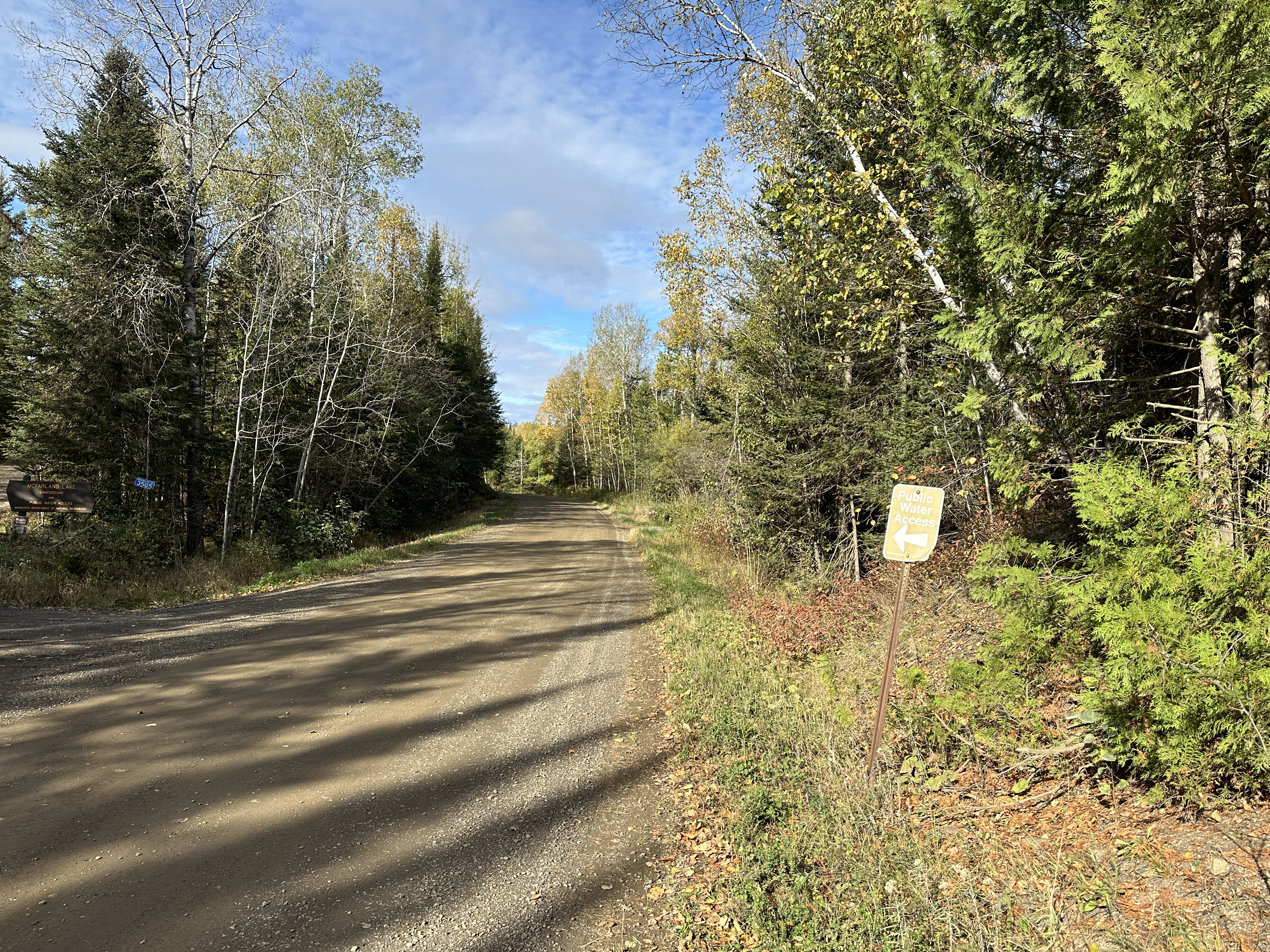
Turn off sign along the Arrowhead Trail (October 8, 2023).
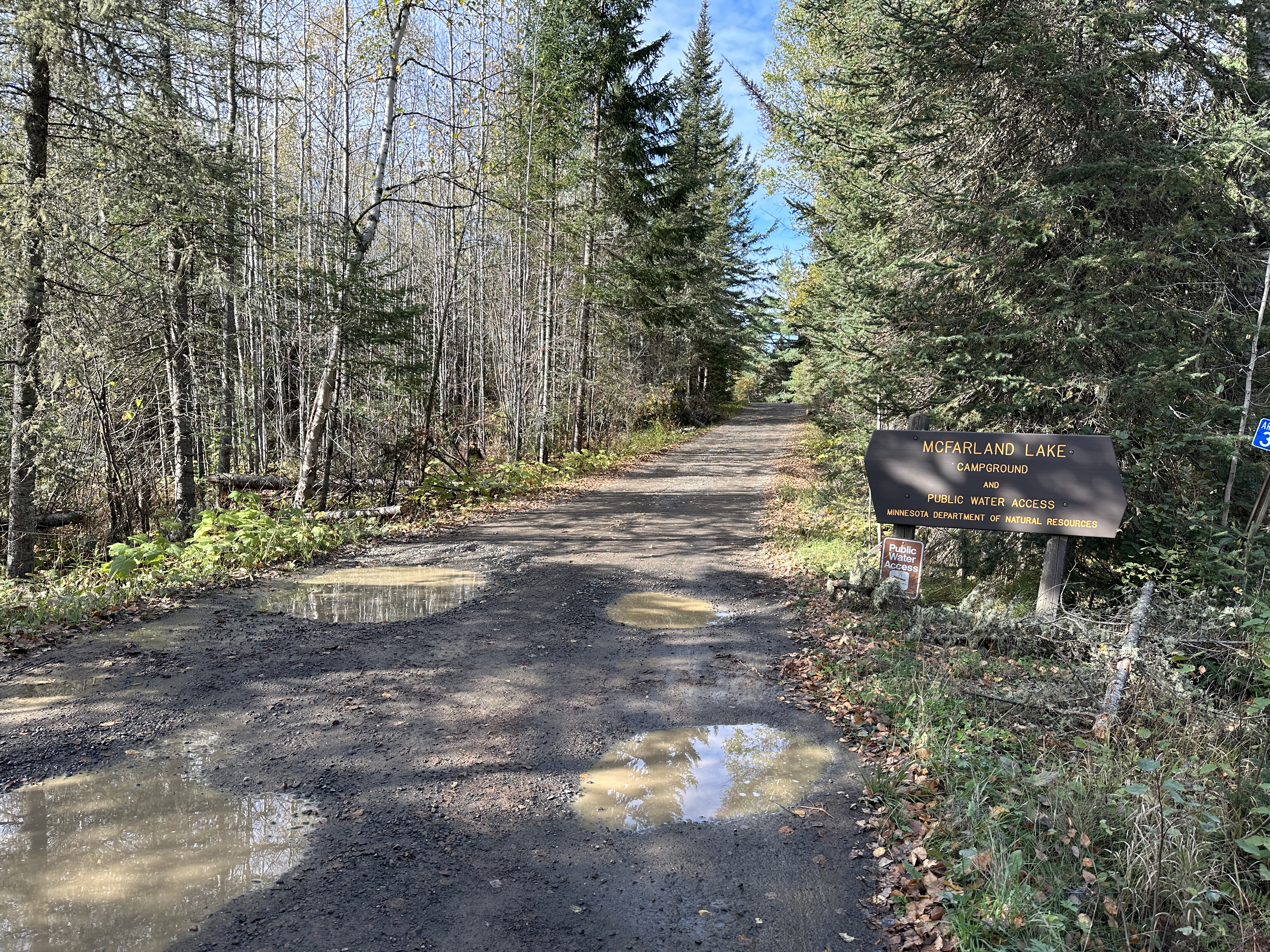
The McFarland Lake Campground access road (October 8, 2023).
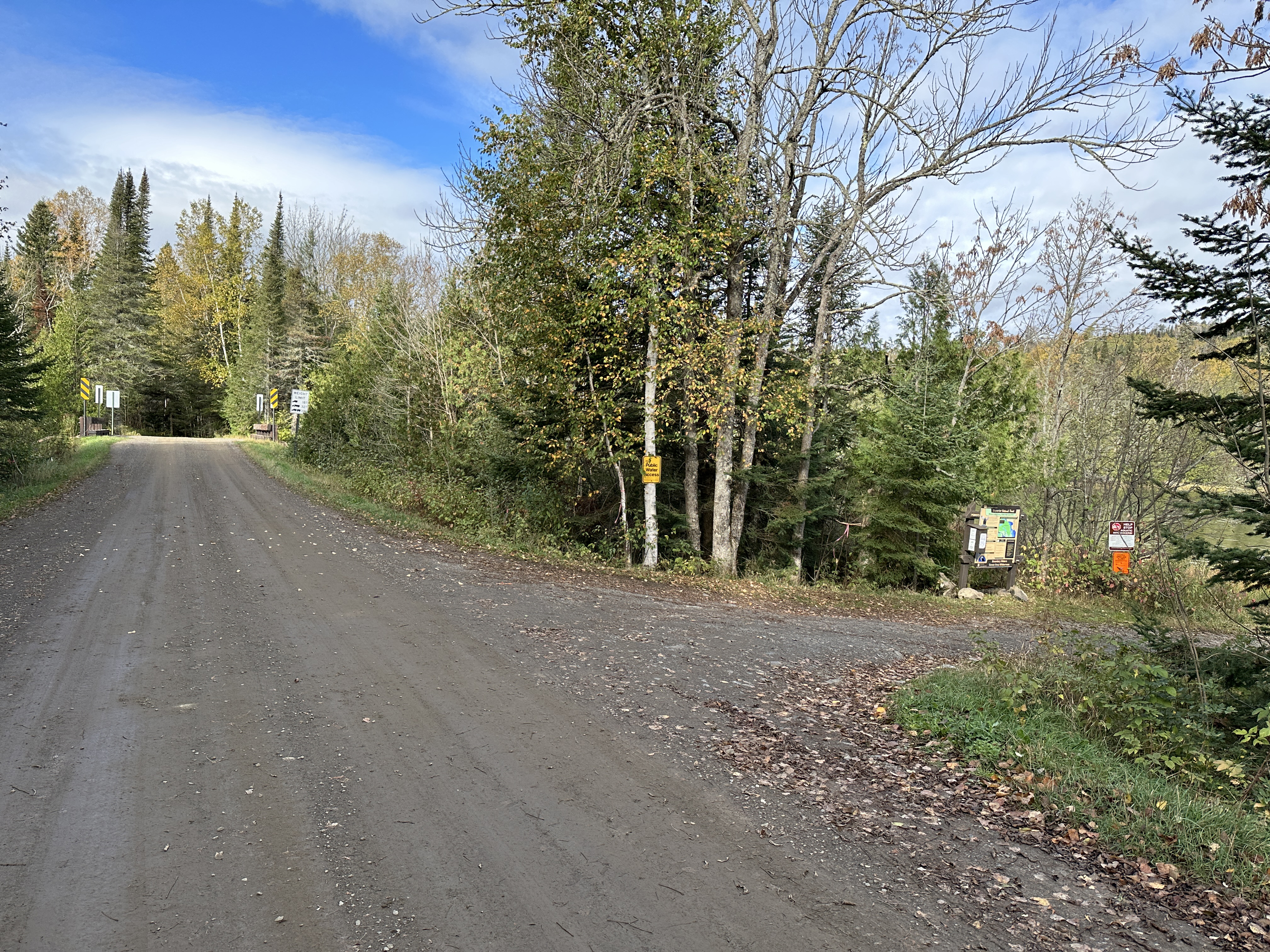
Near the end of the Arrowhead Trail road, you come to the parking lot for BWCA Entry Points 69, 70 and 83 on the right (October 8, 2023).
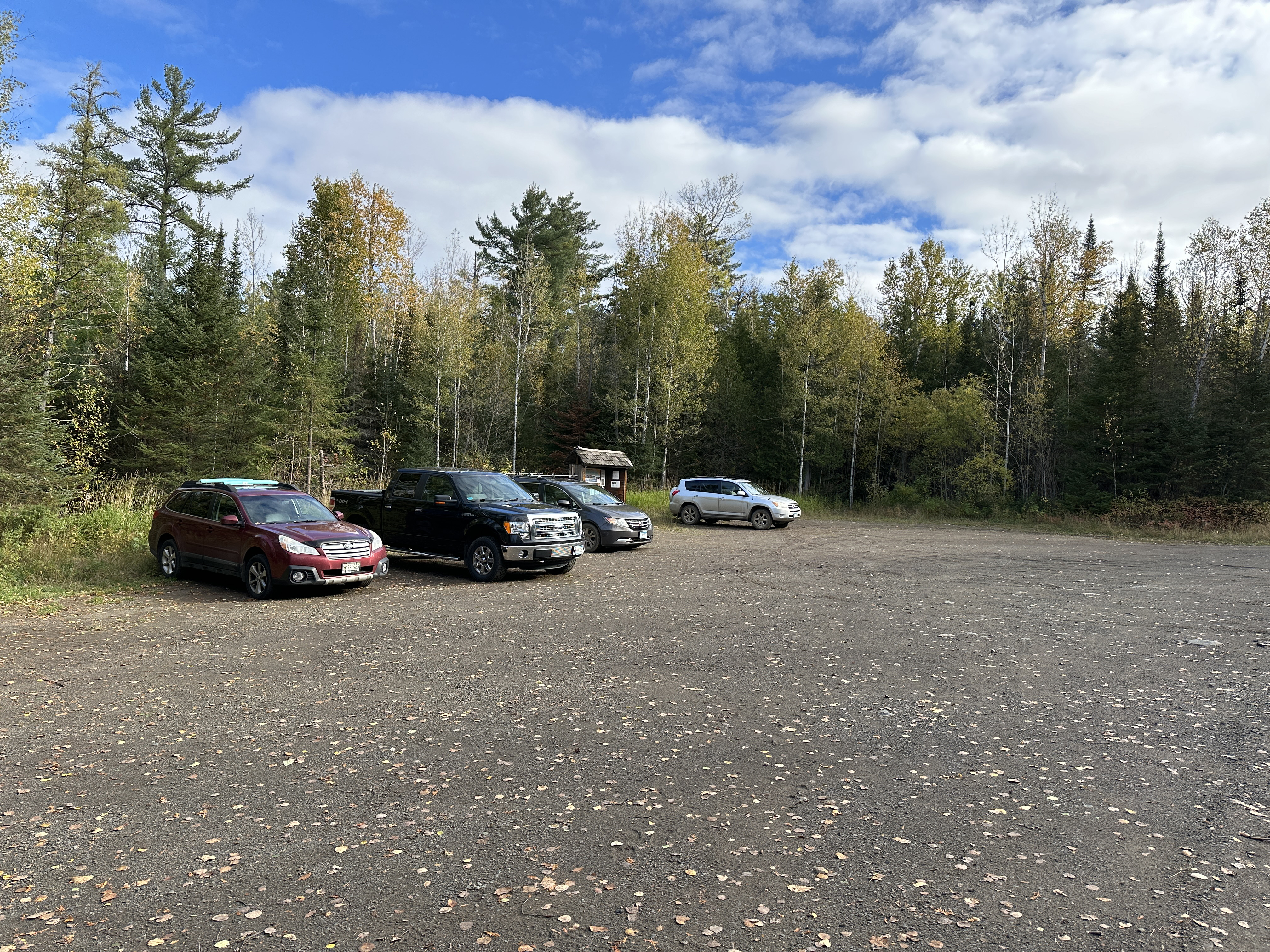
This is the parking lot for BWCA Entry Points 69, 70 and 83. The kiosk bulletin board for BWCA Entry Point 83 - Border Route Trail (East) is visible near the center of the photo (October 8, 2023).
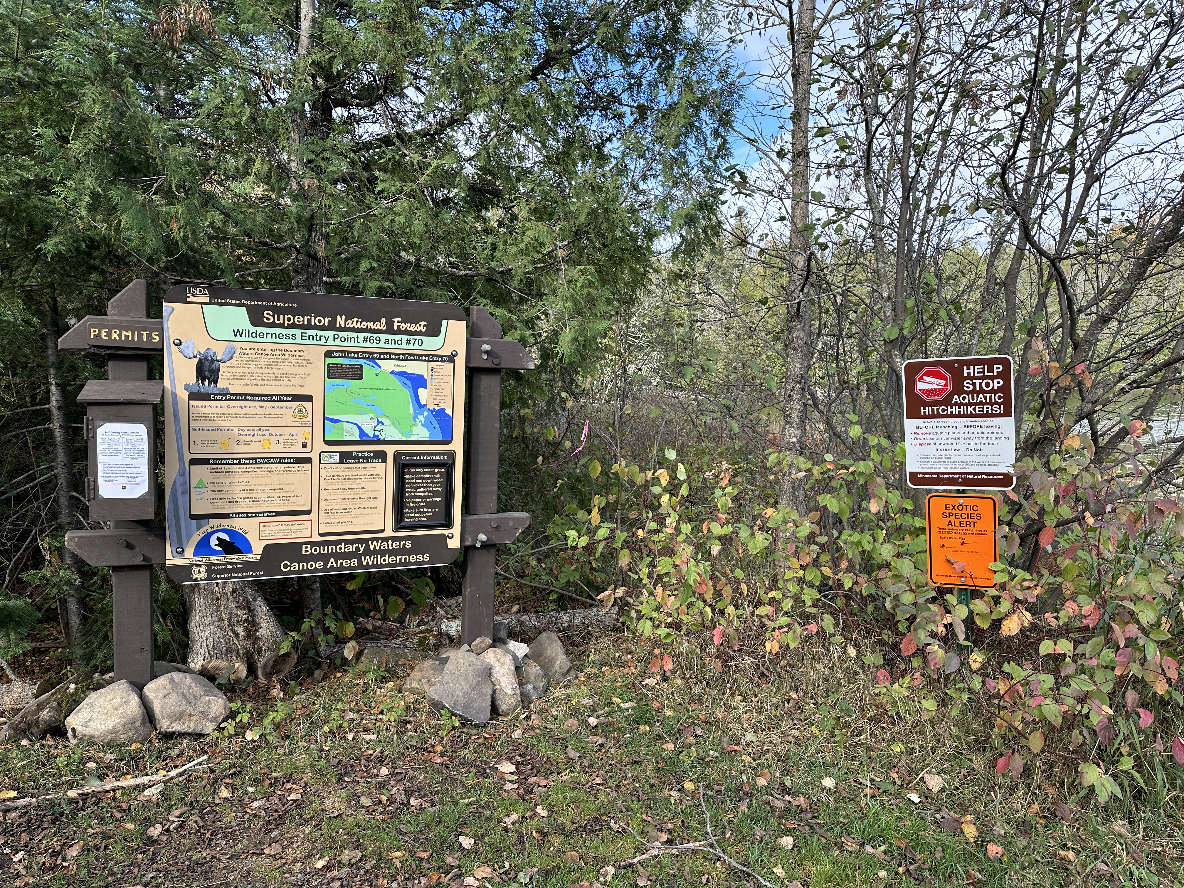
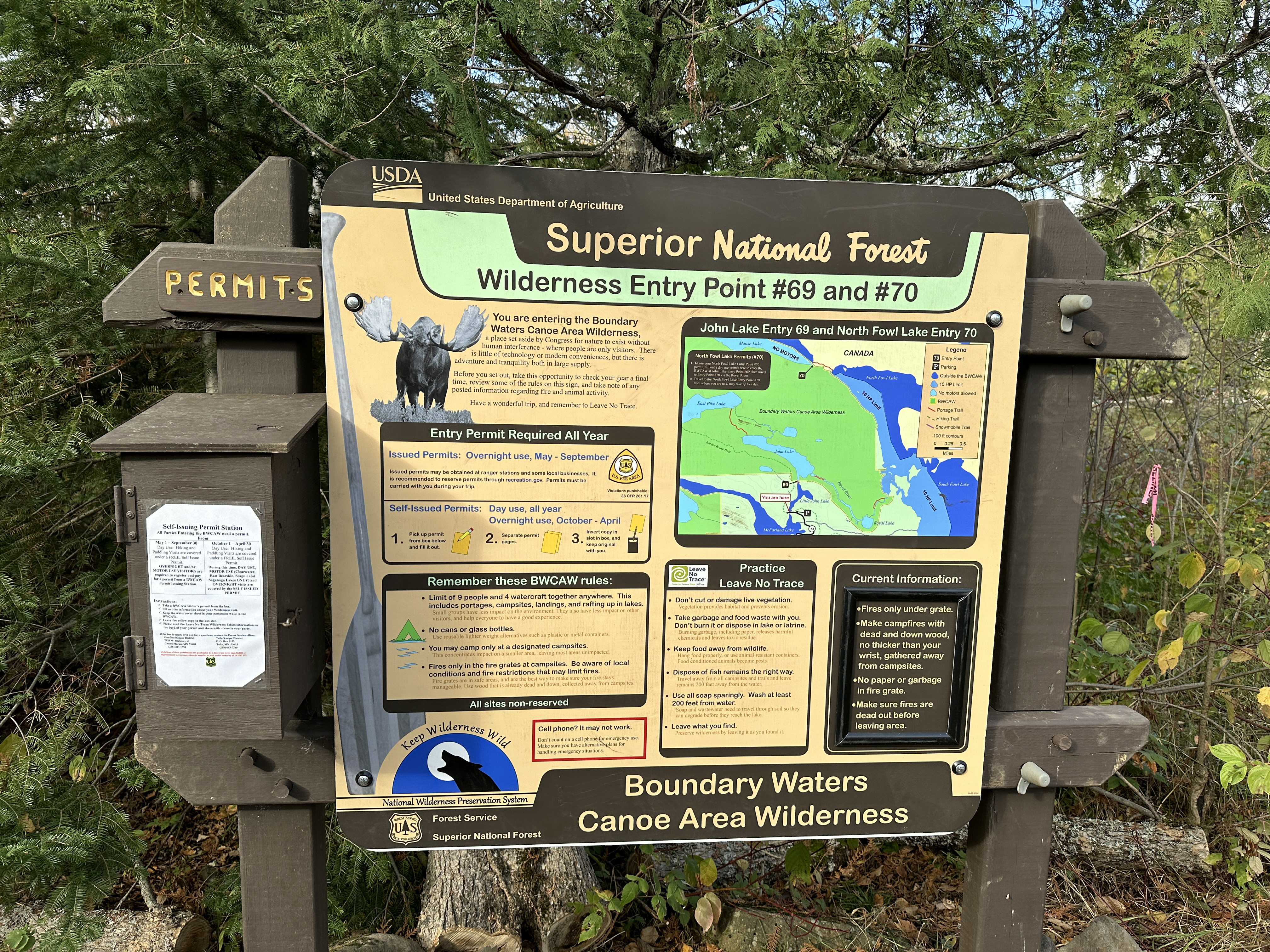
Bulletin board for BWCA Entry Points 69 and 70 (October 8, 2023).
The box on the left is where BWCA day permits are stored. You can fill one out here if you are just entering the BWCA for the day. You can also use these permits if you are here in the offseason for overnight stays in the BWCA. The offseason is from October 1 to April 30 (October 8, 2023).
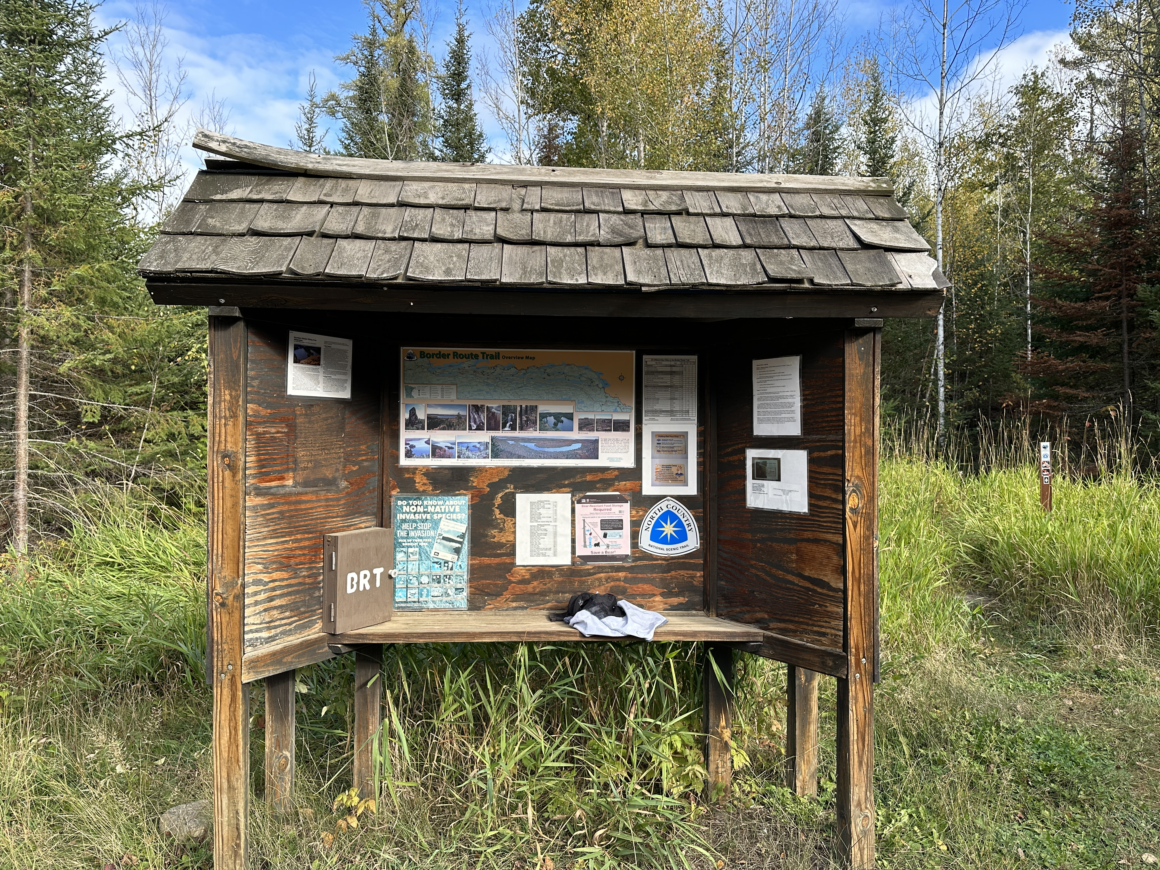
The bulletin board for hikers of the Border Route Trail (BRT) (October 8, 2023).
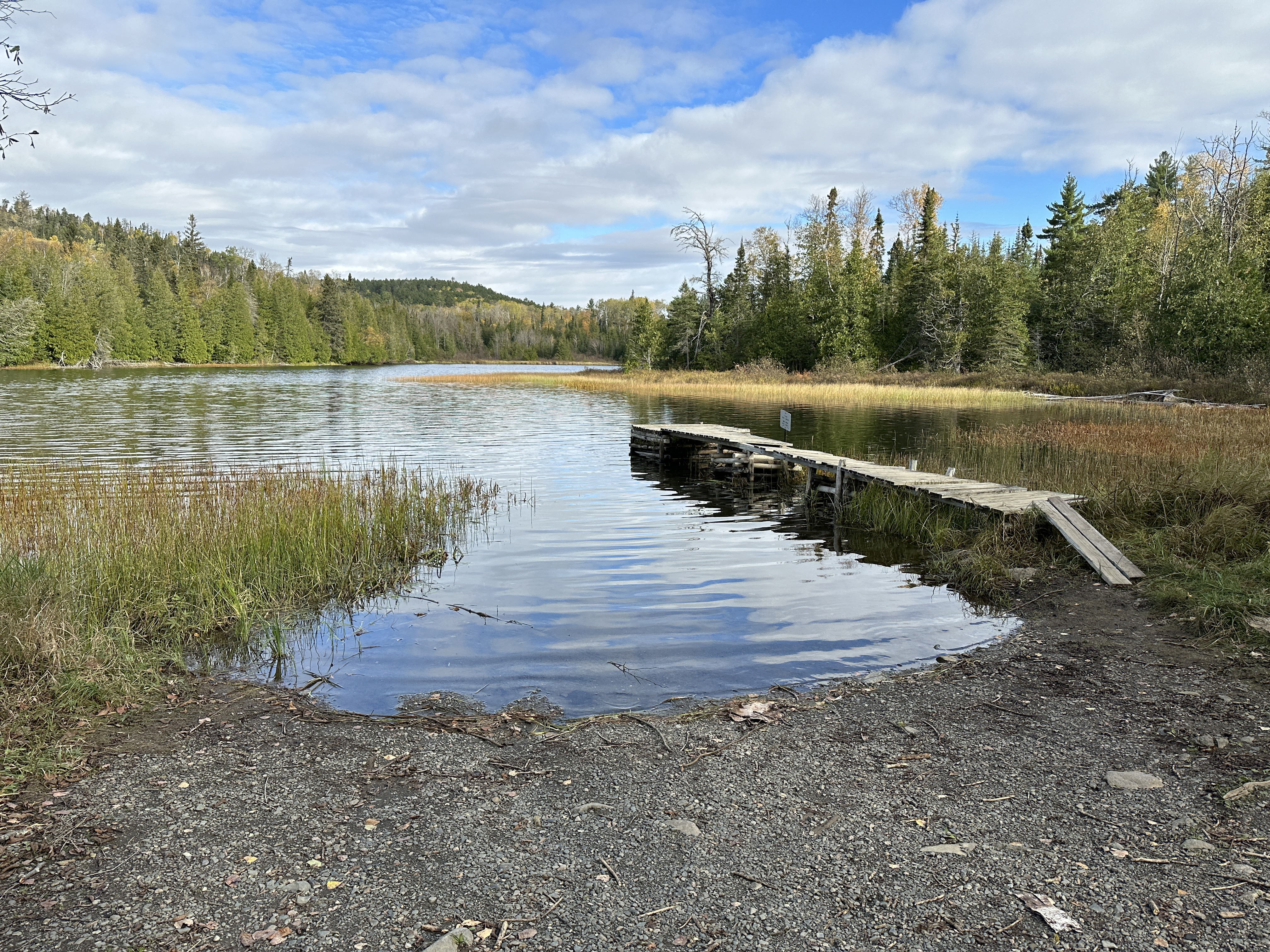
Canoe landing at Little John Lake. You can temporarily park your car close to the water for unloading (October 8, 2023).
This is the outhouse at the McFarland Lake Campground (October 8, 2023).
Typical campsite at McFarland Lake Campground. Each has a picnic table and a fire grate (not shown) set in an open area (October 8, 2023).
Now that you've reached the shore of the lake, visit: LITTLE JOHN LAKE