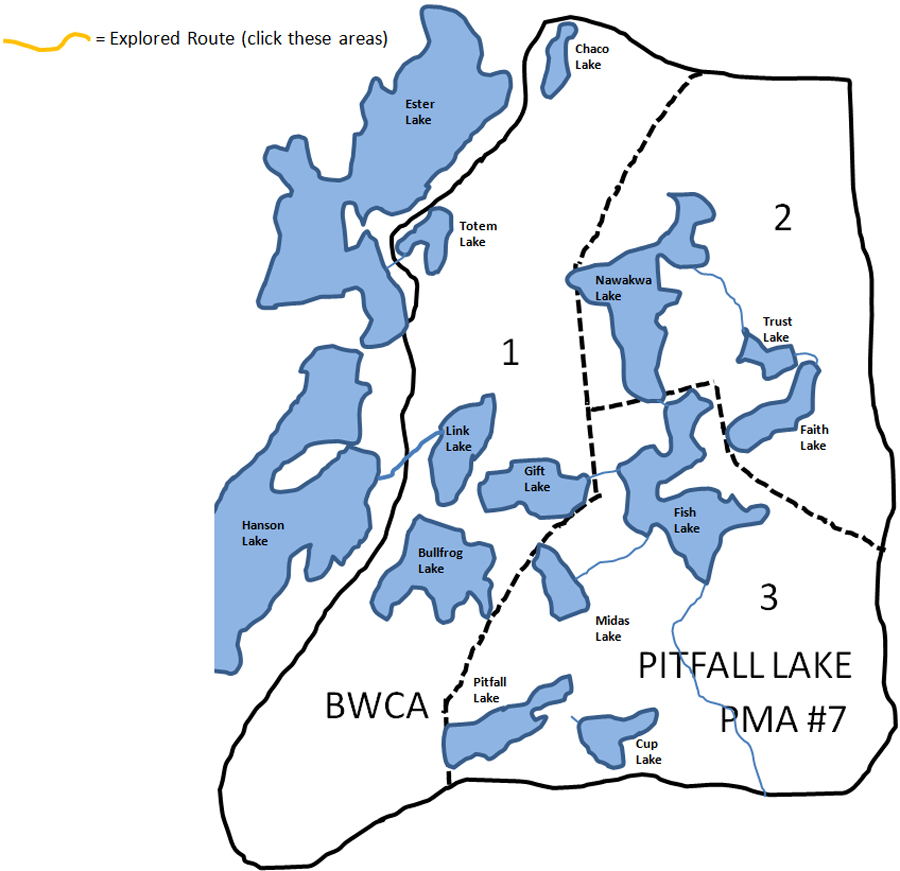
Pitfall Lake Primitive Management Area
Pitfall Lake Primitive Management Area is the PMA that was highlighted in a Backpacker Magazine article and thus brought these remote areas of the BWCA to more peoples attention. Pitfall Lake PMA is fairly easy to explore because all of the lakes in the region are tightly packed together. There are a few exceptions; notably Pitfall Lake itself and Cup Lake and Midas Lake. These three lakes will require more effort to reach than the other nine lakes in this PMA.
Oddly, several of the lakes in this PMA possibly (not positive) take their names from references to fairy tales such as King Midas, The Frog Prince (note that Bullfrog Lake used to be called just Frog Lake), several fairytales are about drinking from a cup, and many tales involve gifts, etc.
Many of the lakes in this PMA have been renamed in relatively recent history. Pitfall Lake used to be called Trap Lake. Nawakwa Lake used to be known as Crooked Lake. Bullfrog Lake had its name changed from Frog Lake. Faith Lake was previously called Hope Lake. Confusingly, Trust Lake used to be called Faith Lake. Lastly, Gift Lake once went by the name of Charity Lake.
Like the Weasel Lake PMA and the Fungus Lake PMA, Pitfall Lake PMA has had a significant portion of its area burned. Here is some recent fire history. The Cavity Lake Fire of 2006 burned about 32,000 acres and basically the entire eastern half of the Pitfall Lake PMA. Another significant fire, the Ham Lake Fire which occurred in 2007, burned a huge swath of the BWCA east of the Cavity Lake Fire. The Ham Lake Fire smoldered 76,000 acres. Since 1999 going through 2011, there was a blowdown and three large fires in the BWCA. The 2011 Pagami Creek Fire was the biggest at 92,000 acres. The blowdown that occurred during the Independence Day weekend in 1999 toppled trees in a path 4 to 12 miles wide and 30 miles long. This derecho as these windstorms are called, began in North Dakota and its winds, sometimes exceeding 100 miles per hour, were traceable for 1,300 miles to the east. Besides knocking down millions of trees in the BWCA, it also did millions of dollars and damage to towns and cities in its path.
|