Mountain Lake
Gunflint Ranger District
MOUNTAIN LAKE CAMPSITES:
Campsite 1 (#678): Westernmost campsite along the south shoreline
Campsite 2 (#717): Second campsite along south shoreline from the west end of the lake
Campsite 3 (#721): Third campsite along south shoreline from the west end of the lake
Campsite 4 (#718): This is the middle of the seven campsites located along south shoreline (second campsite west of Pemmican Lake portage)
Campsite 5 (#722): Campsite just west of the Pemmican Lake portage (portage actually runs through the campsite)
Campsite 6 (#719): First campsite east of the Pemmican Lake portage
Campsite 7 (#720): Easternmost campsite on Mountain Lake
Seven mile long lake along the U.S - Canadian Border. High cliffs rise above the south shoreline. The north shoreline lies within La Verendrye Provincial Park. There is a public access on the Canadian side and motorboats are allowed on that side of the lake. The south half of the lake lies within the BWCA. There is a road along the north shoreline in Canada and sounds of vehicle traffic can occasionally be heard across the lake at night.
The portage to Pemmican Lake is difficult. That small lake holds a good supply of stocked brook trout.
Mountain Lake is the 2nd deepest lake that is partially within the Boundary Waters at 210 feet. However point in the lake is located in Canadian waters. The lake would be ranked somewhere between the 13th and 15th deepest lake in the BWCA if just using its deepest point on the U.S. side of the lake. Check this page for a list of the deepest lakes in the BWCA.
This lake is dangerous when when the wind is blowing. The large size of the lake can result in huge waves for canoes.
Mountain Lake is the source of the Pigeon River. That river begins at the eastern end of the lake.
Moose Mountain, 2012 feet, rises over the east end of the lake near the Cherry Portage.
Exploring Mountain Lake
Click on the photos below to see the full resolution image - Use your browsers back button to close photo and return to this page.
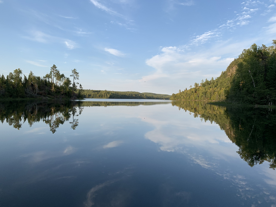
Peering the north/northeast from the Clearwater Lake portage. Canada is visible in the distance. The Watap Lake portage is about a 1/2 mile paddle to the left from here, after going around that point (left side of view). It's almost seven miles of paddling from here to the east to the Cherry Portage, that leads over toward Moose Lake.
Route Connections for Mountain Lake
From Mountain Lake you can portage into Clearwater Lake, Fan Lake, Pemmican Lake (difficult portage) and Watap Lake. You can also access the Border Route Trail about midway along the portage leading to Clearwater Lake.
Return to Top of Page
|


