Fishing: There are northern pike and walleye in both Angleworm Lake and Home Lake. There are smallmouth bass in Whisky Jack Lake (visual observed)
Maps: Fisher F-9; McKenzie #11
Trail Water Views: Spring Creek crossing; Angleworm Lake; Home Lake; Home Creek crossing; Whisky Jack Lake
Fire History:
Wildlife Seen on Visit: Beaver, Black Bear, Grouse
Campsites: 9 (5 sites on Angleworm Lake, but 1 is closed as of 2023), 1 on Home Lake and 1 on Whisky Jack Lake; (6 visited)
Highest Trail Elevation: About 1,550 feet just east of Whiskey Jack Lake
Last Visited: May 28, 2023; Previous Visit(s): September 18, 2015
Scenic Overlooks: Scenic view of wetland between Spring Creek and Angleworm Lake; several high overlooks of Angleworm Lake, overlook of Home Lake; two valley overlooks along east side of look
TRAIL CONNECTIONS AND TRAILHEADS:
Home Lake to Gull Lake Portage: Walk the 274 rod portage
Angleworm Lake to Trease Lake portage: Walk the 428 rod portage
Trailheads: Entry Point #21
Angleworm Lake Trail
Kawishiwi Ranger District
ANGLEWORM LAKE TRAIL CAMPSITES: Campsite 1 (#2269): On Whisky Jack Lake. This is the only campsite on this lake Campsite 2 (#1900): On Angleworm Lake. Southern most of the three campsites in the southwest corner of the lake Campsite 3 (#1898): On Angleworm Lake. Northern most of the three campsites in the southwest corner of the lake Campsite 4 (#1899): On Angleworm Lake. Middle of the three campsites in the southwest corner of the lake
Campsite 5 (#1895): On Angleworm Lake. Likely CLOSED as of 2023 (not verified). Was the north most campsite on east side of lake
Campsite 6 (#1896): On Angleworm Lake. Second campsite from south end of lake on east shore. This is the site with the old fuel tanks Campsite 8 (#Angleworm1): On Angleworm Lake. Unknown campsite number. Second campsite from north end of lake on west shore Campsite 9 (#2097): Campsite on north side of Home Lake, just west of the Gull Lake/Home Lake portage (accessible to hikers and canoeists)
The Angleworm Lake Trail entry point is found along the Echo Trail. From Ely, MN it is 17 miles to the Angleworm Trail parking lot. The entire Angleworm Lake Trail is about 13 miles long according to most maps, but both my GPS units recorded as distance of about 15.3 miles. It circumnavigates both Angleworm Lake and Home Lake. There is also a crossing of Home Creek at the north end of Home Lake, where the creek flows out. Typically a large beaver dam is here, but it sometimes washes out. The trail has lots of elevation change as the path alternates between following the ridgeline and dipping down to the shoreline of Angleworm Lake. You could feasibly hike this trail in one day, if you pack light and are in good shape. Most hikers spend two to three days. Some of the campsites along the trail are also accessible to canoeists. There is also at least one beaver dam crossing on the east side of the lake.
For the first two miles of the Angleworm Lake Trail, the path is shared by those hardy folks portaging their gear to Angleworm Lake. The distance is 716 rods. Even so, you will encounter few paddling groups taking this route due to the long distance and because only two permits are issued per day. Before reaching Angleworm Lake, you will come to a four-way intersection. The choices here are:
1) Go back from the direction you came (turn around and head back toward the parking lot).
2) Head to the left from the intersection and follow the trail to the west side of Angleworm Lake.
Go this way if you want to do the trail clockwise or if you are portaging a canoe.
3) The next trail to the right of 2) above is also the Angleworm Trail. Go down this path if you want to hike the trail in a counterclockwise direction.
4) Lastly, the trail just to your right as you arrive at the four-way intersection from the parking lot is the Trease Lake portage. It is 428 rods.
An old lookout tower used to stand on the west side of Angleworm Lake up a steep hill. Remnants of the old tower still remain, if you can find it.
References:
Beymer, Robert, Boundary Waters Canoe Area – Volume 1 – Western Region (Berkeley: Wilderness Press, 2006), 118, 264.
Hiking the "Stick" section of the Angleworm Lake Trail/Angleworm Portage (from Entry Point parking lot to the lake)
Click on the photos below to see the full resolution image - Use your browsers back button to close photo and return to this page.
The trail begins right next to this sign (May 28, 2023).
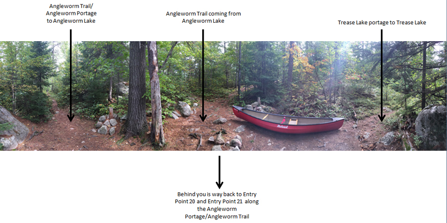
Starting at the BWCA Entry Point 21 parking lot, head generally northbound along the well defined trail until reaching the Four-Way Intersection. This intersection is where the trail coming from the parking, the Trease Lake portage and the Angleworm Trail (coming from either the clockwise or counterclockwise direction) meet. It is at this point that you must decide whether to hike the Angleworm Trail in a clockwise or counterclockwise direction (May 28, 2023).
As you traverse the Angleworm Trail and Angleworm portage between the Entry Point parking lot and Angleworm Lake, you will eventually come to this four way intersection. Your view here is as if you were coming from the Entry Point 20 - Angleworm Lake/Entry Point 21 - Angleworm Trail parking lot. Heading to the left goes to the west shore of Angleworm Lake. Taking the middle trail (just left of the canoe) will take you to Angleworm Lake's east side on the Angleworm Trail (not the portage anymore). Note that this will still get you to a place on Angleworm Lake where you can launch a canoe, it is just slightly more difficult and not the "official" way to the portage landing. Finally the trail on the far right goes up a slight hill and heads off toward the south in the direction of Trease Lake. This is the 428 rod Trease Lake portage and it is a tough one (September 18, 2015).
This is how the four-way intersection looked on May 28, 2023 (compare to annotated image above).
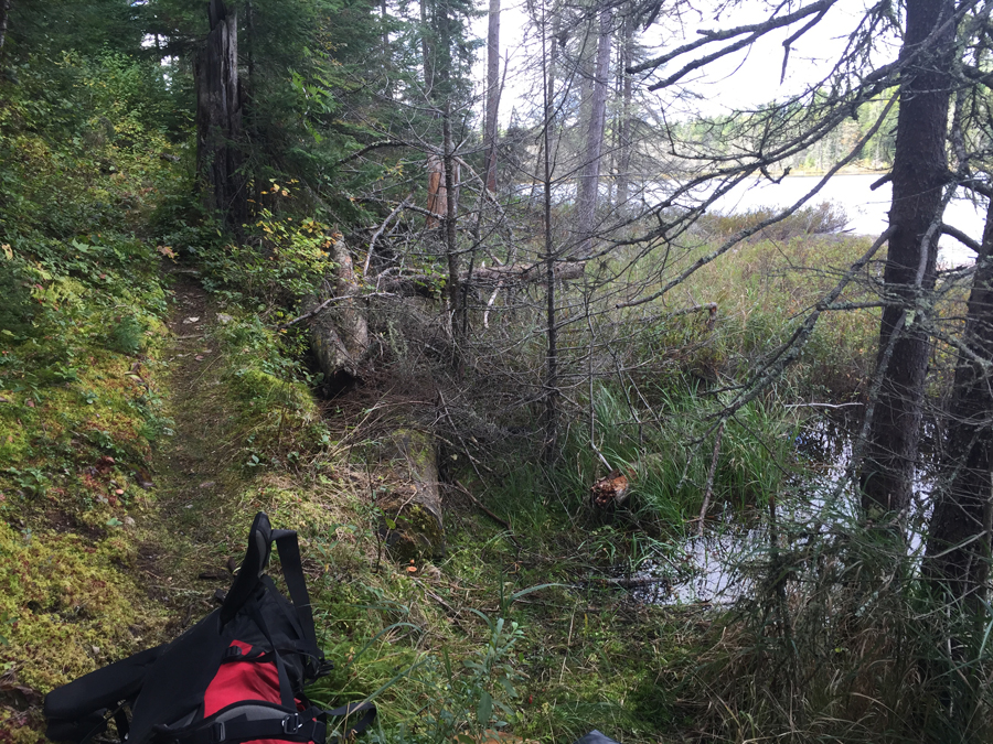
Starting from the Four-Way Intersection, head down the trail that takes you in a counterclockwise direction around Angleworm Lake. Continue to the first beaver dam crossing.
A spot near the south end of Angleworm Lake, on the east shore where the Angleworm Lake Trail comes right down to the lake. The pack is lying on the trail.
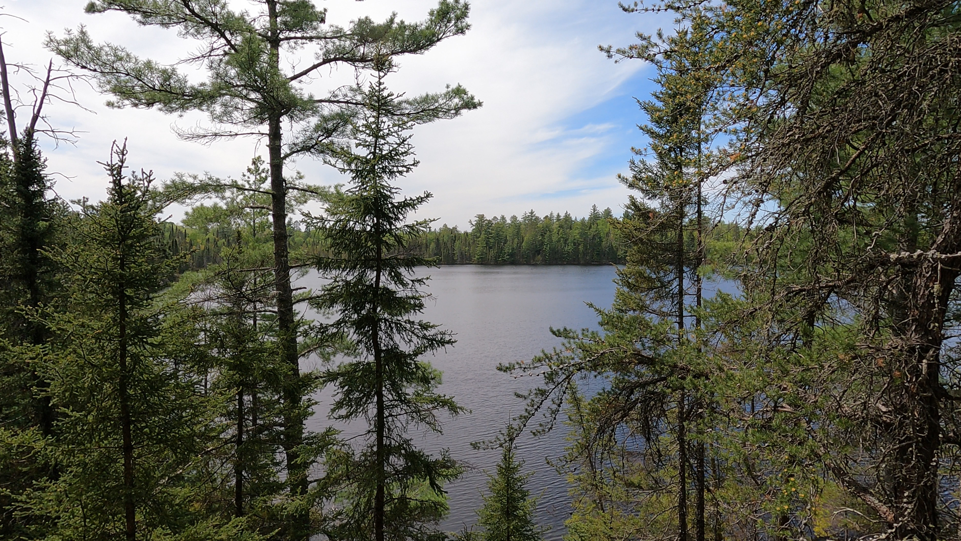
View of Angleworm Lake from the first major overlook you'll come to. This is a view to the north from the southeast corner of the lake.
Beaver dam crossing. This is located along the east side of Angleworm Lake. It is the first beaver dam you have to cross while traveling the Angleworm Trail in a counterclockwise direction. The GPS location is (48.0845861,-91.8835694).
Looking east from the beaver dam up the valley. There used to be a logging era railway that ended near this beaver dam. The railway extended off into the distance and turned to the right. The railway connected to what is now North Grassy Road (same road as you take to the Mudro Lake Entry Point).
Hiking from the beaver dam crossing to the access trail leading to BWCA Campsite 1897 on the shore of Angleworm Lake. This campsite has some interesting relics from the logging era that you can see along the access trail, well before you reach the campsite proper.
At this point where the trail splits, you reach the access trail to BWCA Campsite 1897, which is located down the left trail. The right trail continues you on the counterclockwise hike along the Angleworm Lake Trail. This spot is at GPS coordinates (48.0911555,-91.882538).
If you follow the campsite access trail a short distance, you will see these two large fuel tanks on the left side of the path. If you look around in the woods near this location, you will find many more relics in the area from the logging era. If you continue to follow the trail toward the lake, you will eventually come to the campsite. You'll pass the campsites latrine on your left before reaching the campsite proper. Beware that there may already be people camping here (often canoers), since it is one of the better campsites on the lake.
Continue in a counterclockwise direction along the Angleworm Trail from the BWCA Campsite 1897 access trail to the Whisky Jack Lake campsite, which is BWCA Campsite 2269.
This overlook is near the middle of Angleworm Lake, along it's eastern shoreline. The view is towards the south.
Just past the overlook, you'll see a trail to the left that winds down to the lake shore. It's fairly steep. Good place to fill water bottles.
Not far past the Whisky Jack Lake campsite access trail, you come to this overlook of Whisky Jack Lake.
A short distance down the trail from Whisky Jack Lake, you traverse a rocky ridge that overlooks a large valley. There was a black bear feeding here.
Shortly after leaving the Whisky Jack Lake overlook, you come to another overlook of a valley. There is a black bear in the center of your view.
Black bear feeding on vegetation in the valley below.
Continue on from the overlook, make the bend to the west near the north end of Home Lake and reach the portage that connects Home Lake and Gull Lake.
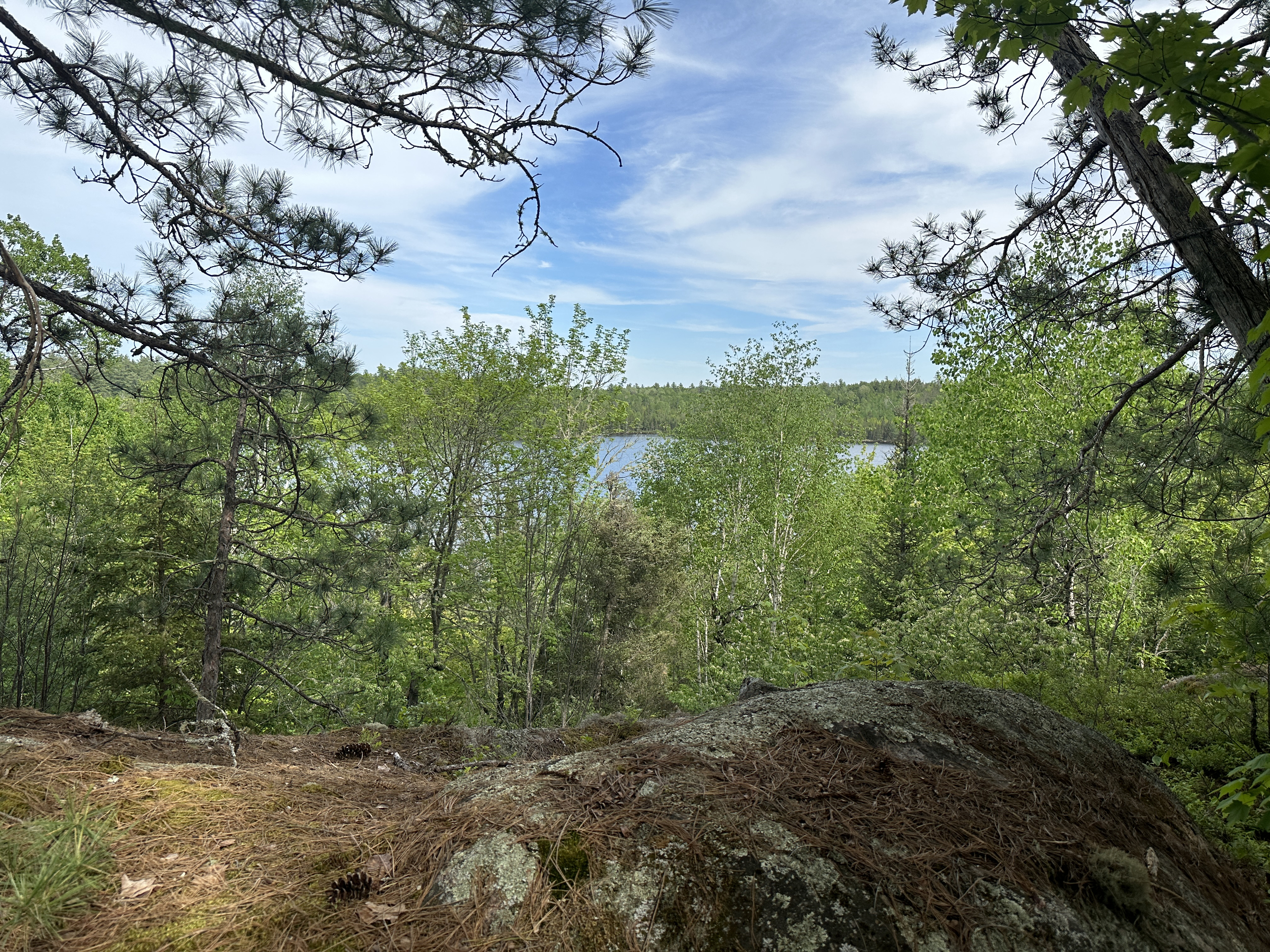
This is another valley overlook a bit further north (maybe a 1/4 mile) of the last one. You can just make out Gull Lake in the distance (just left of center near the horizon) behind the trees.
This is where the Angleworm Trail crosses the Home Lake/Gull Lake portage. The portage is to the left. The Angleworm Trail continues to the right. There is usually a cairn marker here.
Shortly after crossing the portage (a few hundred feet), you will pass by a campsite on your left. This is BWCA Campsite 2097 and it is situated on the north end of Home Lake. Continue past the campsite to the Home Creek crossing, which you'll find in the northwest corner of Home Lake.
The trail comes down close to the north shoreline of Home Lake between the portage and the Home Creek crossing. Good place to soak your feet, take a break and refill water bottles.
Looking downstream from where the Angleworm Trail crosses the creek. Water levels are usually pretty low here, so it is rarely a difficult crossing. Sometimes there is a beaver dam here. This location is near the northwest corner of Home Lake.
Ford Home Creek and continue hiking along the trail. The trail makes a turn to the south shortly past the creek crossing and begins to climb a ridge. There are occasional glimpses of Home Lake along this stretch. This section ends at a campsite near the middle of the west side of Angleworm Lake (currently don't have a campsite number for this site).
As you hike along a ridge near the northwest corner of Home Lake, you can catch occasional glimpses of the lake through the trees.
This is the view from the canoe landing for an unnumbered campsite on the west side of Angleworm Lake. The GPS point is: 48.098791, -91.88611.
From the mid-lake campsite, proceed south along the Angleworm Trail to the southwest corner of Angleworm Lake where you will find three campsites all spaced closely together. The first is BWCA Campsite 1898 (the northern most of the the three).
The small bay near the middle of the west shoreline of Angleworm Lake.
A bit further along the trail and there is another view of Angleworm Lake. Looking southeast in this image. The trail hugs the lake for a while through this area.
Another quick hike to the southern most of the three campsites in this area. This is BWCA Campsite 1900.
Not far south of BWCA Campsite 1900, the Angleworm Trail intersects the Angleworm Portage. From this point back to the entry point parking lot, the Angleworm Trail and the Angleworm Portage are the same path.
A bit further along the trail and there is another view of Angleworm Lake. Looking southeast in this image.
Once the trail and portage join, you soon leave Angleworm Lake behind and head into the forest, heading generally south. At the 4-way intersection, you'll want to stay to the right path to keep heading back to the parking lot.
This is a view of the wetland that is at the south end of Angleworm Lake. This is just south of the portage landing.
Leave the four-way intersection and hike onward. Running out of daylight, as we continue southbound along the trail back to the parking lot. [This video was recorded in low light levels, so it is a bit grainy, especially near the end.]
You'll find this drained wetland not far from where the portage/trail crosses Spring Creek. This image was taken during a period of drought. There is usually more water in this basin.
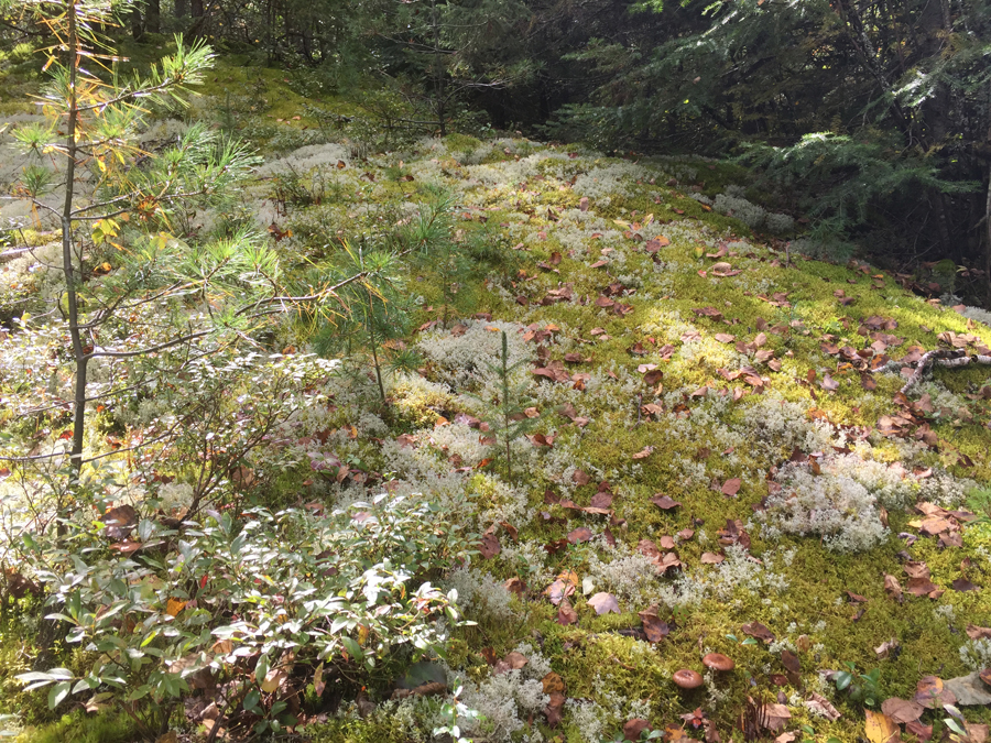
A garden of mosses and lichens in an open space in the forest along the portage/trail.