Fishing: Many lakes along the trail offer fishing opportunities. Too many to list.
Maps: Fisher F-10, F-11, F-12; McKenzie 9, 8, 7
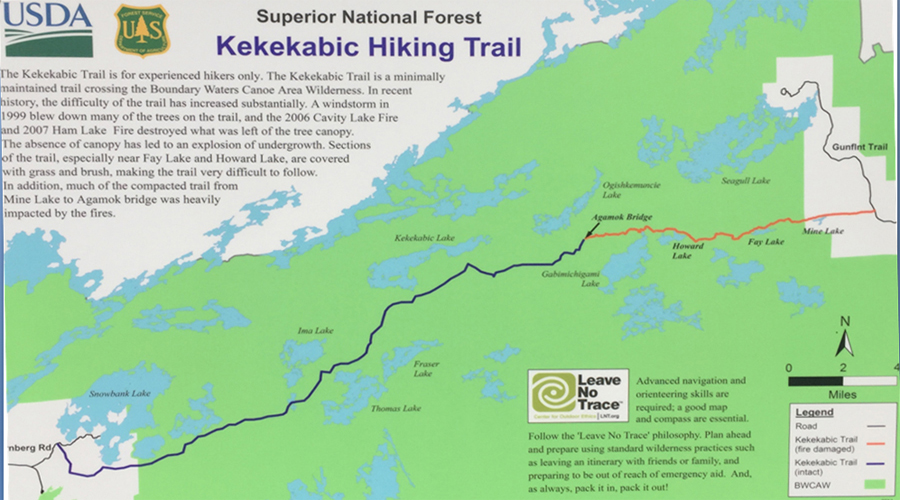
Trail Water Views: Extensive, including waterfalls and rapids. Agamok Falls, Muller Falls. Views of Gabimichigami Lake and Lake Kekekabic.
Fire History: Eastern end of trail heavily impacted by Cavity Lake Fire and Ham Lake Fire - several smaller fires (i.e. Harness Lake Fire) and a 2011 fire near Bakekana Lake
Wildlife Seen on Visit: Grouse, Beavers
Campsites: 8 (2 visited)
Highest Trail Elevation: About 1,959 feet near the Kekekabic Fire Lookout Tower Site (tower has been removed)
Last Visited: March 11, 2024;
Previous Visit(s): November 16, 2023, October 20, 2022, October 3, 2022, September 4, 2016
Scenic Overlooks: Many expansive views; see text and images below.
he Kekekabic Trail is a backcountry hiking trail located in northeastern Minnesota in the United States.
The Kekekabic Trail is anywhere from 37 miles to 42 miles in length, depending on whose measurement you want to use. Officially the Kekekabic Trail Club lists it at 38.6 miles. The trail is quite rugged, often difficult to follow (especially the eastern end) and commonly has obstacles like blowdown, beaver dams and mud to deal with. To mark the trail, blazes and some ribbons are used (usually blue in color, but not always). Also to help follow the trail look for cut timber which is leftover from any trail clearing activities. For this hike, you will definitely want a compass and/or GPS along with some maps of the trail. Pick up the most recent edition of the Kekekabic Trail Guide published by the Kekekabic Trail Chapter of the NCTA for the most current information. It's a high quality guide with excellent maps.
The trails is named for Lake Kekekabic and the old fire lookout tower that once stood near that lake. "Kekekabic" is derived from the Ojibwe languages word, "Keke-quabec", "Keke-quabic", "Cacacowabic" or "Cacaquabic" (depending on how the map maker decided to spell it) and has been interpreted to mean "A hawk nest up on the rocks" or "hawk iron cliffs" or "Hawk Cliff Lake" (Source: Treuer, Anton - Bemidji State University and Johnson, Lee - United States Forest Service). All these names refer to Lake Kekekabic. "Gekek" means "hawk" in the Ojibwe language. The modern day spelling of Kekekabic in the Ojibwe language is "Gekekwaabikosag".
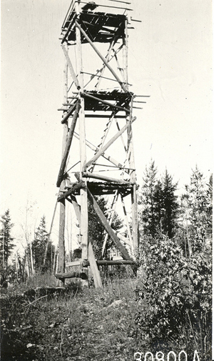
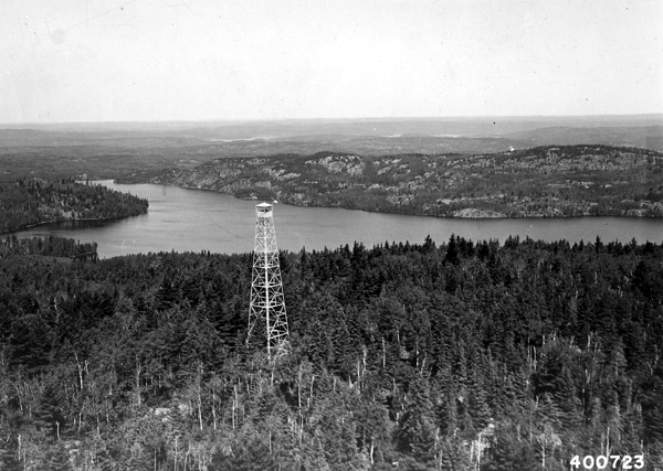
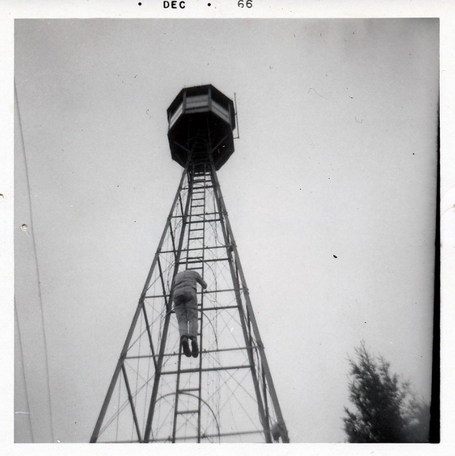
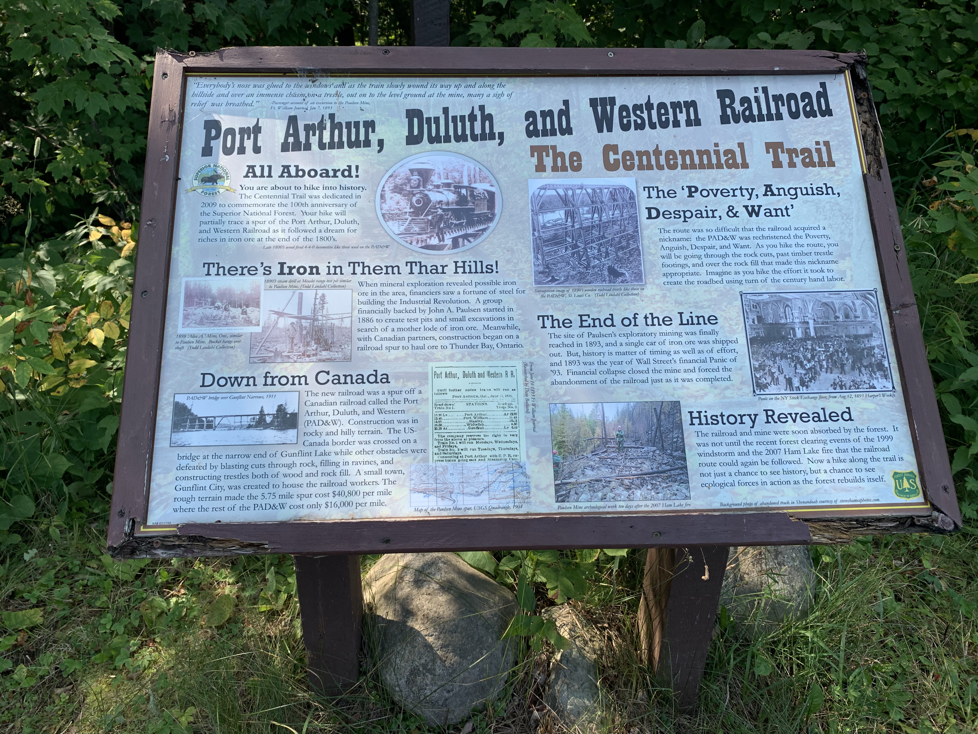
The west end of the trail originally started at Lake One near the Kawishiwi Lodge. It was later moved to its current location near Snowbank Lake. The eastern end of the Kekekabic Trail was created from an old wagon trail. This trail was used to reach the Paulsen Mine which is in the same general area as the Gunflint Lookout Tower. The Paulsen Mine operated for a short period in the 1880's before it closed down. The Kek was built by teams of young men serving in the Civilian Conservation Corp in 1937 and 1938. The main purpose of the trail was to provide access to at least three fire lookout towers scattered along its length. The easternmost tower was the Gunflint Lookout Tower. This tower was removed in 1979. The tallest and most remote was the Kekekabic Lookout Tower. It was 110 feet tall and located near Kekekabic Lake. It's construction was completed on January 12, 1937. The steel for the tower was delivered in the winter over frozen lakes. The lumber and concrete for the tower was flown in by seaplane. The Fernberg Lookout Tower was at the western end of the trail. All these towers only operated until around 1960. At that time, airplanes took over the duty of monitoring the forest for wildfires.
Fernberg Lookout Tower on the left. Kekekabic Lookout Tower (July 23, 1940?) on the right with Lake Kekekabic in the background.
Gunflint Fire Tower, 1966?
One of the highlights of the Kekekabic Trail is the stunning views of the wilderness that hikers will encounter along the way. The trail passes through dense forests, across rocky ridges, and along the shores of pristine lakes. Hikers will have the opportunity to spot wildlife such as moose, black bears, wolves, and bald eagles, as well as a variety of smaller animals and birds.
Camping along the Kekekabic Trail is only allowed at designated campsites, which are located at intervals along the trail. These campsites are primitive and do not have any amenities such as running water or flush toilets.
The Kek is maintained by the Kekekabic Trail Club. As of 2019, the Kek is now part of the North Country National Scenic Trail (NCNST). The trail was established as a hiking trail in the 1960's. It has been maintained by volunteers since 1990.
Hiking the Kekekabic Trail (Eastbound)
TO TRAVEL THIS TRAIL IN THE WESTBOUND DIRECTION, CLICK HERE
Click on the photos below to see the full resolution image - Use your browsers back button to close photo and return to this page.
HIKING FROM BWCA ENTRY POINT 74 PARKING LOT TO THE FIRST BEAVER DAM CROSSING
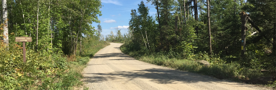
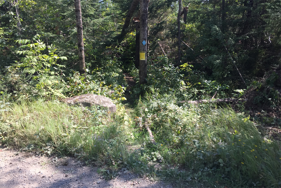
The trail starts on the far right of your view (notice the faint sign with a blue blaze just above it).
This is the start of the west end of the Kekekabic Trail on the south side of the Snowbank Lake Road.
This video shows the Kek hiking eastbound (and Snowbank Lake Trail in a counterclockwise direction) starting from the BWCA Entry Point 74 parking lot until reaching the first major beaver dam crossing. The distance hiked is about 1.7 miles.
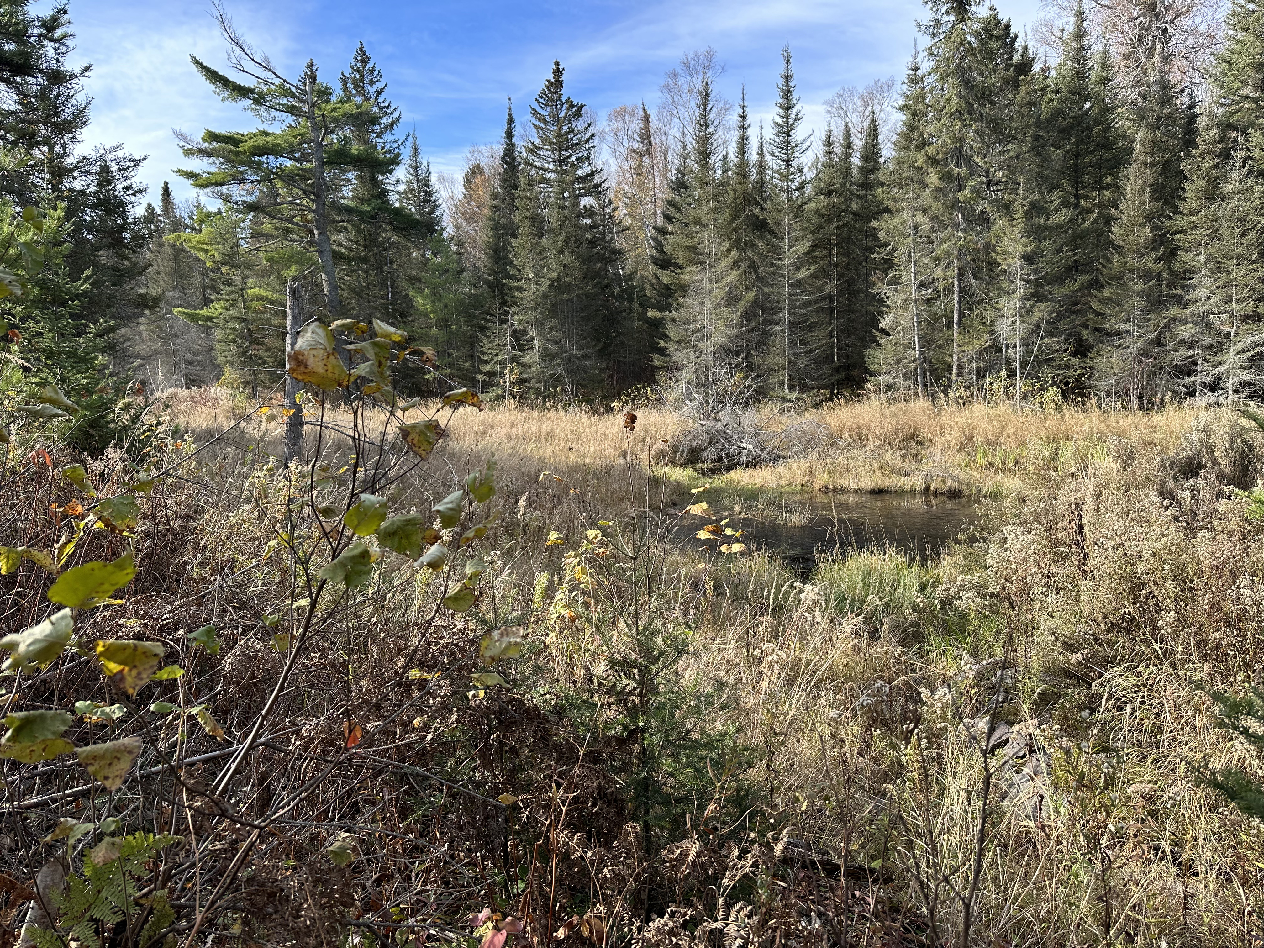
Wetland view near the beaver dam crossing.
HIKING FROM THE FIRST BEAVER DAM CROSSING TO THE SNOWBANK LAKE OVERLOOK
From the beaver dam, continue to the Snowbank Lake overlook. You will pass a spur trail as you hike that heads to the north/northeast for about 1/4 mile to the shore of Snowbank Lake.
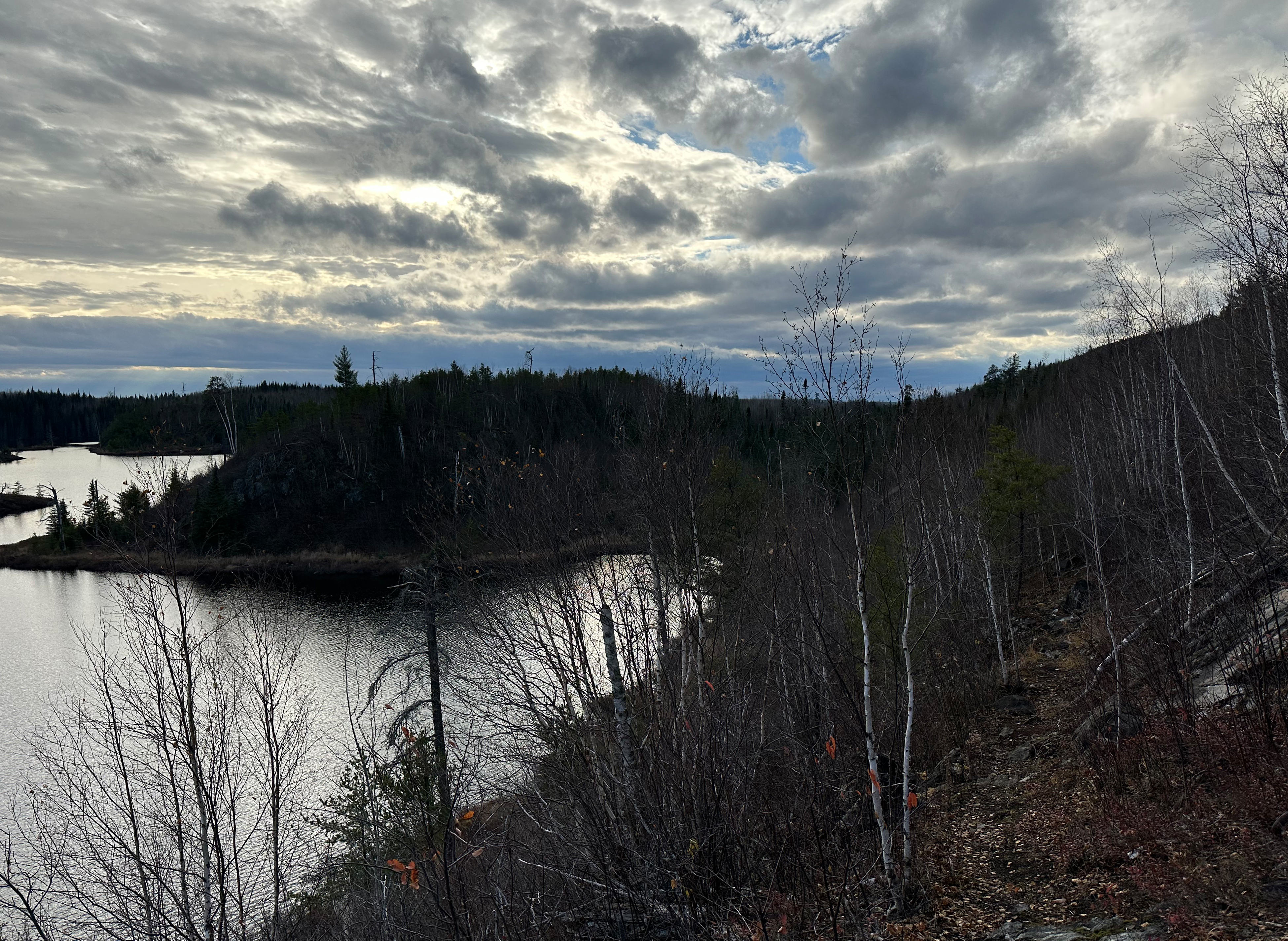
Pickerel Bay of Snowbank Lake is visible from this overlook.
HIKING FROM THE SNOWBANK LAKE OVERLOOK TO THE LOGGING ROAD
Traveling from the Snowbank Lake vista, which provides a distant view of Pickerel Bay to the north, to the logging road crossing.
This pond is about 3/4 mile west of the logging road.
Beaver patrolling the pond.
This boardwalk is about 900 feet before reaching the logging road.
HIKING FROM THE LOGGING ROAD TO THE WEST BECOOSIN-BENEZIE TRAIL JUNCTION
You will enter the BWCA shortly past the logging road. This section ends at the western junction with the Becoosin-Benezie loop trail. That trail forms about a two-mile oval with the Kekekabic Trail and provides access to Benezie Lake and Becoosin Lake. Each of those lakes has two campsites on them.
Western marker for the junction of the Kekekabic Trail and the Becoosin-Benezie Loop Trail.
MISSING THE LARGE SECTION OF TRAIL BETWEEN THE WEST BECOOSIN-BENEZIE TRAIL JUNCTION AND MINE LAKE
1) About a 1/4 mile past the west junction with the Becoosin-Benezie Loop Trail, you come to another interesection. Again this provides access to the Benezie Loop Trail, but also marks the start of the Old Pines Trail. In addition another trail heads off to the northeast here. This is the Snowbank Lake Trail which has been combined with the Kekekabic Trail to this point.
2) Now following the combined Kekekabic Trail / Old Pines Trail, continue about 3/4 mile until you come to a three-way intersection. Going right (south) puts you on the Becoosin-Benezie Loop Trail. Heading left (northeast) continues the combined Kekekabic Trail / Old Pines Trail.
3) For just over 2 miles, the Kekekabic Trail / Old Pines Trail continue northeast and pass just south of Disappointment Lake. At the end of this strech on the very southeastern point of Disappointment Lake, you come to another three-way intersection. Heading left (northwest) is the Disappointment Lake Trail. Heading right (east) is the still combined Kekekabic Trail / Old Pines Trail.
4) About 1/2 mile east, the trail passes just north of Drumstick Lake. This lake is the headwaters of Drumstick Creek.
5) Another 1 mile further on, you come to another three-way interestion. Turning right (south) puts you on the Old Pines Trail. Continuing straight (east) keeps you on the Kekekabic Trail. You can actually go either way at this point as these trails join up only about 1 mile further down the trail. Taking a right will be more difficult as the Old Pines Trail is not as well maintained and it is also the longer path.
6) A mile further along, the Old Pines Trail and Kekekabic Trail rejoin between Moiyaka Lake and Medas Lake. There is also an old portage here that I don't think is maintained any longer that extends from Medas Lake, along the east side of Moiyaka Lake up to Alworth Lake. The portage was about 280 rods long. Where the two trails reconnect along with the old portage now too, there are two campsites in this area. One on the south shore of Moiyaka Lake and one on the north shore of Medas Lake.
This section is contained on McKenzie Map 8:
7) Once past the three-way junction between Moiyaka Lake and Medas Lake, continue generally east on the Kekekabic Trail. A half mile farther on the trail crosses a faint winter use trail that you'll likely not notice.
8) About 1 1/2 miles past the last three-way interestion, you arrive at a creek crossing. There is a portage here connecting Thomas Lake to your right (east) with a navigable creek on your left that leads to Hatchet Lake and Ima Lake, not far upstream.
8) A long stretch of 4 1/2 miles takes you northeast to Strup Lake's northwest corner. The trail continues for about a 1/2 mile along Strup Lake's north shoreline, crossing an 85 rod portage between Strup Lake and Lake Kekekabic. You should walk the portage here if you want to see Lake Kekekabic, as this is the only time The Kek provides access to it. Just past the portage is a campsite on the south side of the trail on the north shore of Strup Lake. Finally the trail passes just south of Whist Lake, another 50 rods or so past the campsite.
10) Past Whist Lake the trail is hilly and rugged for the next 2 miles. The trail continues northeast through this section. At the end of this stretch, just as the trail bends to the southeast, is the site of the old Kekekabic Lookout Tower. The elevation of the trail at this point is 1,919 feet. The site of the old tower is just off the trail.
11) Past the lookout tower, the trail runs southeast for about 1 mile and then bends to the northeast for another 1/2 mile until it passes between two small lakes (Loki Lake to the north and Harness Lake to the south).
12) Another 1/2 mile down the trail, which is now running mostly east, the Kekekabic Trail passes just south of Bushwah Lake. It is also possible to hike down to Travois Lake (south of the trail), but it is difficult. Travois Lake is in the Mugwump Lake Primitive Management Area of the BWCA. The trail again becomes very undulating as it winds generally east. About 1 mile past Bushwah Lake the trail crosses a small creek. About a 1/2 mile past this creek the trail reaches the northwest corner of Agamok Lake. There is a campsite here.
13) From the campsite on the northwest corner of Agamok Lake, the trail runs north about 1/4 mile and comes to Agamok Falls. There is a bridge crossing here. A very scenic area. There are three other campsites in this area. Also Mueller Lake is here and one of the campsites is on its eastern tip.
This section is contained on McKenzie Map 7:
14) After taking in Agamok Falls, the trail passes immediately between two steep hills (one to the north and one to the south of the trail) and then continues roughly eastward. Just past the two hills, the trail enters the burn area which will be with you the rest of the way to the eastern end of the trail. This particular area was burned by the Cavity Lake Fire. Further on, the burnt forest will look the same, but the fire will have been a result of a different fire called the Ham Lake Fire. The trail can be difficult to follow in a few places through this burned section. In 2 miles the trail reaches the very northern tip of Gabimichigami Lake, a large lake. Gabimichigami Lake is the deepest lake entirely within the State of Minnesota (and the deepest in the BWCA obviously) at 209 feet. There is a campsite here on Gabimichigami Lake.
15) For the rest of the way, the Kekekabic Trail continues on a fairly straight path to the east. About 1 1/2 miles past Gabimichigami Lake the trail intersects the north point of Howard Lake. There is another campsite here.
16) Another 1 mile east and the trail runs along the north shoreline of Chip Lake. A 1/2 mile or so past that and you reach Seahorse Lake. There are no campsites at either lake.
17) From Seahorse Lake, continue another 1/2 mile east until you reach Warclub Lake. You will have to cross the creek that connects Warclub Lake and Seahorse Lake. There is a short 15 rod portage that avoids a short unnavigable section of the creek here. After crossing the creek, the Kekekabic Trail runs along the south shore of Warclub Lake and then once past the east end of the lake, along the south bank of the Chub River.
Just before reaching Fay Lake, the Kek crosses the Chub River. There is a 45 rod portage used by canoeists at this point, although the portage is so rough that the Kekekabic Trail is usually used for the portage instead. From the west end of Fay Lake, the trail proceeds along that lakes north shore and just south of Glee Lake for about 1/2 mile eventually coming to a portage crossing that connects these two lakes. This 25 rod portage provides access to Glee Lake on the north and Fay Lake on the south.
About 0.25-miles east of the portage between Glee Lake and Fay Lake, the trail follows the same path as a 55 rod portage that connects the east end of Glee Lake to the west end of Bingshick Lake along a small creek. The trail crosses the creek just west of Bingshick Lake. The trail follows the north shore of Bingshick Lake for about 0.5-miles further and arrives at BWCA Campsite 494.
18) Missing the section of trail between BWCA Campsite 494 and the Mine Lake Overlook heading in this direction. Shortly after leaving BWCA Campsite 494 heading eastbound, you come the the unmaintained portage between Honker Lake and Bingshick Lake. This is a 15 rod portage. Perhaps another 0.2-miles further east of the unmaintained portage, you come to a short spur trail that leads to BWCA Campsite 495. The trail continues east past the campsite to the eastern end of Bingshick Lake. Here the trail follows a creek often through a valley often busy with beavers. About 0.5-miles east of Bingshick Lake you pass the BWCA boundary sign and leave the Boundary Waters Canoe Area. You can see the western end of Mine Lake about 0.25-miles further on. On the north side of this lake is the Mine Lake Overlook.
HIKING FROM THE MINE LAKE OVERLOOK TO THE KEKEKABIC TRAIL/CENTENNIAL TRAIL SPLIT
View towards the west from the Mine Lake Overlook.
Hiking from the Mine Lake Overlook to the junction with the Centennial Trail. Trail follows a valley with a creek running through it. The creek flows through several wetlands through this stretch providing a good opportunities to see beavers at work.
This is a look to the west down the valley that is just east of Mine Lake.
Location where the Kekekabic Trail heading eastbound meets the Centennial Trail. The Centennial Trail continues across the wooden bridge. From this point the rest of the way east to the trailhead on the Gunflint Trail, the Kekekabic Trail and Centennial Trail are combined.
MISSING VIDEO BETWEEN THE CENTENNIAL/KEKEKABIC TRAIL SPLIT AND THE EASTERN TRAILHEAD
CONNECTOR BETWEEN KEKEKABIC EAST TRAILHEAD AND THE BORDER ROUTE TRAIL WEST TRAILHEAD ALONG THE GUNFLINT TRAIL
This is a stroll along the Gunflint Trail from the eastern Kekekabic Trailhead to the western Border Route Trailhead. If you just finished the Kekekabic Trail headed eastbound and plan to continue on the Border Route Trail, this is the link in between them (Note: This has been rerouted as of 2024. Will get an updated video for this rerouted section in 2025).
HIKING FROM THE TRAILHEAD TO THE GUNFLINT LOOKOUT TOWER SPUR TRAIL
Parking lot for hikers of both the Kekekabic Trail and the Centennial Trail. This also serves as BWCA Entry Point 56 - Kekekabic Trail (East).
Interpretive sign in the parking lot.
Start of the Kekekabic Trail (and the Centennial Trail).
The first section of this trail shown in this video is about 0.6 miles long and is a hike from the trailhead to the Gunflint Lookout Tower spur trail junction. This section of the trail is shared by both the Centennial Trail and the Kekekabic Trail and was built in the 1930's specifically to provide a way to get to the fire tower (November 16, 2023).
Older footage of this same section of the trail (October 20, 2022).
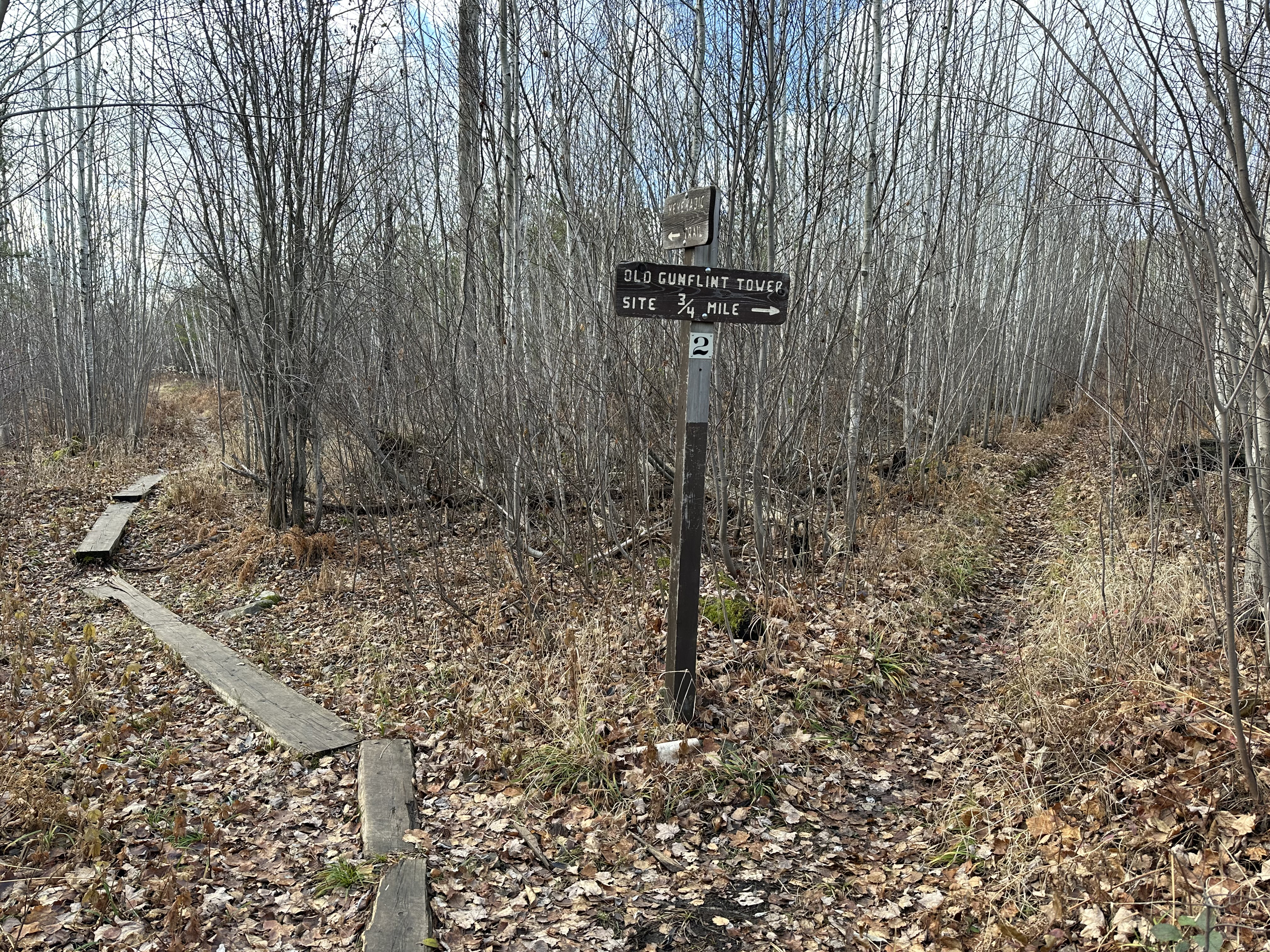
HIKING THE GUNFLINT LOOKOUT TOWER SPUR TRAIL
Site #2 in the Centennial Trail Interpretive Guide.
The spur trail climbs about 250 feet over about 1/2 mile until reaching the area of the old Gunflint Trail Lookout Tower.
View south from near the fire tower. Round Lake, a popular BWCA entry lake, is visible about 1.5 miles away.
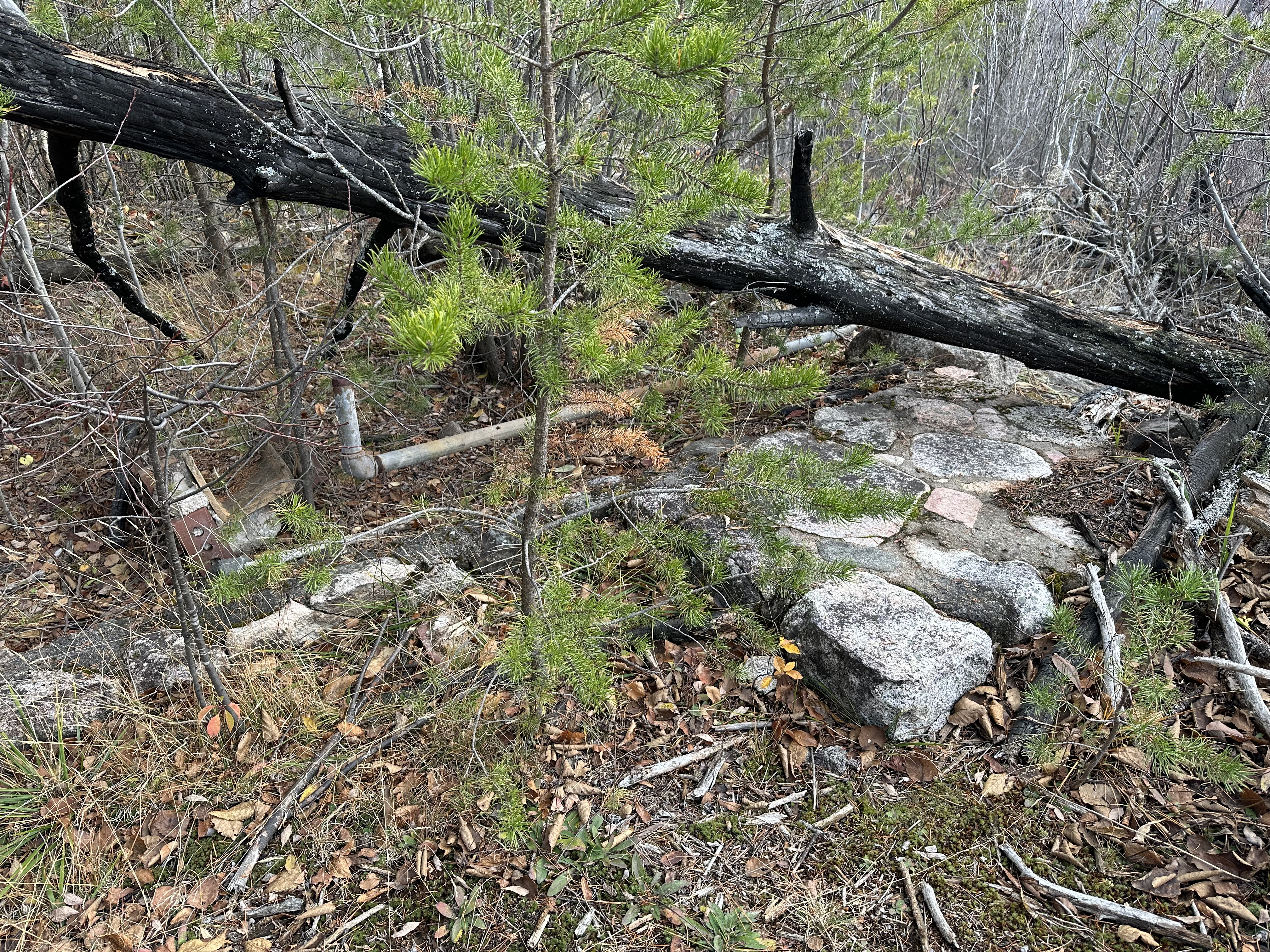
The next few images are remnants of the cabin that used to stand here, mostly only its foundation remains.
Close up of the stonework.
Some fasteners lying on top of foundation stones.
More of the foundation and some piping can be seen here.
Scattered pieces of the foundation.
Closer view of the plumbing.
The next few images are of the fire tower which dates back to the 1930's.
Outside of the toppled tower from another angle.
Old metal bucket and some of the interior (on left) of the tower.
Interior view of the roof/ceiling of the old tower.
The floor of the tower seems to be missing, but the lower metal walls are visible here.
HIKING FROM THE GUNFLINT LOOKOUT TOWER SPUR TRAIL TO THE CENTENNIAL TRAIL/KEKEKABIC TRAIL SPLIT
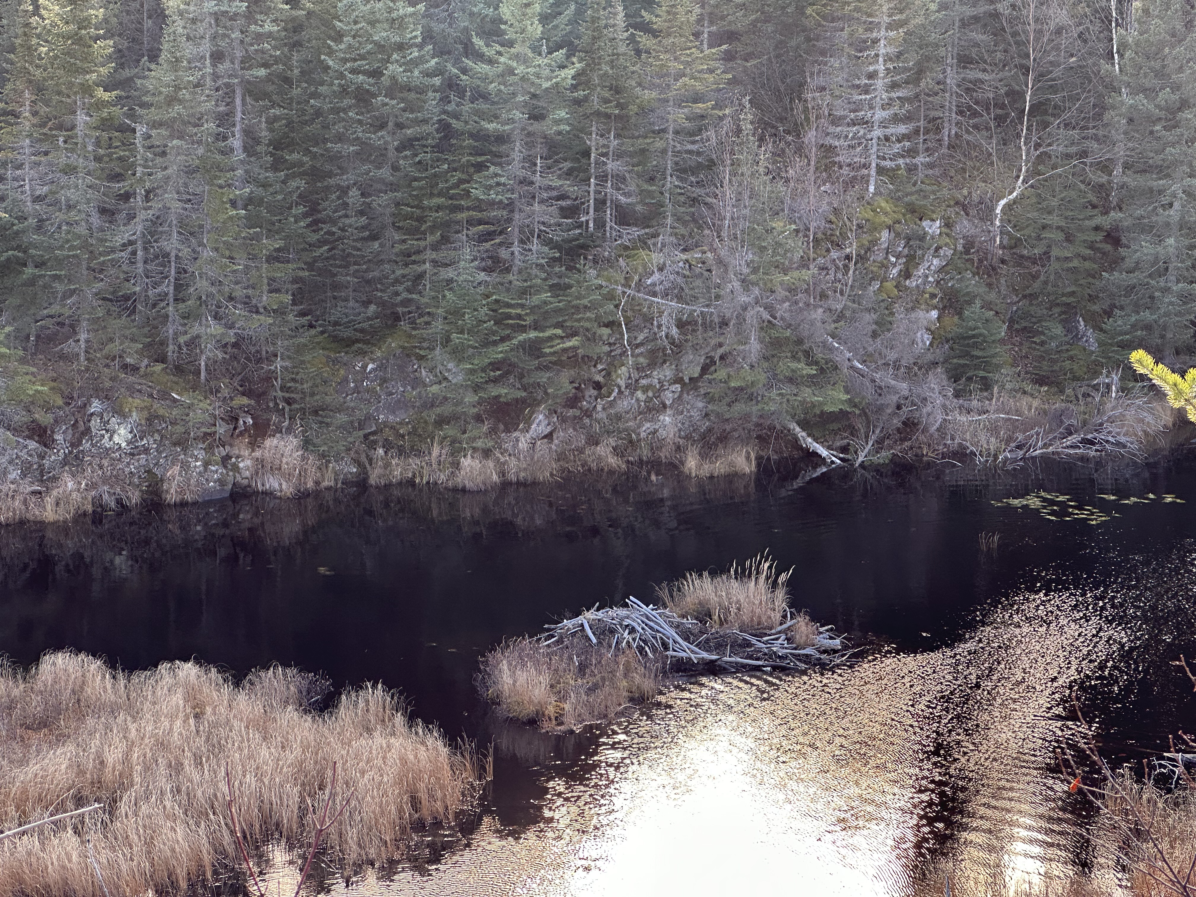
This small pond is about 1/4 mile west of the Gunflint Lookout Tower spur. You'll often seen beaver here.
Another view of the pond.
Along this stretch of the trail, you will pass five separate mining pits, including the Paulsen Mine. Once past the mines, there is a pond and then a small unnamed lake along the south side of the trail. This is a great place to view beavers. Once you get close to the split between the Centennial Trail and the Kekekabic Trail, there is a pile of mine tailings on the north side of the trail (November 16, 2023).
Older video footage of this same section of the Kekekabic Trail (October 20, 2022).
A larger pond or maybe a small unnamed lake is just east of the trail split. The trail rises a good ways above this providing some expansive views.
One of the local residents (lower center of view).
Another beaver in the small unnamed lake.
And another...
Looking back to the east down the small lake. Another beaver is visible on the shore (left center of your view).
A pair of beavers along the shore of this wetland a few thousand feet east of the west end of Mine Lake.
Closer view of the beaver on the shoreline. Small beaver lodge visible in the distance (just left of center).
Here is where the Centennial Trail and the Kekekabic Trail go their separate ways. The Kekekabic Trail continues west into the Boundary Waters for another 37.6 miles, while the Centennial Trail crosses the small creek and then bends back to the east to form a loop that returns you to the trailhead. This bridge marks the location of a switchback used by the railroad to navigate a sharp corner.
HIKING FROM THE CENTENNIAL TRAIL/KEKEKABIC TRAIL SPLIT TO THE MINE LAKE OVERLOOK
Once past the split, there is a continuous valley along the south side of the trail that is filled with a creek that passes through several wetlands.
Past the Centennial/Kekekabic Trail split, hike another 0.6 miles to the Mine Lake Overlook. The Overlook is a total of about 1.8 miles from the eastern trailhead of the Kekekabic Trail (November 16, 2023).
This is older video footage of the same section of the Kekekabic Trail as shown above (October 20, 2022).
Another view of the valley east of Mine Lake.
Glancing back toward the east down the valley. You will likely see a number of beavers in this area.
This is where the creek that you've been following westward through the valley drains into the east end of Mine Lake.
A look at the trail tread as it meanders through the tall grasses near the east end of Mine Lake. The Kekekabic Trail runs along the north shore of the lake.
From the eastern side of Mine Lake, this is a view to the west across the lake.
The Kekekabic Trail was recently (around 2020) re-routed here to climb up this overlook. Previously the trail ran right along the lake shore, but it was prone to flooding. This is looking southwest from the top of the overlook.
Mine Lake as seen from the Kekekabic Trail (November 16, 2023).
Older video footage of Mine Lake (October 20, 2022).
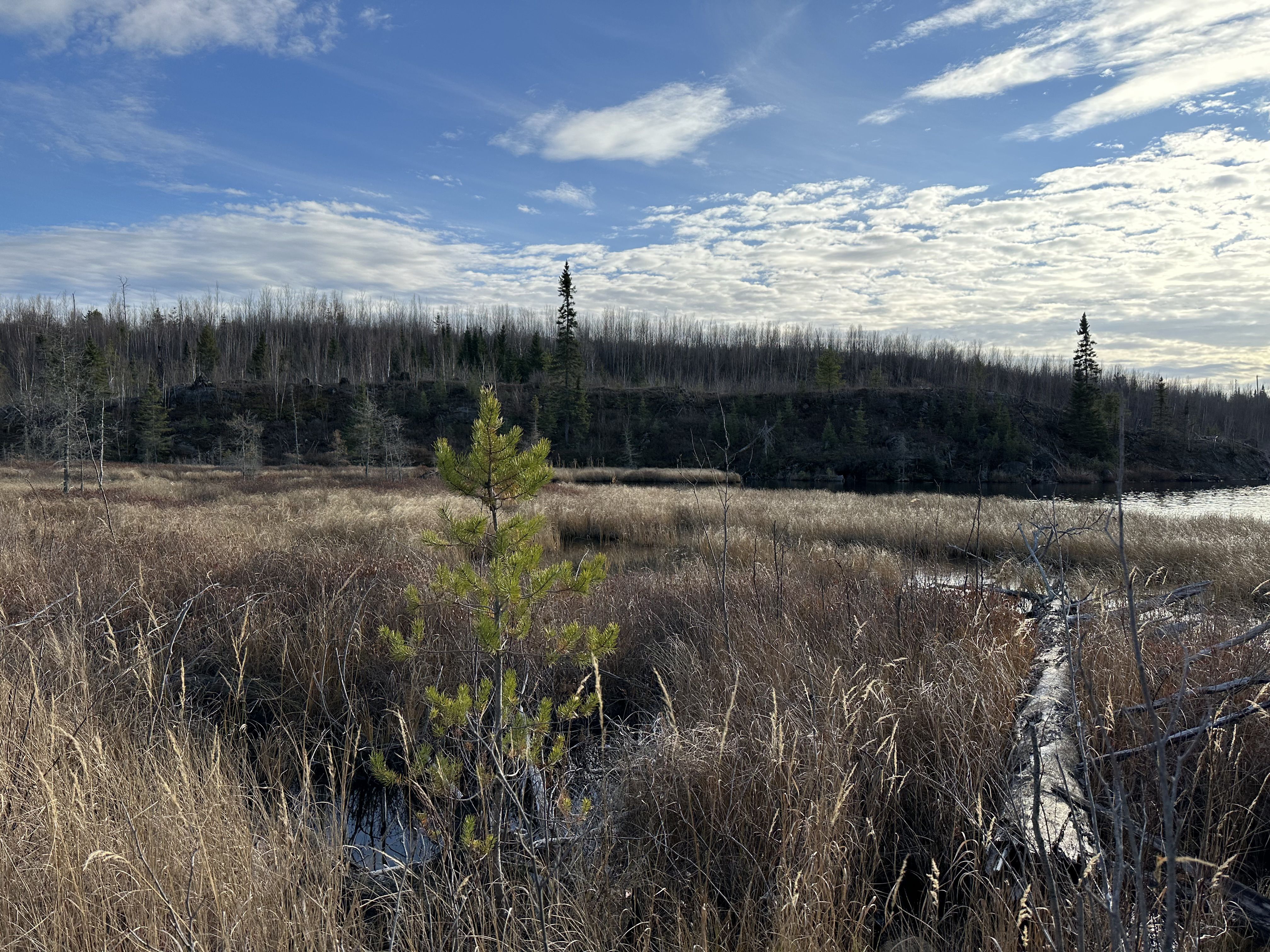
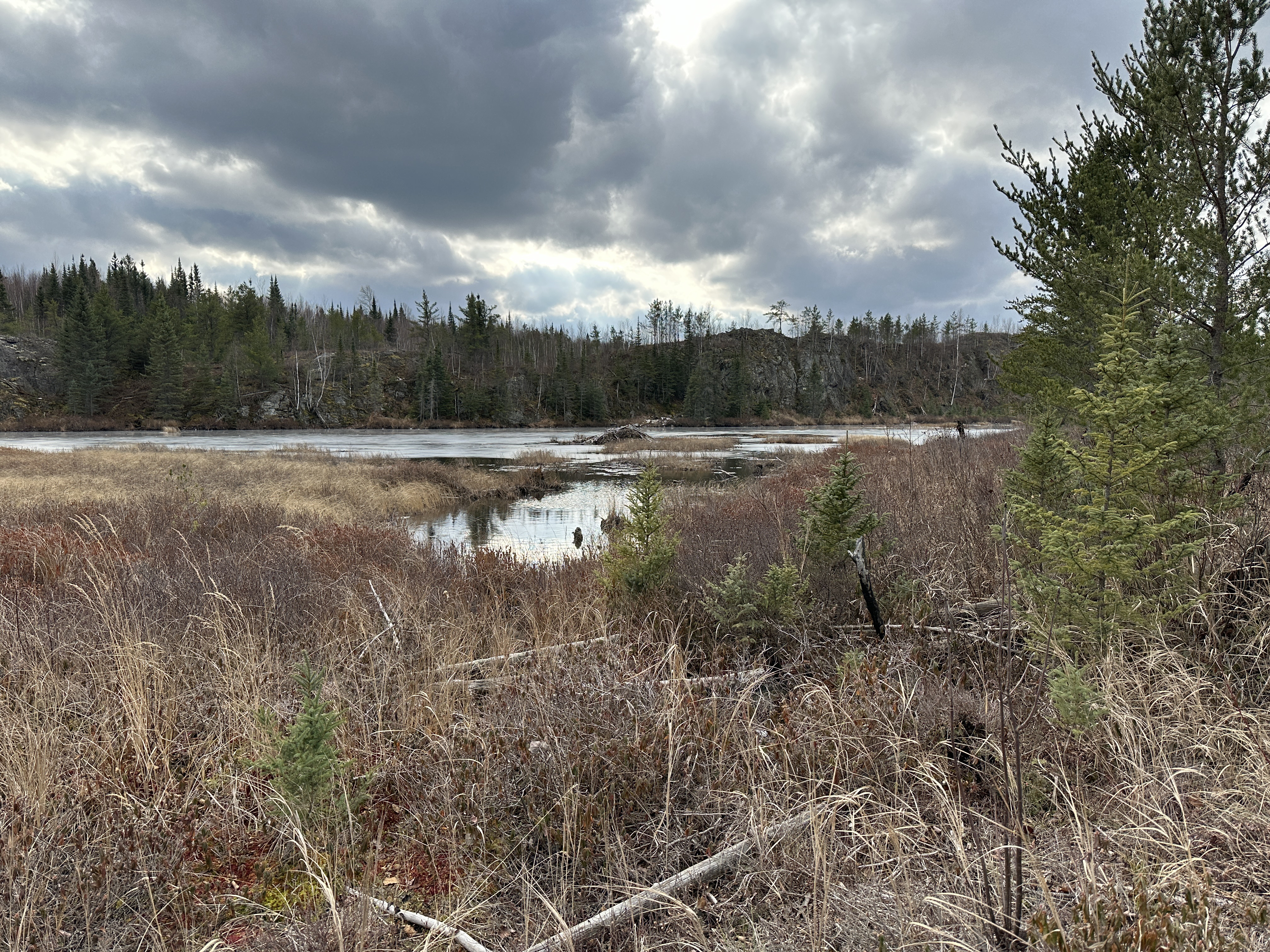
HIKING FROM THE MINE LAKE OVERLOOK TO THE BWCA BOUNDARY SIGN
This stretch of the Kekekabic Trail runs along the north side of Mine Lake. Once past Mine Lake the path follows the north side of a valley leading to Bingshick Lake. The stream flowing through this valley has a large beaver population. Reach the sign that indicates you are entering the Boundary Waters Canoe Area. You need to be in possession of a BWCA permit beyond this point. The segment of trail shown in this video is about 0.8-miles long (November 16, 2023).
Panoramic view of Mine Lake (November 16, 2023).
HIKING FROM THE BWCA BOUNDARY SIGN TO BWCA CAMPSITE 495
The Kek continues to follow the valley between Bingshick Lake and Mine Lake for the next 0.6-miles. Shortly after the trail reaches Bingshick Lake, there is a short spur trail to BWCA Campsite 495 that is located on a point at the eastern end of the lake. This is not long before coming to the unmaintained portage between Bingshick Lake and Honker Lake (November 16, 2023).
Beaver lodge along the stream between Mine Lake and Bingshick Lake (November 16, 2023).
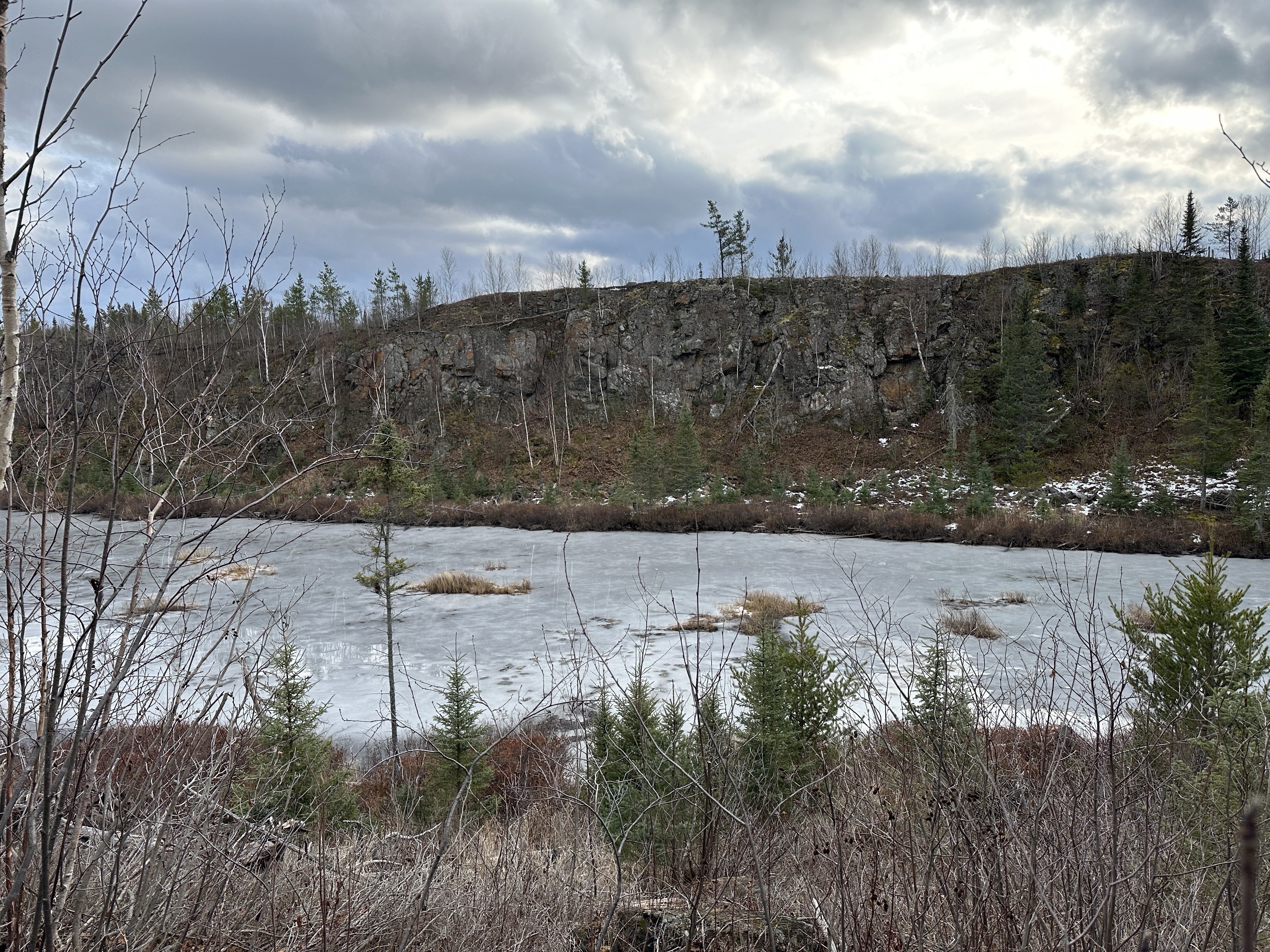
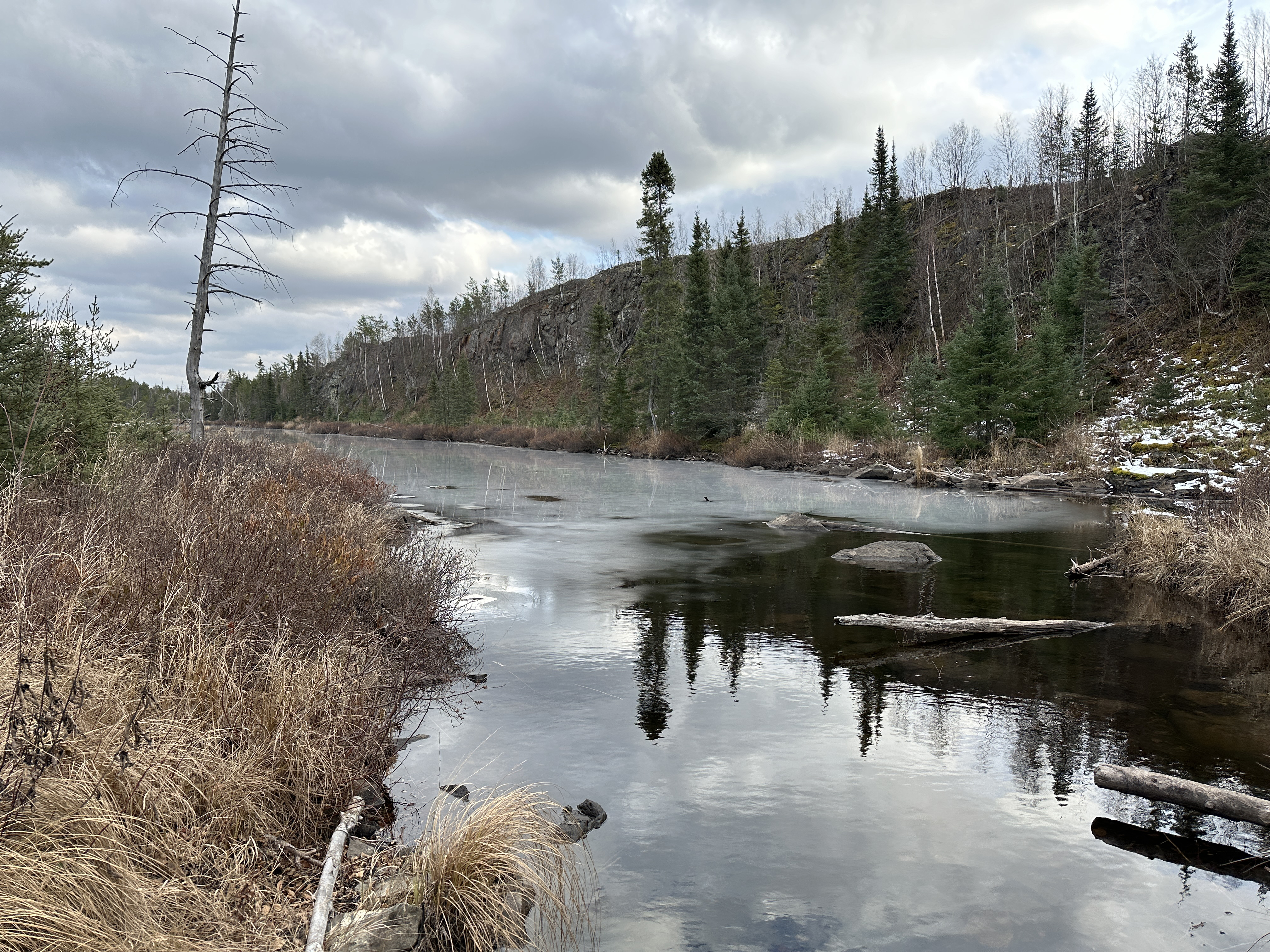
Cliffs on the otherside of the valley (November 16, 2023).
Partially frozen stream. This is just east of Bingshick Lake (November 16, 2023).
HIKING FROM BWCA CAMPSITE 495 TO BWCA CAMPSITE 494
A short distance west of BWCA Campsite 495, you cross the small creek flowing out of Honker Lake into Bingshick Lake. On the west side of this creek is an unmaintained portage that connects these two lakes. BWCA Campsite 494 is just a few hundred feet west of this stream/portage. The distance between the two campsites is about 0.25-miles (November 16, 2023).
HIKING FROM BWCA CAMPSITE 494 TO THE BINGSHICK LAKE/GLEE LAKE PORTAGE
The trail follows the north shoreline of Bingshick Lake all the way to the west end of the lake. Total distance of about 0.6-miles. Good views of the frozen lake. Here it intersects the Bingshick Lake/Glee Lake portage. The trail follows the portage for a short distance until the paths split (March 11, 2024).
HIKING FROM THE BINGSHICK LAKE/GLEE LAKE PORTAGE TO THE FAY LAKE/GLEE LAKE PORTAGE
Where the portage and trail split, we stay to the left and continue along the Kekekabic Trail. If you go right at the split you will soon arrive at Glee Lake. It's only about 0.25-miles until the Kekekabic Trail intersects another portage. This portage connects Fay Lake and Glee Lake (March 11, 2024).
HIKING FROM THE FAY LAKE/GLEE LAKE PORTAGE TO THE CHUB RIVER CROSSING
This video shows the hike of about 0.6-miles starting from the portage between Glee Lake and Fay Lake and ending at the Chub Creek crossing. The trail follows the top of a ridge between Glee Lake (to the north) and Fay Lake (to the south). The last few rods of this hike follow the portage between Fay Lake and Chub Creek. Chub Creek flows into Warclub Lake about a quarter-mile downstream from the crossing. The creek is crossed on a simple bridge made of logs (March 11, 2024).
MISSING THE VIDEOS FOR THE LONG STRETCH OF TRAIL BETWEEN CHUB CREEK CROSSING AND THE EASTERN JUNCTION WITH THE BECOOSIN-BENEZIE TRAIL
HIKING FROM EAST BECOOSIN-BENEZIE TRAIL JUNCTION TO THE SNOWBANK TRAIL JUNCTION
Short hike from the eastern junction of the Becoosin-Benezie Loop Trail and the Kekekabic Trail. A small rock cairn marks this intersection. The junction of the Kek and the Snowbank Lake Trail is marked by an old and very warm vertical log marker. There is also a large white pine tree at this junction.
This marker is for the Kekekabic Trail/Snowbank Lake Trail junction.
HIKING FROM THE SNOWBANK TRAIL JUNCTION TO THE WEST BECOOSIN-BENEZIE TRAIL JUNCTION
Continue westbound from the Snowbank Lake Trail junction to the Becoosin-Benezie Loop Trail west marker. The Becoosin-Benezie Trail forms a short loop along the south side of the Kekekabic Trail that gives hikers access to Becoosin Lake and Benezie Lake. Each of those lakes has two campsites.
This marker is for the Kekekabic Trail and the west junction of the Becoosin-Benezie Trail.
HIKING FROM THE WEST BECOOSIN-BENEZIE TRAIL JUNCTION TO THE LOGGING ROAD
It's about one mile from the Becoosin-Benezie Trail junction to the logging road. Before reaching the logging road, you will cross the BWCA boundary line.
HIKING FROM THE LOGGING ROAD TO THE BEAVER POND
After another half-mile, you come to a beaver pond that is right next to the trail. Beavers are often seen here.
MISSING THE VIDEO BETWEEN THE BEAVER POND AND THE WEST TRAILHEAD OF THE KEKEKABIC TRAIL