GILLIS LAKE CAMPSITES: Campsite 1: (#507) - Campsite on the east shoreline of the lake Campsite 2: (#509) - Just west of the Fern Lake portage
Campsite 3 (#508): On large island along south shore of lake
Campsite 4 (#506): First campsite west of Bat Lake portage
Campsite 5 (#505): First campsite east of the French Lake portage
Campsite 6 (#504): First campsite south of the French Lake portage on west shore
Campsite 7 (#503): Second campsite south of the French Lake portage on west shore
Gills Lake can be an excellent lake for "lakers". The area out in front of the bay leading to the Crooked Lake portage is perhaps the most tempting. Just troll a spoon around the lakes contours to find the fish. A couple good sized islands spot the west end of the lake. Fishing between them can be productive. A large cliff is on the northern and smaller of these two islands. The lake has few northerns, but they tend to be large (perhaps feeding on nice fatty lake trout). There are six large islands in the lake; one with an area of over 30 acres. The shoreline is a tad over nine miles long.
Gillis Lake's water drains out toward the south just west of the portage to Crooked Lake. A small creek carries the water from Gillis Lake into Crooked Lake. The entire drop along this short creek is 14 feet. This portage has the ruins of an old log cabin. There are a pretty set of rapids along the trail too that includes a small waterfall. There used to be an old dock at the Crooked Lake end of this portage, not far from the cabin. This dock was still visible in 2006, but not visible as of 2015, so it disappeared sometime during that time span.
There are quite a few campsites on Gillis Lake, but some of them were impacted by the Cavity Lake Fire. There is a very nice campsite on the east side of the lake just west of Fishgig Lake.
If you are looking for wildlife or a little adventure, try bushwhacking back into Fishgig Lake. It is a late stage lake with a lot of wetland surrounding it.
Gillis Lake is at a crossroads in the BWCA. There are routes to Bat Lake, Crooked Lake, Fern Lake and French Lake from here. The route west of French Lake over to Virgin Lake is lightly traveled.
Until the recent Cavity Lake Fire in 2006, Gillis Lake had avoided the torch since 1875. Another historic fire, in 1864 burned almost all of the forest surrounding Gillis Lake (Heinselman, 1999).
References:
Beymer, Robert, Boundary Waters Canoe Area – Volume 2 – Eastern Region (Berkeley: Wilderness Press, 2006), 61, 147, 156.
Pauly, Daniel, Exploring the Boundary Waters (Minneapolis: University of Minnesota Press, 2005), 323, 330.
Deepest Lakes in the Boundary Waters Canoe Area (BWCA)
Gillis Lake is the third deepest lake entirely within the BWCA (180 feet), surpassed only by Gabimichigami Lake at 209 feet and Lake Kekekabic at 195 feet. Note that Saganaga Lake is deeper, but it isn't entirely in the BWCA. Also the 281 foot maximum depth of Saganaga Lake is in Canadian waters; it never exceeds 138 feet in depth (just east of American Point) in Minnesota waters. Mountain Lake, a border lake, is 210 feet deep, but that point lies on the Canadian side as well (it does get over 140 feet deep in Minnesota waters though). Another deep border lake is Knife Lake which reaches a depth of 179 feet. This depth is achieved in a depth contour that straddles the U.S./Canada border. This point is 3,900 feet due east of Martin Lake (a Quetico Lake) just north of a point and just 800 feet east of a small island. Lac La Croix, another border lake bottoms out at 168 feet in depth (reaches over 130 feet in U.S. waters just north American Point and also just north of the entrance to Lady Boot Bay). The maximum depth is in Canadian waters. Winchell Lake is the fourth deepest lake entirely in the BWCA at 160 feet. Little Saganaga Lake and Snowbank Lake are tied, both at 150 feet, but Snowbank Lake isn't entirely within the BWCA. Sea Gull Lake drops 145 feet down, also partially outside of the BWCA. Cherokee Lake is 142 feet deep. South Lake over on the east side of the BWCA is a border lake and is 140 feet in depth. Tuscarora Lake is 130 feet. Kek Lake (a small lake near Kekekabic Lake) is a 130 foot deep pit. Duncan Lake is also at 130 feet. Same with Clearwater Lake, also 130 feet. North Lake, fittingly just north of South Lake and mostly in Canada is 125 feet deep. Jasper Lake 125 feet. West Pike is a mere 120 feet deep. Ima Lake 116 feet. Pine Lake is 113 feet in depth. Basswood Lake is at 111 feet (but much of the lake is in Canada). Thomas Lake is 110 feet. Hanson Lake is 100 feet.
**All this depth information verified on the Minnesota Department of Natural Resources website (and most double-verified with third party topographic maps when available).**
Here is a list of the deepest lakes in (or partially within, as noted) the BWCA starting with the deepest:
1) Saganaga Lake (281 feet in Canadian waters, 138 feet in U.S. waters)
2) Mountain Lake (210 feet in Canadian waters, over 140 feet in U.S. waters) 3) Gabimichigami Lake (209 feet - deepest natural lake entirely in Minnesota and BWCA - Loon Lake, not in BWCA, is 2nd at 202 feet)
4) Lake Kekekabic (195 feet - second deepest lake entirely in BWCA)
5) Gillis Lake (180 feet - third deepest lake entirely in BWCA)
6) Knife Lake (179 feet - this depth contour straddles the U.S./Canada border)
7) Lac La Croix (168 feet - in Canadian waters, several spots exceed 130 feet in depth in U.S. waters)
8) Crooked Lake (165 feet - in U.S. waters, north end of Thursday Bay)
9) Winchell Lake (160 feet - fourth deepest lake entirely in BWCA)
10) Little Saganaga Lake (150 feet - tied for fifth deepest lake entirely in BWCA)
11) Snowbank Lake (150 feet - this lake is not entirely within the BWCA)
12) Takucmich Lake (150 feet - tied for fifth deepest lake entirely in BWCA)
13) Sea Gull Lake (145 feet - this lake is not entirely within the BWCA)
14) Cherokee Lake (142 feet - seventh deepest lake entirely within the BWCA)
15) South Lake (140 feet - this maximum depth occurs in U.S. waters)
16) Gun Lake (135 feet - this is the "Gun" Lake just west of Takucmich Lake - eigth deepest lake entirely within the BWCA)
17) Clearwater Lake (130 feet - this lake is not entirely within the BWCA)
18) Duncan Lake (130 feet)
19) French Lake (130 feet)
20) Kek Lake (130 feet - a tiny lake right by Lake Kekekabic)
21) Oyster Lake (130 feet)
22) Tuscarora Lake (130 feet)
23) Howard Lake (125 feet)
24) Jasper Lake (125 feet)
25) North Lake (125 feet - this depth occurs in Canadian waters and most of this lake is in Canada)
26) Swan Lake (122 feet)
27) West Pike Lake (120 feet)
28) Peter Lake (120 feet)
29) Ima Lake (116 feet)
30) Ottertrack Lake (116 feet - this depth is in Canadian waters in north arm; in U.S. waters depth exceeds 80 feet 0.6 miles W of Ester Lake portage)
31) Pine Lake (113 feet)
32) Basswood Lake (111 feet - this is in Canadian waters about 0.75 miles NE of United States Point, depth exceeds 100 feet in U.S. waters nearby)
33) Amoeber Lake (110 feet)
34) Bat Lake (110 feet)
35) Ester Lake (110 feet)
36) Lake of the Clouds (110 feet)
37) Thomas Lake (110 feet)
38) Fraser Lake (105 feet)
39) Rabbit Lake (105 feet)
40) Vernon Lake (101 feet)
41) Hanson Lake (100 feet)
42) Trout Lake (98 feet)
Click on the photos below to see the full resolution image - Use your browsers back button to close photo and return to this page.
PADDLING FROM THE BAT LAKE PORTAGE TO THE ONLY CAMPSITE ON THE EASTERN SHORELINE
A near perfect view of a small island offshore from the Bat Lake portage landing.
From the Bat Lake portage landing, you take an evening paddle along the eastern shoreline of Gillis Lake. You eventually make it to a campsite in the east/southeast part of the lake. This campsite is just west of Fishgig Lake.
Gillis Lake looking west. It is mid-October. View from the only campsite on the east shore of Gillis Lake. Visit the Campsite -or- Explore Another Route **********************************************END OF ROUTE***********************************************
PADDLING FROM THE ONLY CAMPSITE ON THE EAST SHORELINE TO THE CROOKED LAKE PORTAGE
Another sunset view of Gillis Lake from the campsite on the east shore of the lake.
Starting out in the morning from the campsite on the eastern shoreline of Gillis Lake, you stay along the shore and make your way over to the Crooked Lake portage landing.
A look to the north from the beginning of the portage that leads to Crooked Lake. Portage to Crooked Lake -or- Explore Another Route **********************************************END OF ROUTE***********************************************
PADDLING FROM THE CROOKED LAKE PORTAGE TO THE FERN LAKE PORTAGE
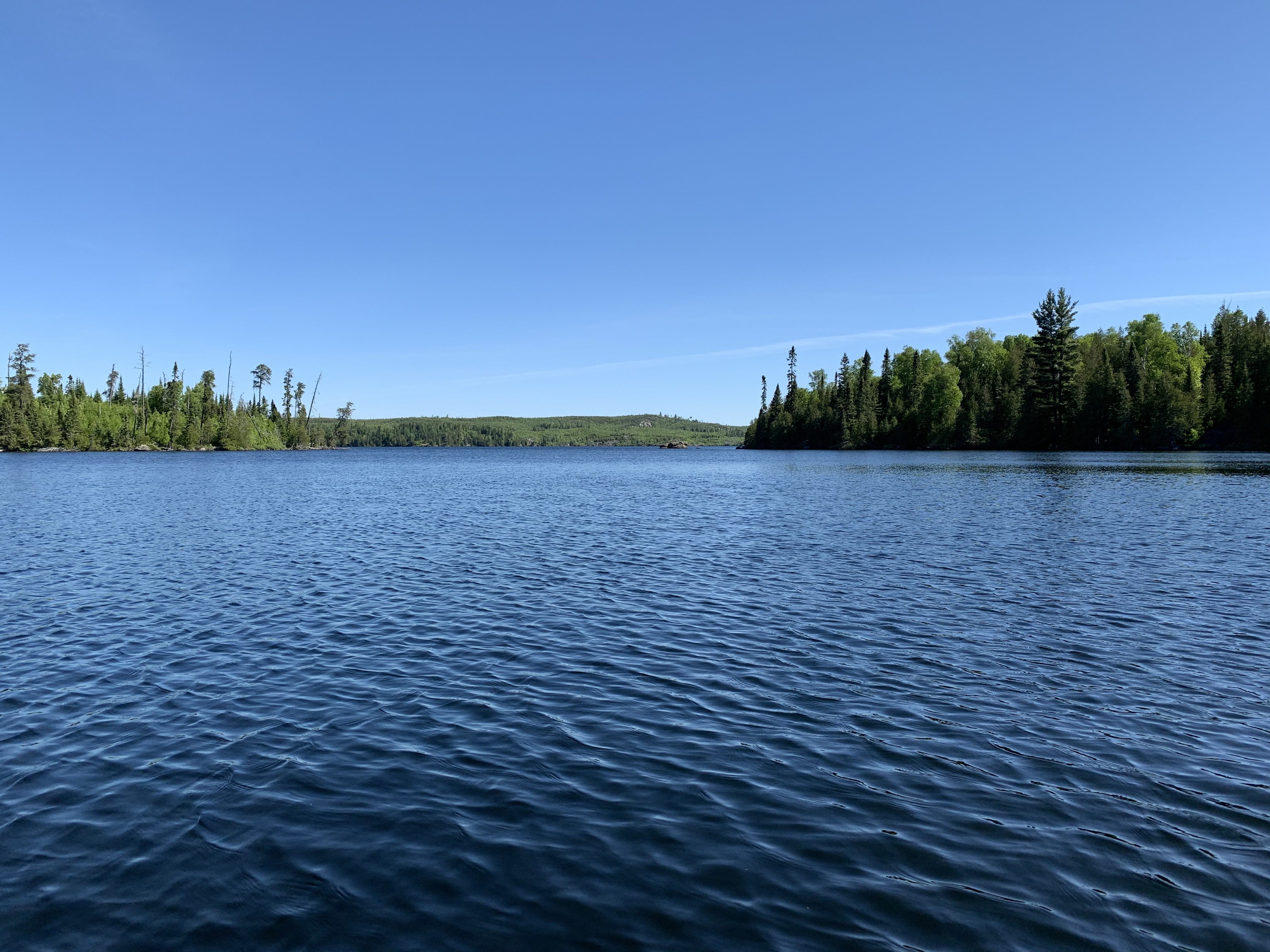
Arriving at Gillis Lake along the Crooked Lake portage. Looking north. The east end of a large island is visible to the left in the distance.
This is just after heading out onto Gillis Lake after leaving the Crooked Lake portage. The view is toward the north. On the left side of your view is the eastern end of a large island.
Paddling west along the south shore of Gillis Lake. On your right is a large island which suffered fire damage, that extends westward across your field of vision into the middle distance.
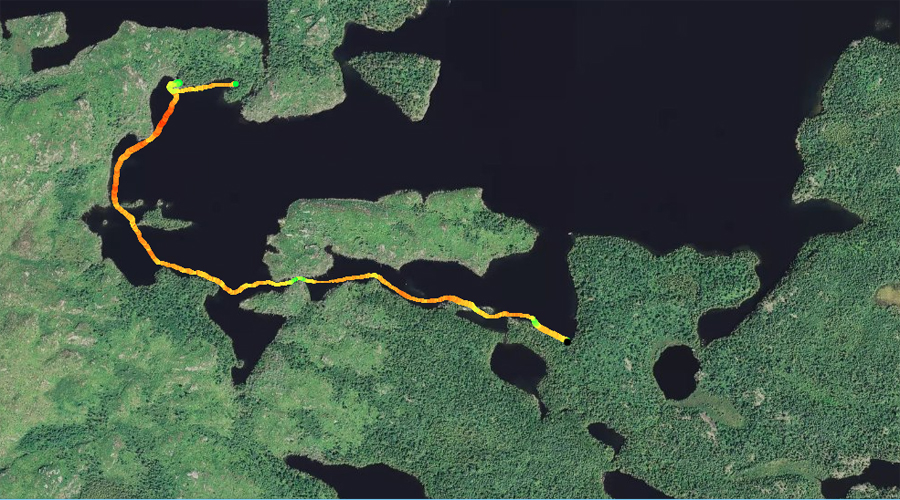
This route across Gillis Lake begins at the Crooked Lake portage. From there, head due west along the very south side of Gillis Lake. At one point, you must squeeeeeeeeeze through a narrow choke point (this way could be blocked if a tree happens to fall across it) between the south shore of the lake and a large island to your north (on your right) in order to get into the western end of Gillis Lake. Continue paddling over to the west shoreline and then northward, going behind the small island in this part of the lake. You check out the campsite that is located along the north shore just south of Fern Lake on your map. From the campsite, it's just a short paddle east to the Fern Lake portage.
The small bay just south of Fern Lake and west of the Fern Lake portage. This bay is the location of a decent campsite. Direction of view is southward.
You are looking on a line to the southwest from the Fern Lake portage toward the western most end of Gillis Lake. Portage to Fern Lake -or- Explore Another Route **********************************************END OF ROUTE***********************************************