Bat Lake
» Display Bat Lake Map
» Display scrollable USGS Topo Map of Bat Lake
» Show Simple Bat Lake Map
Nearest Entry Point: Brant Lake #52 Fishing: MN DNR; Lake Trout
Maps: Fisher F-12; McKenzie #7 Lake Depth: MN DNR; 110 feet
Fire History: 2006 Cavity Lake Fire Lake Size: 83 acres
Campsites: 3 Wildlife Seen on Visit: None
Last Visited: October 9, 2015 Lake Elevation: About 1704 feet
Water Clarity: MN DNR

ROUTES/PORTAGES FROM BAT LAKE:
To Gillis Lake: Walk the 25 rod portage
To Green Lake: Walk the 70 rod portage

Bat Lake

Gunflint Ranger District

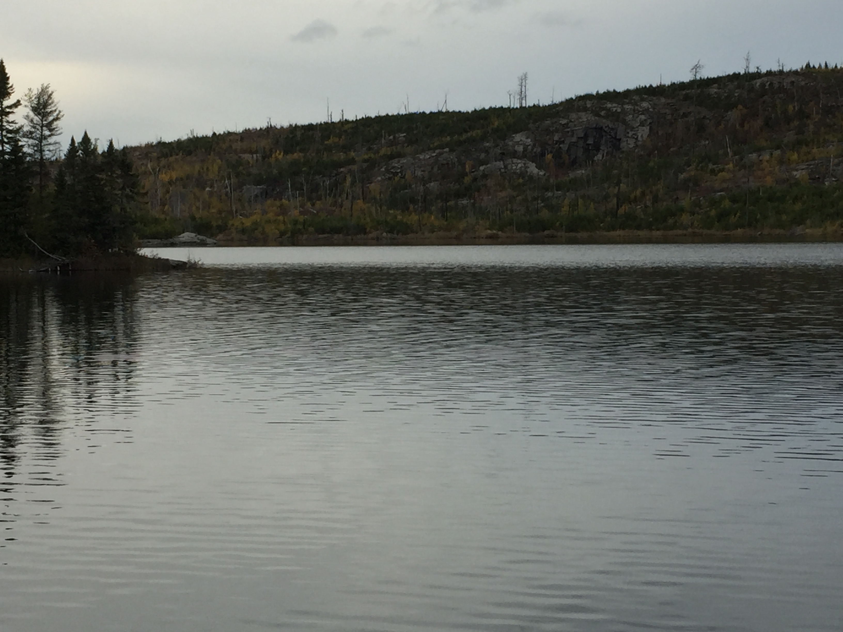
The north shore of Bat Lake between theGreen Lake and Gillis Lake portages was almost completely burned by the Cavity Lake Fire. The south shore of the lake is still intact. Two of the lakes three campsites are on the south shore. The campsite on the north shore is still open. Note that Bat Lake is the first lake along the route from Brant Lake to have campsites. Most paddlers in this area are focused on camping on Gillis Lake, so something on Bat Lake is usually available. A big rock platform marks the Gillis Lake portage landing.

The portage from Gillis Lake to Bat Lake is short, but rather rocky and with an incline if coming from Gillis Lake. The other portage from Bat Lake to Green Lake is easy.

Bat Lake has plenty of small lakers; good eating size. This lake is often passed by as many would rather spend time fishing on Gillis Lake. Bat Lake was stocked with lakers in 1989 and 1991. The lake is certainly deep enough to support lake trout. At 110 feet in depth, it is one of the deepest lakes in the BWCA.

The burned north shore of Bat Lake exposes some fairly impressive cliffs.

Water from Bat Lake drains out through a wetland into an unnamed lake about 40 rods to the west. The water from this small lake then drains south into Gillis Lake. Gillis Lake's water level is 53 feet below that of Bat Lake.

References:
Beymer, Robert, Boundary Waters Canoe Area – Volume 2 – Eastern Region (Berkeley: Wilderness Press, 2006), 147.
Pauly, Daniel, Exploring the Boundary Waters (Minneapolis: University of Minnesota Press, 2005), 323, 330, 333.

Exploring Bat Lake

Routes to locations on Bat Lake are shown below:
Paddling from the Green Lake portage to the Gillis Lake portage

Click on the photos below to see the full resolution image - Use your browsers back button to close photo and return to this page.

PADDLING FROM THE GREEN LAKE PORTAGE TO THE GILLIS LAKE PORTAGE

Bat Lake 1
A view to the west from the Green Lake portage. This is late afternoon in mid-October.


Staying relatively close to the south shore of the lake, you paddle across Bat Lake in the BWCA on a late fall day (Video has some sound issues).


Bat Lake 2
Here you are looking from the Gillis Lake portage landing.


Bat Lake 3
A steep ridge of rock is more easily visible because of the 2006 Cavity Lake Fire.

Route Connections for Bat Lake

From Bat Lake, you can portage to Gillis Lake or Green Lake.

Return to Top of Page


PMA #1: Weeny PMA #4: Tick PMA #7: Pitfall PMA #10: Hairy
PMA #2: Canthook PMA #5: Spider PMA #8: Mugwump PMA #11: Weasel
PMA #3: Sundial PMA #6: Drag PMA #9: Humpback PMA #12: Fungus
- www.BWCAwild.com - All Rights Reserved.
All images, videos and text property of www.BWCAwild.com - No reuse without permission.
DISCLAIMER AND TERMS OF USE --- CONTACT US --- PRIVACY POLICY