Entry Point 74 - Snowbank Lake Trail / Kekekabic Trail (West)
Kawishiwi Ranger District
From Ely, Minnesota, BWCA Entry Point 74 is about 21 miles. Drive 19.5 miles east on the Fernberg Trail (aka Highway 169) until you reach Snowbank Lake Road. Turn left and continue for 1.5 miles to the entry point parking lot which will be on your left. Note that the Kekekabic Trail (heading east) starts on the right side of the road, across the road from the parking lot. The entry point for Snowbank Lake is just a bit further down the road.
This entry point is for the Snowbank Lake Trail and the west terminus of the Kekekabic Trail. Also, there is a new entry point (as of 2025) for hikers of the North Country National Scenic Trail wanting to do a through hike of the Kekekabic Trail and also the Border Route Trail (BRT). The permit you need for this is BWCA Entry Point 91 - NCT - West (Thru-Hike). The reason you need this new permit is because you will leave the BWCA crossing the Gunflint Trail near where these two trails meet. It is illegal to exit and then re-enter the Boundary Waters Canoe Area. Before this permit became available, you were required to have to permits (one for the Kek and the other for the BRT) with overlapping dates.
The Snowbank Lake Trail is a loop trail circumnavigating Snowbank Lake. The Kekekabic is a linear trail that has its eastern terminus on the Gunflint Trail about 42 miles away. On the otherside of the Gunflint Trail (literally across the road and about 400 feet north), is the west terminus of the Border Route Trail. That trail continues another 65 miles east until it connects to the Superior Hiking Trail. So from this point it is possible to hike across the BWCA over to Lake Superior and down the North Shore to Duluth and even to the Wisconsin-Minnesota border, a distance of about 415 miles. Once at the Wisconsin Border, you can continue along the North Country National Scenic Trail (NCNST)). That trail continues all the way to New York in the eastern United States.
Note that the Kekekabic Trail and the Border Route Trail are now part of the NCNST. To hike both of these trails together, use a permit for either Entry Point #90 or Entry Point #91, depending on which way you are hiking. The Superior Hiking Trail is also now part of the NCNST. Work has also started on building the NCNST connection between the western end of the Kekekabic Trail and the eastern end of the Mesabi Trail which currently ends in Ely, Minnesota (as of 2025). This section of trail would generally parallel the Fernberg Road.
The Kekekabic Trail Club maintains both of these trails (the Snowbank Lake Trail and the Kekekabic Trail). They also publish an excellent trail guide for the Kekekabic Trail. For more information check out their website.
Another blowdown occurred on July 21, 2016 which required some serious trail clearing efforts to make both of these trails functional again. As of summer 2019, the Kekekabic Trail is fully open.
Exploring the Entry Point
Click on the photos below to see the full resolution image - Use your browsers back button to close photo and return to this page.
Sign for Snowbank Lake entry point and the Snowbank Lake Trail entry point seen along the Fernberg Trail. The west terminus of the Kekekabic Trail also is located at the same place as the Snowbank Lake Trailhead.
Another sign along Snowbank Lake Road showing the turn off to the parking lot for the trailheads.
The parking lot is visible on the far left of your view. The Snowbank Lake Trail begins just to the left of those two signs. The Kekekabic Trail starts/ends just to the right, out of your view directly across the road from that faintly visible sign posted to the birch tree near the right side of your vision.
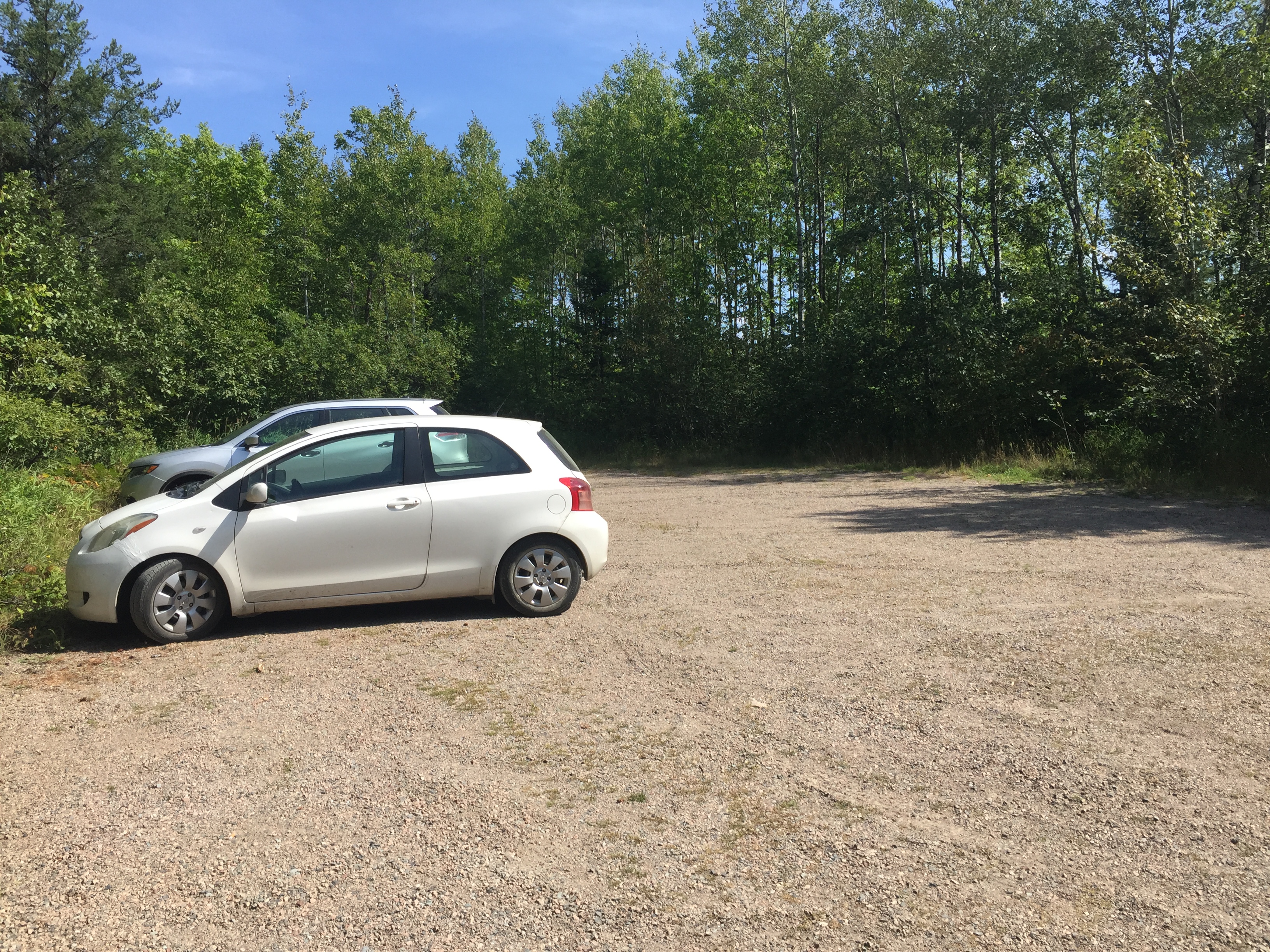
The parking lot where your car will hang out while you hike. It will usually have some company.
The Snowbank Lake Trail starts just to the left of the sign. The Kekekabic Trail starts across the road from this parking lot. The small box on the lower left of the sign contains forms for filling out a day permit. You need a day permit if you don't have an overnight hiking permit.
The older set of bulletin boards. These were replaced sometime between 2017 and 2022.
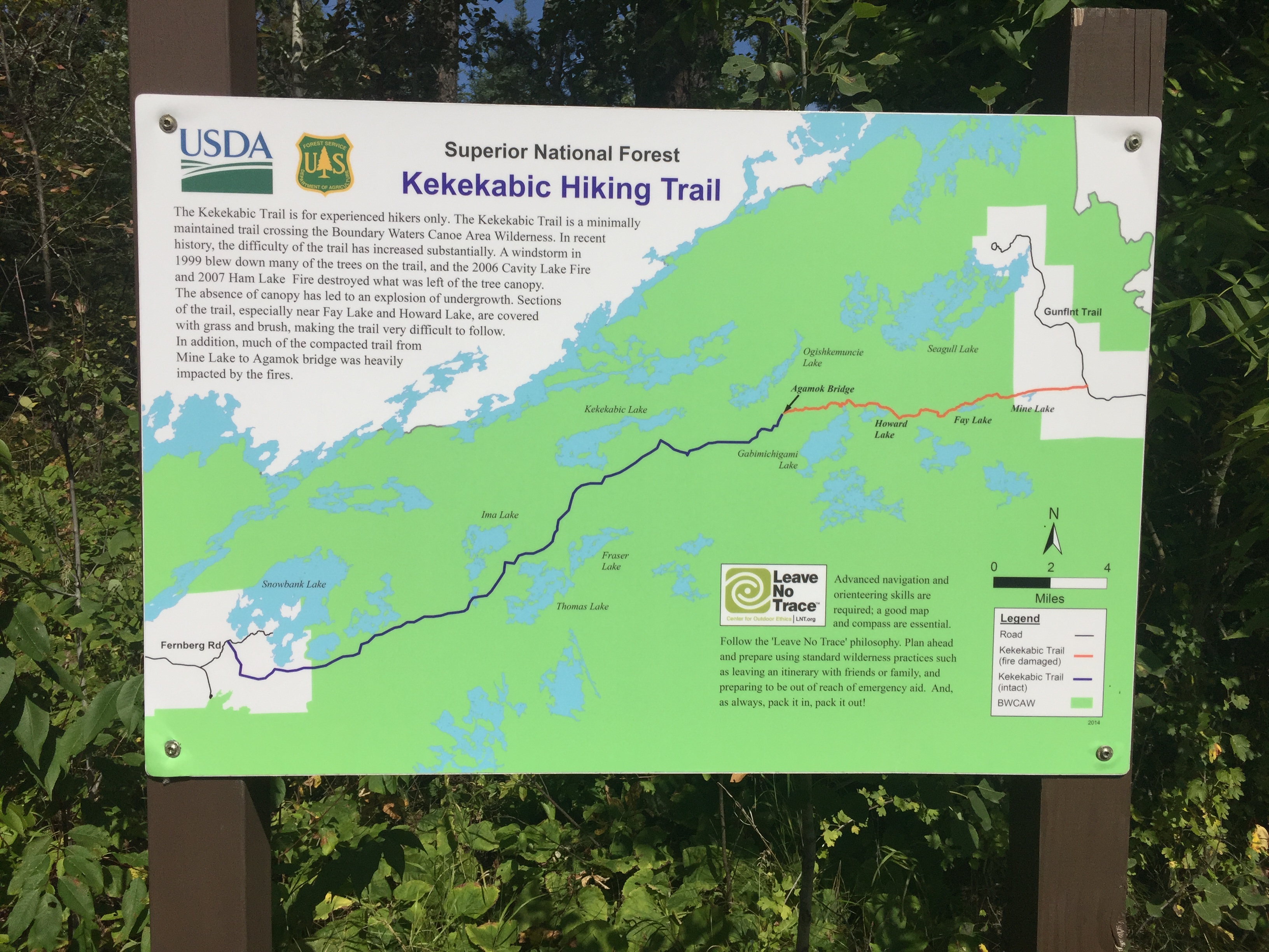
Sign showing "The Kek". You're standing on the very left side of this map by the Fernberg Rd. The trail ends on the right side of the map at the Gunflint Trail. After you walk across the Gunflint Trail, you can continue east along the Border Route Trail.
The Beginning of the Snowbank Lake Trail - heading in the direction around west side of Snowbank Lake
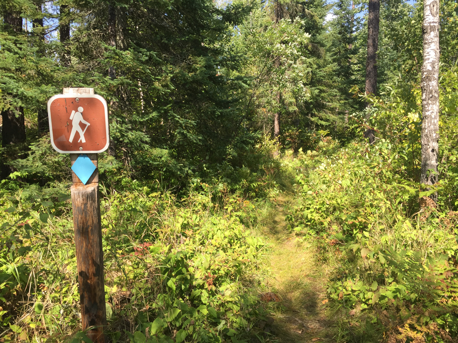
Perhaps 20 feet in from the parking lot is this sign post with a blue blaze attached. The trail is also visible.
Walking from Start of the Kekekabic Trail (West end) to Beginning of the Snowbank Lake Trail which starts in the Parking Lot
The Beginning of the Kekekabic ("The Kek") Trail -- (This is the west end of the trail - from here you head east)
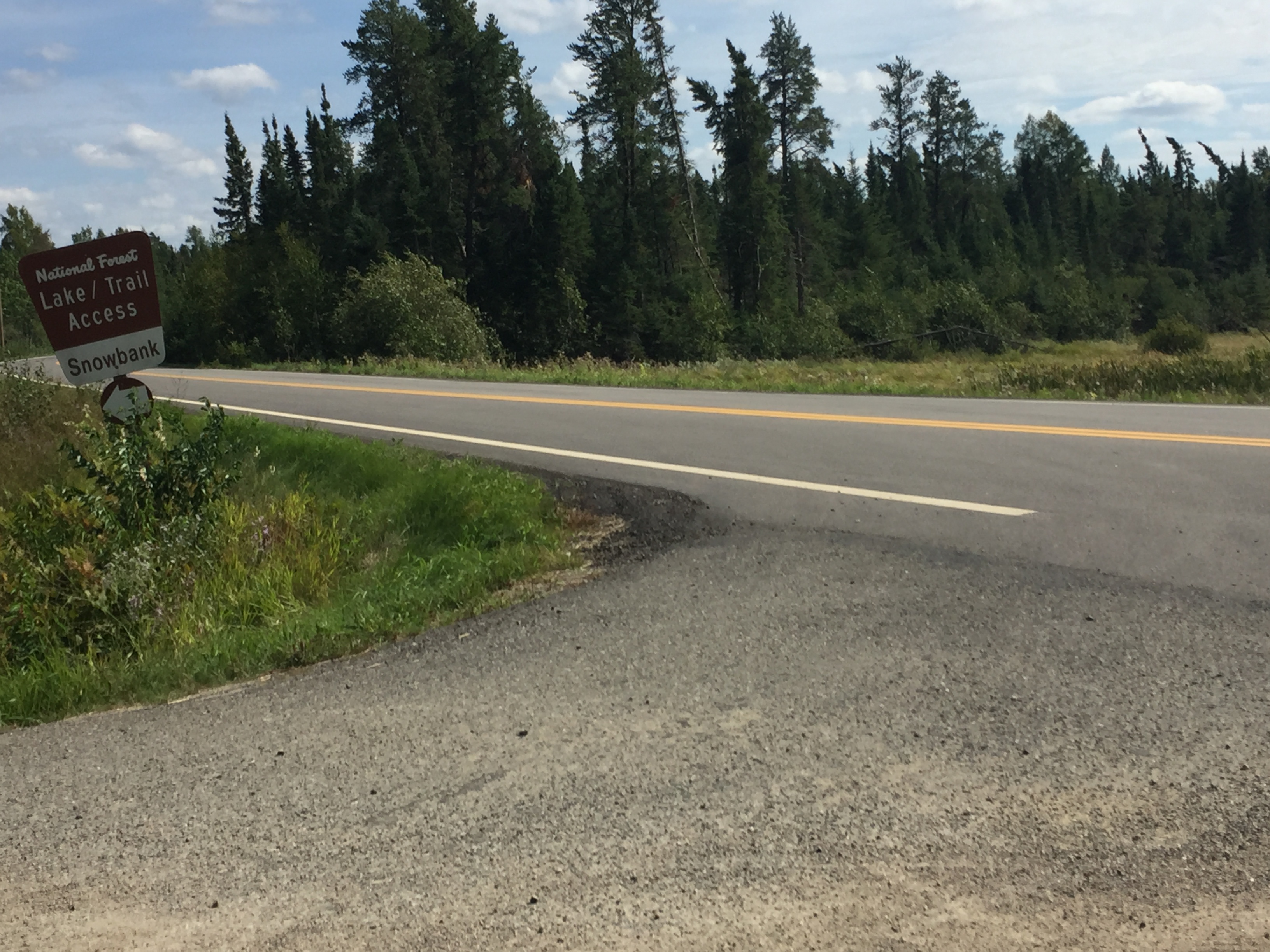
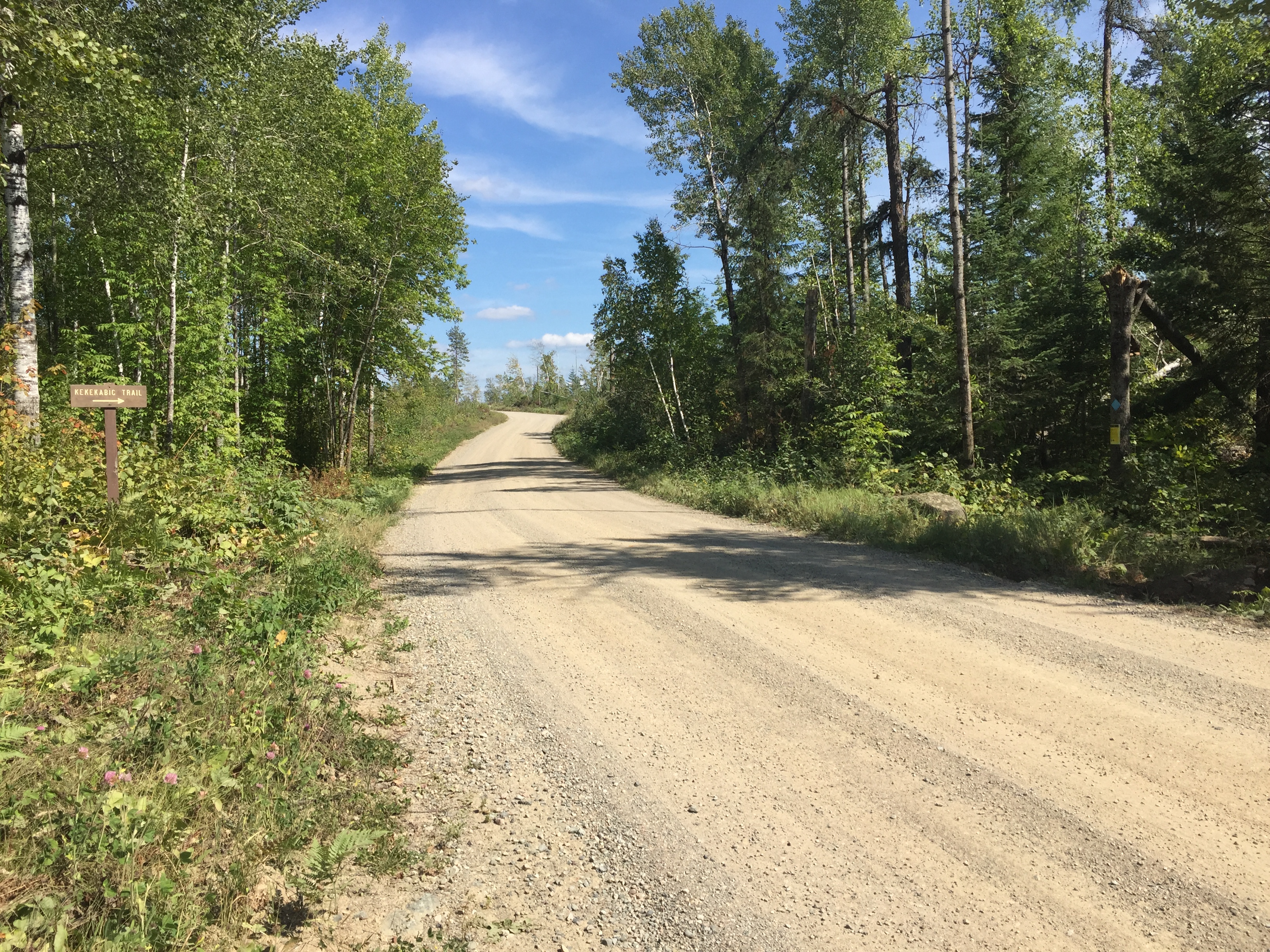
This sign is just past the entrance to the parking lot. The Kekekabic Trail which runs conterminously with the Snowbank Lake Trail is on the right side of the road from this vantage point. From this point it is about 42 miles to the east end of the Kekekabic Trail which ends at the Gunflint Trail (which is really a road - Cook County Road 12 in fact).
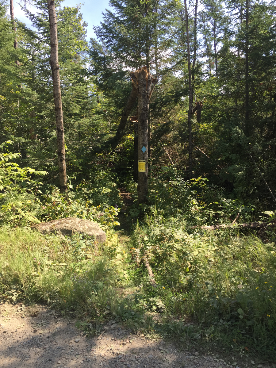
This is what the beginning of the Kekekabic Trail looks like while standing on the Snowbank Lake Road. As you can see there is a blue blaze and a yellow sign beneath it. The yellow sign is a warning that the trail is in bad shape. Really bad shape. In Summer 2016 a severe blowdown impacted the area and the Kekekabic Trail was nearly impassable. That broken tree fell right into the middle of the trail.
A look back across Snowbank Lake Road while standing about 10 feet down the Kekekabic Trail. The parking lot entrance is on the far left of your view. The sign for "Kekekabic Trail" is faintly visible in profile toward the right of your view.