Centennial Trail (along the Gunflint Trail in Minnesota)
Gunflint Ranger District
The Centennial Trail is located about 47 miles up the Gunflint Trail (County Road 12) starting from Grand Marais, Minnesota. This is not far past Gunflint Lake. There is ample parking here on the left side of the road. The parking lot is also used by hikers of the Kekekabic Trail.
The Centennial Trail forms a 3.3 mile loop. The trail is just outside of the BWCA, so you don't need a permit. However, the Centennial Trail and the Kekekabic Trail share the same footpath for about the first 1.2 miles. If you continue west on the Kekekabic Trail, you will eventually need a permit once you go past Mine Lake.
At the trailhead, you will find an interpretive sign showing 14 points of interest along this historic trail. Here is a link to a PDF of these 14 interpretive sites. Images and videos of these areas are shown below on this page. The historic past of this trail relates to mining. Much of the trail used to be the bed of the Port Arthur, Duluth and Western Railroad. This railroad served the Paulsen Mine, named after John A. Paulson who backed the operation financed by the Gunflint Iron Company. The trail passes many of the mining pits dug during the 1890's looking for economically viable ore. Not much ore was ever found and the whole mining operation in this area was short lived.
Much of the Centennial Trail is relatively flat, however the south side of the loop has some steep sections where the trail ascends out of a gorge. The trail also goes over several small hills in this section.
A spur trail about 0.6 files from the parking lot leads to the Gunflint Lookout Tower. The spur trail itself is about 0.5 miles long and is steadily uphill gaining around 250 feet of elevation.
Another enjoyable hike just 500 feet further up the Gunflint Trail in this area is the Magnetic Rock Trail, which is a section of the Border Route Trail. Note that the Border Route Trail and the Kekekabic Trail are part of the North County National Scenic Trail. This national trail extends from North Dakota to New York and is the longest hiking trail in the United States.
Click on the photos below to see the full resolution image - Use your browsers back button to close photo and return to this page.
HIKING FROM THE TRAILHEAD TO THE GUNFLINT LOOKOUT TOWER SPUR TRAIL
Parking lot.
Interpretive sign in the parking lot.
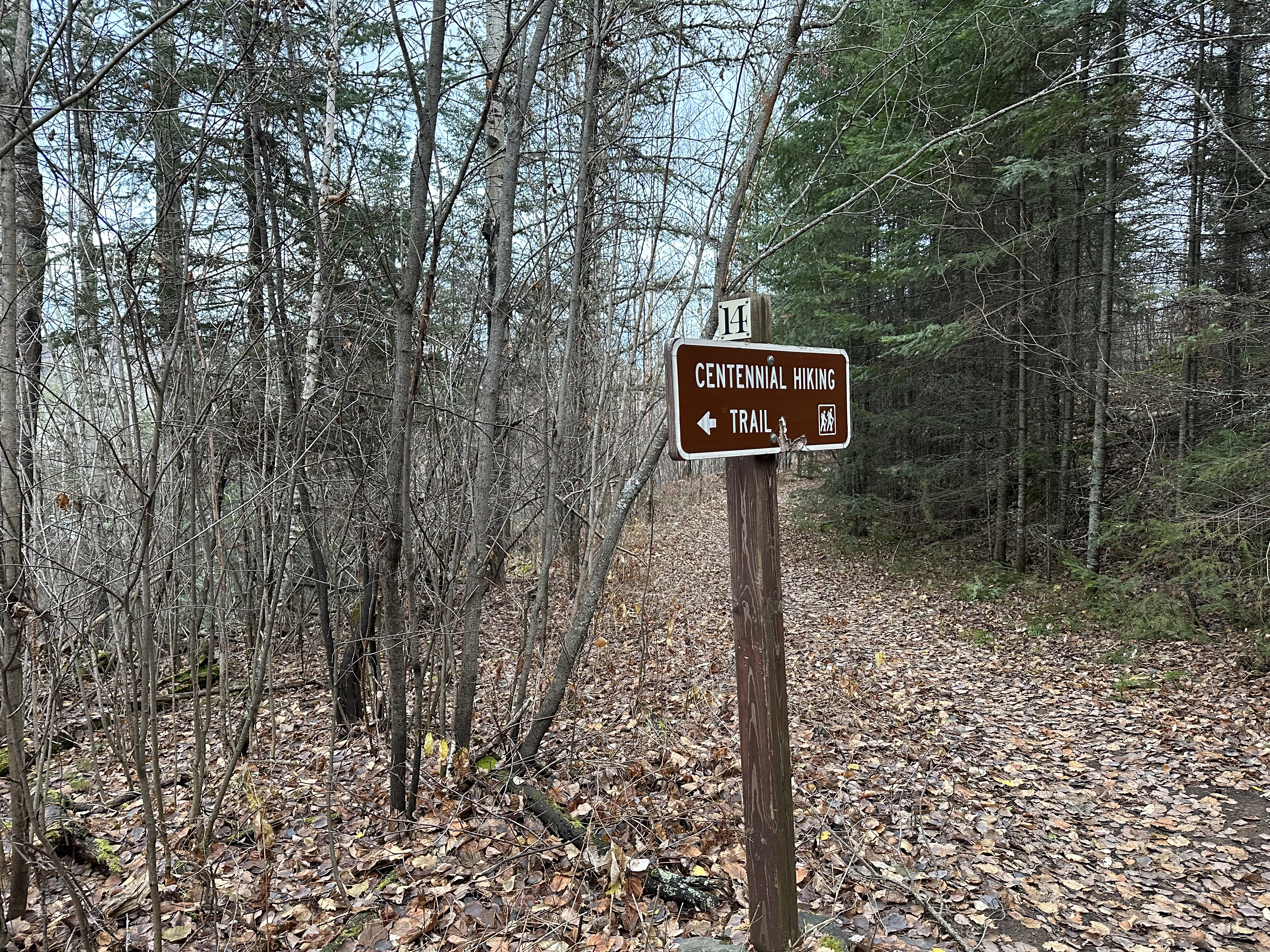
Start of the Centennial Trail (and the Kekekabic Trail).
The first section of this trail shown in this video is about 0.6 miles long. This is Site #1 in the Centennial Trail Interpretive Guide. In this stretch you're hiking from the trailhead to the Gunflint Lookout Tower spur trail along the combined Centennial Trail and Kekekabic Trail. This part of the trail was built in the 1930's specifically to provide a way to get to the fire tower.
HIKING THE GUNFLINT LOOKOUT TOWER SPUR TRAIL
Site #2 in the Centennial Trail Interpretive Guide.
If you are using the Centennial Trail Interpretive Guide, this is #2. The spur trail climbs about 250 feet over about 1/2 mile until reaching the area of the old Gunflint Trail Lookout Tower.
View south from near the fire tower. Round Lake, a popular BWCA entry lake, is visible about 1.5 miles away.
The next few images are remnants of the cabin, mostly its foundation.
Close up of the stonework.
Some fasteners lying on top of foundation stones.
More of the foundation and some piping.
Scattered pieces of the foundation.
Closer view of the plumbing.
The next few images are of the fire tower which dates back to the 1930's.
Outside of the toppled tower from another angle.
Old metal bucket and some of the interior (on left) of the tower.
Interior view of the roof/ceiling of the old tower.
The floor of the tower seems to be missing, but the lower metal walls are visible here.
HIKING FROM THE GUNFLINT LOOKOUT TOWER SPUR TRAIL TO THE CENTENNIAL TRAIL/KEKEKABIC TRAIL SPLIT
This small pond is about 1/4 mile west of the Gunflint Lookout Tower spur. You'll often seen beaver here.
Another view of the pond.
Along this stretch of the trail, you will pass five separate mining pits, including the Paulsen Mine (this is #3 in the Centennial Trail Interpretive Guide). Once past the mines, there is a pond and then a small unnamed lake along the south side of the trail. This is a great place to view beavers. Once you get close to the split between the Centennial Trail and the Kekekabic Trail, there is a pile of tailings on the north side of the trail (this is #4 in the Interpretive Guide).
A larger pond or maybe a small unnamed lake is just east of the trail split. The trail rises a good ways above this providing some expansive views.
One of the local residents.
Another beaver in the small unnamed lake.
And another...
Looking back to the east down the small lake. Another beaver is visible on the shore along the left of your view.
Closer view of the beaver on the shoreline. Small beaver lodge visible in the distance.
Pair of beavers doing what beavers do along the shoreline. Beavers are very common along this section of the Kekekabic and Centennial Trails.
Here is where the Centennial Trail and the Kekekabic Trail go their separate ways. The Kekekabic Trail continues west into the Boundary Waters, while the Centennial Trail crosses the small creek and then bends back to the east to form a loop that returns you to the trailhead. This bridge marks the location of a switchback used by the railroad to navigate a sharp corner (#5 in the Interpretive Guide). Shortly after crossing this bridge, you'll see another interpretive area, this time another mining pit (#6 in the Interpretive Guide).
HIKING FROM CENTENNIAL TRAIL/KEKEKABIC TRAIL SPLIT BACK TO THE TRAILHEAD
After you cross the bridge over the little creek at the trail split, the path trends uphill until you get to the top of a ridge. The trail then follows this high ridge east for a while. This is the small unnamed lake, looking east. You're now on the south side of the lake. You will likely spot beavers swimming around this body of water.
You'll pass interpretive sites #5 through #14 along this hike. The trail is now heading back to the east as it loops back to the trailhead. Along the first half of this section (probably the most scenic of the entire trail), the path is mostly running along the top of a ridgeline that provides distant views in all directions. When the trail leaves the ridgeline, it descends steeply through a forested section. The final part of the trail is along Round Lake Road and the Gunflint Trail as it makes its way back to the trailhead.
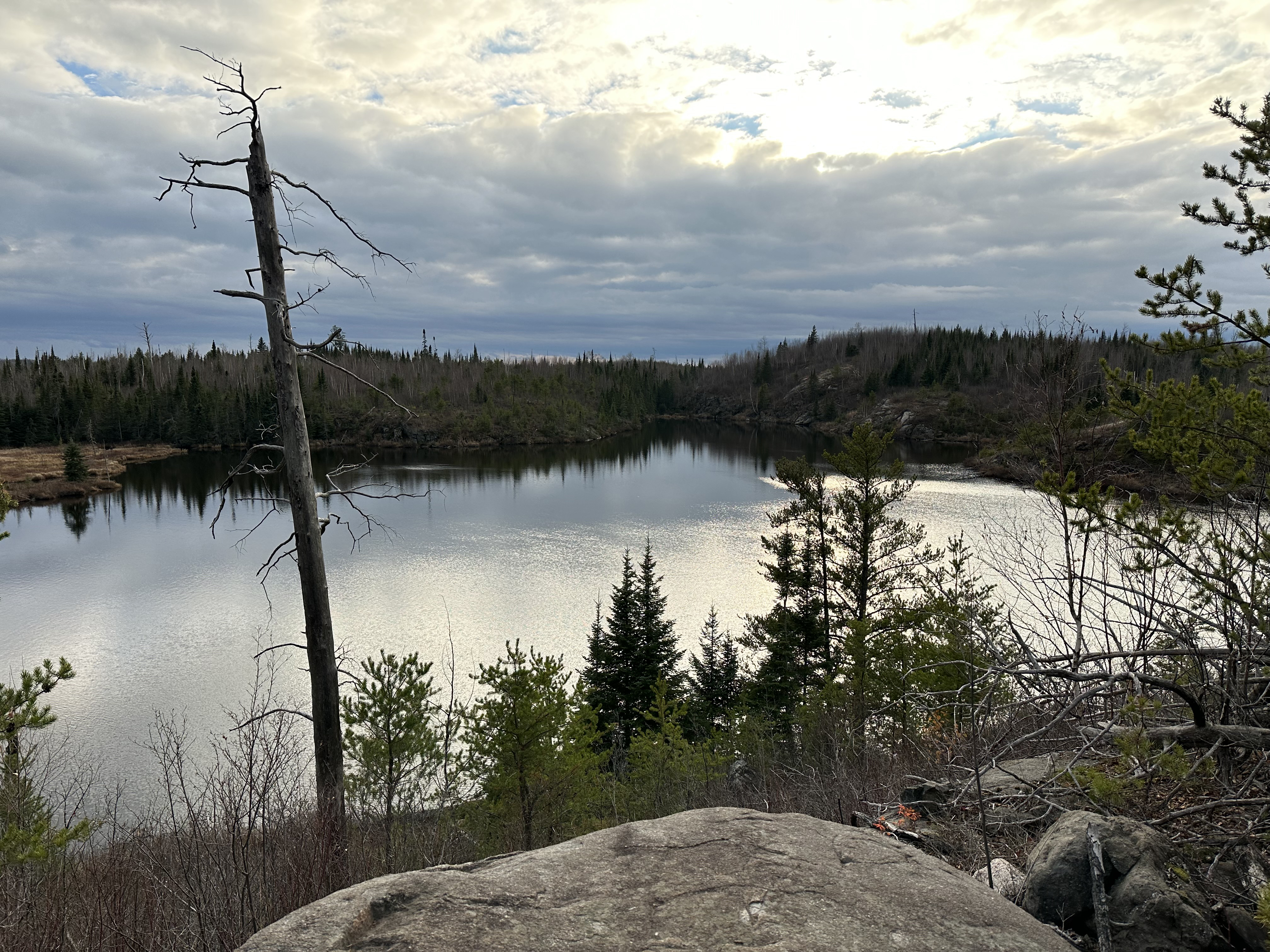
Another unnamed lake that lies to the south of the Centennial Trail. This is the largest lake that is right next to this trail.
The Port Arthur, Duluth & Western Railroad tracks ran along the shoreline of this lake below this overlook.
View to the east along the high ridgeline.
The eastern end of the unnamed lake.
Looking east and down at the valley below. Gunflint Lake is just visible near the center of your view in the far distance (about 3 miles).
Another look at the valley.
Here we are near to Interpretive Point #11. A trestle built of white pine logs was constructed from near the point where you are standing over to that rock outcrop on the left, which is around 500 feet away.
This is Interpretive Point #14 and marks the ended of the guided trail portion of your hike. Past this point, the trail stops following the old PAD&W rail bed.