FALL LAKE CAMPSITES: Campsite 1: (#1758) - Campsite on south end, east side of Mile Island Campsite 2: (#1761) - Campsite on north tip of Mile Island Campsite 3: (#1760) - Second campsite from the north tip of Mile Island Campsite 4: (#1759) Abandoned due to windstorm as of 2018 - Third campsite from the north tip of Mile Island
Campsite 5: (#1762) - South end of Mile Island on the west side
Campsite 6: (#1763) - Located near the middle of the island away from the other campsites on the island
Campsite 7: (#1764) - On the point to the east of the Newton Falls portage
Campsite 8: (#1765) - This campsite is right next to the busy Newton Falls portage
Fall Lake is the location of BWCA Entry Point 24 and the Fall Lake Campground which is run by the U.S. Forest Service. Motorboats are allowed on Fall Lake.
From Fall Lake you can basically go two directions, both of which lead to some part of Basswood Lake. Heading northwest from the entry point, you can portage 40 rods around Newton Falls into Newton Lake. Paddling the length of Newton Lake is about a two mile journey. At the north end of Newton Lake there is a 90 rod portage around Pipestone Falls. This gets you into Pipestone Bay of Basswood Lake. If you head to the northeast from the entry point, you are faced with the Four Mile Portage (1,280 rods). The other end of this portage is at Hoist Bay on Basswood Lake. Note that once north of Muskeg Lake, the Four Mile Portage becomes very difficult in places because it is often flooded, mostly as a result of beaver activity. It's not all bad. Along the way (at about the 1 1/2 mile mark) there is access to three lakes. Ella Hall Lake can be reached over a 45 rod portage from the Four Mile Portage. Mud Lake is reachable over an 85 rod portage from the southwest corner of Ella Hall Lake and from a spur trail of 85 rods off the Four Mile Portage. Muskeg Lake is along the Four Mile Portage, but there isn't a maintained portage into the lake any longer, as it was destroyed by a recent windstorm that swept through the area (2018). You can still bushwhack down to the lake with minimal effort.
Fall Lake offers reasonable fishing mostly for northern pike and walleye.
Fall Lake is the location of the mouth of the Kawishiwi River. The Kawishiwi River flows into Fall Lake at the powerplant in the south part of the lake. You can reach the falls by following the Kawishiwi Falls Trail. There is a sign marking it along the Fernberg Trail. The lake is also fed by a small creek coming from Stub Lake just east of the entry point. Another major source of water into the lake is from the Shagawa River which flows into the southwest end of the lake. The waters of Fall Lake flow to the north over Newton Falls into Newton Lake on their way to Basswood Lake.
There used to be a direct portage between Fall Lake and Mud Lake. This portage began just east of the existing Four Mile Portage that leads to Basswood Lake. The old portage appears on the old 7.5 minute USGS topographic maps. It does not appear on Fisher Maps as old as 1983. Use can use a spur trail off of the Four Mile Portage nowadays to access Mud Lake.
Logging in this area was extensive. The east shore of Fall Lake was logged by the St. Croix Lumber Company in the first decade of the 1900's. This was the largest logging company that existed near what is now the BWCA. This logging company operated out of Winton, Minnesota. St. Croix was sold to a fellow named Edward Hines in 1911. The mill closed in 1923. Slash fires occurred in 1923, burning over much of the forest that the St. Croix Company had logged. Slash fires occur in recently logged areas because the lack of a tree canopy allows the forest floor to dry out. The leftover brush from logging becomes tinder dry and ignites easily (Heinselman, 1999). Another lumber company that operated on Fall Lake was the Swallow and Hopkins. Their mill was built in 1898. This mill operated until 1922 when it was taken over by the General Logging Company (part of a large firm called Weyerhaeuser - still exists). The milling for this company was done in Cloquet, Minnesota. They focused their logging efforts around the area surrounding Horse Lake, to which they had built a rail spur (Heinselman, 1999).
The Swallow and Hopkins Lumber Company wass responsible for building the Four Mile Portage, which was originally the location of a railway between Fall Lake and Basswood Lake. It was built in 1901 (Heinselman, 1999).
More information about Fall Lake and in particular the Four Mile Portage, check out the book "A Wonderful Country - The Quetico-Superior Stories of Bill Maggie" by Dave Olesen (see pages 9-11).
Extensive information about logging operations around Fall Lake can be found in the book "A Boundary Waters Wilderness Ecosystem" by Miron Heinselman.
Click on the photos below to see the full resolution image - Use your browsers back button to close photo and return to this page.
PADDLING FROM BWCA ENTRY POINT 24 TO THE FOUR MILE PORTAGE (LEADS TO MUD LAKE, ELLA HALL LAKE AND BASSWOOD LAKE)
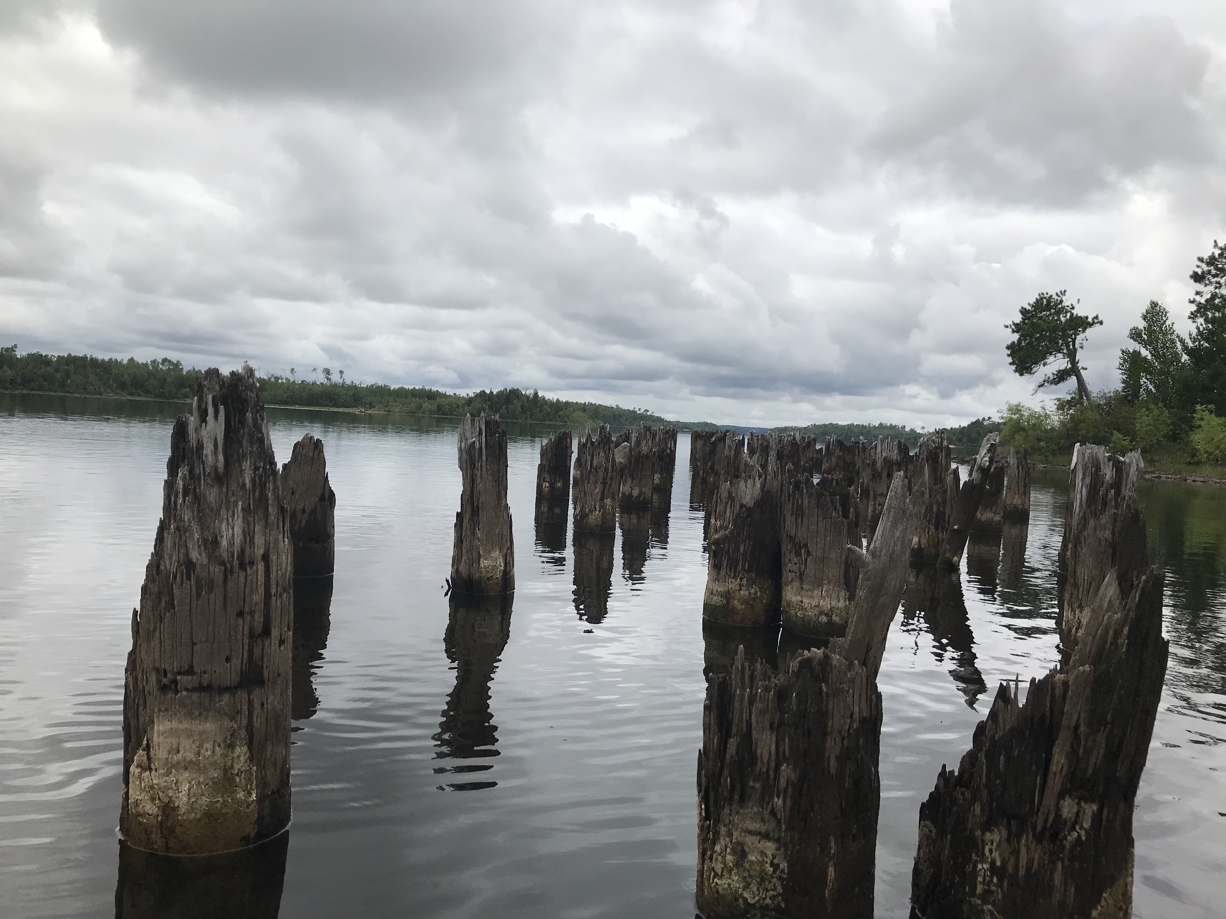
Paddling directly to the start of the Four Mile Portage. You can see the landing for this portage from well out on Fall Lake because there are the remains of an old pier next to it, that stands well above the water. Travel the Four Mile Portage -or- Explore Another Route ***********************************************END OF ROUTE***********************************************
PADDLING FROM THE FOUR MILE PORTAGE TO THE BWCA ENTRY POINT 24 LANDING
An evening paddle across a calm Fall Lake back to the entry point landing. Explore BWCA Entry Point 24 -or- Explore Another Route ***********************************************END OF ROUTE***********************************************
PADDLING FROM BWCA ENTRY POINT 24 TO MILE ISLAND AND EXPLORING THE THREE CAMPSITES THERE
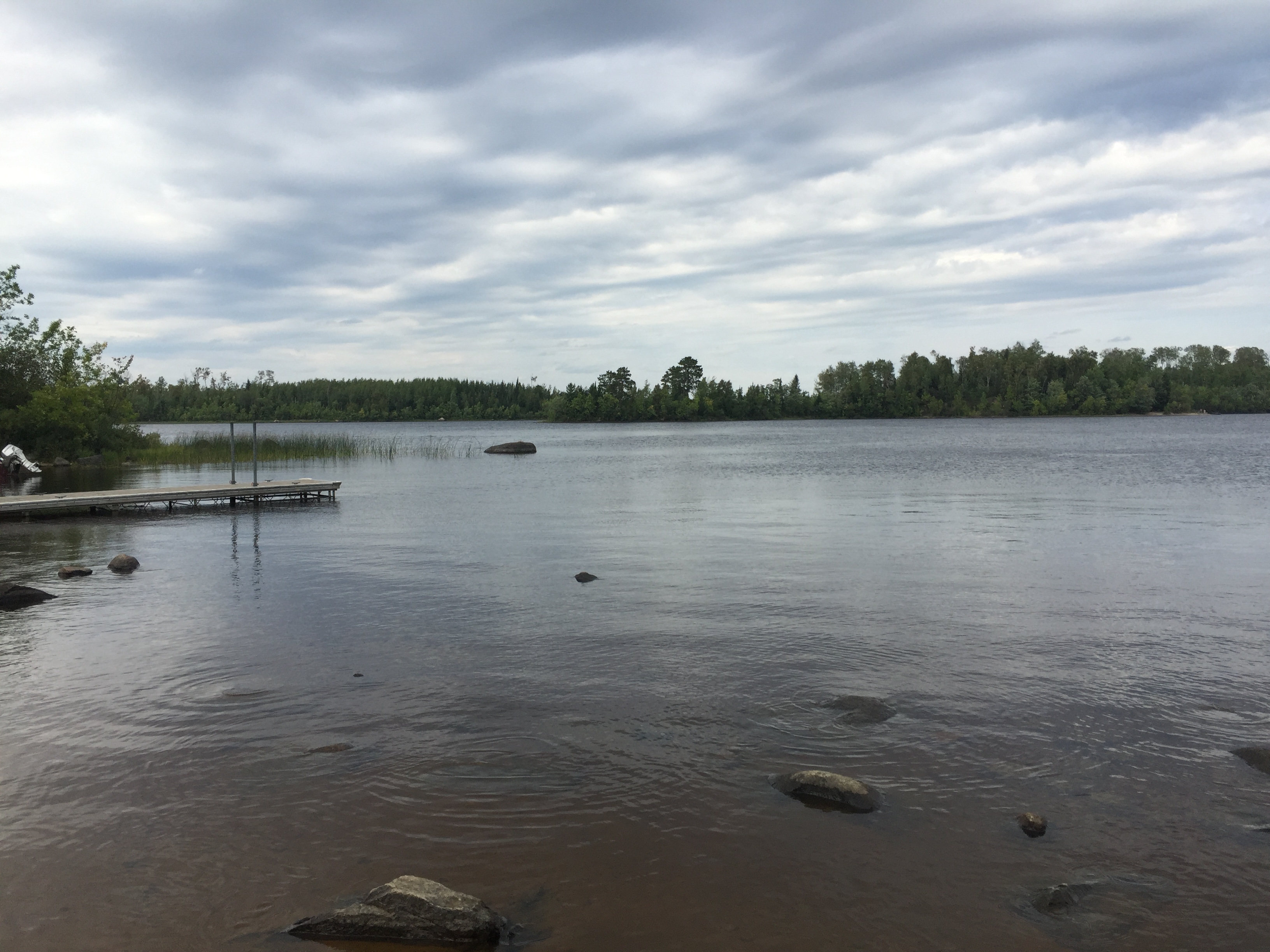
Looking roughly northwest. The end of the dock at the entry point landing is visible on the left.
From BWCA Entry Point 24 you are looking to the northeast across Fall Lake. In the middle distance is Mile Island on the left. The south end of Mile Island demarcs the boundary of the BWCA.
Turning from a compass direction of northwest to northeast, looking out at Fall Lake from the BWCA Entry Point 24 boat landing.
Paddling from BWCA Entry Point 24 to the campsite on the south end of Mile Island.
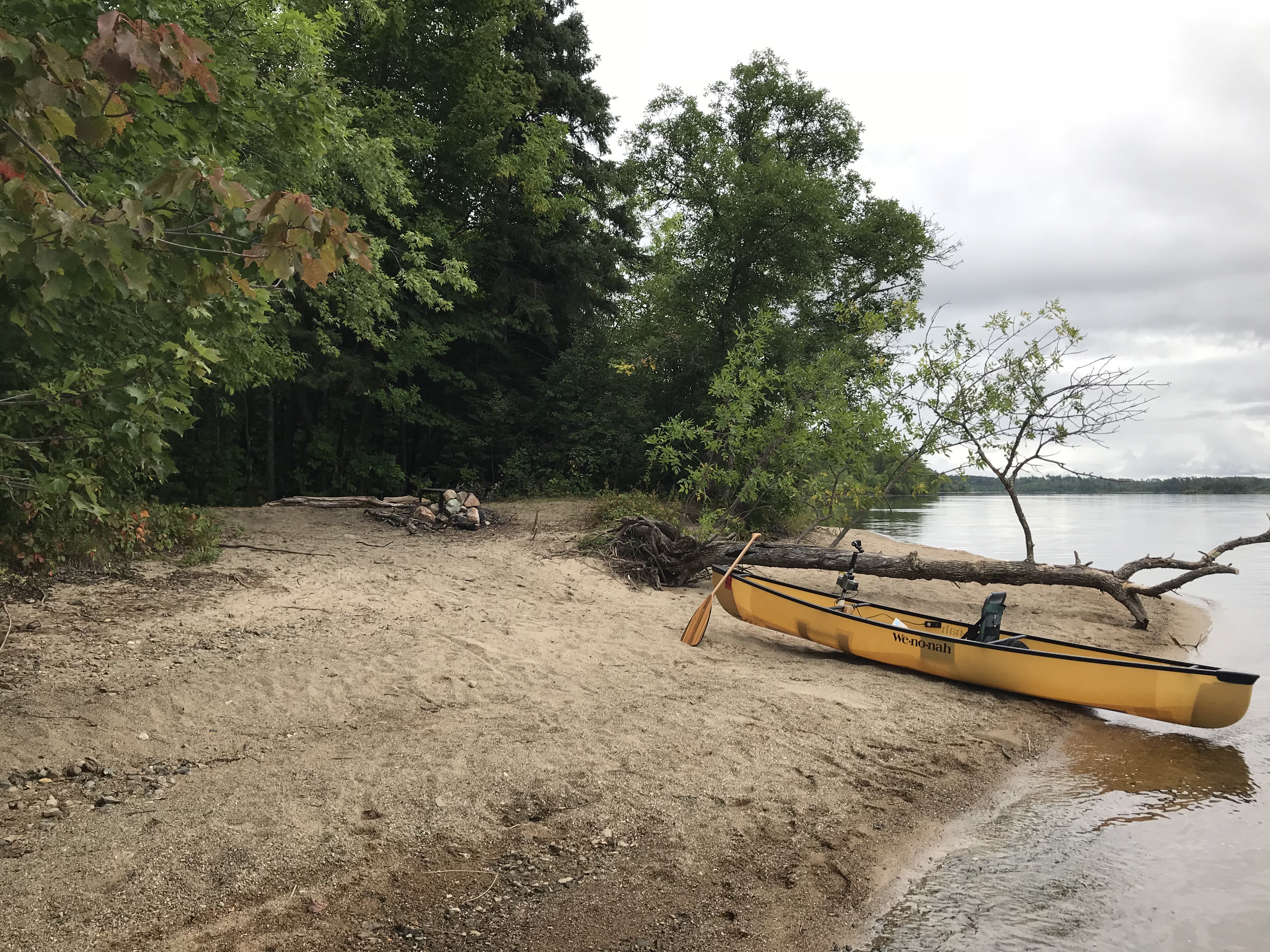
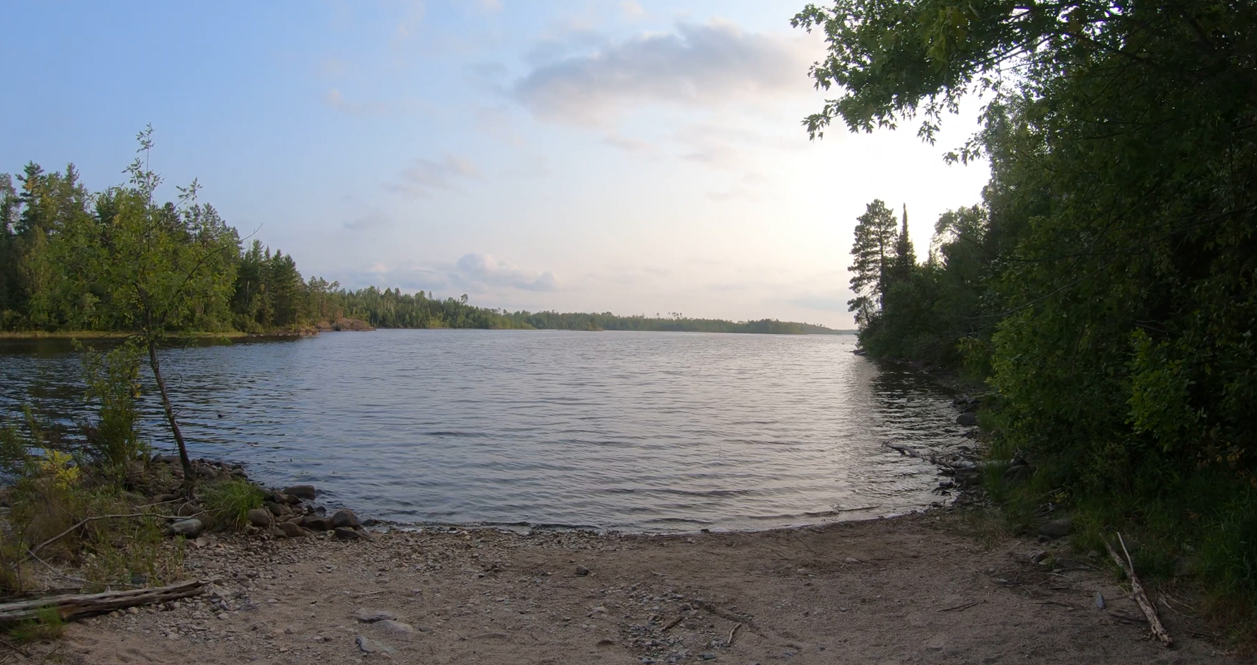
The campsite on the south end of Mile Island nearest the Fall Lake entry point is a sand beach backing up to the forest that covers much of the island.
After pulling away from the sand beach at the south campsite, paddle north to another campsite on Mile Island. This is the middle of the three campsites on the north end of Mile Island.
View of the campsite from the canoe landing. This is the middle of the two campsites on the north end of Mile Island.
Leave the middle campsite and paddle the short ways to the northern most campsite on Mile Island.
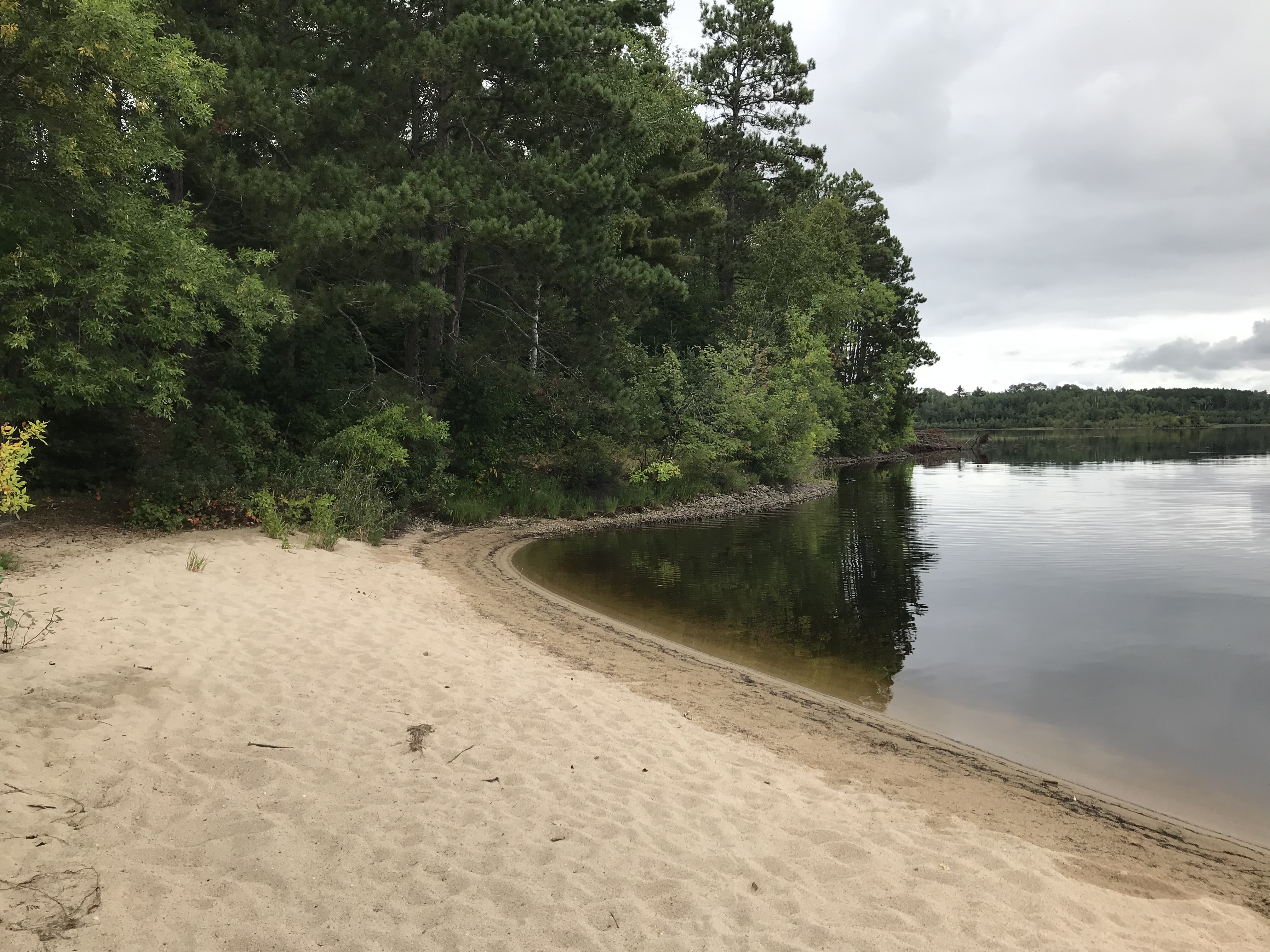
The beach landing at the north most campsite on Mile Island.
From the campsite on the north end of Mile Island, paddle across an open part of Fall Lake to the north until you reach the start of Four Mile Portage. This long portage connects Fall Lake to Basswood Lake and several smaller lakes along the way.
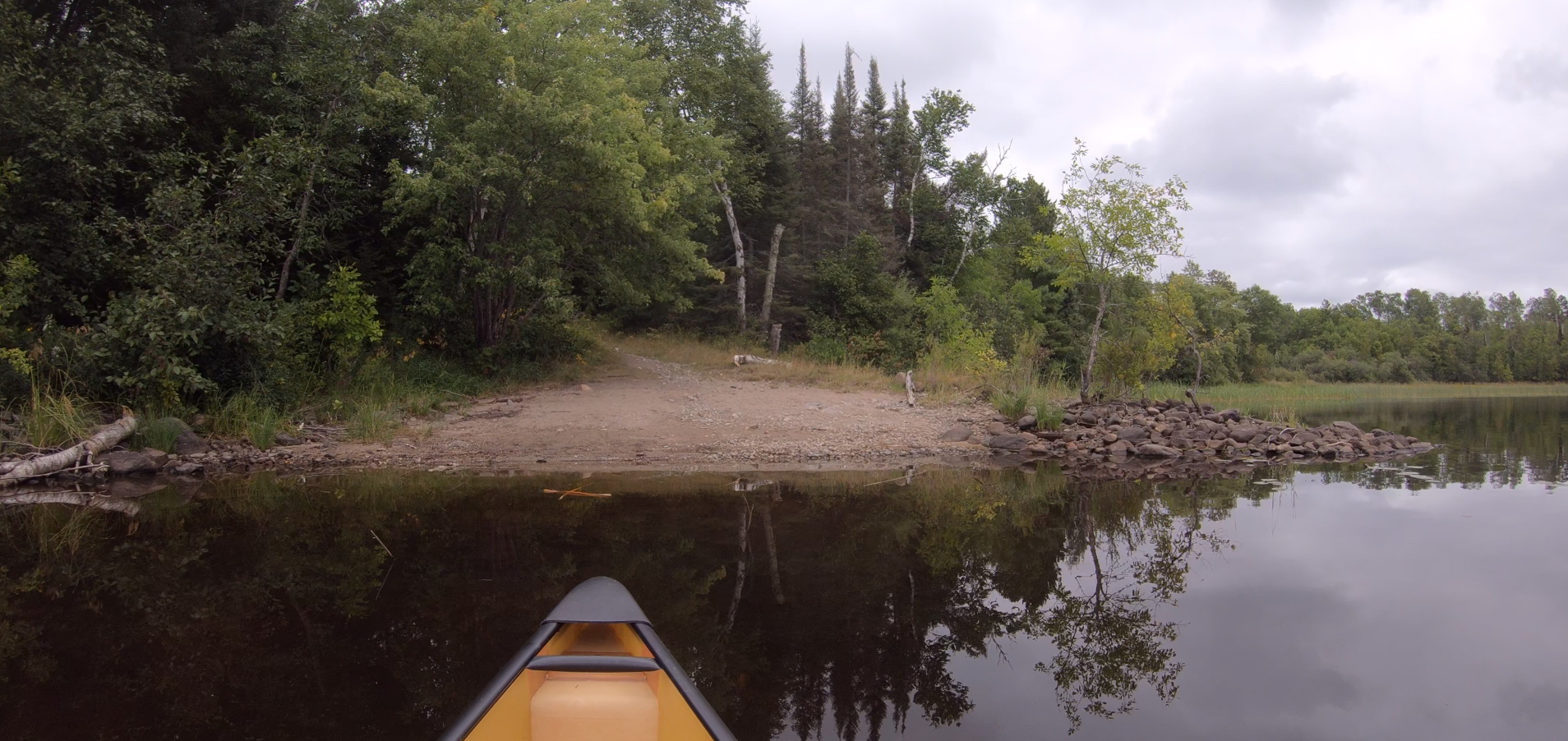
On final approach to the start of the Four Mile Portage at Fall Lake. Travel the Four Mile Portage -or- Explore Another Route ***********************************************END OF ROUTE***********************************************
PADDLING FROM THE FOUR MILE PORTAGE TO BWCA ENTRY POINT 24
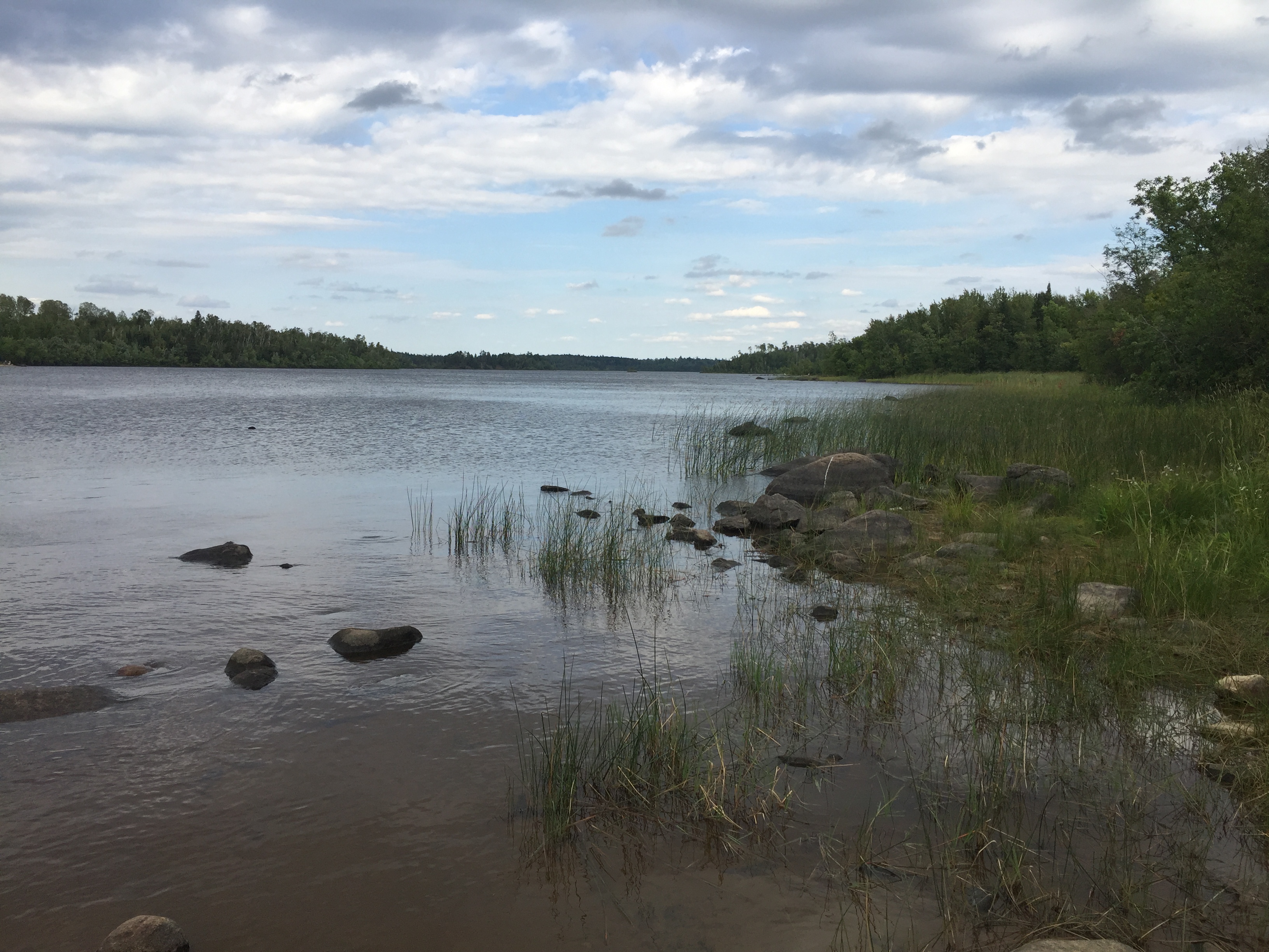
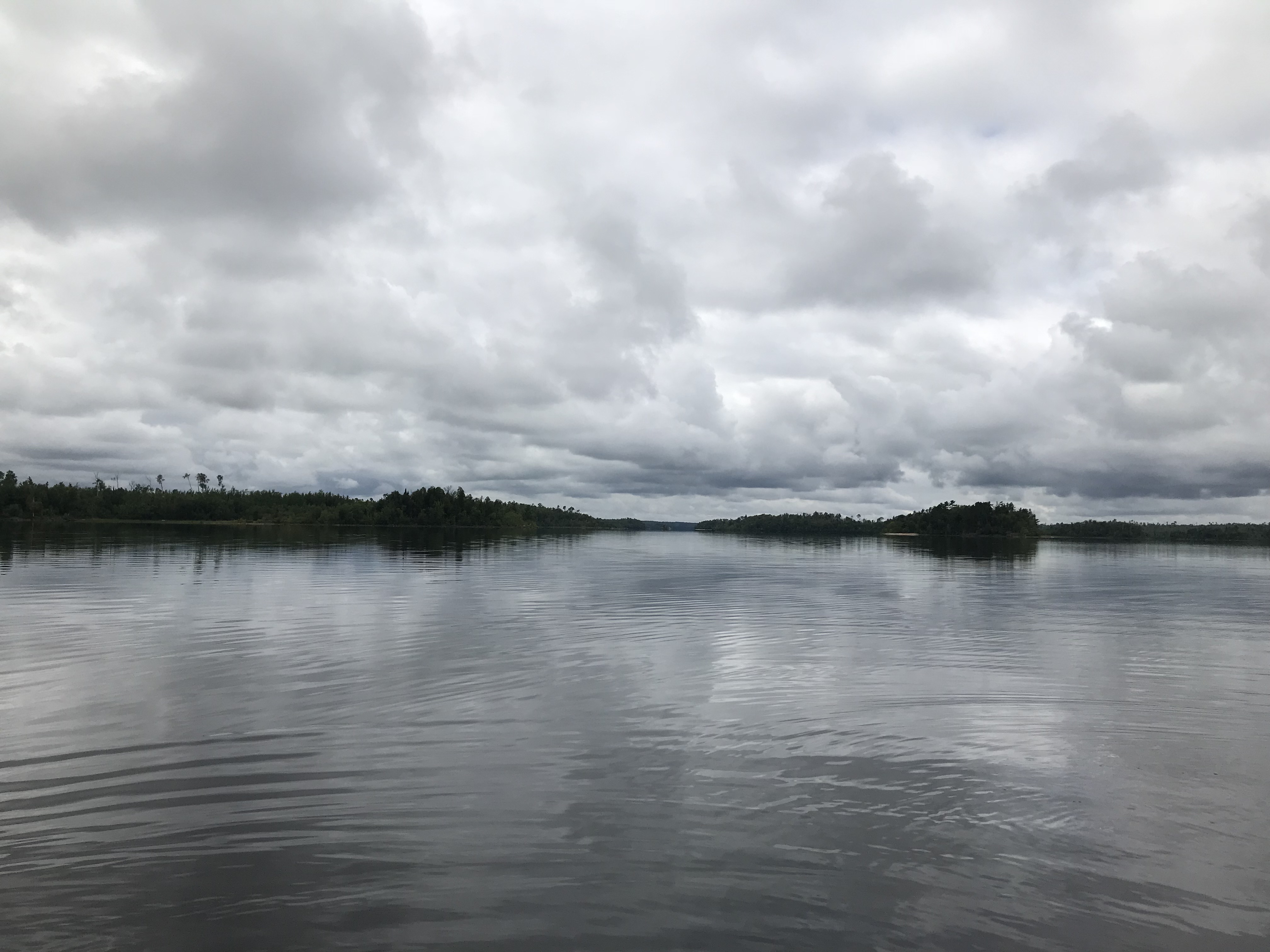
View from the south end of the Four Mile Portage of Fall Lake. The bay where this portage is located is in the eastern most bay at the north end of the lake. Looking toward the southwest. The distant shoreline near the middle of your view is almost 1.5 miles away.
Paddling through Fall Lake from the Four Mile Portage to an abandoned campsite (as of 2018) on the west side of Mile Island. This campsite was damaged by the July 2016 windstorm.
Close up of the decaying dock/pier structure that is near the end of the Four Mile Portage.
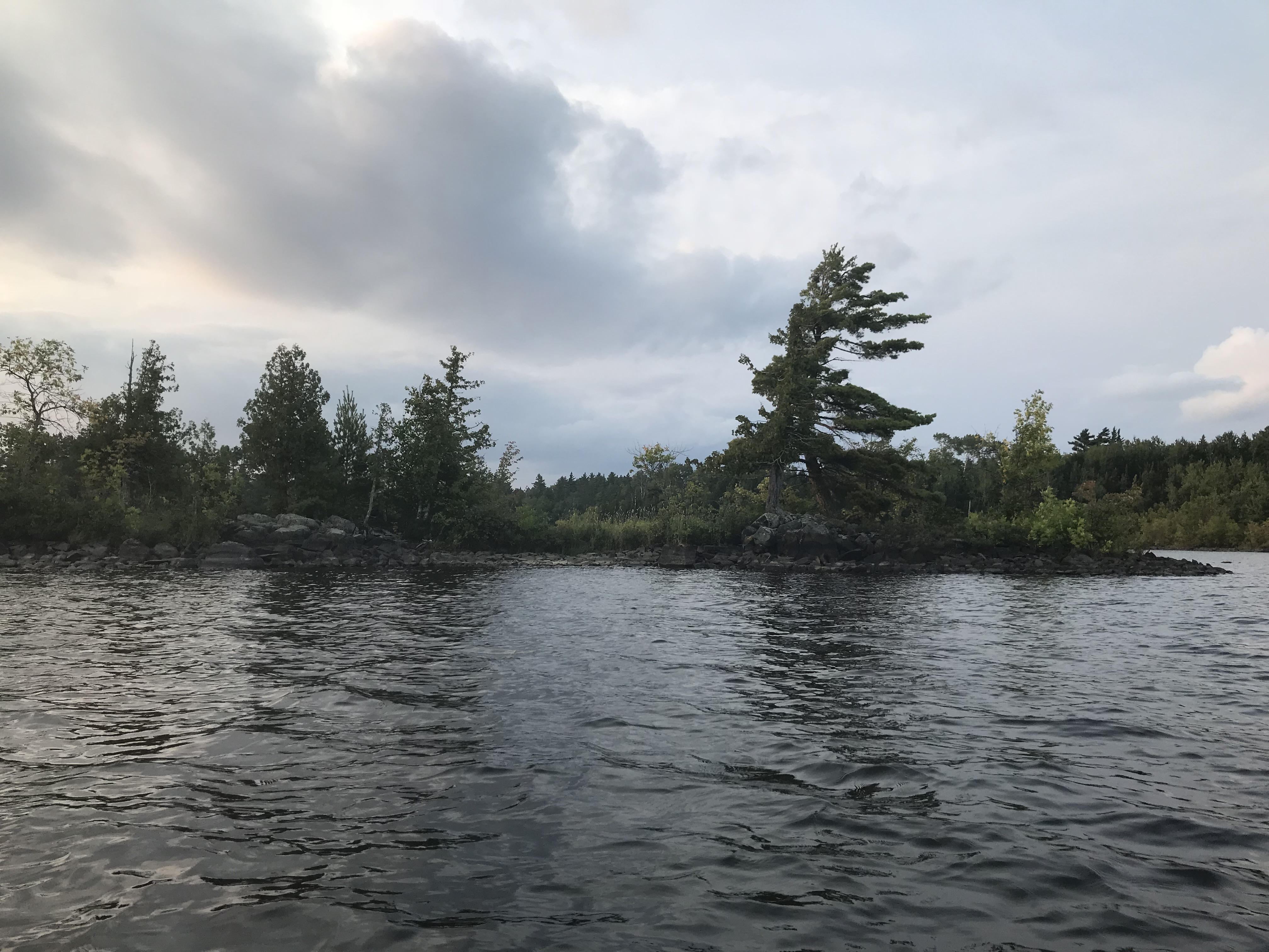
This is the small island that is due west of the point where the old log pier is located.
View is to the west taking in the west end of the small island. Near sunset in mid-summer.
Mile Island can be seen to the right of center. The campsite on the north tip of the island is also visible (the sand beach just right of center).
Paddling from the abandoned campsite on the west side of Mile Island, to the BWCA Entry Point 24 canoe landing.
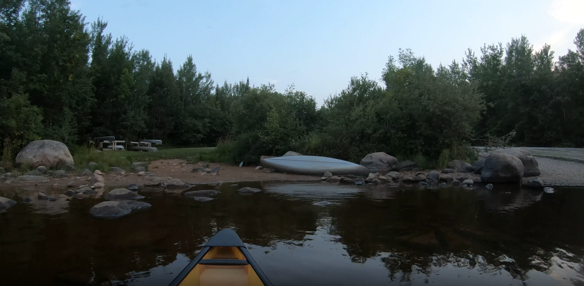
The canoe landing at BWCA Entry Point 24. There is also a boat ramp here which you can partially see to the far right. Explore BWCA Entry Point 24 -or- Explore Another Route ***********************************************END OF ROUTE***********************************************
Route Connections for Fall Lake
From Fall Lake, you can portage to Newton Lake. There is also the Four Mile Portage that connects Fall Lake to Hoist Bay on Basswood Lake. Along the Four Mile Portage there is access to Muskeg Lake, but you will have to do a little bushwhacking to get to the water. There is also a 45 rod portage spur from the Four Mile Portage to Ella Hall Lake. Another spur trail leads to Mud Lake. You can also leave the wilderness at BWCA Entry Point 24.