Portage between Fall Lake and Basswood Lake and surrounding area
Length in Rods: 1,280 rods (4 miles) - portage wheels are allowed
Date portage was last visited: August 2, 2024;
Previous Visit(s): June 30, 2024, July 22, 2018
Portage Rating: Easy (just really really long) from Fall Lake to the north end of Muskeg Lake [except where it crosses Muskeg Creek where it is flooded - Rugged]; between Muskeg Lake and Basswood Lake the portage rating is "Rugged" or "Bushwhack" - read below for details
The Portage between Fall Lake and Basswood Lake
Four Mile Portage or The Long Portage
Click on the photos below to see the full resolution image - Use your browsers back button to close photo and return to this page.
Update (August, 2024): This portage has become more difficult since BWCAwild visited it in 2018. In 2024, the local beavers have built dams that have flooded the trail around where it crosses Muskeg Creek. In the spring, you will have to paddle across this flooded area. In the late summer (when things are typically dryer), you can walk through the water in this section. The north end of the portage past Muskeg Lake is a bushwhack in places, but the trail is easy to follow. It just might be under several feet of water. You can float a canoe over these sections. There wasn't any downed trees or anything that prevent passage, just mud and water. You can still use a portage wheel along this route.
This is a well known portage in the BWCA. It is known as the Four Mile Portage or The Long Portage. It is approximately four miles or 1,280 rods in length. Yup, that's a long ways to carry a bunch of gear. This is about half of the length of the grandpappy of all portages, The Grand Portage. The portage is a bug breeding ground since the entire length of it passes through swamps and other low lying areas prone to standing water. You will want to bring a head net, bug spray alone will not keep these bugs at bay. On a positive note, you are allowed to use a portage wheel on this portage (a hand pulled or pushed cart with wheels).
The portage, which was built in 1901 by the Swallow and Hopkins Company, was previously a railroad grade used to serve the logging industry (Heinselman). The portage extends from Fall Lake to Hoist Bay on Basswood Lake (there are spur portages off the Four Mile Portage to Ella Hall Lake and Mud Lake too). Hoist Bay is named for the hoist that was positioned there to lift logs onto the rail cars for their trip back to Fall Lake. They actually ran a 40 ton locomotive along this railway (Heinselman, 1999). Read the book "The Boundary Waters Wilderness Ecosystem" by Miron Heinselman, which contains a wealth of information about historical logging operations in the Boundary Waters Canoe Area. More information about this portage can be found in the book "A Wonderful Country - The Quetico-Superior Stories of Bill Maggie" by Dave Olesen (see pages 9-11).
After World War II, the Four Mile Portage was used to transport tourists to some of the many resorts operating on Basswood Lake. There was even a gift shop located on the Basswood Lake end of the portage. Basswood Lake was buzzing with large motorboats and even houseboats during the late 1940's until the early 1960's. Buses carried the tourists across the portage. After the railway was removed, wheeled traffic started using it instead. The last motorized vehicles to cross the portage were removed in about 1984 (Rom, 1987).
As noted above, there are two spur trails along the Four Mile Portage. One spur portage is to Ella Hall Lake. The other spur is to Mud Lake. Back in the logging days, both of these portages were rail spurs of the main rail line between Fall Lake and Basswood Lake (Hoist Bay). There also used to be a rail spur that directly connected Fall Lake to Ella Hall Lake. This railway started in the northeast part of Fall Lake and was built in 1899 or 1900 (Heinselman, 1999).
The Four Mile Portage is in good condition out to Muskeg Lake., with the expception of where it crosses Muskeg Creek. Muskeg Creek is flooding the trail because of beaver activity. However, a short ways past Muskeg Lake, the portage is in rough shape in many areas. Depending on water levels, recent precipitation and beaver activity, there may be parts of the trail between Muskeg Lake and Basswood Lake that you need to bushwhack through or even paddle across! The section of the trail from Fall Lake to the north side of Muskeg Lake is very easy to follow; a wide path and quite flat along most of its length.
Portaging Direction: From Fall Lake to Basswood Lake
Before starting this portage, you may want to do a little fishin' (notice swirl right in front of canoe). This portage used to host a railway back in the logging era, so it is wide and flat as a pancake. The canoe landing as you can see, poses no difficulties. This portage landing once was used to load huge amounts of supplies to be shuttled across the portage on trucks to outposts on Basswood Lake. That's a fish swirl right in front of the canoe (July 22, 2018).
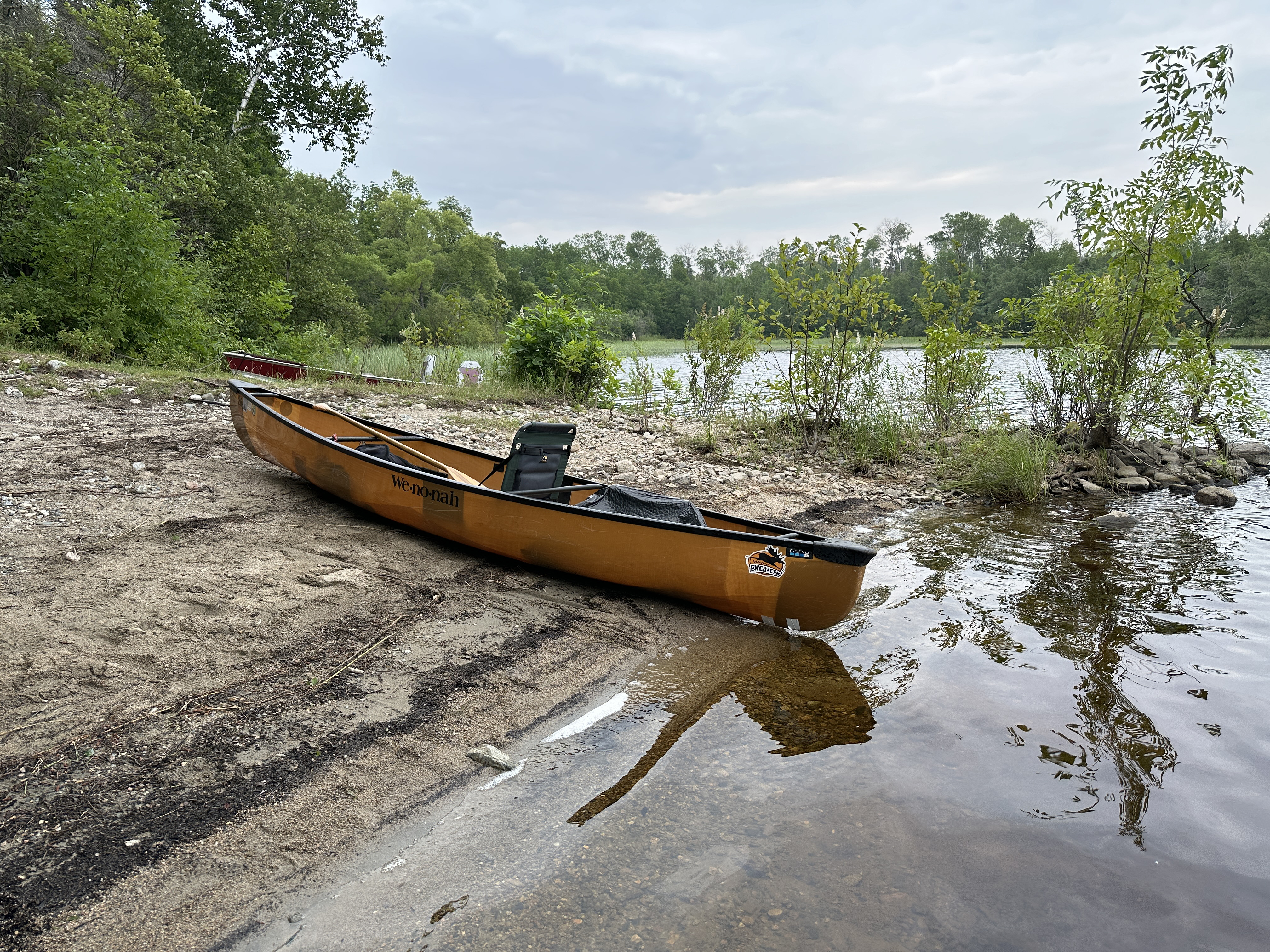
The start of this long portage is a sandy beach on Fall Lake. Scroll down a short ways to get to the full video of the trail (August 2, 2024).
Older photo of the portage landing. A close up of the sandy canoe landing on the Fall Lake end of the Four Mile Portage (July 22, 2018).
This video shows in entire portage from Fall Lake to Basswood Lake. Other than being ridiculously long, much of this portage is pretty easy, at least as far north as Muskeg Lake. The exception is a short section where Muskeg Creek flows over the portage. You may have to wade or even paddle over that obstacle. The portage is generally wide, well trodden and flat. Even better, you can use a portage wheel on this portage...just roll your gear down the trail (at least until it gets stuck in the mud or completely submerged by standing water on the portage). However, once you get a short distance past Muskeg Lake, this portage becomes an entirely different animal. Much of the north end of the portage is flooded due to heavy beaver activity. There are a few overgrown areas too, but the trail was still easy to follow through them. The bugs will make you scream if you aren't wearing a headnet and covering your skin. Bug spray probably want be enough to hold these bloodsuckers off. You won't be able to use a portage wheel for several long stretches in the northern half of the portage (August 2, 2024).
This is older video footage of roughly the southern half of the Four Mile Portage from Fall Lake to the north end of Muskeg Lake. The thing that has mostly changed from the video above is the flooding near Muskeg Creek. In this video, the portage trail is mostly dry, but in the more recent video above, this area is inundated with water (July 22, 2018).
Perhaps 1/3rd of a mile before the Mud Lake portage intersects the Four Mile portage, you will come to this wetland area. This is actually Muskeg Creek where it intersects the portage. The portage is now often flooded in this area (2024). Image from July 22, 2018.
A typical view of the Four Mile Portage (aka Long Portage on many maps) (July 22, 2018).
You have arrived at the intersection of the Four Mile Portage and the Mud Lake portage. This is a somewhat rugged portage spur leading to Mud Lake. It is 84 rods long (July 22, 2018).
The northeast corner of Muskeg Lake as viewed from the Four Mile Portage. It's still about two miles further to Basswood Lake from here. You are about halfway done from a mileage point-of-view, but the portage is much more difficult to travel between Muskeg Lake and Basswood Lake. The northern section of the portage is often flooded because of beaver activity. There are several sections you may have to sometimes paddle across because the water gets so deep. If you do make it to Hoist Bay on Basswood Lake, look for an old steam locomotive just below the lakes surface near the end of this portage (July 22, 2018).
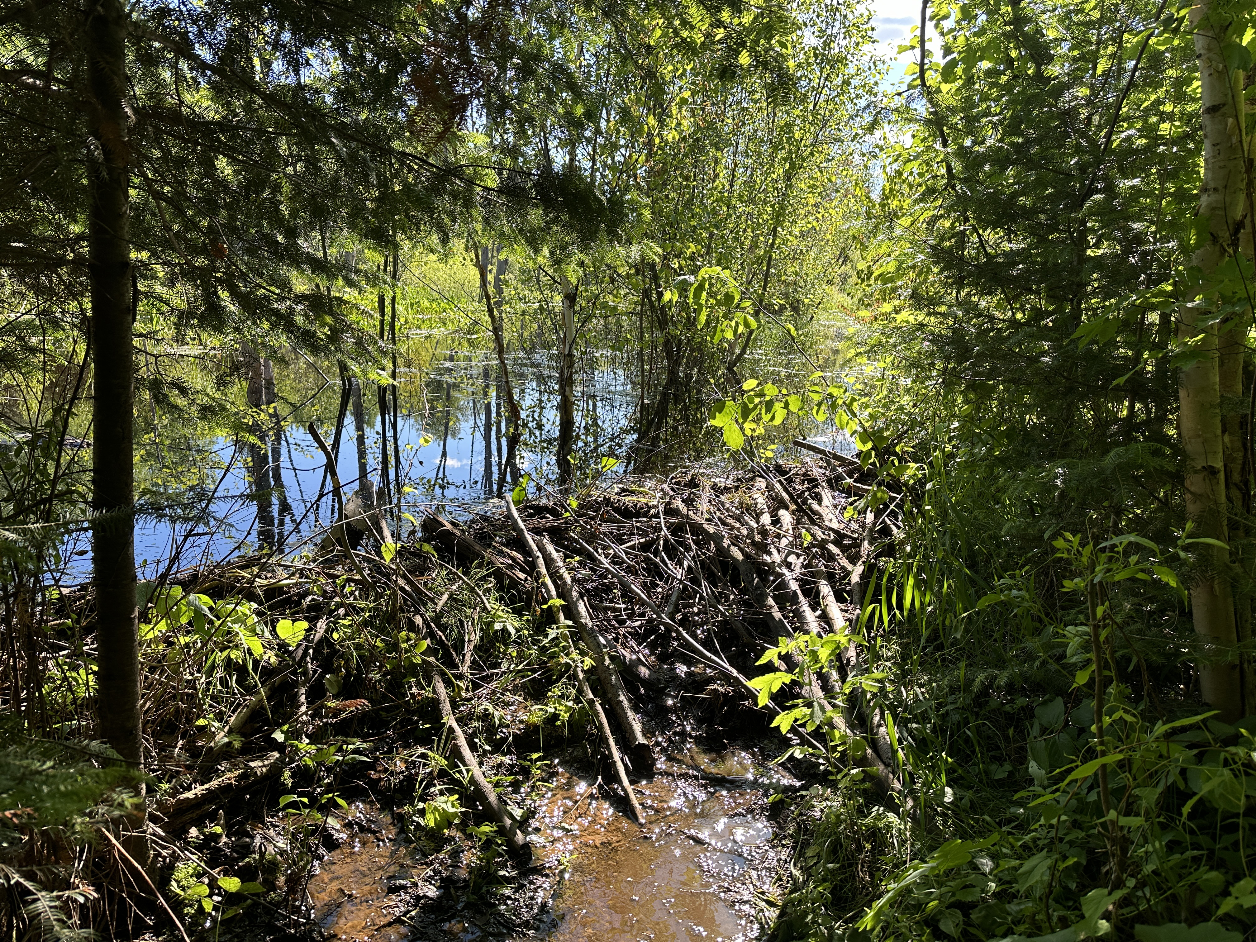
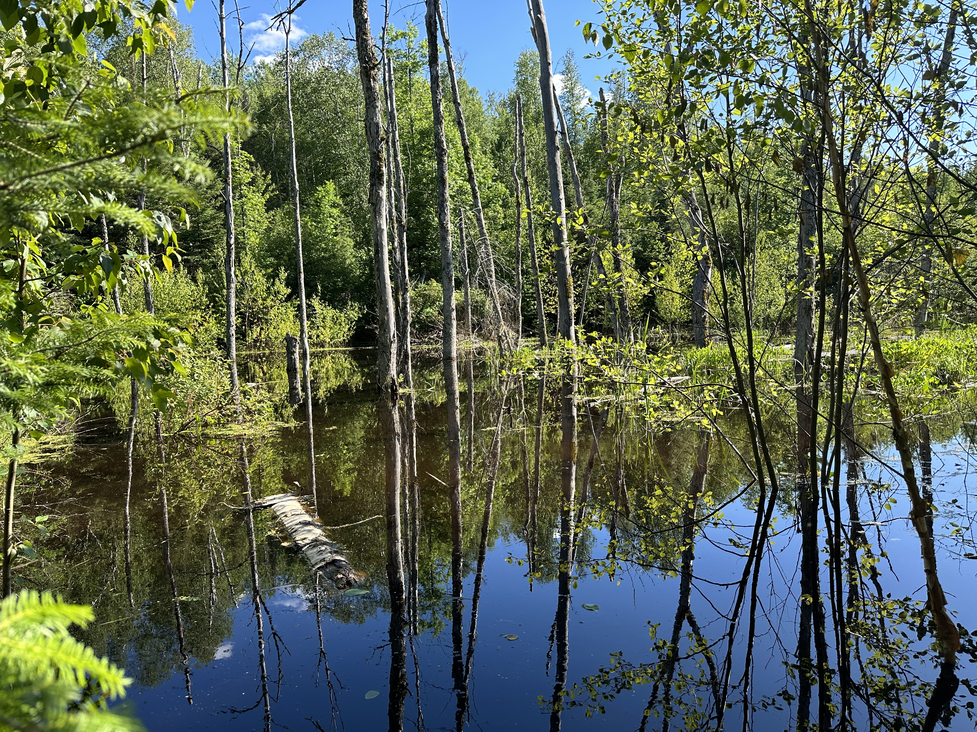
This beaver dam is what causes a large section of the Four Mile Portage to be flooded. This dam is located 4,400 feet from the shore of Basswood Lake. You are standing on the portage at the base of the dam. The water on the otherside of the dam on this date was about four feet deep (June 30, 2024).
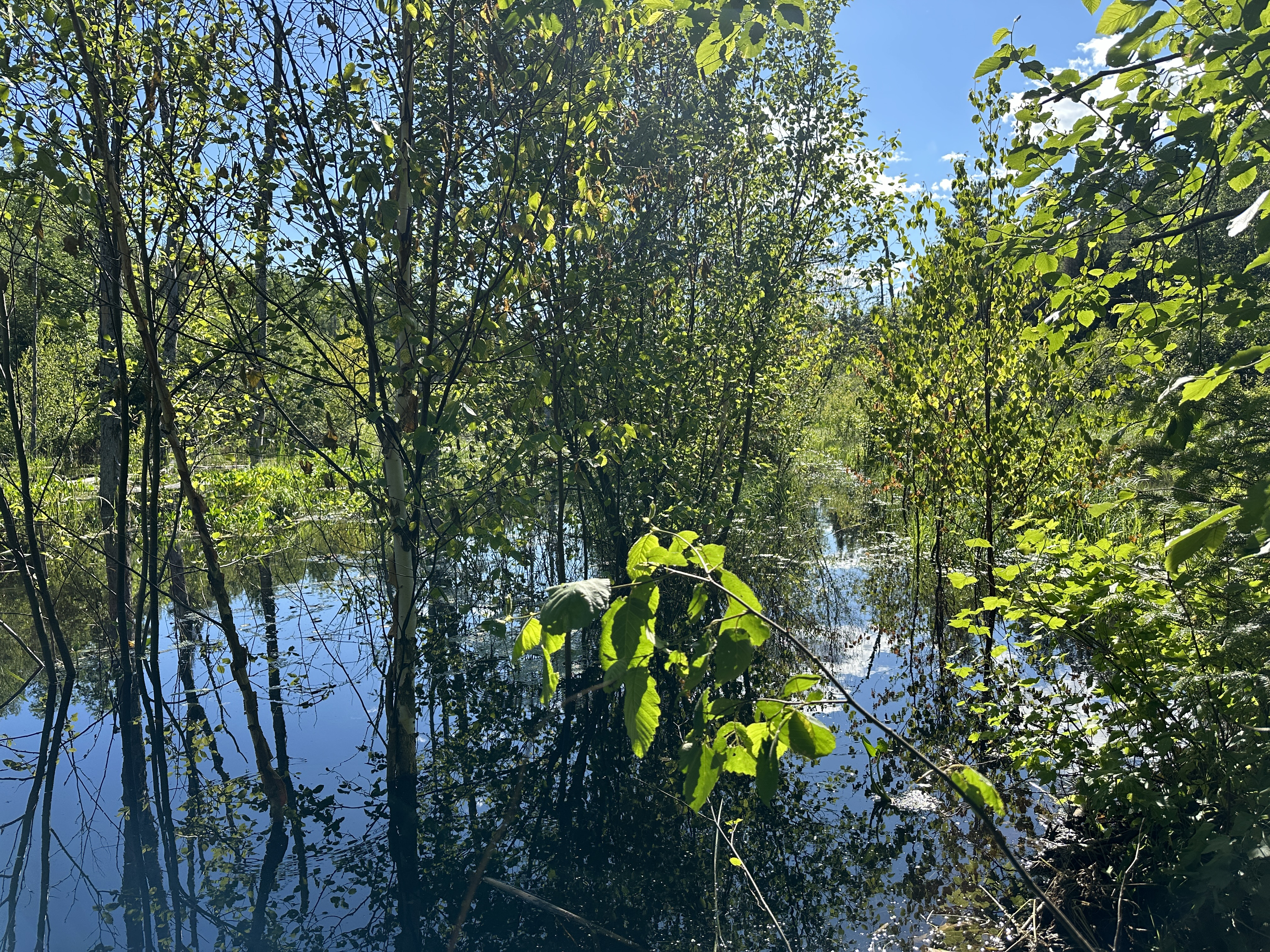
Just to the right of center you can see where the portage trail is located, even though it is under the water. The path is nearly straight here in this area. You would just paddle your canoe down that line until you reach the other side of the pond (or wade through chest deep water) (June 30, 2024).
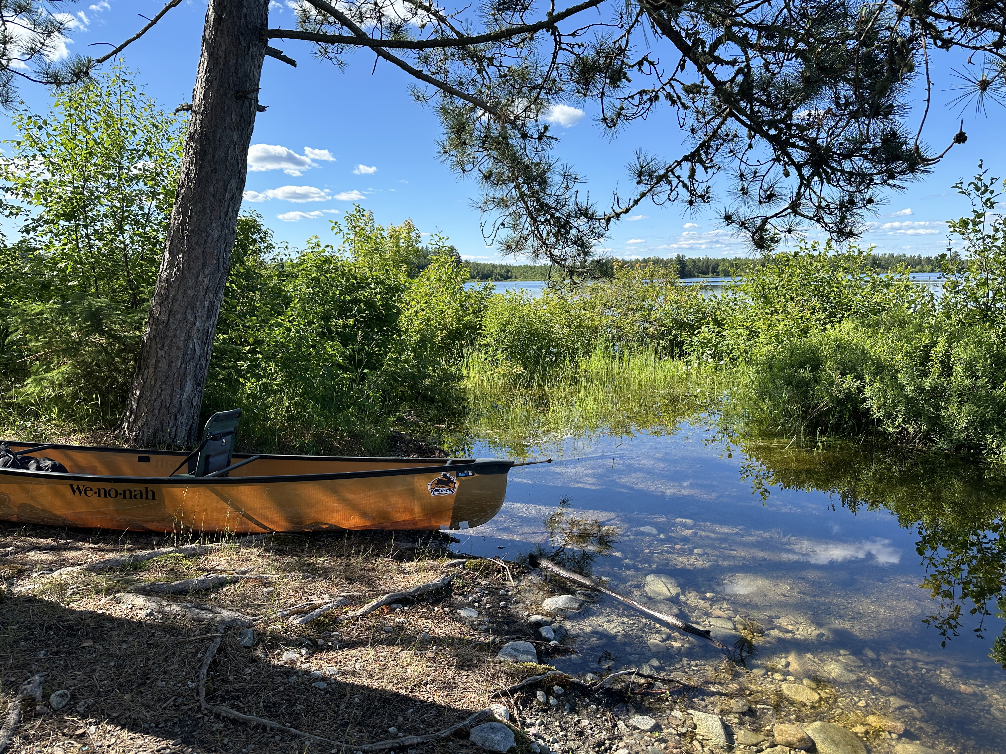
Clearing on the Basswood Lake end of the Four Mile Portage. There is usually a fire ring here, but it is not an official campsite (June 30, 2024).
The Basswood Lake portage landing. You made it! Water levels were high on Basswood Lake (June 30, 2024).
Now that you've made it over the portage, visit:BASSWOOD LAKE
Portaging Direction: From Basswood Lake to Fall Lake
This is the entire Four Mile Portage between Basswood Lake and Fall Lake. Note that I recorded this on two separate days about a month apart. The day switch occurs near the beaver dam that crosses the portage, about 4,400 feet from the Basswood Lake end of the portage. Starting at that beaver dam, the portage is often flooded for about the next mile. One you reach the north end of Muskeg Lake, the Four Mile Portage becomes a wide, flat and easily walked trail. The only obstruction south of Muskeg Lake is where the portage crosses Muskeg Creek. This area is often flooded because of beaver activity. You may need to paddle or wade through water there, depending on conditions. The portage landings on both ends of this trail are excellent.
The portage landing on Basswood Lake. There is an old steam hoist underwater just offshore. The water in the lake has to be low to see it.
Campfire ring in a clearing on the Basswood Lake end of the Four Mile Portage. This is not a legal BWCA campsite.
This beaver dam is what causes a large section of the Four Mile Portage to be flooded. This dam is located 4,400 feet from the shore of Basswood Lake. You are standing on the portage at the base of the dam. The water on the otherside of the dam on this date was about four feet deep (June 30, 2024).
View of the pond created by the beaver dam. The portage trail goes through this pond, or rather underneath it (June 30, 2024).
Coming from Basswood Lake, this is your first view of Muskeg Lake. This means you are about halfway across the Four Mile Portage. The southern half of the Four Mile Portage is much easier (July 22, 2018).
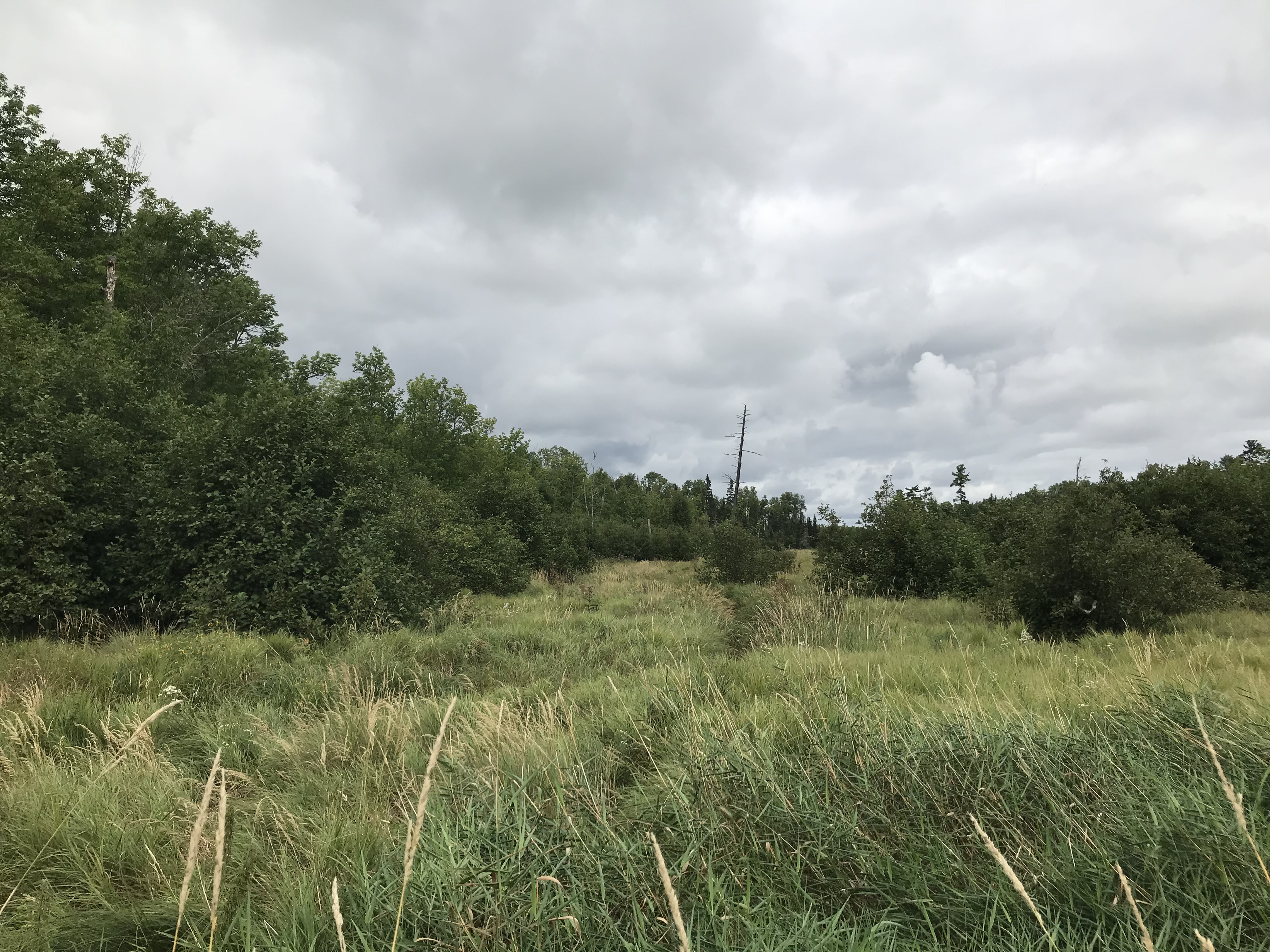
Looking to the north at the lowland area through which Muskeg Creek flows. This is the location where Muskeg Creek is crossed by the Four Mile Portage. The portage is often flooded at this location (July 22, 2018).
You made it across the Four Mile Portage to Fall Lake (August 2, 2024).
Now that you've made it over the portage, visit:FALL LAKE