ELLA HALL LAKE CAMPSITES: Campsite 1: (#1750) - Just east of Mud Lake portage on the point - Appeared abandoned in 2018 Campsite 2: (#1754) - Middle of the campsite along the north shoreline. (Note: BWCA Campsite 1755 to the west of this one may not exist). Campsite 3: (#1753) - Eastern most portage on the north shore of the lake. Campsite 4: (#1752) - Eastern most portage on the south shore of the lake.
Campsite 5: (#1751) - Likely closed. Was located at the southernmost point on the lake along.
Campsite 6: (#1755) - Was just east of the portage to the Four Mile Portage. Was not able to find it in 2024
So you may have visited this lake in the past or plan to in the future. But did you ever wonder why the lake is named Ella Hall Lake? It turns out this is an obscure but interesting bit of Minnesota history dating back to the latter part of the 1800's. This is when the area that is now the BWCA was just starting to see its first European settlers. The lake is named Ella Hall for a 15 year old girl who died here back in 1885. The exact cause of her death is a bit of a mystery, but Ella Hall's grave is located on this lake. The Ojibwe who lived in the area when the Hall family did, referred to Ella as "Annie", so the lake was once commonly referred to as "Annie Hall Lake".
There are six campsites indicated on the map for this lake, but only four could be located and one of those four is in an abandoned state. Because the lake is located along the Four Mile Portage, portage wheels are allowed, which eliminates much of the drudgery of carrying your gear out here.
Ella Hall Lake is nearly landlocked; there is a tiny creek flowing out the far east end of the lake through the wetland in that area. That little creek flows into Good Creek.
Fishing on the lake can be pretty good for northern pike. Ella Hall Lake probably doesn't get as many visitors as it used to, because the Four Mile Portage is more difficult to travel now due to beaver activity.
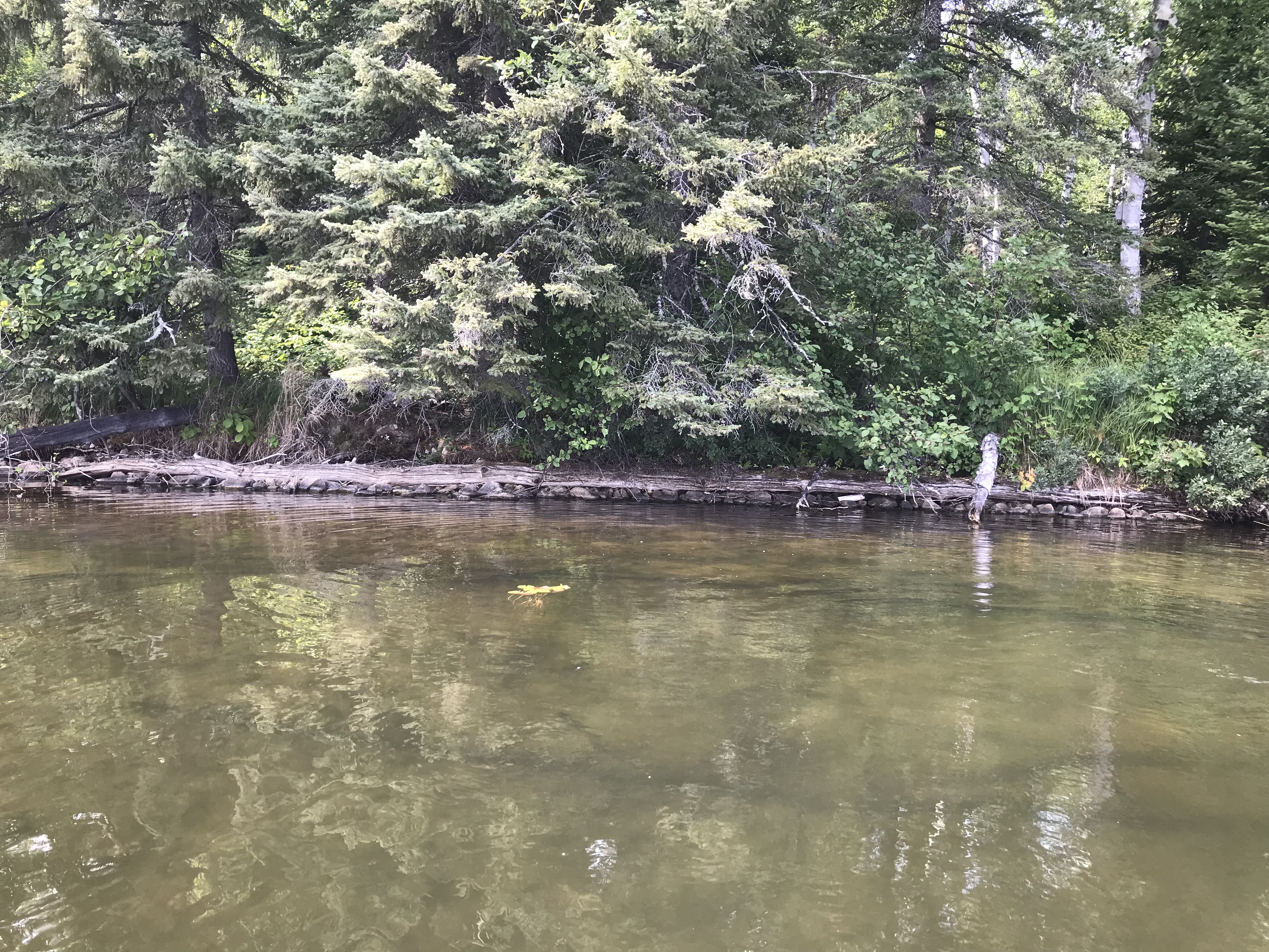
The remains of an old pier or dock-like structure are found on the north shore in the western end of the lake.
A short railroad spur was built in either 1899 or 1900 that connected the northeast end of Fall Lake directly to Ella Hall Lake (Heinselman, 1999).
Old 7.5 minute topographic maps show that Ella Hall Lake had another portage near the northeast corner of the lake that extended to the north/northeast until intersecting the Four Mile Portage (Long Portage), about 100 rods before that portage reaches Basswood Lake.
The portage to Mud Lake is not heavily used and is moderately overgrown. The portage into Ella Hall Lake from the Four Mile Portage is well worn and easily passable. A recent windstorm in the area decimated many of the trees along this portage (2018). This portage begins very near to Muskeg Lake. However, Muskeg Lake is not easily accessible because of said windstorm (probably the July 2016 storm) which destroyed the short portage down to the lake. You can still reach Muskeg Lake with a bit of bushwhacking from several spots along the Four Mile Portage.
Click on the photos below to see the full resolution image - Use your browsers back button to close photo and return to this page.
PADDLING FROM THE FOUR MILE PORTAGE SPUR PORTAGE TO BWCA CAMPSITE 1754
Your destination is just a short paddle of perhaps 1/2 mile to the northeast along the shoreline. Visit BWCA Campsite 1754 -or- Explore Another Route ***********************************************END OF ROUTE***********************************************
PADDLING FROM BWCA CAMPSITE 1754 TO BWCA CAMPSITE 1753
A brief paddle to the southeast along the north shore of Ella Hall Lake to another campsite. Visit BWCA Campsite 1753 -or- Explore Another Route ***********************************************END OF ROUTE***********************************************
PADDLING FROM BWCA CAMPSITE 1753 TO ELLA HALL'S ISLAND
Follow the shoreline to the northeast and then go around the north side of the large island in the eastern end of Ella Hall Lake. Ella Hall Island is the small island directly east of the big island. The landing is on the east side of the little island. Explore Ella Hall's Island -or- Explore Another Route ***********************************************END OF ROUTE***********************************************
PADDLING FROM ELLA HALL'S ISLAND TO BWCA CAMPSITE 1752
Paddle about 1/2 mile towards the southwest to the next campsite located along the south shoreline of Ella Hall Lake. Visit BWCA Campsite 1752 -or- Explore Another Route ***********************************************END OF ROUTE***********************************************
PADDLING FROM BWCA CAMPSITE 1752 TO THE UNMAINTAINED BWCA CAMPSITE 1750
Paddle on a westbound heading for close to a mile to the unmaintained campsite located on a point. The landing for this rugged campsite is on the west side of the point within sight of the Mud Lake portage landing. Visit BWCA Campsite 1750 -or- Explore Another Route ***********************************************END OF ROUTE***********************************************
PADDLING FROM THE UNMAINTAINED BWCA CAMPSITE 1750 TO THE MUD LAKE PORTAGE
Quick paddle to the southwest corner of Ella Hall Lake where you will find the start of the Mud Lake portage. It's only about 1/4 mile away. Portage to Mud Lake -or- Explore Another Route ***********************************************END OF ROUTE***********************************************
PADDLING FROM THE MUD LAKE PORTAGE TO BWCA CAMPSITE 1754
Paddling on a north/northeast heading to the campsite located on the north shoreline of Ella Hall Lake. The campsite is in the western end of the lake. Visit BWCA Campsite 1754 -or- Explore Another Route ***********************************************END OF ROUTE***********************************************
PADDLING FROM BWCA CAMPSITE 1754 TO THE FOUR MILE PORTAGE SPUR PORTAGE
A short journey of perhaps 1/2 mile towards the southwest to the start of the spur portage that will take you back to the Four Mile Portage. There is a good portage landing here. Portage to the Four Mile Portage -or- Explore Another Route ***********************************************END OF ROUTE***********************************************
PADDLING FROM THE MUD LAKE PORTAGE TO SMALL ISLAND AT EAST END OF LAKE
A beaver lodge a short ways east of the Mud Lake portage.
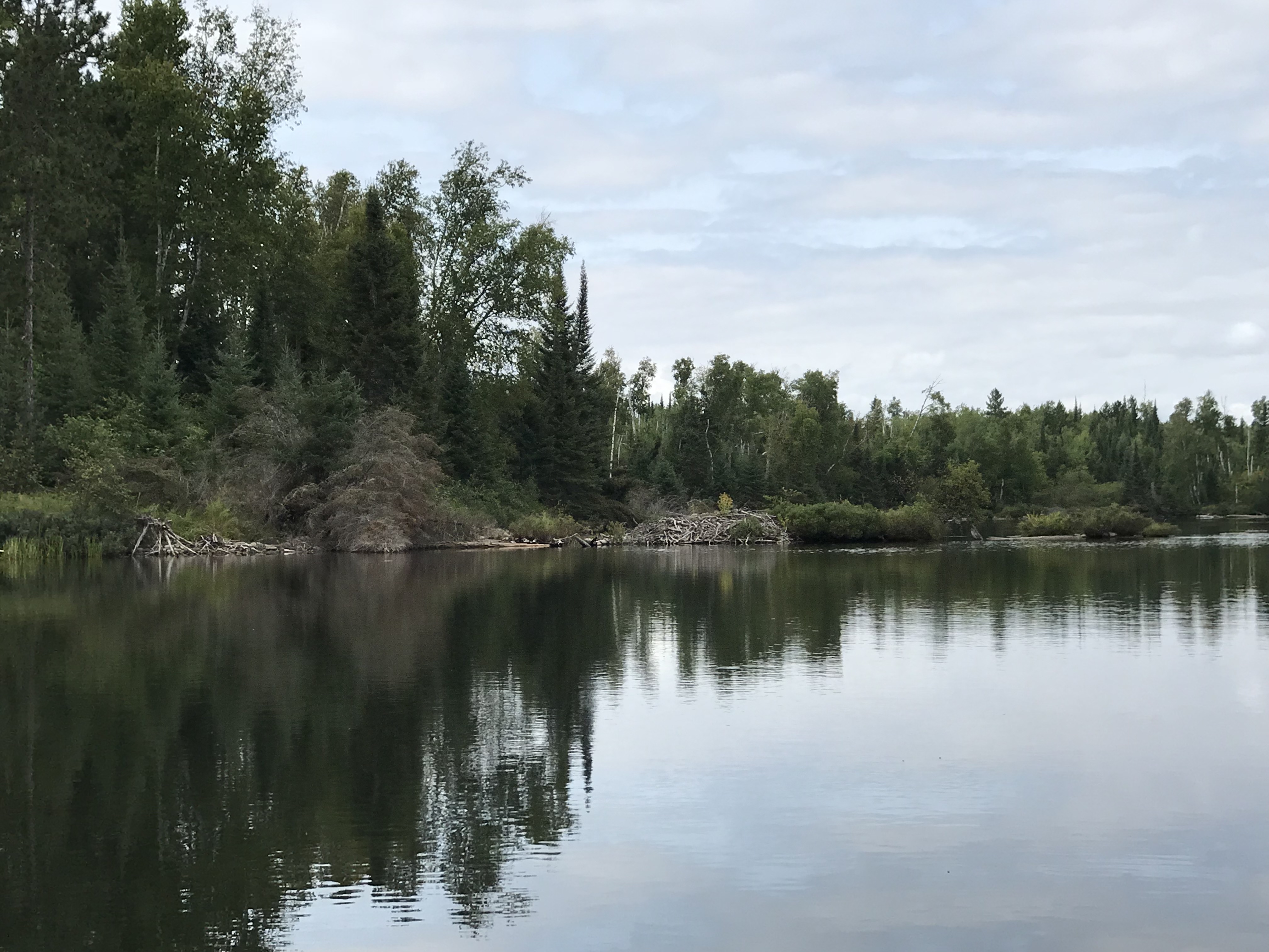
Beginning at the Mud Lake portage, paddle along the south shoreline of Ella Hall Lake until arriving at the small island in the far eastern end of the lake.
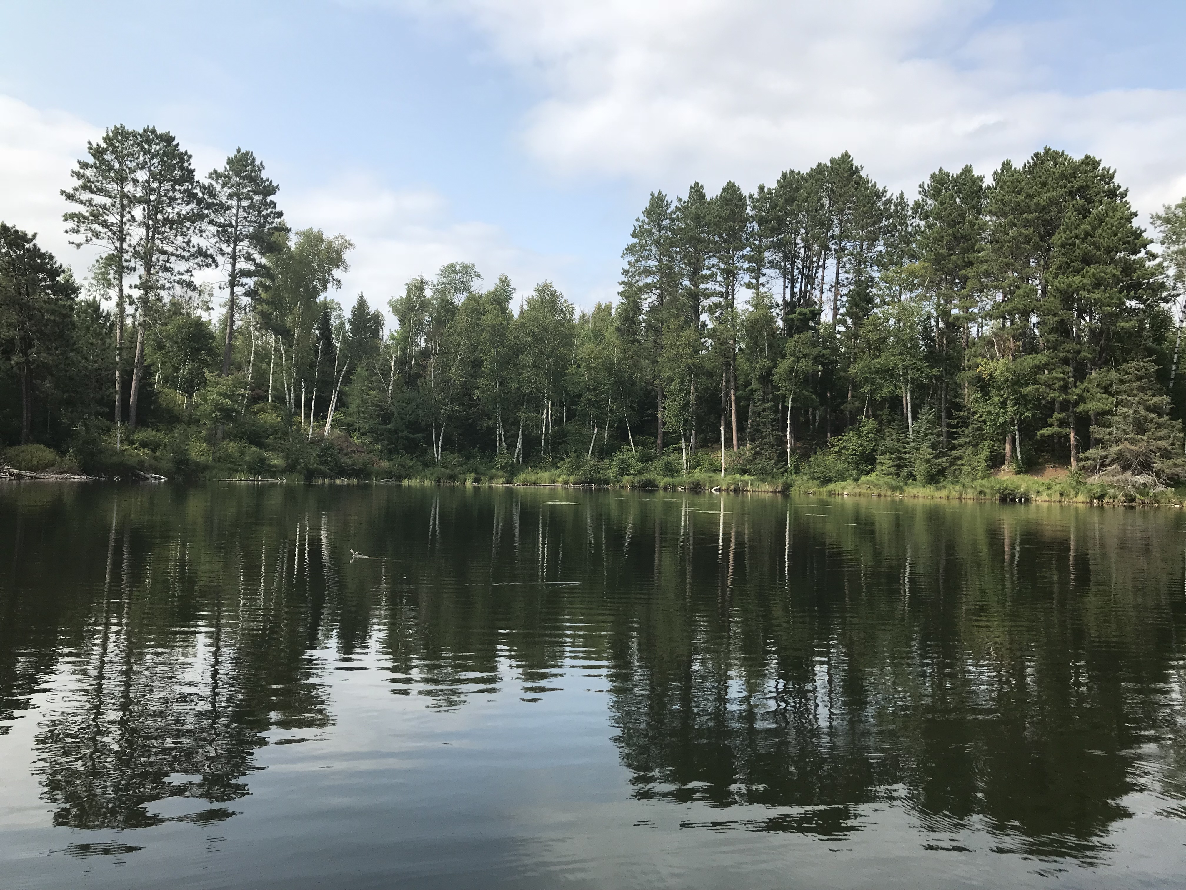
The south shoreline of Ella Hall Lake. This is near the middle point of the lake. View is to the east/northeast. Explore Another Route ***********************************************END OF ROUTE***********************************************
PADDLING FROM EAST END OF LAKE TO WEST END WHERE PORTAGE TO THE FOUR MILE PORTAGE IS LOCATED
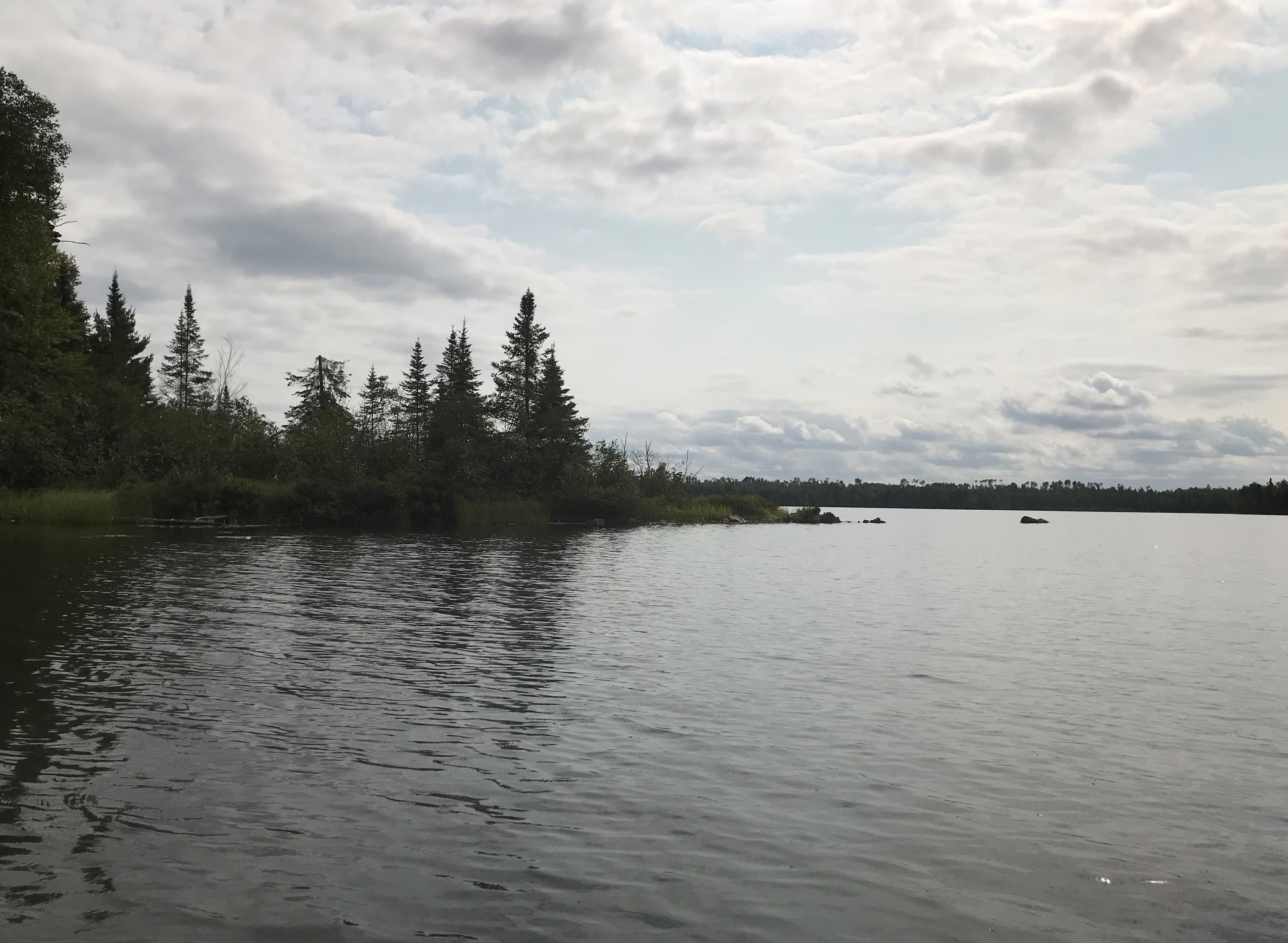
This stretch of paddling begins on the east end of Ella Hall Lake. You paddle all the way to the west end of the lake, generally staying near the north shoreline. The trip ends at the portage from Ella Hall Lake that leads out to the Four Mile Portage (very near to Muskeg Lake).
This is a view to the west, looking at a small point extending off the north side of the largest island in Ella Hall Lake.
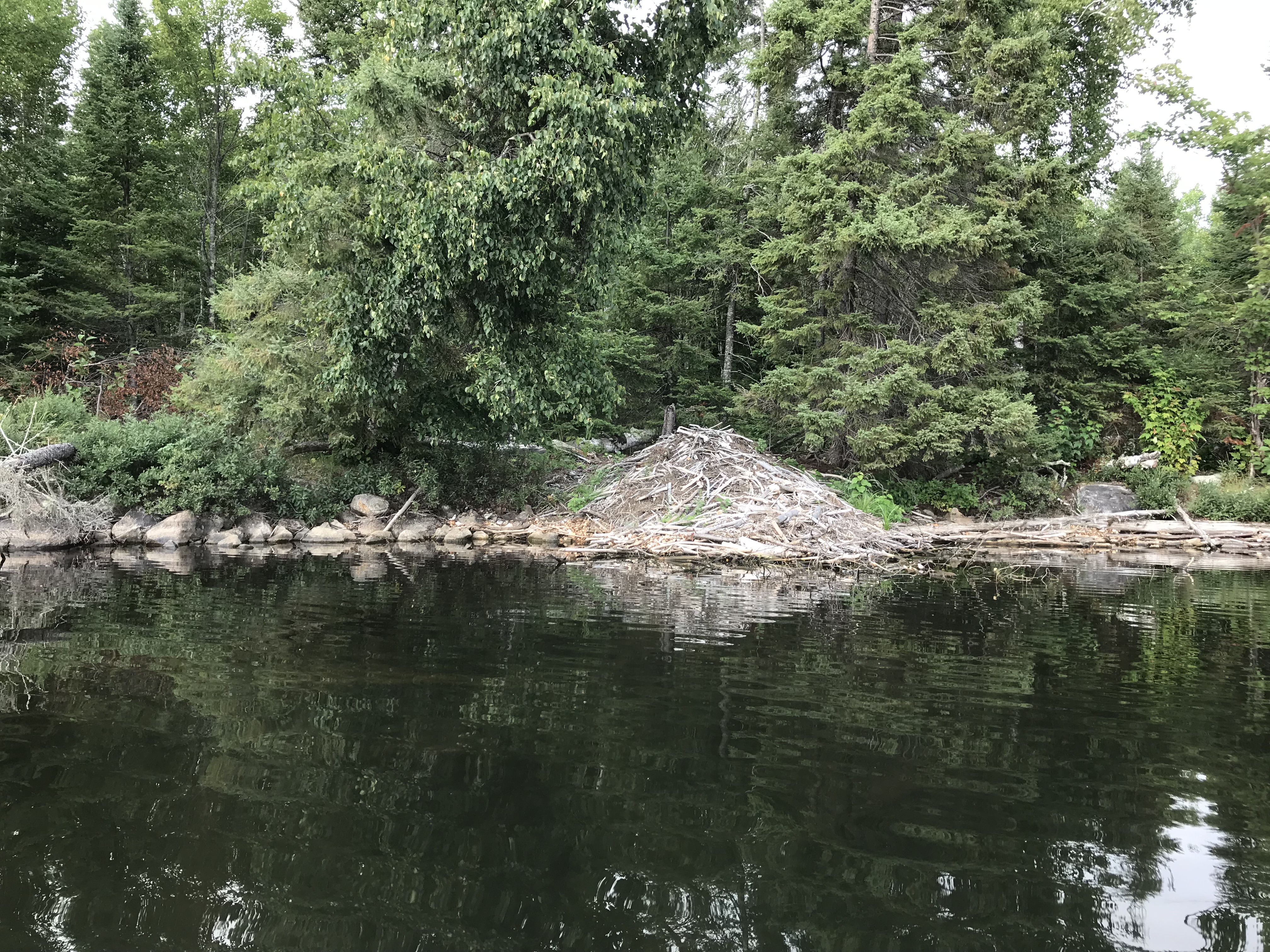
A beaver lodge which is located in the northwest corner of Ella Hall Lake.
The remains of an old dock or pier along the north shore, in the western end of the lake.
A shallow bay in the west end of Ella Hall Lake. Portage to the Four Mile Portage -or- Explore Another Route ***********************************************END OF ROUTE***********************************************
Route Connections for Ella Hall Lake
From Ella Lake, you can portage to Mud Lake and the Four Mile Portage (and arrive near Muskeg Lake). Portage does not extend to Muskeg Lake anymore as it was destroyed by a windstorm (as of 2024). The Four Mile Portage connects Fall Lake and Basswood Lake. You can use portage wheels on the Four Mile Portage.