MUD LAKE CAMPSITES: Campsite 1: (#1756) - Was in an abandoned looking condition as of 2018 - Southeast shore of lake
Campsite 2: (#1757) - Could not locate this campsite in 2018
The maps for this lake show it has two campsites. During visit in 2018, the campsite along the south shoreline was found, but was in an abandoned status - heavily overgrown with a number of fallen trees lying in the middle of the site. The campsite just east of the Ella Hall Lake portage was not found.
This quiet lake probably sees few visitors. Since there may be no place to camp, this lake would be suited for day trips for paddlers base camping on Ella Hall Lake. The portage between Ella Hall Lake and Mud Lake is in reasonable shape. The portage between Mud Lake and the Four Mile Portage is a little rougher.
The lake has northern pike in it. Also several loons and trumpeter swans were present. A number of beaver lodges speckle the lakes shoreline too. The lake doesn't entirely seem to live up to it's name of 'Mud Lake'. Much of the lake has a sandy and rocky bottom.
Muskeg Creek starts here and flows out the west side of the lake. You cross the creek just south of where the Mud Lake portage intersects the Four Mile Portage.
There used to be a portage between Fall Lake and Mud Lake. This portage began at the point on the southwest shoreline of Mud Lake. The portage reached Fall lake just east of the existing Four Mile Portage landing. The old portage appears on the 1960's 7.5 minute USGS topographic maps. It does not appear on Fisher Maps as old as 1983. The portage that goes from Mud Lake to the Four Mile Portage is actually relatively new. That portage does not appear on maps dated before the early 1980's.
Click on the photos below to see the full resolution image - Use your browsers back button to close photo and return to this page.
PADDLING FROM THE PORTAGE THAT CONNECTS TO THE FOUR MILE PORTAGE TO THE ABANDONED CAMPSITE
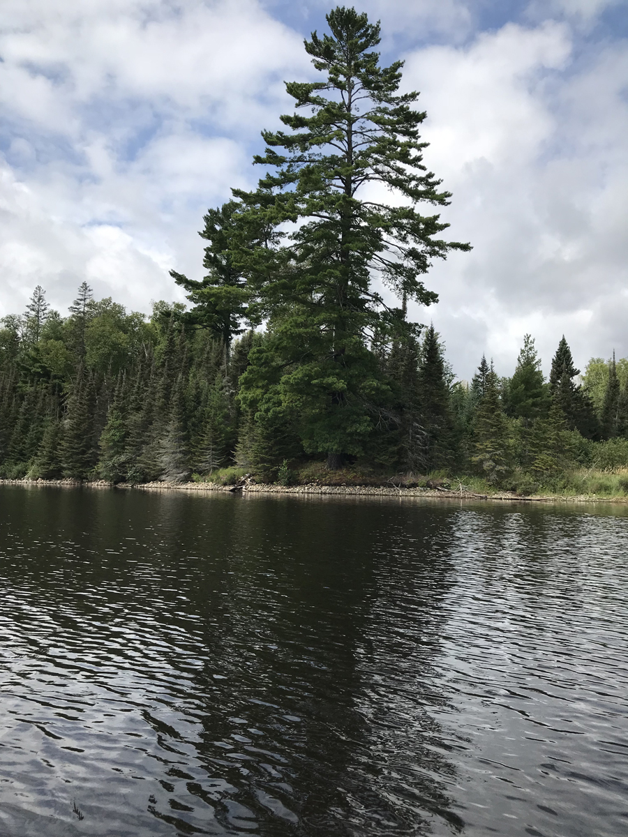
A prominent pine that stands along the west shoreline of Mud Lake (July 22, 2018).
Heading out from the portage connecting Mud Lake to the Four Mile Portage. Paddling the lake in a counterclockwise direction until you arrive at the abandoned campsite. This overgrown campsite is on the south shoreline of Mud Lake (July 22, 2018).
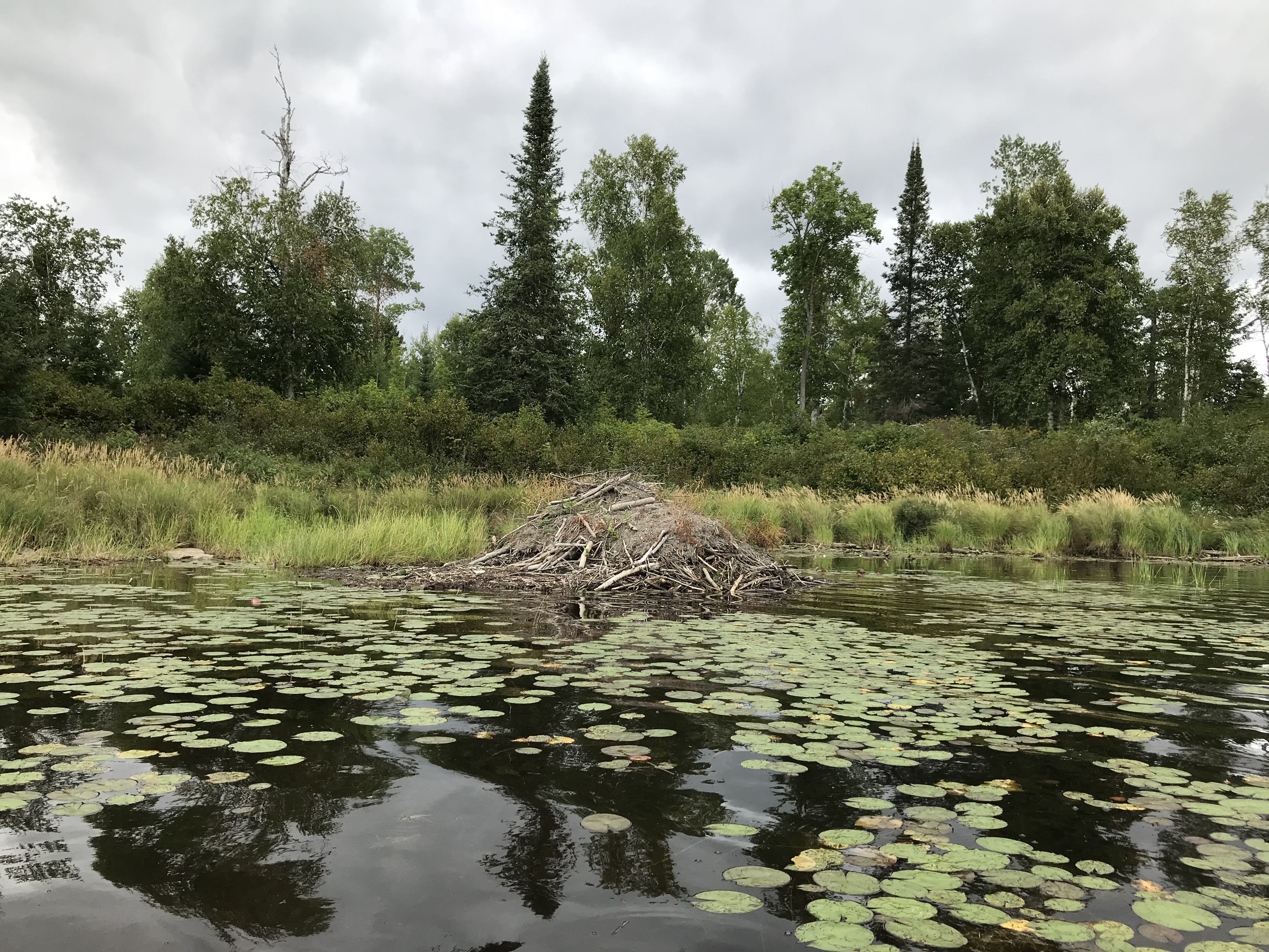
An old, overgrown beaver lodge near the northwest shore of the Mud Lake (July 22, 2018).
The shallow northwest bay of the lake. This is the beginning of Muskeg Creek which flows out of Mud Lake to the west/northwest to Muskeg Lake (July 22, 2018).
Another beaver lodge located along the north side of the sharp west point of land, that juts out into Mud Lake (July 22, 2018). Visit the Abandoned Campsite -or- Explore Another Route ***********************************************END OF ROUTE***********************************************
PADDLING FROM THE ABANDONED CAMPSITE ON EAST SHORE TO THE ELLA HALL LAKE PORTAGE
After leaving the abandoned campsite in the southeast part of Mud Lake, continue in a counterclockwise direction around the shoreline. Eventually you reach the Ella Hall Lake portage location, which is along the north shoreline (July 22, 2018). Portage to Ella Hall Lake -or- Explore Another Route ***********************************************END OF ROUTE***********************************************