Have not yet visited this Primitive Management Area lake. The information displayed on this page are notes used for planning a future trip to this area. Use the information on this page at your own risk.
To reach Snatch Lake, follow a relatively wide stream channel to the northwest out of a small bay located along the northern shoreline of Ima Lake. This channel/creek was loaded with lily pads and a few fallen trees that were just under the waters surface. It is passable in summer, but would be easier in the spring before the vegetation grows in and the water levels are still high.
Snatch Lake is prettier than expected; not just another small swampy lake. The lake has the usual blooms of lily pads and other aquatic vegetation. A small island and a varied landscape add to the scenery. The island has a single lone pine tree rising from it. A small cliff can be found along the southwest shoreline. The lake has dark, bog stained water that contrasts nicely with all the green of the aquatic veggies. No obvious camping spots on this lake and it is so easy to get back to Ima Lake that there is really no reason to stay here. A good, quick day trip from Ima Lake. One of the easiest PMA lakes to visit.
Click on the photos below to see the full resolution image - Use your browsers back button to close photo and return to this page.
View looking back to the southeast towards Ima Lake, while traveling down the creek to Snatch Lake.
A short paddle through thick lily pads from Ima Lake to Snatch Lake. You meet a few submerged trees along the way *CRASH* too.
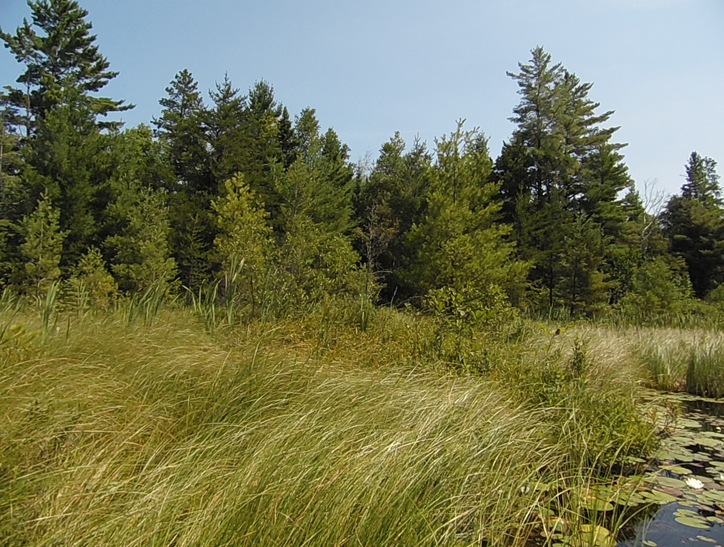
The shoreline along the creek between Ima Lake and Snatch Lake.
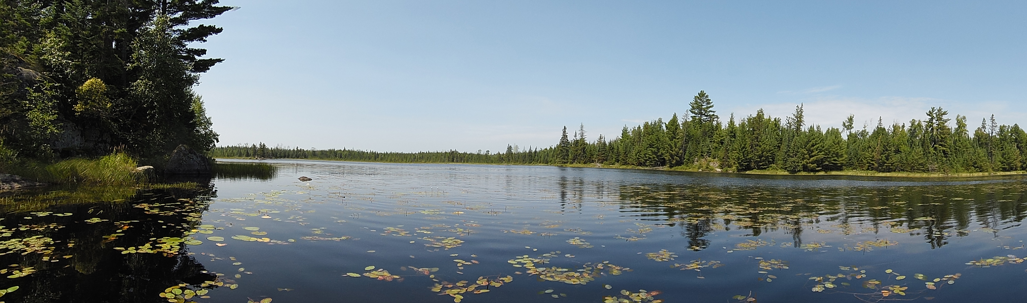
Snatch Lake opens up before you as you complete the paddle up the creek from Ima Lake. View is toward the northwest.
Bushwhack to Snatch Lake
You luck out for this PMA lake as there is no bushwhack required. Lakes in Primitive Management Areas don't get any easier to visit than this one.
Exploring Snatch Lake
You're looking west across Snatch Lake from near the lakes eastern shoreline.
Northeast corner of Snatch Lake.
North shoreline of Snatch Lake. This is the north shore on the eastern end of the lake.
This is just west of the north bay along the northern shoreline of the lake.
North shore of the lake. Most of the shoreline of this lake is very low elevation. Only the south shore of the lake has substantial geographic relief.
The northwest part of Snatch Lake. This is the area where a small unnamed creek flows in.
This is a counterclockwise paddle around the perimeter of Snatch Lake. You start off along the north shoreline and head toward the west end of the lake. The west end of the lake is covered in lily pads, many having white flowers. As you look toward the southwest corner of the lake, you see a small island with a single pine tree. Some cliffs are visible along the south shoreline. The east end of the lake also has extensive lily pads, especially where the creek flows out.
A look to the east now that you've reached the western end of the lake.
This is the southwest corner of Snatch Lake. To the left side of this view is what used to be the north half of a small island. The lake has filled in around this former island. Most of this filled in area is currently peat bog, but enough soil has formed and the ground has become stable and permanant enough that small trees are starting to take root.
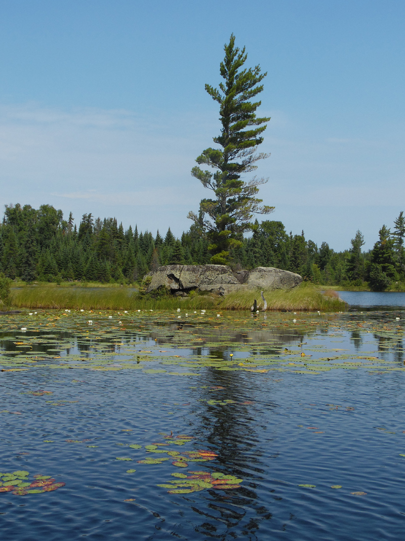
Distant view of the small island with the lone pine tree. South shoreline creates a backdrop for the island.
The solitary pine on the lakes only island.
South shore of the lake. This is really the only rocky outcrop and small cliff along the entire shore of the lake.
Southeast part of the lake. The creek flows out of Snatch Lake about the center of your view, hidden within the tall grass.