Jester Lake is a short bushwhack from Fool Lake. If you made it all the way into Fool Lake, Jester Lake is worth the extra effort required to visit it. Note that Jester Lake is shown as "Vester" Lake on USGS topographic maps.
What Jester Lake lacks in size, it makes up for in depth. Much of the north end of the lake is over 30 feet deep. The south end of the lake is much shallower and runs 8 to 12 feet in depth. There is a sharp depth change near the bend in the lake. Goes for about 12 feet to 40 feet almost instantly.
In the very northern part of Jester Lake are some odd rock formations. These formations are on both sides of the lake. The formatation almost certainly extends under the water across the entire width of that portion of the lake. These formations also make a good place to camp, there is a lot of open space on them. These rock ledges provide a hard surface and landing a canoe here is easy as pie. There were a number of moose tracks in the sand here.
Fish locator detected a lot of fish in Jester Lake, especially where the lake transitions from shallow to deeper water. The bottom seemed to be mostly rock, particularly in the northern half of the lake.
Jester Lake represents a dead end with no "easy" access to other lakes or streams in the area.
A number of smaller burns affected the eastern part of the Boundary Waters Canoe Area Wilderness in 1936, including some areas in the Hairy Lake Primitive Management Area.
1894 saw a large number of fires throughout the entire BWCA. The fire in this area is called the Snipe Lake/Round Lake- Gunflint Lake/Pine Lake Area Complex. This fire probably got its start near Round Lake, a popular BWCA entry point.
Another fire started within what is now the Hairy Lake Primitive Management Area. The ignition point was probably somewhere between Mass Lake and Auk Lake. This fire, which took place in 1846, is called the Auk Lake/Long Island Lake/Cross Bay Lake Complex.
The 1824 Long Island Lake/Rush Lake/Loon Lake Complex probably burned the eastern part of the Hairy Lake Primitive Management Area and moved eastward. It likely started somewhere around Snipe Lake, or perhaps the northwest part of Long Island Lake.
Way back in 1727, the Gordon Lake/Brule Lake/Winchell Lake Complex burned this area. It probably began somewhere near Sawbill Lake.
Click on the photos below to see the full resolution image - Use your browsers back button to close photo and return to this page.
The entire approach into Jester Lake is from Fool Lake. Visit that page for more information.
Bushwhack to Jester Lake
With your canoe just out of the water after coming up the small creek from Fool Lake, begin a fairly short bushwhack. This bushwhack allows you to take advantage of the remains of a faint portage trail that is no longer maintained. There are a few nasty fallen trees, lots of mean little, sharp branched pine trees and a slippery incline next to a big rock to negotiate. As you reach Jester Lake, launch the canoe from the top of an overgrown beaver dam.
PADDLING FROM THE FOOL LAKE BUSHWHACK TO THE NORTH END OF THE LAKE
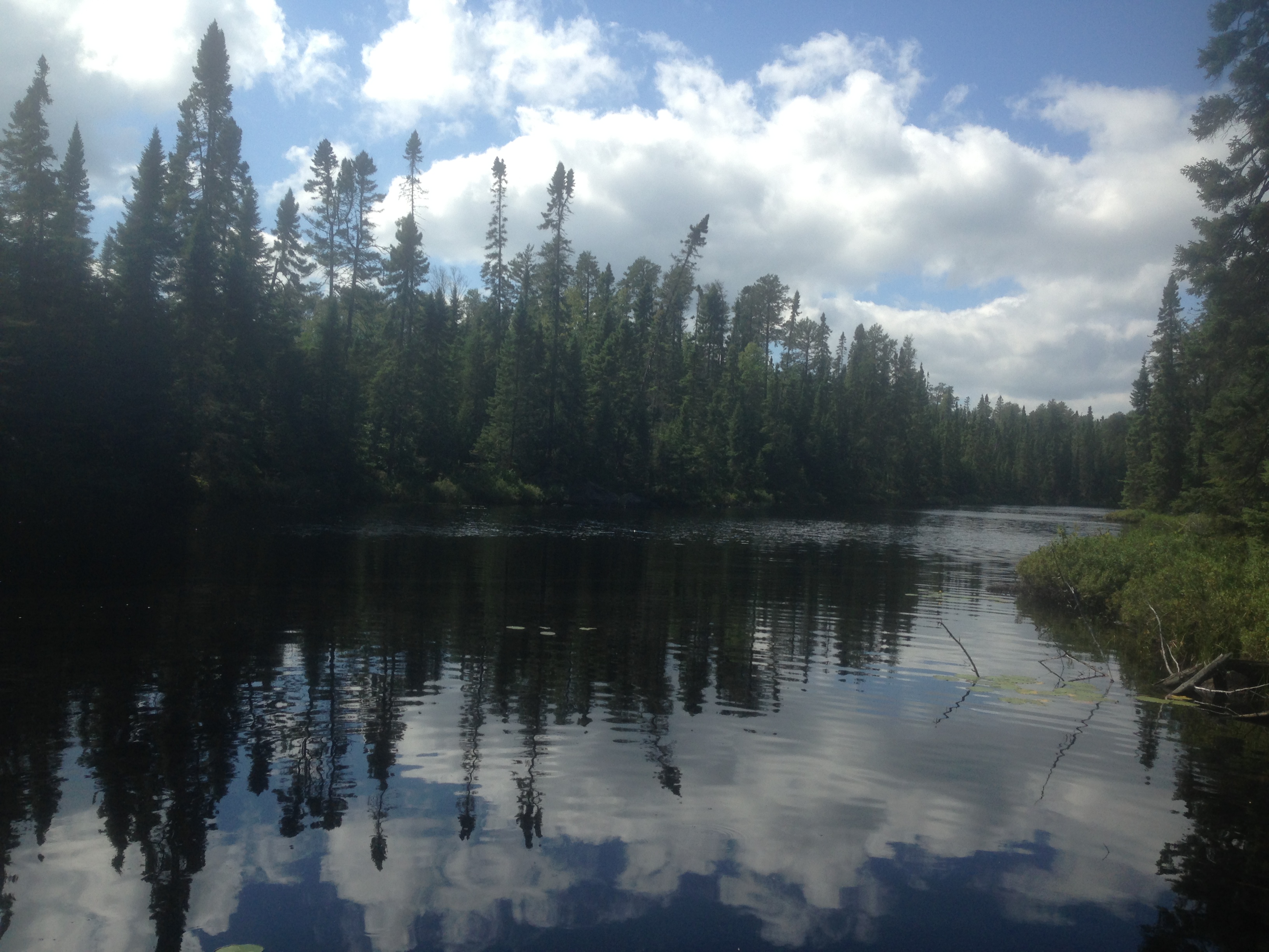
Looking to the northwest across Jester Lake from the south end of the lake.
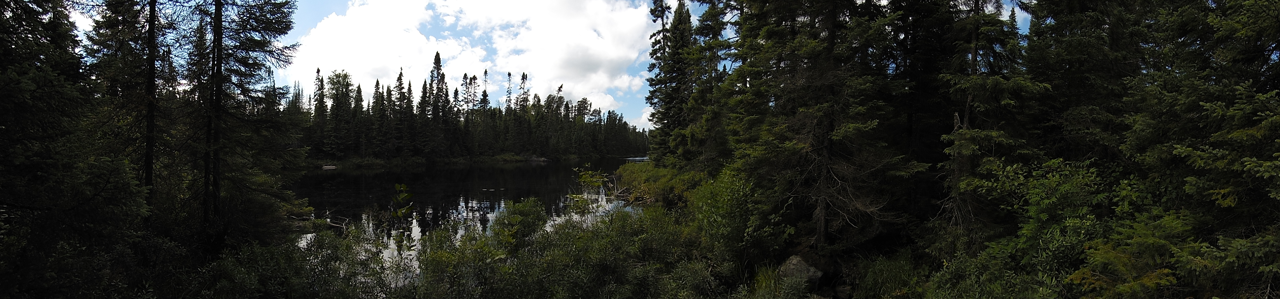
Panoramic view of Jester Lake from the start of the Fool Lake bushwhack. This is also the location of a small creek that flows from Jester Lake to Fool Lake. An old, heavily overgrown beaver dam barricades the creek.
Setting off from the beaver dam, paddle along the eastern shore of Jester Lake. At the north end of the lake, you find some odd geological formations that appear to extend under the water, since they can be traced to the other side of the lake. Two of these formations are separated by a small bay. The third formation is all the way across the lake.
This rock formation is across the lake from two other similar rock formations. This formation is in the northwest corner of the lake.
PADDLING FROM THE NORTH END OF THE LAKE TO THE FOOL LAKE BUSHWHACK
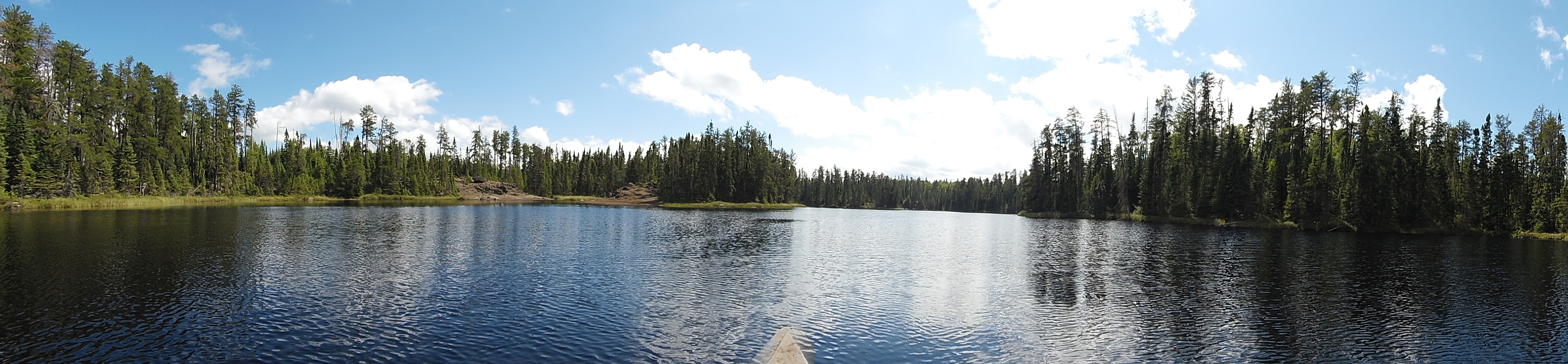
View of the north end of Jester Lake. The view is toward the south.
Visiting the rock formations in the north end of Jester Lake. You then paddle back towards the south end of the lake, staying mostly along the west side of the lake. The paddle ends at the Fool Lake bushwhack.
These two formations are in the northeast bay of the lake separated by a narrow stretch of water.