ROUTES/PORTAGES FROM LONG ISLAND LAKE:
To Cave Lake: Walk the 109 rod portage
To Karl Lake: Walk the 35 rod portage
To Karl Lake: Paddle In (to south end of Karl Lake)
To Long Island River: Paddle In
To Muskeg Lake (via two portages along Muskeg Creek): Walk the 20 and 4 rod portages
To Yogi Lake: Bushwhack
about 85 rods
Long Island Lake
Gunflint Ranger District
LONG ISLAND LAKE CAMPSITES: Campsite 1 (#570): Campsite on point just northeast of Long Island River mouth Campsite 2 (#566): Campsite just north of Long Island River mouth on west shore Campsite 3 (#569): Campsite on prominent point on west shore of lake
Campsites can be hard to find on Long Island Lake during the June through August months, as everyone seems to head to this lake.
Western end of Long Island Lake saw logging activity in the 1950's. This logging activity was carried out by Consolidated Papers of Wisconsin and the tract covered about 38 square miles. The logging tract also included Cash Lake due south of Long Island Lake (Heinselman, 1999).
A 3,400 acre fire burned between Gordon Lake and Long Island Lake in 1936.
Long Island Lake has many tributaries feeding it. From the south is the Long Island River flowing north from Cherokee Lake. Water from Ash Lake flows in via a small creek from the south. Toward the east end of the lake, Fun Lake drains into Long Island Lake. Muskeg Lake drains in on the far east end of the lake, as well as both Finn Creek and Banadad Creek. On the far west end of the lake, a small drainage comes in from both Yogi Lake and Plug Lake. These last two lakes are in the Hairy Lake Primitive Management Area which lies to the west of Long Island Lake. Long Island Lake drains through the channel to Karl Lake. Karl Lake is sort of a large bay on the north side of Long Island Lake (the division point between the lakes is somewhat vague).
You may be able to skip the 4 rod portage along Muskeg Creek on the way to Muskeg Lake if water levels are good. The portage to Karl Lake is easy with a nice beach on the Long Island Lake end of it. It is also possible to paddle straight into Karl Lake's south end from the middle of the north shore of Long Island Lake.
References:
Beymer, Robert, Boundary Waters Canoe Area – Volume 2 – Eastern Region (Berkeley: Wilderness Press, 2006), 60, 85, 95, 96, 109, 110, 118, 123, 124, 125, 130, 132, 139, 151.
Heinselman, Miron, The Boundary Waters Wilderness Ecosystem (Minneapolis: University of Minnesota Press, 1999), 118.
Pauly, Daniel, Exploring the Boundary Waters (Minneapolis: University of Minnesota Press, 2005), 271, 299, 312-314.
Click on the photos below to see the full resolution image - Use your browsers back button to close photo and return to this page.
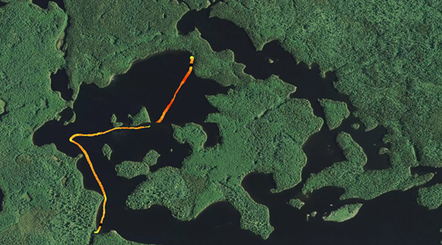
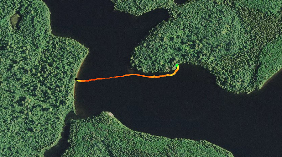
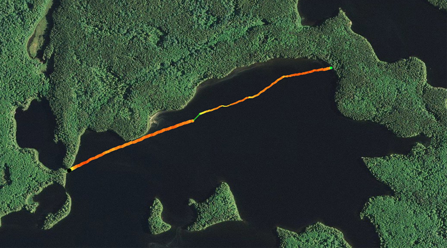
PADDLING FROM THE KARL LAKE PORTAGE TO THE MOUTH OF THE LONG ISLAND RIVER
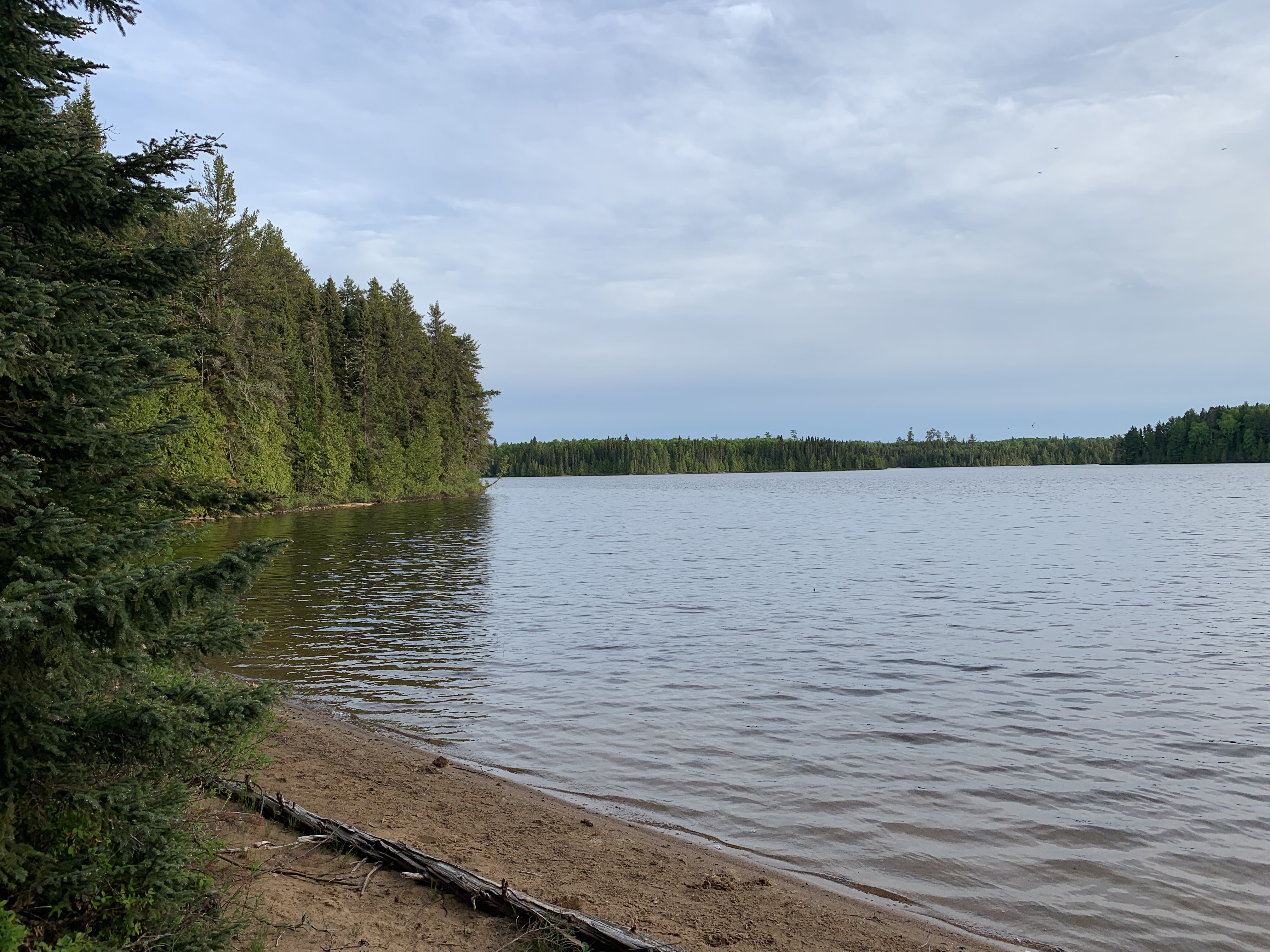
Long Island Lake in the early evening at the beginning of the summer season. View is from the Karl Lake portage. Great beach here if you want to go swimming.
An extended paddle from the Karl Lake portage to the mouth of the Long Island River. Generally paddling to the southwest, staying to the east of the central islands in the northwest bay of Long Island Lake. It is late evening by the time we reach the area where the Long Island River flows into the lake. Paddle into the Long Island River -or- Explore Another Route **********************************************END OF ROUTE***********************************************
PADDLING FROM THE MOUTH OF THE LONG ISLAND RIVER TO THE CAMPSITE JUST UP THE WEST SHORELINE
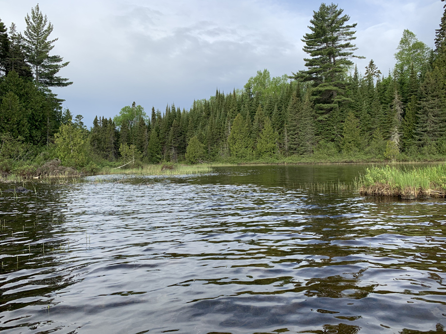
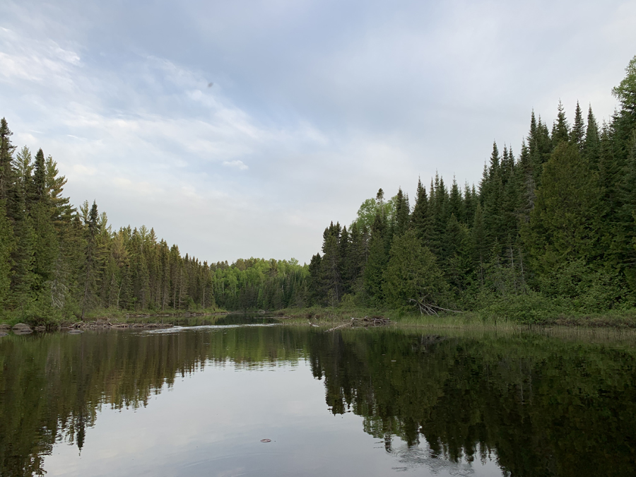
This is the mouth of the Long Island River where it flows into Long Island Lake. The current is very minimal.
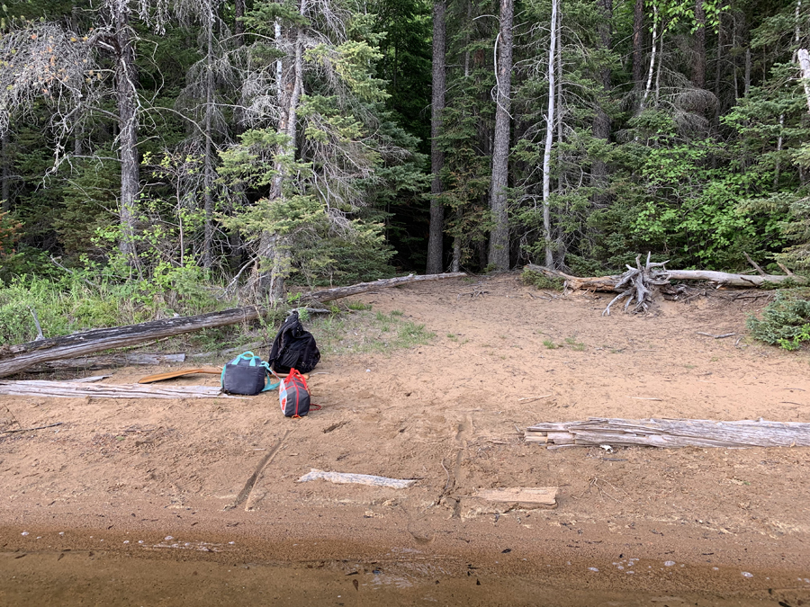
A quick paddle from the mouth of the Long Island River just up the west shoreline to a campsite. This is not a very good campsite, but would do in a pinch. Campsites often fill up early on Long Island Lake, especially during the peak summer season.
PADDLING FROM THE CAMPSITE NEXT TO THE LONG ISLAND RIVER MOUTH TO NEARBY CAMPSITE ON THE POINT
There is a campsite just a couple hundred feet or so north of the mouth of the Long Island River along the western shoreline of Long Island Lake. This isn't a particularly good campsite. Knowing that, you paddle from that campsite over to a better campsite located just a few minutes to the northeast on the point. A much better campsite. Visit the Campsite -or- Explore Another Route **********************************************END OF ROUTE***********************************************
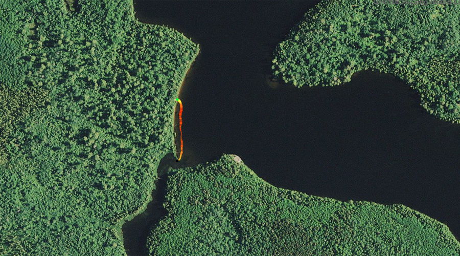
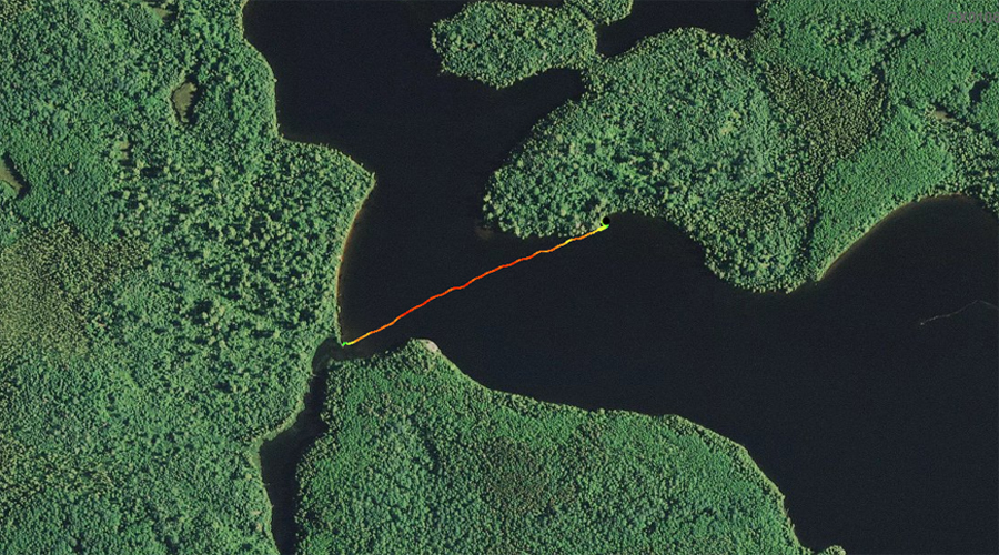
PADDLING FROM CAMPSITE JUST NORTHEAST OF THE LONG ISLAND RIVER MOUTH TO THE LONG ISLAND RIVER
Looking to the east from the campsite just after setting off from shore in the canoe.
A brief quarter-mile paddle from the campsite on the point just to the northeast of the mouth of the Long Island River, over to the river itself.
Your view as you enter the Long Island River from Long Island Lake. Paddle into the Long Island River -or- Explore Another Route **********************************************END OF ROUTE***********************************************
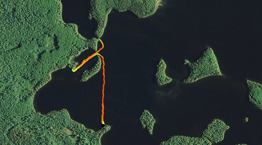
PADDLING FROM THE CAMPSITE ON POINT ON THE WEST SHORELINE TO THE YOGI LAKE BUSHWHACK
The canoe is loaded up. About ready to pull away from the campsite. Great landing here.
Paddling generally north from the campsite on the prominent point along the west shoreline of Long Island Lake, up the the inlet to the tiny bay due south of Yogi Lake on your map.
If you are adventurous, this is where the going starts to get a little tougher if you are planning to bushwhack up to Yogi Lake, which is in the Hairy Lake PMA. This is the inlet to the small bay just south of Yogi Lake on the map. Your first task will be getting over that little beaver dam. Bushwhack to Yogi Lake in the Hairy Lake PMA -or- Explore Another Route **********************************************END OF ROUTE***********************************************
PADDLING FROM THE YOGI LAKE BUSHWHACK TO THE KARL LAKE PORTAGE
This trek commences at the inlet to the small bay just south of Yogi Lake and continues to the Karl Lake portage, generally following the northwest shoreline of the lake.
Unloading your gear after reaching the beach where the portage to Karl Lake is located. Portage to Karl Lake -or- Explore Another Route **********************************************END OF ROUTE***********************************************
Route Connections for Long Island Lake
From Long Island Lake, you can portage to Cave Lake, Muskeg Creek (which leads to Muskeg Lake) and the north end of Karl Lake. You can also paddle into the south end of Karl Lake or into the Long Island River. In addition, you can bushwhack to Ferret Lake or Fun Lake by following the short creeks that connect them to Long Island Lake. Banadad Creek and Finn Creek also connect to Long Island Lake, but they are basically impassable. From the northwest part of Long Island Lake, you can also bushwhack up a creek to Yogi Lake, which is in the Hairy Lake Primitive Management Area.