ROUTES/PORTAGES FROM KAWISHIWI LAKE:
To Kawishiwi River (between Kawishiwi Lake and Square Lake): Paddle In
To BWCA Entry Point #37: Visit this BWCA Entry Point
Kawishiwi Lake
Tofte Ranger District
KAWISHIWI LAKE CAMPSITES: Campsite 1: (#1012) - Just east of BWCA Entry Point 37 landing Campsite 2: (#1011) - South most of the four campsites on east shoreline Campsite 3: (#1007) - Only island campsite on the lake Campsite 4: (#1010) - On the point, just north of island, along east shoreline Campsite 5: (#1006) - North most campsite on lake just west of Kawishiwi River outlet Campsite 6: (#1009) - Back in the bay on east shoreline of lake Campsite 7: (#1008) - North most campsite along the east shore of lake
Kawishiwi Lake is the headwaters of the Kawishiwi River, a very important river for navigation throughout history in what is now the Boundary Waters Canoe Area.
There are seven campsites on this lake and many are often taken early on busy weekends. The campsite on the island in the northwest part of the lake is very popular. Next to the entry point landing is the Kawishiwi Lake Campground which is a campground run by the U.S. Forest Service.
Getting your canoe into Kawishiwi Lake is easy as BWCA Entry Point 37 allows you to back your car right up to the edge of the lake. This is nice after the long drive out here. You park your car across the road from the entry point. It is a large parking lot.
The only exit from Kawishiwi Lake is along the Kawishiwi River which begins in the northeast corner of the lake. This limits route options from this entry point. The river is slow moving here and flows northeast toward Square Lake.
There used to be a 2+ mile portage between Kawishiwi Lake and Perent Lake. This portage started where the small creek flows into Kawishiwi Lake at the very south end of the lake (near the present day campground). The portage ran south/southwest to the northeast bay of Perent Lake. As of Fall 2020, this old portage has been re-blazed. Appears the portage can be followed through the forest. See this trip report on BWCA.com.
References:
Beymer, Robert, Boundary Waters Canoe Area – Volume 1 – Western Region (Berkeley: Wilderness Press, 2006), 47, 48, 50, 52, 55.
Heinselman, Miron, The Boundary Waters Wilderness Ecosystem (Minneapolis: University of Minnesota Press, 1999), 116, 120.
Pauly, Daniel, Exploring the Boundary Waters (Minneapolis: University of Minnesota Press, 2005), 236.
Click on the photos below to see the full resolution image - Use your browsers back button to close photo and return to this page.
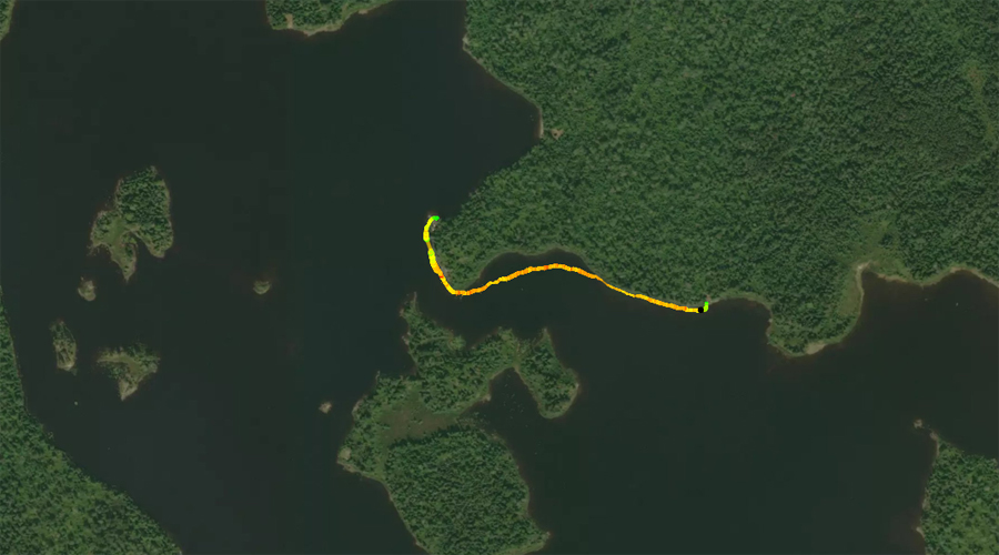
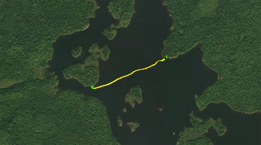
PADDLING FROM BWCA ENTRY POINT 37 TO THE START OF THE KAWISHIWI RIVER
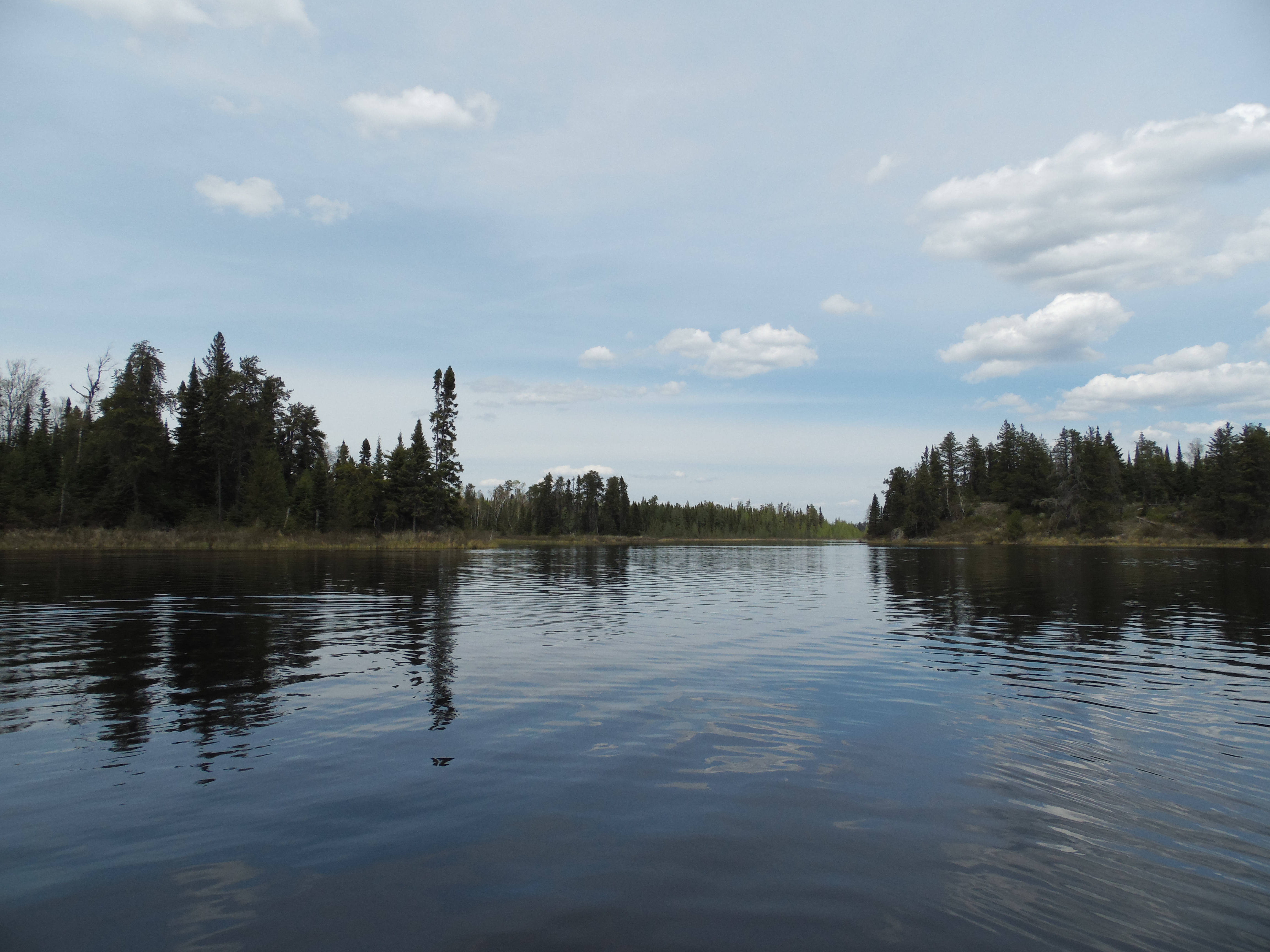
View to the west from the point located on the eastern shoreline that is just north of the lakes largest island.
Heading out from BWCA Entry Point 37, you paddle in a northwesterly direction across most of the lake to the north shoreline. There is a campsite located here. From the campsite you head east until paddling into the headwaters of the Kawishiwi River. You are now headed downstream toward Square Lake.
Once you are in the north part of Kawishiwi Lake, looking to the south provides a nice view of the lake.
You find this campsite along the north shore of Kawishiwi Lake, west of where the Kawishiwi River begins. This is BWCA Campsite 1006.
Paddling toward the east, you approach the beginning of the Kawishiwi River. This river will continue for another 75 miles through many lakes, until it eventually reaches its mouth at Fall Lake. Paddle into the Kawishiwi River -or- Explore Another Route ***********************************************END OF ROUTE***********************************************
PADDLING FROM BWCA ENTRY POINT 37 TO BWCA CAMPSITE 1012
Canoe a short distance down the shoreline toward the east from the entry point landing to reach this campsite.
PADDLING FROM BWCA CAMPSITE 1012 TO BWCA CAMPSITE 1011
Starting at BWCA Campsite 1012, travel across Kawishiwi Lake to the northwest until reaching the eastern shoreline. BWCA Campsite 1011 is just south of the point and northeast of the island. Visit BWCA Campsite 1011 -or- Explore Another Route ***********************************************END OF ROUTE***********************************************
PADDLING FROM BWCA CAMPSITE 1011 TO BWCA CAMPSITE 1010
Brief paddle between two campsites along the northeast shoreline of Kawishiwi Lake. Paddling direction is generally to the northwest. BWCA Campsite 1010 is on the tip of the point, due north of the large mid-lake island. It is the middle of the three campsites near this point. Visit BWCA Campsite 1010 -or- Explore Another Route ***********************************************END OF ROUTE***********************************************
PADDLING FROM BWCA CAMPSITE 1010 TO BWCA CAMPSITE 1009
BWCA Campsite 1010 is located is the middle of the three campsites in this area and is locatedon the point. BWCA Campsite 1009 is just to the northeast, a short distance away.
PADDLING FROM BWCA CAMPSITE 1009 TO BWCA CAMPSITE 1008
Continue toward the northwest along the east shoreline of Kawishiwi Lake until reaching BWCA Campsite 1008 which is on the northeast point of the lake.
PADDLING FROM BWCA CAMPSITE 1006 TO BWCA CAMPSITE 1007
Paddling from BWCA Campsite 1006, which is just west of the outlet of the Kawishiwi River, to BWCA Campsite 1007, which is the only island campsite on Kawishiwi Lake. Visit BWCA Campsite 1007 -or- Explore Another Route ***********************************************END OF ROUTE***********************************************
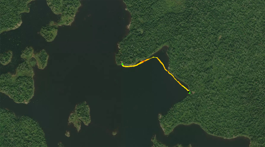
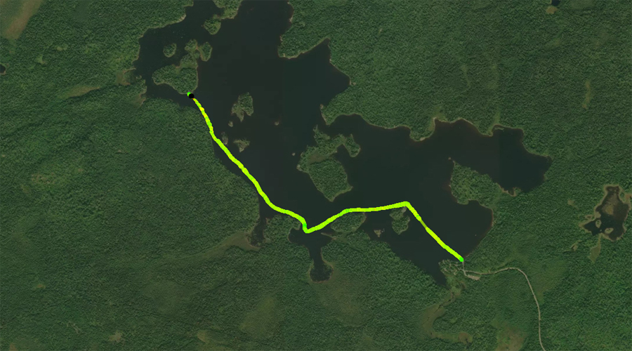
PADDLING FROM BWCA CAMPSITE 1007 TO THE BWCA ENTRY POINT 37 CANOE LANDING
Paddling from the only island campsite on Kawishiwi Lake to the BWCA Entry Point 37 canoe landing. The route roughly follows the southwest shoreline of the lake. Direction of travel is towards the southeast.
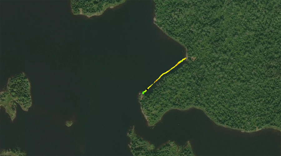
PADDLING FROM THE OUTLET OF THE KAWISHIWI RIVER TO BWCA CAMPSITE 1006
Paddlng from the outlet of the Kawishiwi River on Kawishiwi Lake to the campsite on the north shore of the lake. Visit BWCA Campsite 1006 -or- Explore Another Route ***********************************************END OF ROUTE***********************************************