North Wilder Lake
Tofte Ranger District
NORTH WILDER LAKE CAMPSITES:
Campsite 1 (#2230) - Accessible from the Powwow Trail. Near the Harbor Lake portage
Campsite 2 (#1520) - Was on the north side of channel leading to east bay of lake (probably closed)
Campsite 3 (#1521) - Was due northeast of the Harbor Lake portage on east shoreline (probably closed)
The 2011 Pagami Creek Fire torched nearly all the forest along the shores of North Wilder Lake. None of the small islands that dot the lake were spared.
The lake has darkly stained water. Fishery contains northern pike and walleye.
There used to be three campsites on this lake. It is probable that two are closed having not been restored since the fire. One of them is definitely open. The open campsite is just north of the Harbor Lake portage near the island on the west side of the lake. However, this campsite is primarily for hikers of the Powwow Trail. The canoe landing at this campsite is very difficult, being along a steeply sloped rock face.
Wilder Creek flows into the south end of North Wilder Lake from South Wilder Lake. The creek then drains out the eastern tip of the lake and flows northeast until reaching its mouth at the Kawishiwi River near the west end of Hudson Lake.
The Powwow Trail runs along nearly the entire western shoreline of North Wilder Lake. The trail comes right down to the lakeshore in a few places so can be accessed by paddlers.
Exploring North Wilder Lake
Click on the photos below to see the full resolution image - Use your browsers back button to close photo and return to this page.

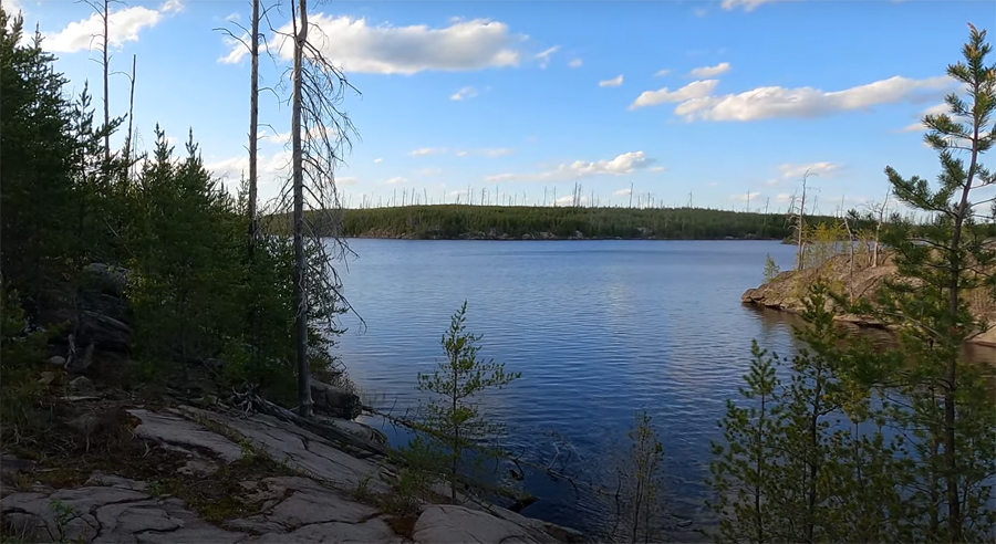
North Wilder Lake view from the Harbor Lake portage landing (May 25, 2024).
View of the lake from BWCA Campsite 2230 (May 25, 2024).
Route Connections for North Wilder Lake
From North Wilder Lake you can portage to Harbor Lake and South Wilder Lake (via the Powwow Trail). You can also portage into Wilder Creek that flows down to Hudson Lake. The Powwow Trail runs along the west side of North Wilder Lake.
Return to Top of Page
|


