Lake Four
Kawishiwi Ranger District
LAKE FOUR CAMPSITES:
Lake Four Campsite 1 (1494) - Second campsite from west end of lake and located on a point along north shoreline
Lake Four Campsite 2 (1483) - First campsite west of the Fire Lake portages in the north arm of Lake Four
Lake Four Campsite 3 (1496) - Just south of narrow bay on lakes northside. Site just north of three tiny islands - OPEN (Verified 05/20/2023)
Lake Four Campsite 4 (1498) - At south end of the largest peninsula extending out from north shore of lake
Lake Four Campsite 5 (1492) - Westernmost campsite on Lake Four near the Lake Three channel
Lake Four Campsite 6 (1495) - Third campsite from the west end of the lake along the north shoreline in burn area
Lake Four Campsite 7 (1503) - On small point almost due west across from where Kawishiwi River flows into lake - OPEN (Verified 05/20/2023)
The eastern end of Lake Four is somewhat river like. The Kawishiwi River flows strongly into this part of the lake. The river flows over several sets of rapids just before entering the lake. Also from the north a creek from Fire Lake drains into the east end of the north arm of Lake Four. Another creek coming from Bridge Lake flows into the western end of this north arm. The north arm of Lake Four feels much more remote than the rest of the lake. Lake Four is often busy (for the Boundary Waters), especially during the peak summer period, with many groups of canoeists either camping on this lake or heading for Lake Insula.
You can usually count on pretty good fishing on Lake Four. Seems better than Lake Three, Two and One. There are good numbers of northern pike (some large), lots of smallish walleyes and a good population of smallmouth bass (some whoppers). Good fishing has been experienced on the narrow eastern end of the lake where the Kawishiwi River flows in.
The water from Lake Four flows out to the west, feeding Lake Three. All the Numbered Lakes are just wider sections of the Kawishiwi River.
With the exception of the north arm of Lake Four, about 90% of the lakes shoreline was burned by the Pagami Creek Fire which passed through this area in September 2011. However, there are small patches of trees along the shoreline and several campsites just happened to be located in these patches. Only a few campsites on the lake are in completely treeless areas.
Some maps show Bridge Lake as being a western extension of the the north arm of Lake Four. The two water bodies are distinct. A beaver dam often blocks the narrowest part of the channel leading to the large north bay (which is north of the north arm of Lake Four). This channel is about 1/3 mile east of the Bridge Lake portage along the north shoreline.
The forest surrounding Lake Four was logged in the first two decades of the 20th century by the St. Croix Lumber Company out of Winton (Heinselman, 1999). The 2011 Pagami Creek fire was the most recent big fire in this area. However, this area was impacted by the Bald Eagle-Isabella Fire in 1824. That fire burned roughly 60,000 acres (Heinselman, 1999).
References:
Beymer, Robert, Boundary Waters Canoe Area – Volume 1 – Western Region (Berkeley: Wilderness Press, 2006), 192, 201.
Heinselman, Miron, The Boundary Waters Wilderness Ecosystem (Minneapolis: University of Minnesota Press, 1999), 100, 200.
Pauly, Daniel, Exploring the Boundary Waters (Minneapolis: University of Minnesota Press, 2005), 180-181.
Rom, William N., M.D., Canoe Country Wilderness (Stillwater: Voyageur Press, 1987), 39-40.
Exploring Lake Four
Routes to locations on Lake Three are shown below:
No routes explored on this lake yet.
Click on the photos below to see the full resolution image - Use your browsers back button to close photo and return to this page.

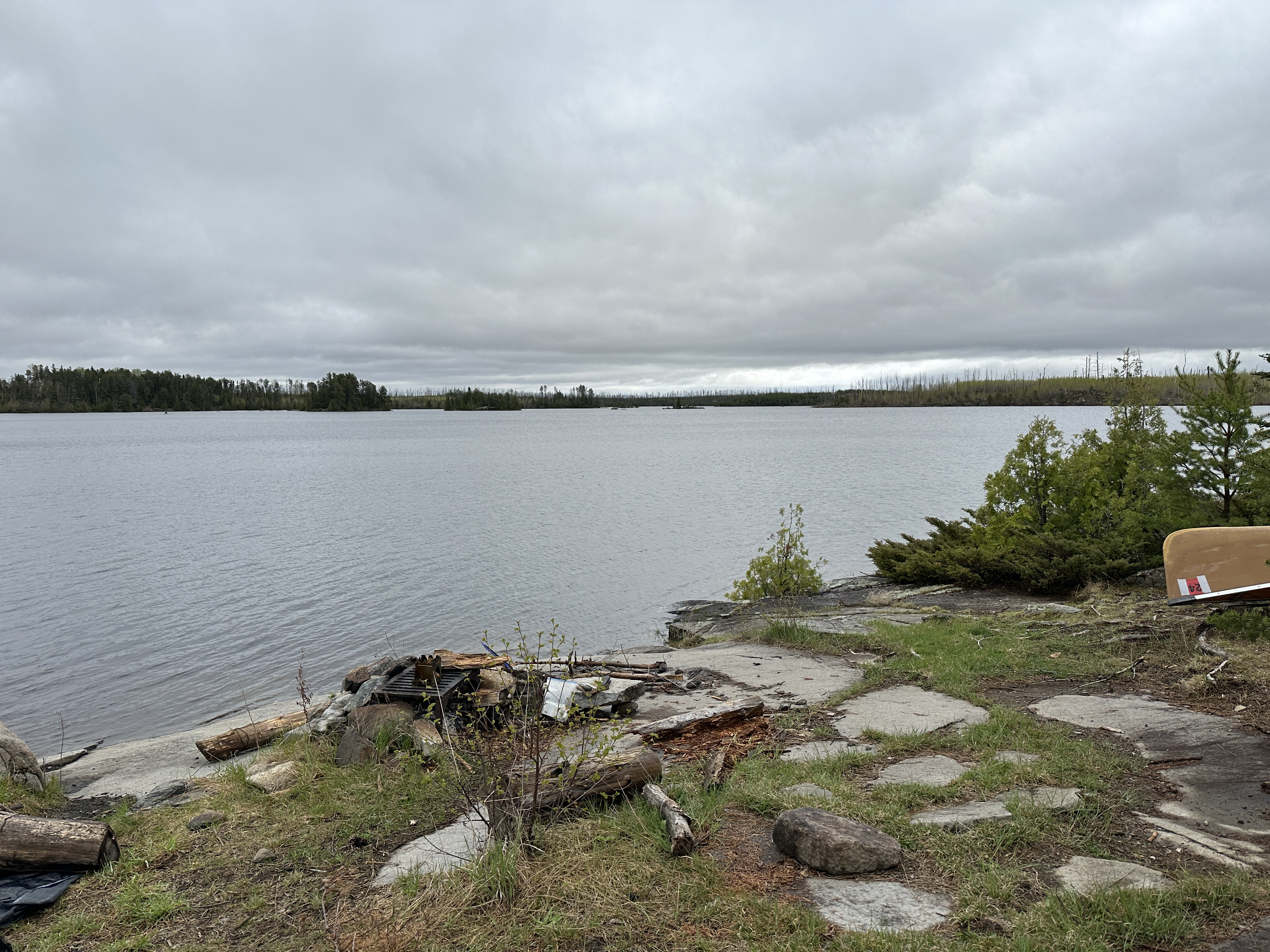
Looking southeast from BWCA Campsite 1495. This campsite is in the area burned by the 2011 Pagami Creek Fire. There is another campsite just visible in the far left of your view near those small islands. That is BWCA Campsite 1496. It is a much better campsite than this one.
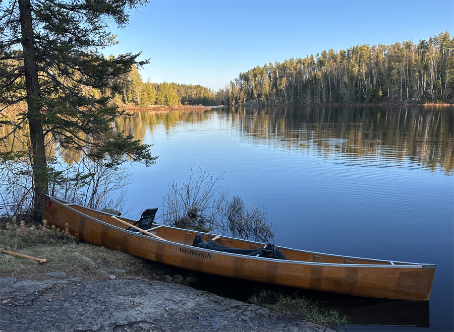
This view is from BWCA Campsite 1498 which is located near the middle of Lake Four. Looking south.
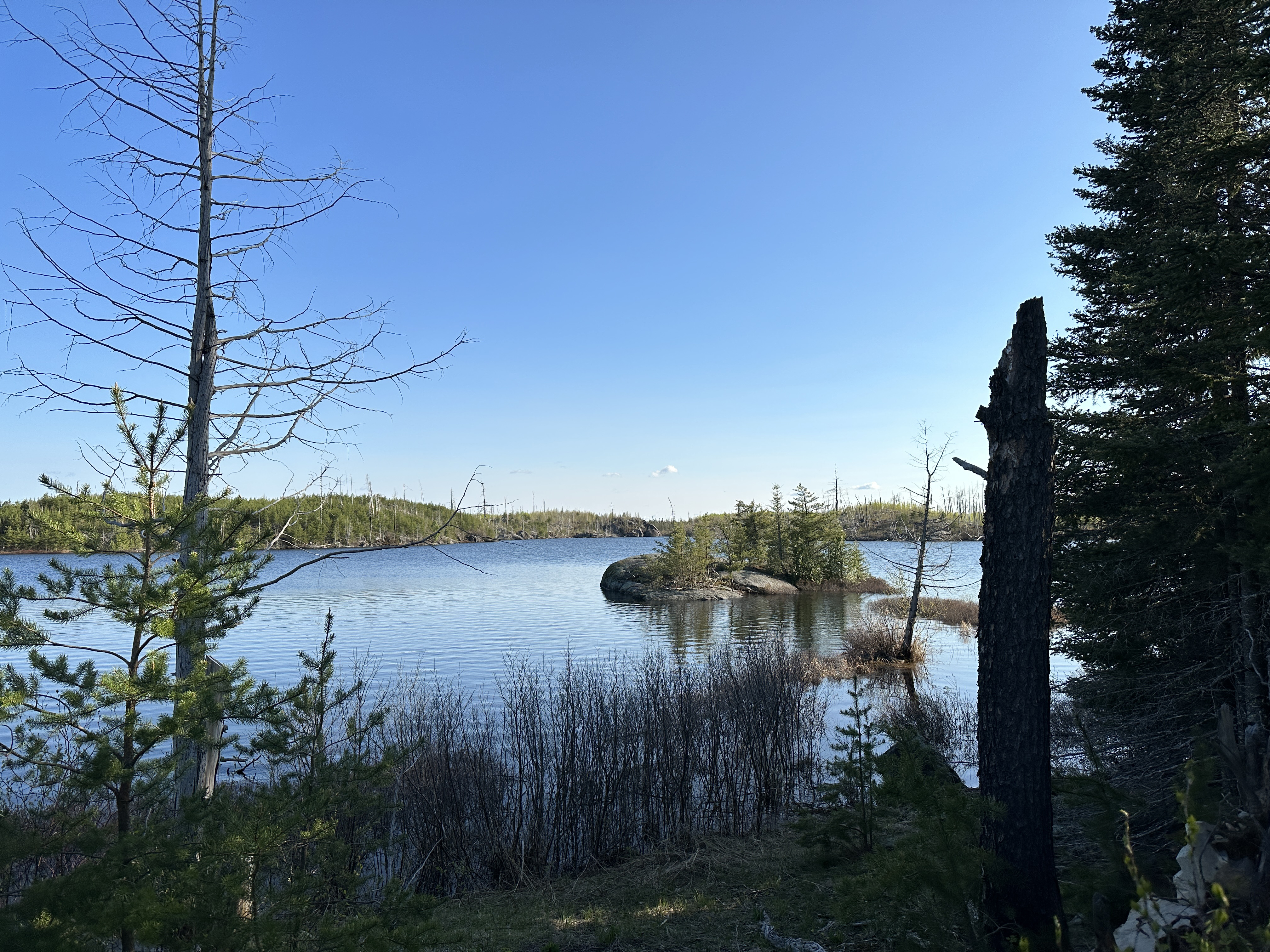
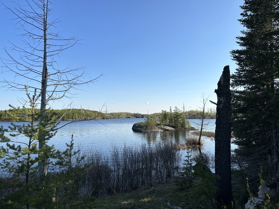
There are three campsites (as of 2023) in the north arm of Lake Four. This part of Lake Four is less traveled than the rest of the lake. This is the view toward the channel leading back to the main lake from BWCA Campsite 1483. This is the western most campsite located in the north arm.
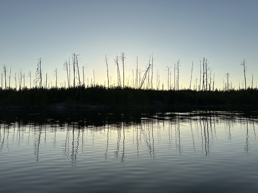
A view west of the snags still standing along the west shoreline of the eastern most section of Lake Four. This isn't far from where the Kawishiwi River flows into the east side of the lake.
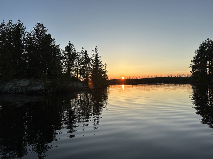
This is a view toward the west at sunset from just offshore of BWCA Campsite 1496. There are a few small islands out in front of this campsite. The islands escaped the fire. BWCA Campsite 1495 is along that western shoreline near the center of your view, but impossible to make out from this vantage point.
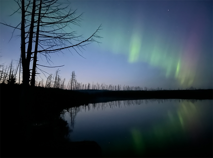
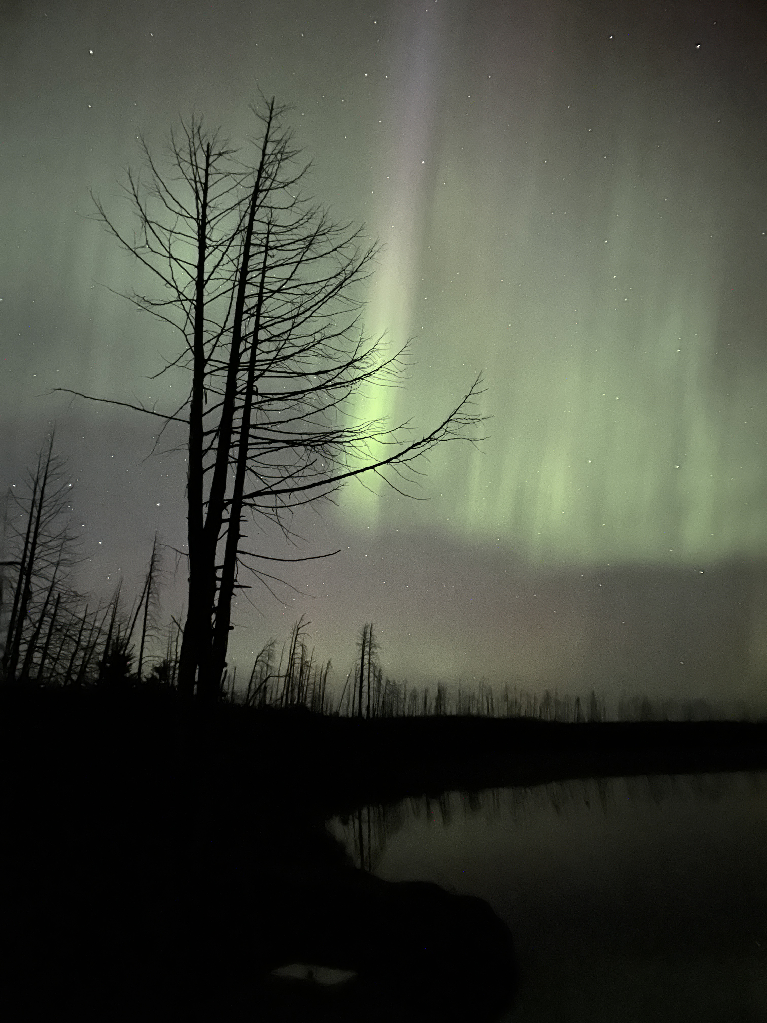
Looking northeast at twilight from BWCA Campsite 1495. The northern lights are already visible even though the sky is still fairly bright. This was on May 19, 2023.
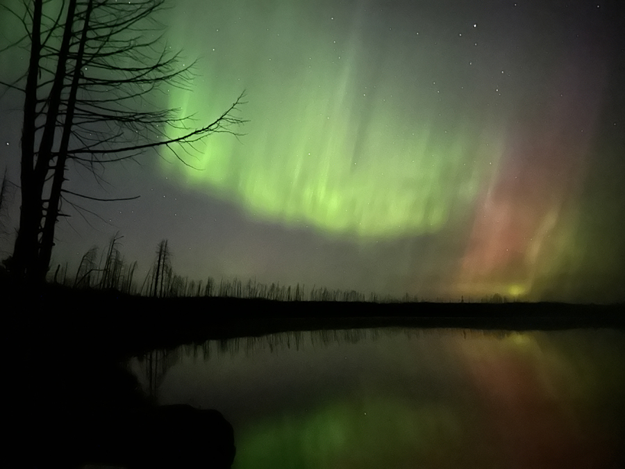
Another view of the northern lights (Aurora Borealis) on May 19, 2023. This is around 10 PM at night with the sky almost completely dark.
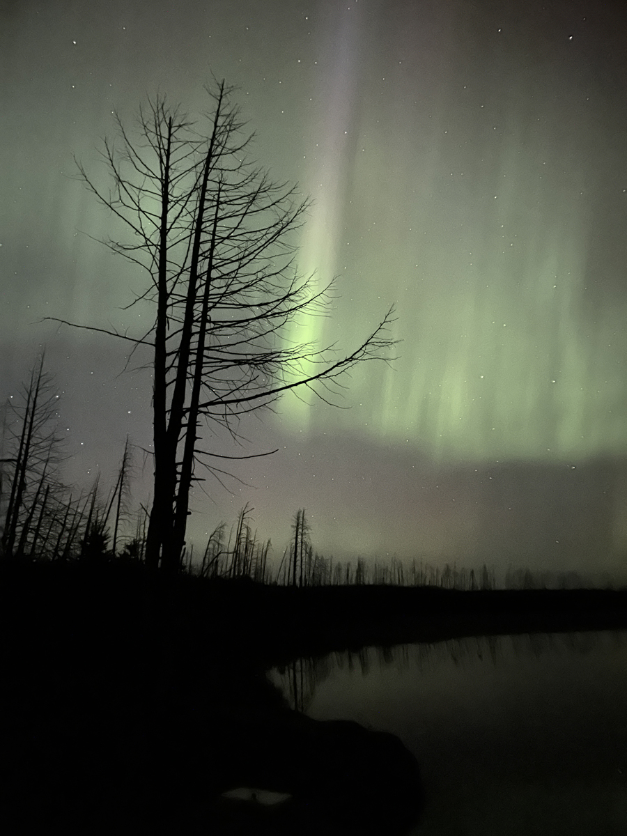
A bright ray arcing up toward the zenith. Northern lights on May 19, 2023 from BWCA Campsite 1495.
Route Connections for Lake Four
From Lake Four, you can paddle into Lake Three or the Kawishiwi River heading upstream. You can also portage to Bridge Lake or carry over two portages to Fire Lake.
Return to Top of Page
|