Lake One Area
Overlay #18 in the BWCA
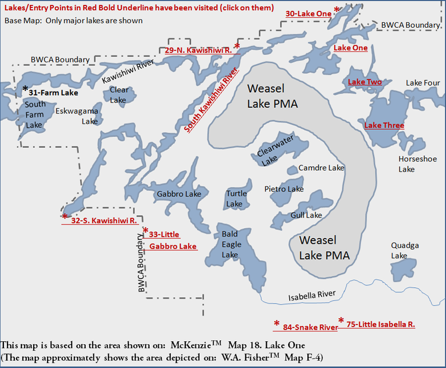
Lake One (Entry Point #30) and Lake Two are semi-manmade lakes created by a couple of dams along the Kawishiwi River. Lake Three is the largest of the numbered lakes. Lake Four provides access up to Bridge Lake and Fire Lake, a good place to go if you want to get away from the crowds in this busy area.
The area south of the numbered lakes is less traveled and includes Clearwater Lake, Bald Eagle Lake and Gabbro Lake and Little Gabbro Lake. The most direct entry point into this area is Entry Point #33 for Little Gabbro Lake. Clearwater Lake connects two sections of the Weasel Lake Primitive Management Area (PMA) together. The entire Weasel Lake PMA is on this map. There used to be (before the 2011 Pagami Creek Fire anyway), a long portage that led from the east end of Clearwater Lake out to Judd Lake and Rock Island Lake beyond. Pagami Creek flows out of the west end of Clearwater Lake and winds its way to Lake One. Pagami Creek can be traveled, but don't expect it to be easy until you get near Pagami Creek as which point the creek opens up a bit.
The Isabella River has a number of entry points along it via its tributaries. It can be paddled eastward to Isabella Lake.
In general, everything from Lake Two south and from just east of the South Kawishiwi River was burned by the 2011 Pagami Creek Fire.
The following major lakes (and many other minor lakes) are shown on the McKenzie #18 Map:
Bald Eagle Lake
Camdre Lake
Clear Lake
Clearwater Lake
Eskwagama Lake
Gabbro Lake
Gull Lake
Horseshoe Lake
Isabella River
Kawishiwi River
Lake One
Lake Two
Lake Three
Lake Four
Pietro Lake
Quadga Lake
South Farm Lake
South Kawishiwi River
Turtle Lake
|