Confusion Lake is a wide stretch of the Kawishiwi River just north of Lake One. The lake is accessible from Lake One via a 44 rod portage.
The lake begins where a series of three or four modest rapids end along the Kawishiwi River, soon after it flows out of Lake One. This is just downstream of the old Lake One Number One dam. The remains of this dam are visible from the head of the rapids where the Kawishiwi River flows out of Lake One. There is a sand beach landing on the shoreline of Lake One, on the opposite side of the Kawishiwi River outlet from the Lake One to Confusion Lake portage (the 44 rod portage on the map). You can use this landing to get out and explore the dam area. The dam was used to raise the level of Lake One a few feet (itself just a wide section of the Kawishiwi River which flows through it) to facilitate logging operations.
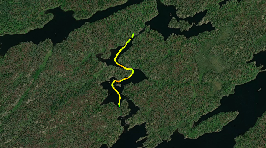
Confusion Lake gets its name from the confusing series of channels that make up the Kawishiwi River in this area and the myriad portages that connect all these stretches of the river. The portages are necessary because of the many sets of rapids in this area.
Near the middle of Confusion Lake, at its narrowest point, there is a short stretch of water with some mild current (reinforcing the fact that this is really a river). To make things more confusing, note that Confusion Lake is not shown on many maps. It is not shown on the McKenzie Maps. It is shown on the Fisher Map series (at least the older ones). You'll see it mentioned in descriptions of this area too.
References:
Beymer, Robert, Boundary Waters Canoe Area – Volume 1 – Western Region (Berkeley: Wilderness Press, 2006), 186, 199, 201, 213, 225, 233, 241, 247.
Beymer, Robert, Boundary Waters Canoe Area – Volume 2 – Eastern Region (Berkeley: Wilderness Press, 2006), 46.
Pauly, Daniel, Exploring the Boundary Waters (Minneapolis: University of Minnesota Press, 2005), 184.
Exploring Confusion Lake
Click on the photos below to see the full resolution image - Use your browsers back button to close photo and return to this page.
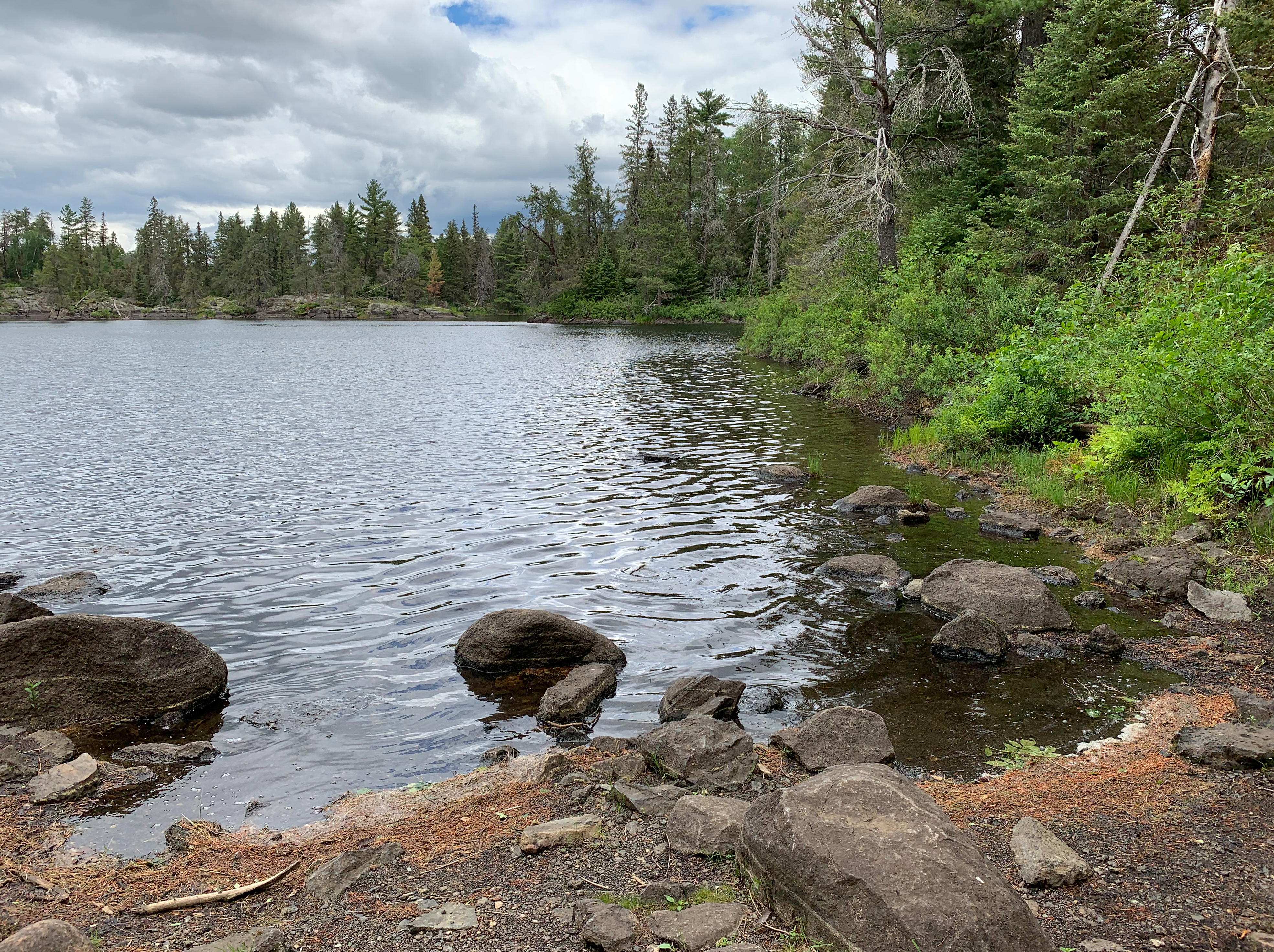
Confusion Lake from the Kawishiwi River portage. The rapids are just to your left out of view. Stay to the right as you leave this portage landing.
Paddling through Confusion Lake beginning at the 32 rod Kawishiwi River portage and ending at the start of the 44 rod Lake One portage landing. Near the middle of Confusion Lake, there is a narrow channel where there is some noticeable current. Confusion Lake is really just a wide section of the Kawishiwi River. This lake isn't shown on some maps. It is shown on the Fisher Map series.
This is where the Kawishiwi River flows out of Confusion Lake. This is next to the 32 rod Kawishiwi River portage.