Ram Lake has a soft greenish tint to its clear waters, somewhat reminiscent of the glacial tint caused by silt runoff in mountain lakes. The lake occupies a basin on a small plateau raised about 150 feet above the surrounding area. Even so, the water from Ram Lake only trickles out through a very small creek toward Dislocation Lake.
Trips starting at Ram Lake offer limited route options. Many groups to out and back trips (weekend visits). The portages beyond Ram Lake tend to be difficult, especially the one between Little Trout Lake and Misquah Lake. The portage from Rum Lake to Little Trout Lake is not easy either. It is reasonable to walk back to your car if you decide on a route from Ram Lake to Bower Trout Lake.
This lake only allows one permit quota per day, but it is often a busy place anyway. Lots of folks come to Ram Lake on day permits to fish for the lakers and the rainbows in the lake. The latter fish was stocked by the Minnesota DNR. The lake trout seem to be the more abundant of the two species. Seems to be few rainbows now.
There are two campsites on the lake. The site on the north point is more accessible. The campsite on the east end of the lake is located on a high rock shelf about 25 feet above the lake. This makes for nice views, but hard work getting from the camp down to the lake. The canoe landing at this site isn't good either.
The portage from the parking lot into Ram Lake will get your heart beating. It is uphill almost the entire way with boulders strewn along the trail. At the end, there is a stairway made of fitted boulders that leads down to the shore of Ram Lake.
References:
Beymer, Robert, Boundary Waters Canoe Area – Volume 2 – Eastern Region (Berkeley: Wilderness Press, 2006), 96, 98, 100, 102.
Pauly, Daniel, Exploring the Boundary Waters (Minneapolis: University of Minnesota Press, 2005), 286.
Click on the photos below to see the full resolution image - Use your browsers back button to close photo and return to this page.
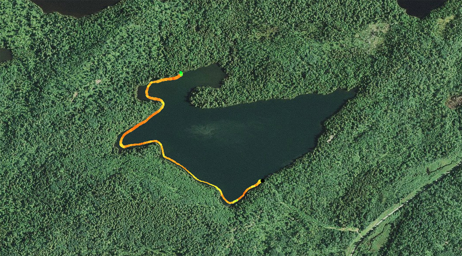
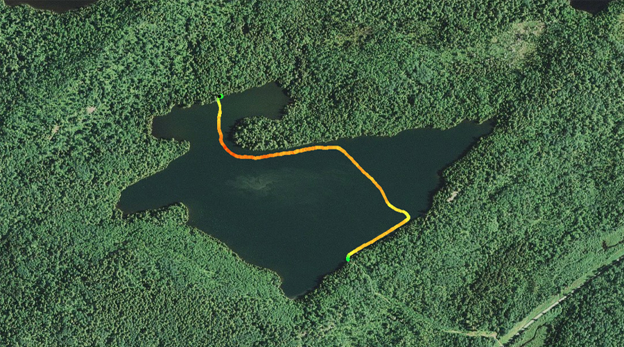
PADDLING FROM THE BWCA ENTRY POINT 44 PORTAGE TO THE KROFT LAKE PORTAGE
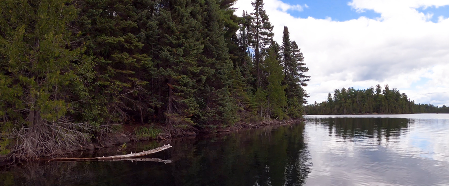
Looking toward the northeast from the entry point portage landing.
Following the shoreline along the west side of the lake, beginning at the entry point portage and finishing at the Kroft Lake portage.
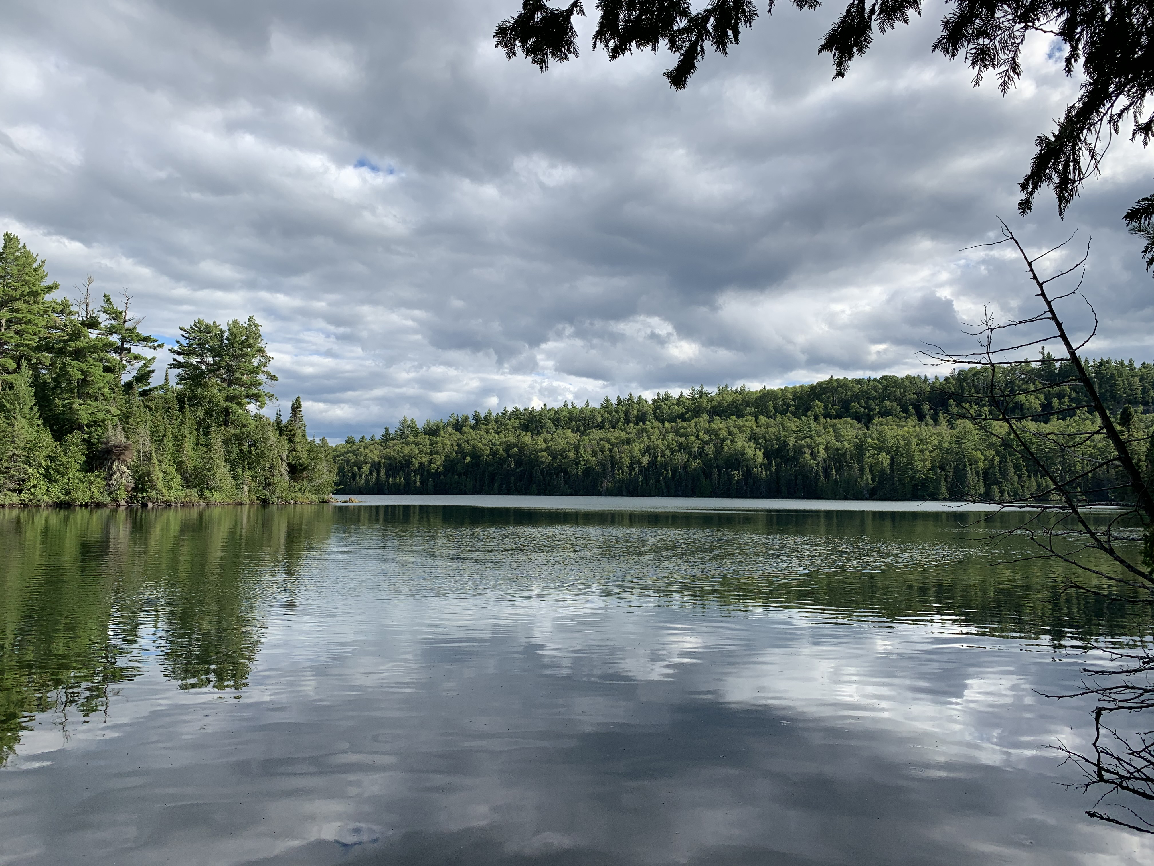
Paddling along the northwest shore of the lake. The point visible to the right of your view is the lakes north point that sticks out toward the west from the northern shoreline.
Ram Lake from the Kroft Lake portage. The north point of the lake is just left of center. There is a campsite located near the end of the point, on its south side. Portage to Kroft Lake -or- Explore Another Route ***********************************************END OF ROUTE***********************************************
PADDLING FROM THE KROFT LAKE PORTAGE TO THE BWCA ENTRY POINT 44 PORTAGE
The lakes main point is visible to the left. View is toward the south/southeast. This is from the Kroft Lake portage.
Just east of the campsite located on the north point, looking almost straight east.
After paddling away from the Kroft Lake portage, continue along the north shore of the lake and then southwest down the lakes east shoreline. You briefly check out the campsite on the east end of the lake while passing by. This campsite is located up on the rock shelf. From the area of the campsite, paddle a short ways down the same shoreline to the BWCA Entry Point 44 portage landing.
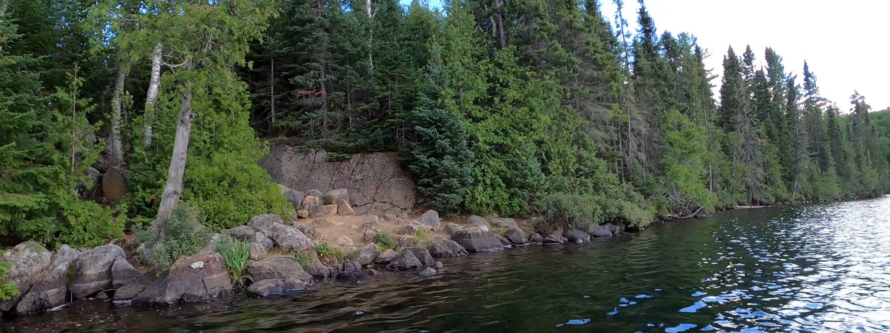
Rock face marks the location of the lakes eastern campsite. This campsite has a tough landing and involves a bit of a climb up to the actual site.
Approaching the portage that heads back to the entry point parking lot. This portage is easier going from Ram Lake to the parking lot because it is mostly downhill in that direction. Portage to Ram Lake -or- Explore Another Route ***********************************************END OF ROUTE***********************************************