Little Trout Lake
» Display Little Trout Lake Map
» Display scrollable USGS Topo Map of Little Trout Lake
» Show Simple Little Trout Lake Map
Nearest Entry Point: Ram Lake #44 Fishing: MN DNR; Lake Trout
Maps: Fisher F-13; McKenzie #3 Lake Depth: MN DNR; 56 feet
Fire History: 2016 Lake Size: 127 acres
Campsites: 3 (3 visited) Wildlife Seen on Visit:
Last Visited: August 17, 2020 Lake Elevation: About 1910 feet
Water Clarity: MN DNR

ROUTES/PORTAGES FROM LITTLE TROUT LAKE:
To Misquah Lake: Walk the 230 rod portage
To Rum Lake: Walk the 62 rod portage

Little Trout Lake

Gunflint Ranger District

LITTLE TROUT LAKE CAMPSITES:
Campsite 1 (#2016): On island by Rum Lake portage
Campsite 2 (#776): East end of lake on point
Campsite 3 (#777): Just east of Misquah Lake portage

The lake is aptly named as it does have lots of modest sized lake trout swimming in it. That is the only species of game fish in harvestable numbers existing in the lake.

Little Trout Lake has a small outlet in its southeast corner. This little creek flows south to Slough Lake. That drainage extends to the South Brule River.

There are three campsites on this lake. None of them are bad. There is a campsite on one of the lakes three islands. It's subjective, but the campsite on the point in the east of of the lake may be the most desirable.

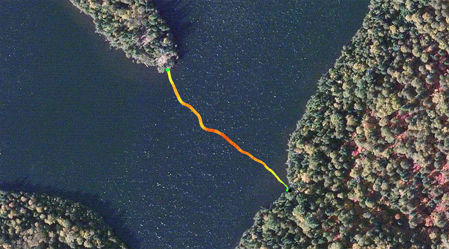
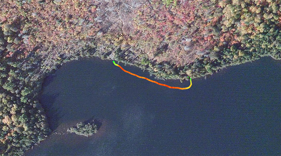
Both portages into Little Trout Lake require a high degree of effort. In the case of the portage to Misquah Lake, you will need to summon all of your energy reserves to make it over that one as it is one of the hardest portages in the BWCA. The trail is very rocky, somewhat overgrown and crosses over two hills.

The area around this lake may have been subjected to a prescribed burn in September/October of 2016. You can see evidence of this if you camp at the campsite near to the Misquah Lake portage. If you walk from the lake shore up to the campsites latrine, you will pass into the burned area. The intentional ignition was performed to reduce fuel created by the July 4, 1999 windstorm. The burn area extends from Dugout Lake and Iota Lake on the east to about the middle of a north/south line extended through Lac Lake on the west. The burn area starts about 1/2 mile south of the South Brule River and goes north up to nearly Little Trout Lake. Another burn area extends from the west end of Little Trout Lake up along the west side of Misquah Lake which seems to be be an unrelated burn, not related to this prescribed burn. See Lux Lake Prescribed Burn.

Gaskin Mountain is visible to the northeast from many parts of Little Trout Lake. You are looking at its south slopes as viewed from Little Trout Lake. It's summit lies about 1/2 mile north/northeast of the lake. The Gaskin Mountain summit is the fifth highest point in the state of Minnesota.

References:
Pauly, Daniel, Exploring the Boundary Waters (Minneapolis:  University of Minnesota Press, 2005), 286, 287.

Exploring Little Trout Lake

Routes to locations on Little Trout Lake are shown below:
Paddling from the Rum Lake portage to the island campsite
Paddling from the island campsite to the campsite on the point in east end of lake
Paddling from the east campsite on the point to the campsite just east of Misquah Lake portage
Paddling from campsite just east of Misquah Lake portage to the Misquah Lake portage
Paddling from the Misquah Lake portage to the Rum Lake portage

Click on the photos below to see the full resolution image - Use your browsers back button to close photo and return to this page.

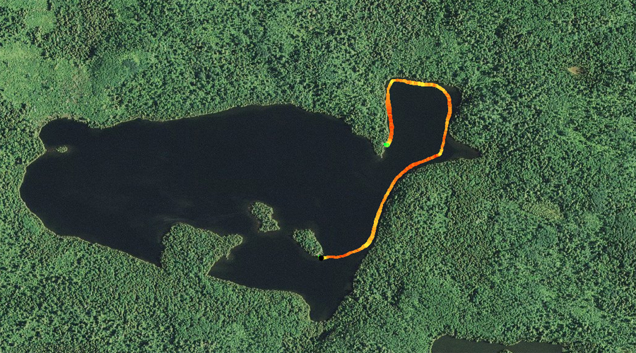
PADDLING FROM THE RUM LAKE PORTAGE TO THE ISLAND CAMPSITE

Little Trout Lake 1
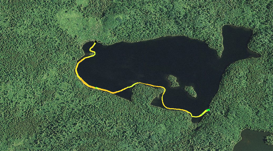
The small island just right of the center of your field of vision is the location of the lakes island campsite. The canoe landing for that campsite faces the Rum Lake portage landing. There is another similarly sized island just to its left and beyond (barely visible).


Little Trout Lake map1Brief paddle from the Rum Lake portage to the island campsite.


Visit the Campsite -or- Explore Another Route
***********************************************END OF ROUTE***********************************************


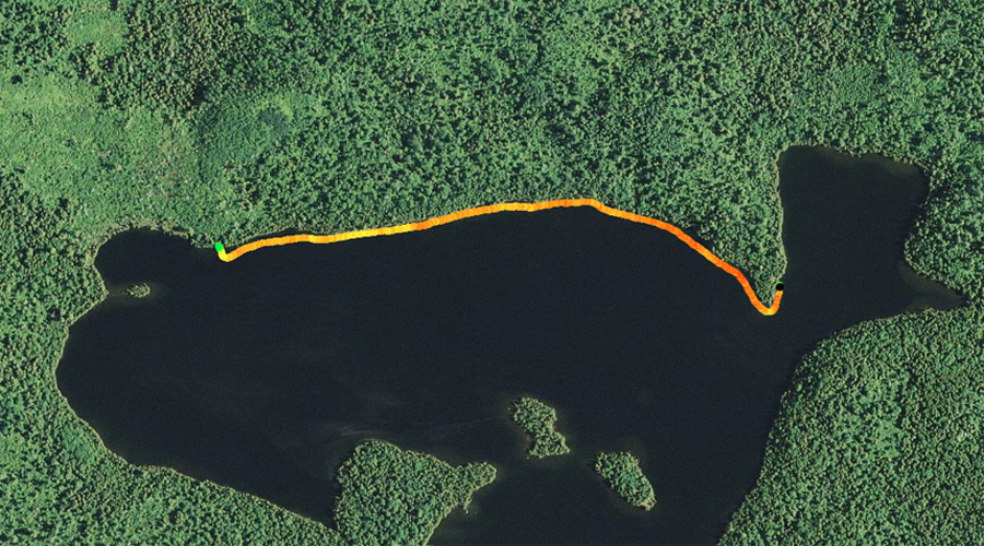
PADDLING FROM THE ISLAND CAMPSITE TO THE CAMPSITE ON THE POINT IN EAST END OF LAKE

Little Trout Lake 2
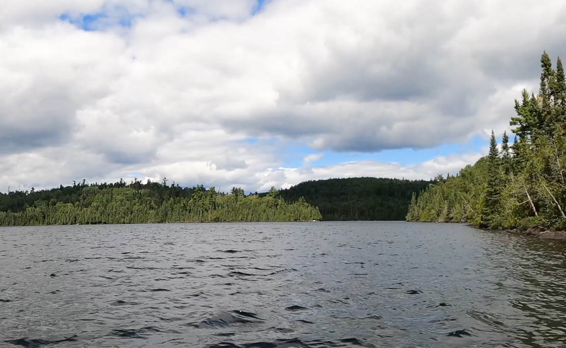
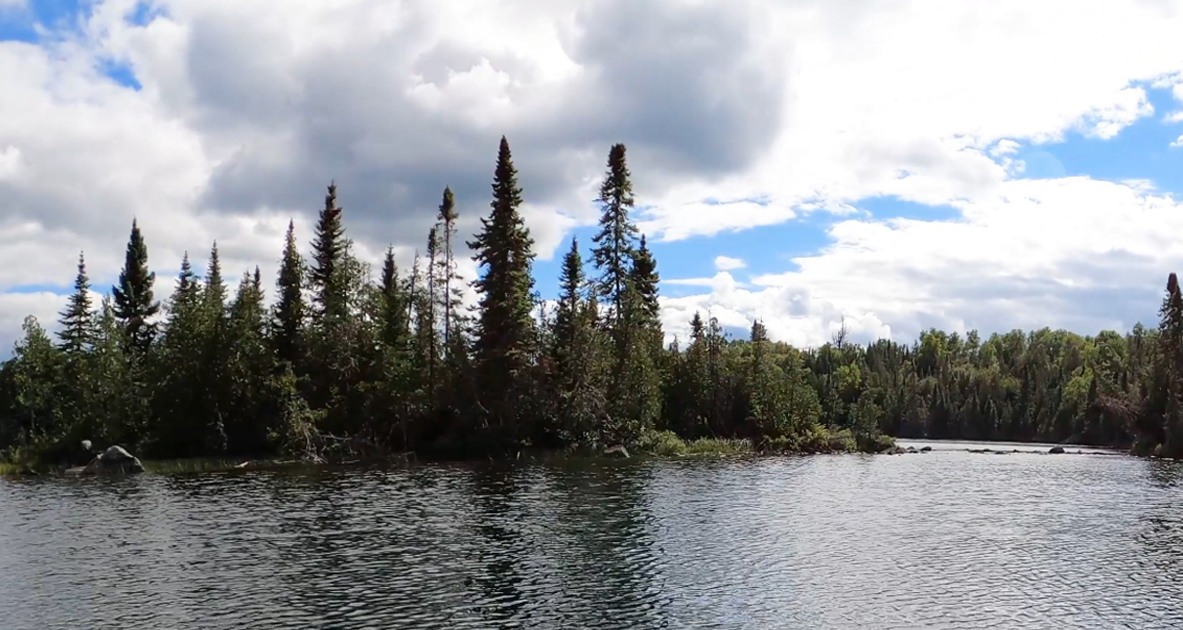
Paddling toward the north along the east shore of Little Trout Lake. The hill shaded by a passing cloud just to the right of the middle of your view is Gaskin Mountain.


Little Trout Lake map2A leisurely paddle that takes you from the lakes' island campsite into the eastern bay of Little Trout Lake. After making a lazy turn to the left paddling through the bay, canoe over to the campsite on the sharp point near the bays western entrance.

Visit the Campsite -or- Explore Another Route
***********************************************END OF ROUTE***********************************************


PADDLING FROM THE EAST CAMPSITE ON THE POINT TO THE CAMPSITE JUST EAST OF MISQUAH LAKE PORTAGE

Little Trout Lake 3
Looking south from the eastern campsite on the point.


Little Trout Lake map3Paddle around the point and then hug the north shoreline of Little Trout Lake until reaching the campsite just east of the Misquah Lake portage.

Visit the Campsite -or- Explore Another Route
***********************************************END OF ROUTE***********************************************


PADDLING FROM CAMPSITE JUST EAST OF MISQUAH LAKE PORTAGE TO THE MISQUAH LAKE PORTAGE


Quick paddle from the campsite westward along the north shore of Little Trout Lake to the Misquah Lake portage. This is one mean portage.


Little Trout Lake 4
Little Trout Lake map4The start of the Misquah Lake portage. This is a rugged 230 rod portage. It starts out at this "boulder pile for a canoe landing".


Portage to Misquah Lake -or- Explore Another Route
***********************************************END OF ROUTE***********************************************


PADDLING FROM THE MISQUAH LAKE PORTAGE TO THE RUM LAKE PORTAGE

Little Trout Lake 5
This island lies just south of the Misquah Lake portage in the west end of Little Trout Lake. This is the smallest of the lakes three islands.


Little Trout Lake map5Canoeing from the Misquah Lake portage to the Rum Lake portage following the scenic west and south shoreline of Little Trout Lake.


Portage to Rum Lake -or- Explore Another Route
***********************************************END OF ROUTE***********************************************

Route Connections for Little Trout Lake

From Little Trout Lake you can portage to Misquah Lake or Rum Lake. The portage to Misquah Lake is a doozy.

Return to Top of Page


PMA #1: Weeny PMA #4: Tick PMA #7: Pitfall PMA #10: Hairy
PMA #2: Canthook PMA #5: Spider PMA #8: Mugwump PMA #11: Weasel
PMA #3: Sundial PMA #6: Drag PMA #9: Humpback PMA #12: Fungus
- www.BWCAwild.com - All Rights Reserved.
All images, videos and text property of www.BWCAwild.com - No reuse without permission.
DISCLAIMER AND TERMS OF USE --- CONTACT US --- PRIVACY POLICY