Scenic Overlooks: Upper and Lower Johnson Falls, marshland above the upper falls
TRAIL CONNECTIONS AND TRAILHEADS:
Connections: Portage - Pine Lake to Canoe Lake
Trailheads: Pine Lake end of the portage to Canoe Lake
Johnson Falls Trail
Click on the photos below to see the full resolution image - Use your browsers back button to close photo and return to this page.
LaCroix Ranger District
There are three entry points that provide moderately easy access for paddlers that want to visit Johnson Falls. The easiest (but likely the longest drive for most folks) is from BWCA Entry Point 68 - Pine Lake. This route involves no portages, but a lot of paddling. You must paddle the nearly the entire length of Pine length (8 miles) and all of McFarland Lake. BWCA Entry Point 64 - East Bearskin Lake is probably the second easiest, but you got to cross the portage between Canoe Lake and Pine Lake (not bad if you leave canoe and gear at Canoe Lake). BWCA Entry Point 62 - Clearwater Lake is probably the third easiest (some long portages on this one). This trail can be a little crowded on some days, so plan for mid-week visit or off season if you want the place to yourself.
The trail to Johnson Falls starts at the Pine Lake end of the portage between Canoe Lake and Pine Lake. The trail is not maintained, but it gets enough traffic to keep it very passable. There are some muddy spots along the trail, along with occasional blowdown and some rocky areas. The entire walk to the falls is a little over half a mile. There is plenty of elevation change, so some folks may find it a strenuous walk.
This waterfall is located on the Crocodile River and you will get nice views of the river as you work your way down the trail. The Crocodile River starts at Kiowa Lake and flows west for a short ways before flowing into Crocodile Lake. From Crocodile Lake the river drops down a ridge into East Bearskin Lake near BWCA Campsite 697. There is actually a pretty waterfall, just a short hike back in the woods located near this campsite. The river than flows into Alder Lake, then Canoe Lake and then Paddle Lake. Between Canoe Lake and Paddle Lake you can actually paddle and/or walk the river for a short ways. From Paddle Lake it quickly reaches Johnson Falls. After the falls the river continues a short ways to Pine Lake. From Pine Lake the Crocodile River flows into McFarland Lake and then into Little John Lake near BWCA Entry Points 68, 69 and 70. The last lake the river flows through is Little John Lake. From here it pours into John Lake which is part of the Royal River. Thus, the Crocodile River is a tributary of the Royal River.
Johnson Falls is made up of two waterfalls. One thing that makes this waterfall special is that isn't not developed like waterfalls you may find in a state park. The lower waterfall is impressive, but the upper falls is even a little better, so keep going. Just above the upper falls is a wetland through which the Crocodile River flows that also makes for a pleasant viewing experience. If the river isn't really high, many people swim in the pools below the falls.
Hiking the Johnson Falls Trail
Click on the photos below to see the full resolution image - Use your browsers back button to close photo and return to this page.
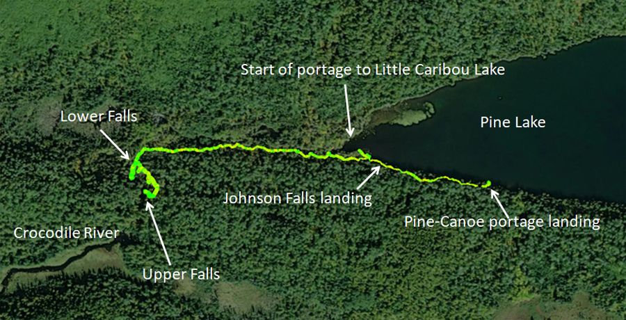
This is the portage landing on Pine Lake if you're group is headed to Canoe Lake. As you face the landing, the start of the Johnson Falls Trail is immediately on the right side, just as you start heading along the portage to Canoe Lake.
Here is a map of the actual route using GPS waypoints.
The hike to both the lower and upper falls will take about 30 minutes, give or take. Expect some mud filled areas, a few blown down trees and some nice views of the river as you walk. The trail steepens when it leaves the river and gets closer to the waterfalls.
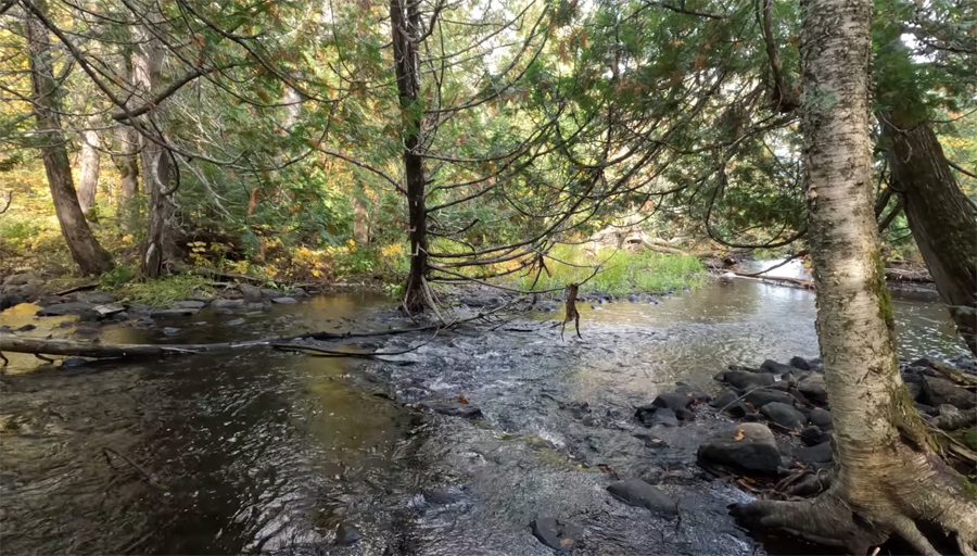
Downstream view of Crocodile River several hundred yards below Lower Johnson Falls.
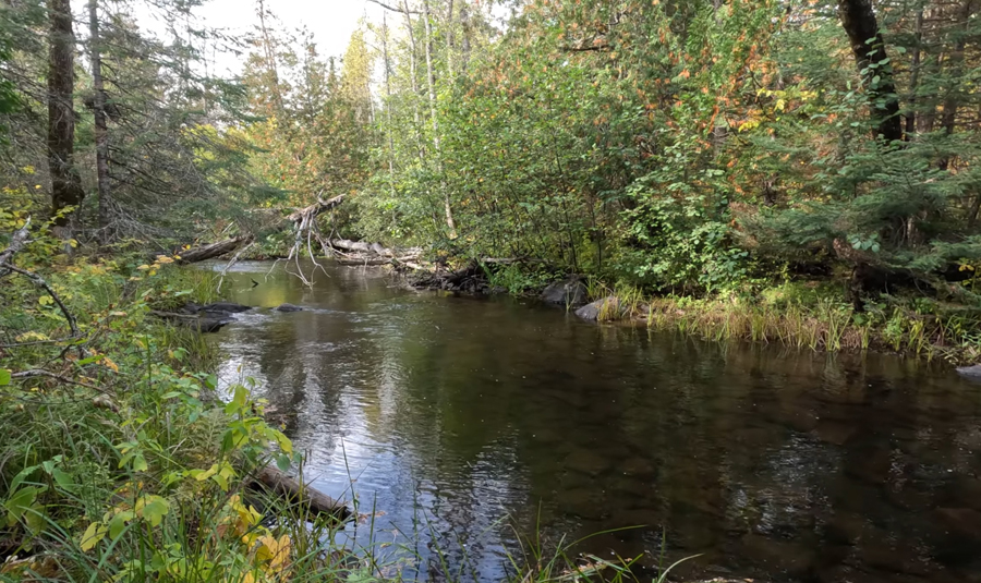
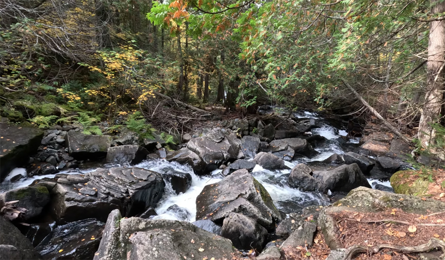
Tranquil section of the Crocodile River below Lower Johnson Falls.
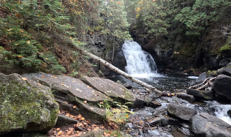
Lower Johnson Falls. This was in October, 2022.
Peering downstream at the rapids below Upper Johnson Falls.


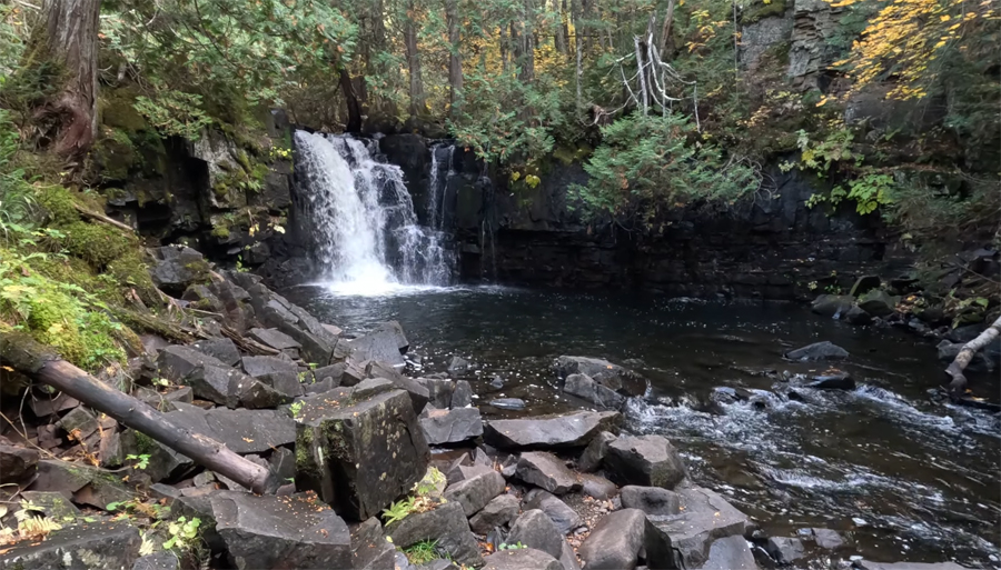
 Upper Johnson Falls in October 2022.