SMOKE LAKE CAMPSITES: Campsite 1: (#919) - Campsite in the northeast corner of lake behind the island Campsite 2: (#921) - Southern most campsite on the east shoreline Campsite 3: (#2310) - ABANDONED - Was located on the west side of the island just south of BWCA Campsite 919 Campsite 4: (#920) - Southernmost campsite along the western shoreline Campsite 5: (#2021) - Northernmost campsite along the western shoreline
Smoke Lake is one of the three lakes east of Sawbill Lake with a name related to fire. These are known as the "fire" lakes.
Smoke Lake is a relatively shallow lake bordered by marsh along long stretches of its shoreline.
Since it is the first lake off of Sawbill Lake and very close to the entry point for this area, the four campsites on Smoke Lake can fill up quick. Burnt Lake, over the next portage can be similarly busy. Beyond Burnt Lake, you must traverse a long portage of 230 rods to reach Kelly Lake. Therefore, find a campsite early if you don't plan on going further this day.
Smoke Lake has no tributaries other than runoff from the surrounding land. Much of the area around Smoke Lake is boggy and low. The water from Smoke Lake flows out the northern tip of the lake through a slow moving creek. This creek flows for about a mile through lowland to the north before emptying into Sawbill Lake. If you are up for a little exploration, try paddling this creek to Sawbill Lake from Smoke Lake. It is flat water and the creek only loses a single foot of elevation over a mile on its way to Sawbill Lake. There will be a few beaver dams to hurdle and muck and other obstructions to navigate.
Click on the photos below to see the full resolution image - Use your browsers back button to close photo and return to this page.
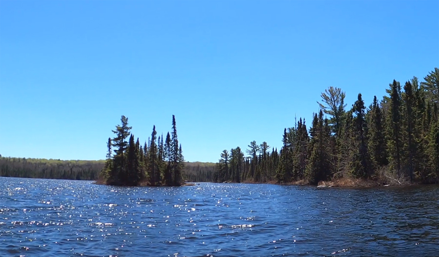
PADDLING FROM THE SAWBILL LAKE PORTAGE TO BWCA CAMPSITE 920
Paddling generally towards the northeast from the portage dock to the campsite (August 4, 2025).
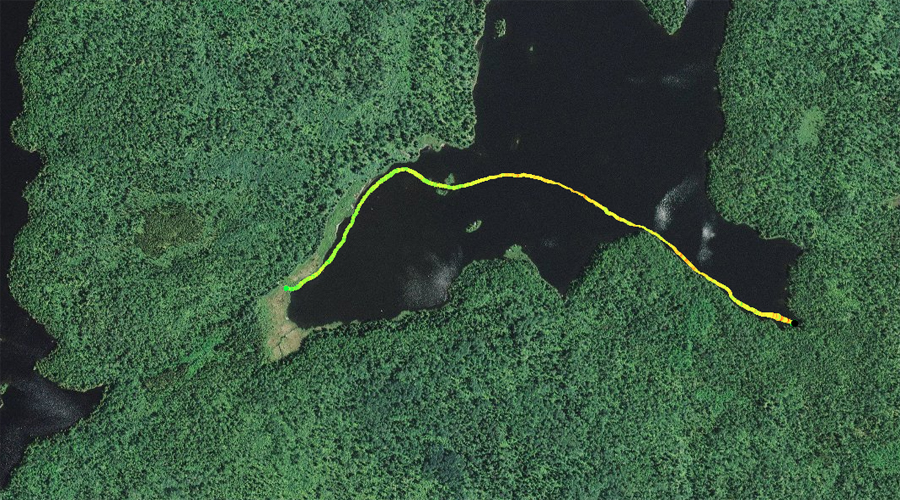
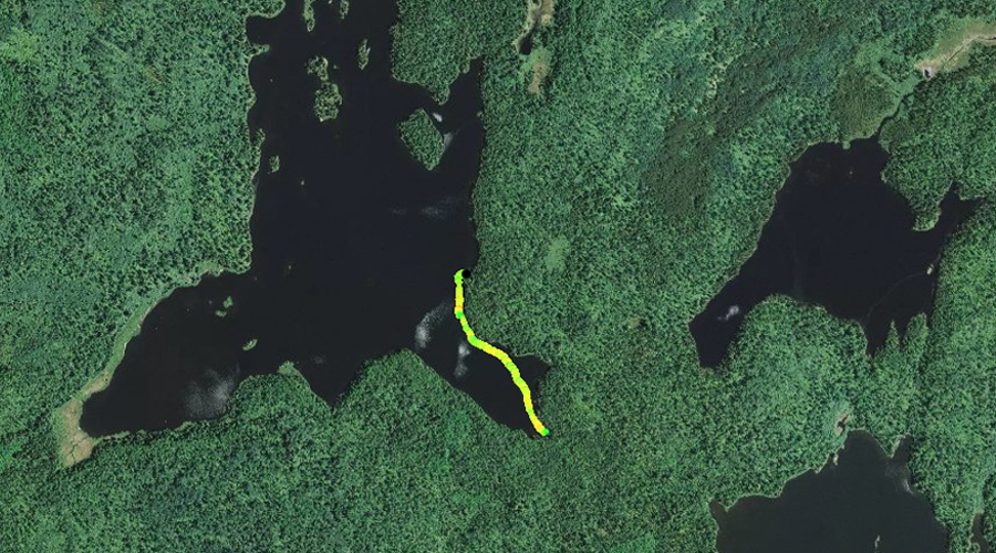
PADDLING FROM BWCA CAMPSITE 920 TO BWCA CAMPSITE 2021
Following the west shoreline of Smoke Lake northbound until reaching the next campsite in the northwest corner of the lake (August 4, 2025).
PADDLING FROM BWCA CAMPSITE 2021 TO BWCA CAMPSITE 921
Weave amongst a couple islands at the north end of the lake and then paddle toward the south/southeast, arriving at BWCA Campsite 921 (August 4, 2025).
PADDLING FROM THE BURNT LAKE PORTAGE TO THE SAWBILL LAKE PORTAGE
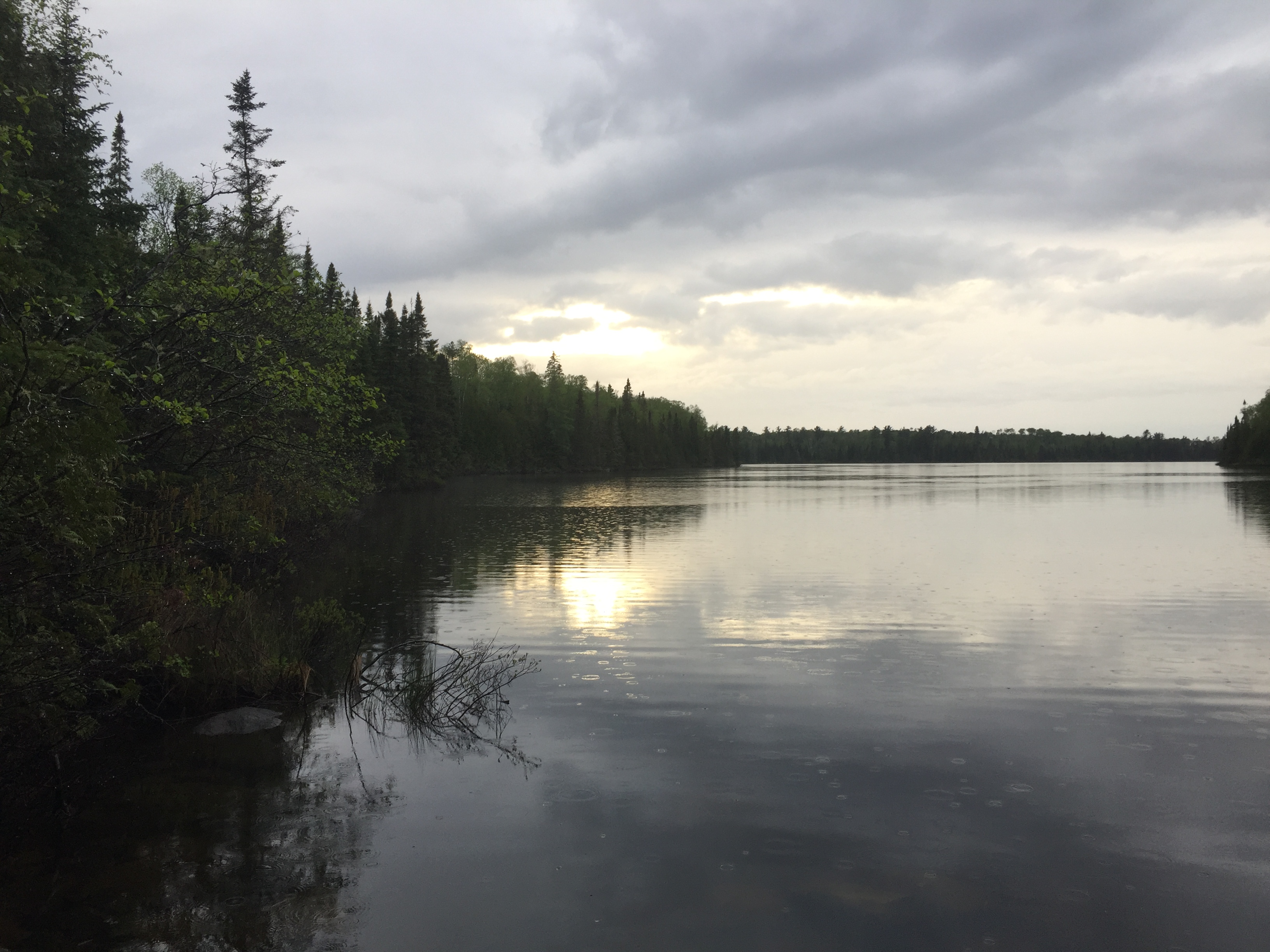
Smoke Lake near sunset during a light rain not far from the Burnt Lake portage. Looking off to the northwest (May 27, 2016).
Westbound paddle between the two portages. The route stays somewhat close to the south shoreline of the lake (August 4, 2025).
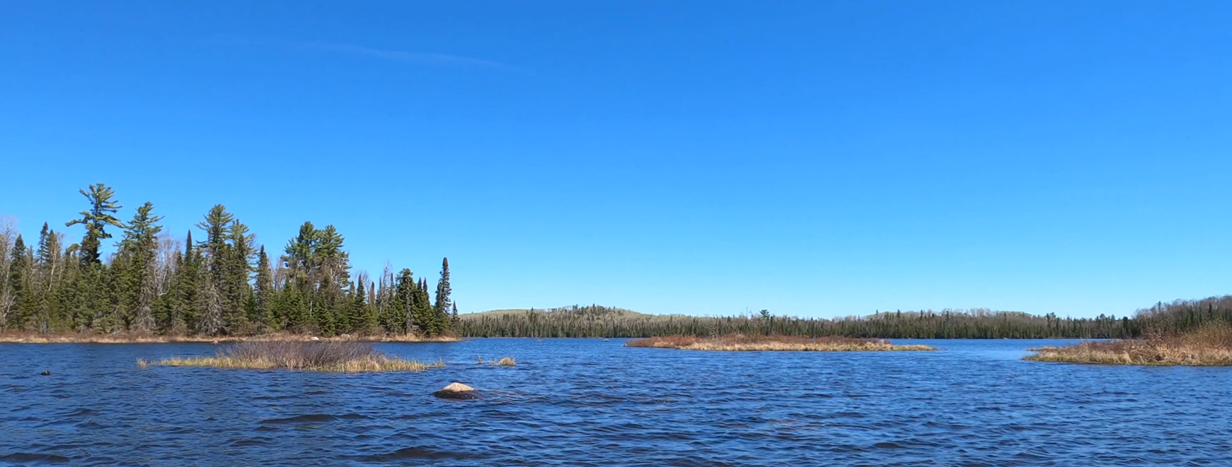
A clear sunny day with a bit of a breeze blowing. The voyage begins from the Burnt Lake portage and follows the south shoreline. As you round the point to the west, strike out across the lake to the northwest until reaching the northwest shoreline, just west of the campsite on the point. Follow the marshy shoreline to the west until arriving at the Smoke Lake portage (May 21, 2020).
(Older video footage following roughly the same paddling route as above.) As evening quickly approaches and the rain moves out of the area, you paddle from the Burnt Lake portage over to the Sawbill Lake portage. This portage begins at the end of a wooden dock built out into the marsh (May 27, 2016).
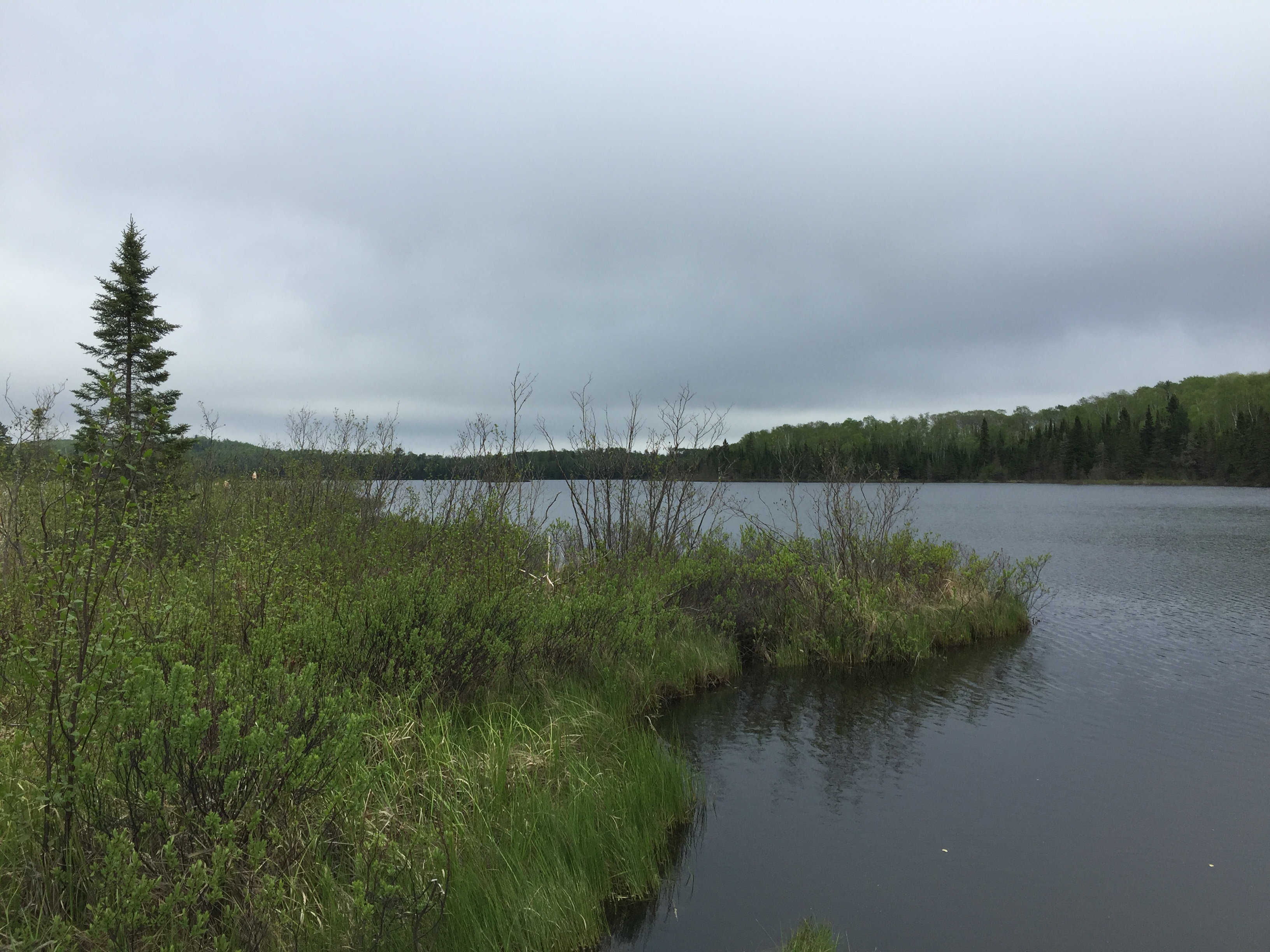
Peat bog shoreline which is found along much of Smoke Lake, especially the western bay (May 27, 2016).
Almost the same view as above, but about four years later (May 21, 2020).
View of Smoke Lake from the portage landing for Sawbill Lake. There is a wooden boardwalk structure that extends out into Smoke Lake through the peat bog. You are currently standing on it. Note the peat bog just left of center which is right at the end of the boardwalk at your feet. Don't be tempted to take a step onto it, as it is floating peat bog and may not support you (May 27, 2016). Portage to Sawbill Lake -or- Explore Another Route ***********************************************END OF ROUTE***********************************************
PADDLING FROM THE SAWBILL LAKE PORTAGE TO BWCA CAMPSITE 919
Nearing the point on the west side of the lake as you come out of the southwest bay. That point has a campsite on it. The west shore of the lake has a lot of low lying marsh terrain (May 21, 2020).
A small island about midway up the west shoreline. View is toward the south (May 21, 2020).
After leaving the dock at the Sawbill Lake portage, paddle along the north shoreline and around the point, past the campsite that is located there. Head up into the north end of the lake, staying near the west shoreline. Meander around a few of the islands at the north end of the lake and then turn southward. You paddle until you reach the south end of the largest island in the lake. Finally, make an abrupt turn to the north and head for the campsite located in this part of the lake. Probably the best campsite on the lake (May 21, 2020). Visit the Campsite -or- Explore Another Route ***********************************************END OF ROUTE***********************************************
PADDLING FROM BWCA CAMPSITE 919 TO BWCA CAMPSITE 921
Coming up to the campsite on the east shoreline. The peninsula of rock makes it easy to find (May 21, 2020).
Starting at the campsite behind the island in the northeast part of the lake, paddle further down the east shoreline to another campsite (May 21, 2020). Visit the Campsite -or- Explore Another Route ***********************************************END OF ROUTE***********************************************
PADDLING FROM BWCA CAMPSITE 921 TO THE BURNT LAKE PORTAGE
Brief paddle following the shoreline to the southeast to the Burnt Lake portage landing (August 4, 2025).
Pull away from the nice landing this campsite provides and head south and then southeast to the Burnt Lake portage. The portage offers a decent landing too (May 21, 2020).