SLIM LAKE CAMPSITES: Campsite 1 (#1981): Campsite on west shore behind island.
Many paddlers don't go past Slim Lake, they just stay here. For good reason too. This is a beautiful lake dotted by four small islands. There are several good campsites. Three are along the west shoreline and one in the south end of the lake on the east shore. Campsites have sweeping views of this long narrow lake. High cliffs capped with some large pines surround it. Wolves are commonly heard in this area.
Another reason many don't travel beyond Slim Lake is because there are so few campsites in the small lakes to the west. Rice Lake offers only a single campsite and a fairly easy portage. However, going past Rice Lake requires a long portage to Hook Lake which also has but a single campsite. From Hook Lake you can travel to Keneu Lake, which is on a dead end route. Keneu Lake offers you the best chance of solitude and has one campsite too. The only route out of this area is over a 500+ rod portage out to Big Rice Lake, which most groups will find disagreeable.
Slim Lake is a busy lake during the summer and it may be hard to get a campsite. There is now a fourth campsite on this lake just south of the small bay leading to the entry point parking lot. This new campsite is on the west shoreline and it isn't on older maps. The campsite behind the island along the west shoreline of the lake is also quite descent.
There may still be a trail from the southeast campsite on the lake (about 80 rods long) that leads to the top of "Old Baldy", an elevated rock formation on the south end of Slim Lake. Old Baldy offers panoramic views...and perhaps some good blueberry picking in season (Beymer, 2006).
References:
Beymer, Robert, Boundary Waters Canoe Area – Volume 1 – Western Region (Berkeley: Wilderness Press, 2006), 56, 58, 62, 65.
Heinselman, Miron, The Boundary Waters Wilderness Ecosystem (Minneapolis: University of Minnesota Press, 1999), 57, 101, 117, 118.
Pauly, Daniel, Exploring the Boundary Waters (Minneapolis: University of Minnesota Press, 2005), 84-86.
Click on the photos below to see the full resolution image - Use your browsers back button to close photo and return to this page.
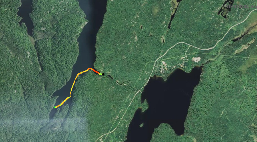
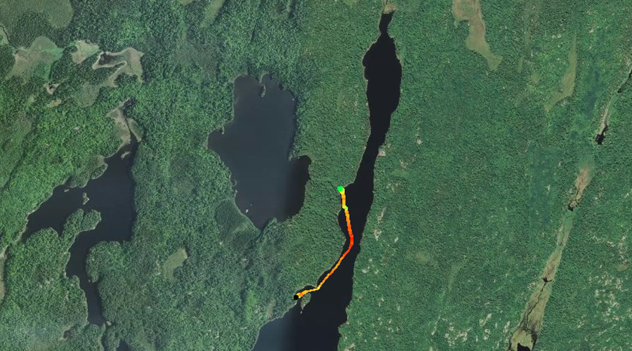
PADDLING FROM BWCA ENTRY POINT 6 PORTAGE TO THE SOUTH END OF SLIM LAKE
A look to the west from the small bay where the entry point portage is located, on the east side of the lake. The west shoreline of Slim Lake is visible in the distance.
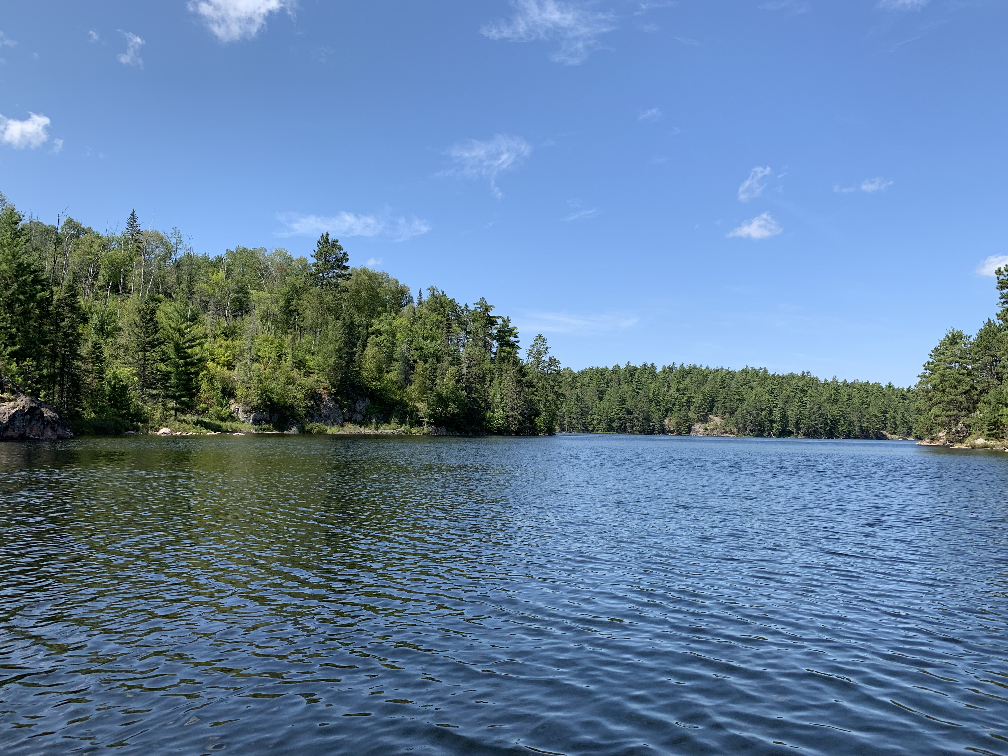
Looking to the north. This is the view just after entering the main lake from the small bay on the east side of the lake, where the entry point portage is located.
Looking south from a location in the southern part of Slim Lake. The two small islands found there are visible. There is a campsite back behind the left island, in the southeast corner of the lake.
A quick paddle from the entry point portage landing, takes you out of the small bay on the east side of the lake, into the main body of Slim Lake. From there you turn south and paddle along the east shoreline, until reaching the southern end of the lake. Two islands are in the south end of the lake and you paddle between them. You pass by the campsite located in the southeast corner of the lake, but there is a canoe beached there so you continue on.
To the right in the foreground, is the south end of the larger of the two islands located in the south end of Slim Lake. A rather interesting cliff formation is visible in the background along the west shoreline.
A lumpy cliff formation along the west shoreline of Slim Lake, just west of the larger of the two islands found in this part of the lake.
Distant view of the campsite in the southeast corner of Slim Lake. You can just make out the canoe parked there (just left of center) by the campsites current residents. Explore Another Route ***********************************************END OF ROUTE***********************************************
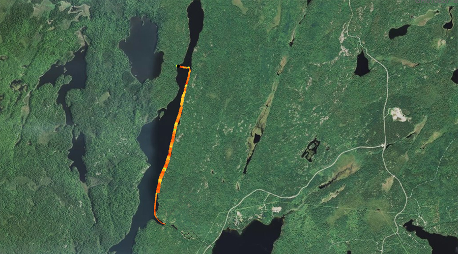
PADDLING FROM SOUTH END OF SLIM LAKE TO THE CAMPSITE BEHIND THE ISLAND ALONG WEST SHORELINE
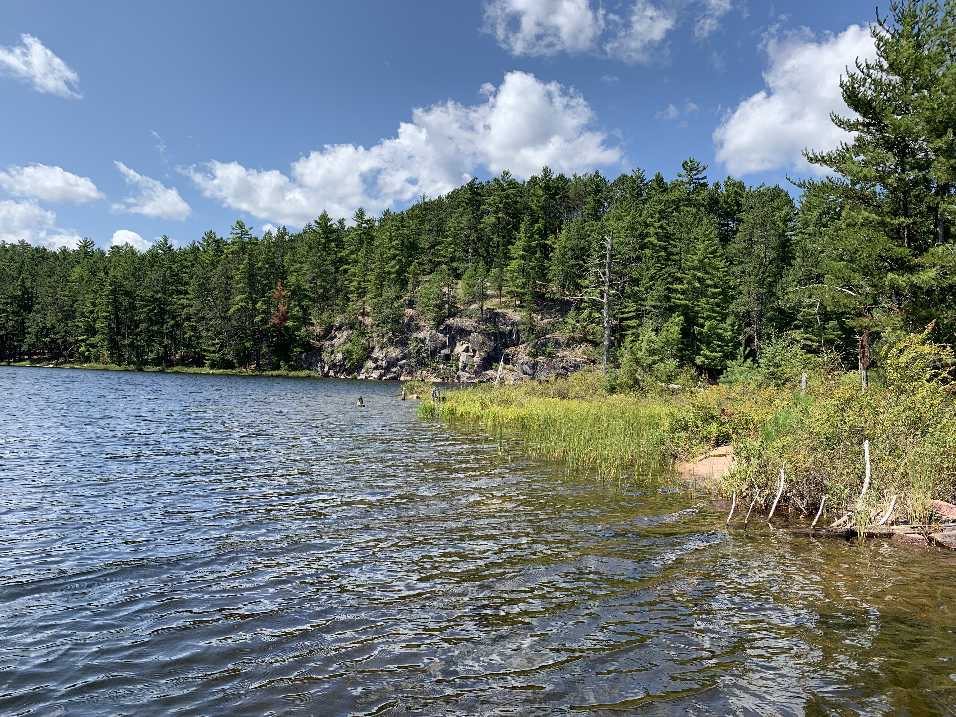
View to the north up the long expanse of Slim Lake. You are in the south end of the lake, just off the point near the western shore of the lake. This point is just northwest of the larger of the two islands in this part of the lake. A campsite is visible in the distance, on the west (left) shore, just right of center where the bare rock is visible. This campsite isn't on most newer maps of the BWCA.
The smaller of the two islands in the south end of the lake is near the center of your view. Behind it are some of the bare rock hills that are prevalent along much of the eastern shoreline of Slim Lake. The larger island is partially visible to your far right.
Distant view of the southern most of the three campsites found along the western shoreline of Slim Lake. This campsite isn't on newer maps of the Slim Lake area.
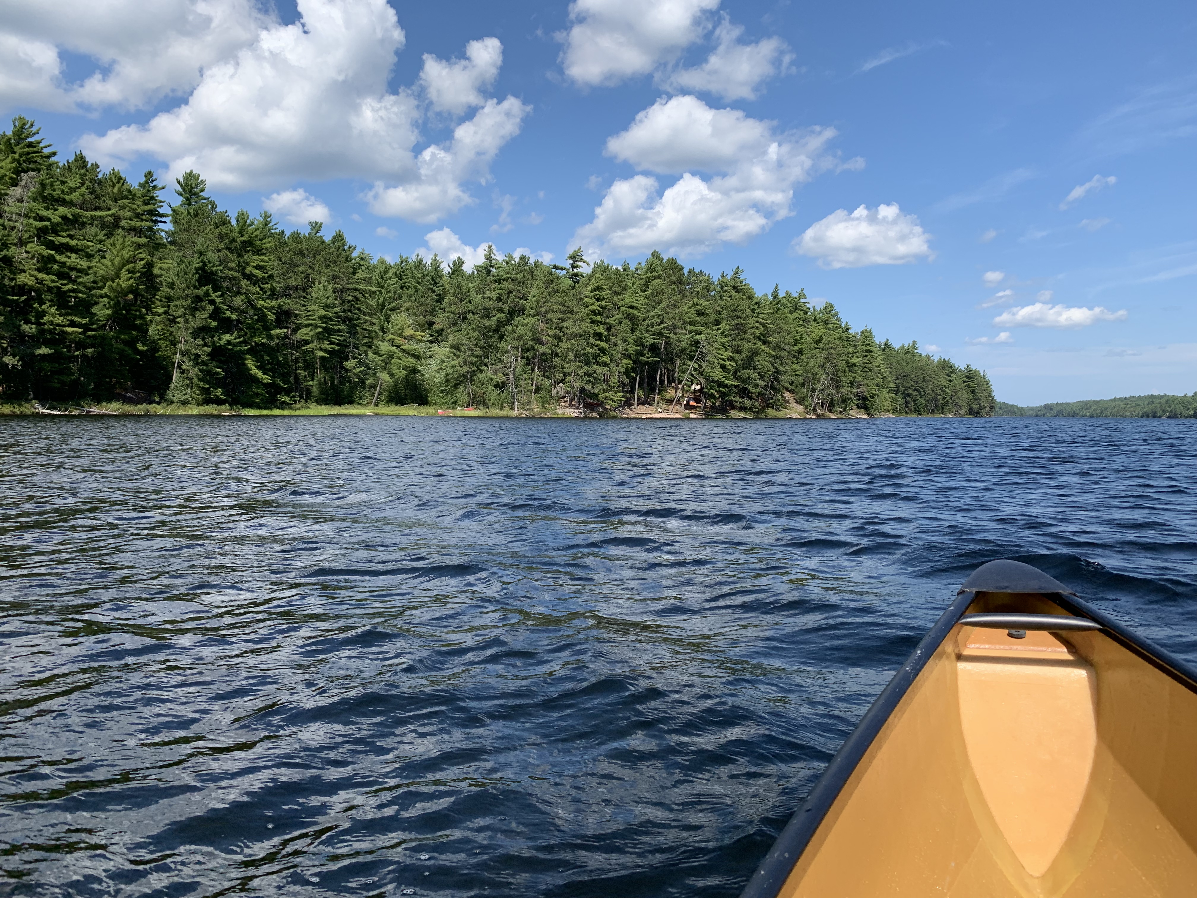
Continuing up the west shore of Slim Lake. Here you are looking north. The small bay where the entry point portage is located, is directly across the lake to your right from this vantage point.
Starting near the two islands in the south end of Slim Lake, paddle northward staying along the west shoreline. Eventually you reach the middle of the west shores three campsites; this is the campsite behind the island. Along the way you pass the southern most of the three campsites on the west shore (not shown on newer maps).
A look due east at the small bay where the entry point portage can be found. Viewed from west side of Slim Lake.
Rock slab that slopes down into Slim Lake about mid-lake, forming the sharp point along the west shore.
A possible lightning strike knocked out this large pine and burned a small area of the ground around it. The tip of the notable rock point is visible to the left side of your view. This is along the west shoreline of the lake.
The campsite behind the small island along the west shore, as seen from the lake. The island is just out of your view to the right. Visit the Campsite -or- Explore Another Route ***********************************************END OF ROUTE***********************************************
PADDLING FROM CAMPSITE BEHIND ISLAND ON WEST SHORELINE TO THE RICE LAKE PORTAGE
Beaver lodge just south of the portage to Rice Lake, along the west shoreline.
This is a paddle up the west shoreline of Slim Lake, from the campsite located behind the island to the Rice Lake portage. This trek passes the northern most of the three campsites on the west shoreline too.
From Slim Lake, you can portage to BWCA Entry Point #6. Continuing past the entry point parking lot, you can portage down the road you drove in on. This will get you to Burntside Lake. You can also portage to Rice Lake.