ROUTES/PORTAGES FROM FOURTOWN LAKE:
To Mudro Lake: Walk the portages of 30 rods, 141 rods and 30 rods. Paddle several sections
To Horse Lake: Walk the 10 rod portage, paddle across pond, walk the 80 rod portage
To Boot Lake: Walk the 48 rod portage
To Alruss Lake: Unmaintained portage accessible from portage between Mudro Lake and Fourtown Lake
To (Moosecamp) Creek: Paddle In
Fourtown Lake
Kawishiwi Ranger District
FOURTOWN LAKE CAMPSITES:
None visited yet.
This lake gets a fair amount of traffic so don't expect to have it to yourself. Saw a large number of bald eagles and a couple of whitetail deer hanging out in an empty campsite. Fourtown Lake flows out to the east into Horse Lake and then the Horse River.
The three portages along the creek in the gorge between Mudro Lake and Fourtown Lake are very rocky. Sections of these portages, particularly the first and last 30 rod portage could be underwater during high water levels. There were many bald eagles here in springtime. There are some lovely views to be had along these portages.
There was also once a portage from Fourtown Lake directly to Horse Lake. This portage ran from the back of the second bay (on east side of lake) from the north end of Fourtown Lake over to the west side of Horse Lake, near its north end. Portage is still visible on modern day satellite images. This portage would have been about 180 rods long.
While the maps show two portages between Fourtown Lake and Horse Lake, if the water levels are low you may have to add two more to your to do list. During the logging era, sluiceways were built at the location of these portages (Rom, 1987).
The creek flowing from Moosecamp Lake into the north end of Fourtown Lake is easily navigated in a canoe even in low water. The only issue is the beaver dams. Expect to be lifting your gear over a lot of these structures.
There used to be a log sluiceway in the channel leading to Horse Lake. Was unable to locate the old rock cribs that supported a bridge near the mouth of Moosecamp Creek (Rom, 1987). The day was windy and the water was churned up, so there was little visibility below the surface.
The campsite (BWCA Campsite 1110) in the southeast most bay (its about the third campsite north of the Fourtown Creek portage on east shore) has many old artifacts from the pre-BWCA days, including an old car. This is where the spur railway that came off a longer railway spur that ran along the west side of Tin Can Mike Lake reached Fourtown Lake. The spur running along Tin Can Mike Lake ended at the south end of Horse Lake, just to the north. A telephone line paralled these rail spurs.
Logging operations were extensive on Fourtown Lake until about the mid-1920's. The General Logging Company had a logging camp on Fourtown Lake. Fourtown Lake was part of the railway that connected it to Horse Lake and Jackfish Bay on Basswood Lake. Spurs of this railroad also ran from Fourtown Lake to Angleworm Lake and Home Lake (Heinselman, 1999). Old stumps are still visible in the shallows and along the shore of this lake. They are leftover evidence of the logging period that extended into the late 1960's around Fourtown Lake. Two trails used by loggers used to run west from the southern tip of Fourtown Lake. These trails joined together about 1.25 miles to the west at the south end of a large wetland that extends southward from Boot Lake. Where the trails joined, they intersected a short spur of the logging railroad (built by the General Logging Company and known as the Cloquet Line). This spur extended north from the main railway route for about one mile before coming to a dead end here. The main route of this railway runs up to the east of Angleworm Lake. This railway eventually ended near the start of the bushwhack portage that connects the Beartrap River (now in the Sundial PMA) and Beartrap Lake.
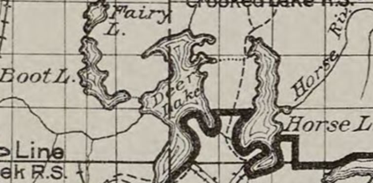
The lake gets its name because it is within the boundary lines of four different Minnesota townships. Fourtown Lake was one of the last sizeable lakes to be added to the BWCA. Back in the early 20th Century, Fourtown Lake was named Deer Lake (map below was published in April, 1927).
References:
Beymer, Robert, Boundary Waters Canoe Area – Volume 1 – Western Region (Berkeley: Wilderness Press, 2006), 131, 141, 145.
Heinselman, Miron, The Boundary Waters Wilderness Ecosystem (Minneapolis: University of Minnesota Press, 1999), 101, 103, 104, 122.
Pauly, Daniel, Exploring the Boundary Waters (Minneapolis: University of Minnesota Press, 2005), 136, 152.
Rom, William N., M.D., Canoe Country Wilderness (Stillwater: Voyageur Press, 1987), 93, 95, 130.
Click on the photos below to see the full resolution image - Use your browsers back button to close photo and return to this page.
PADDLING FROM FOURTOWN CREEK PORTAGE TO MOUTH OF MOOSECAMP CREEK
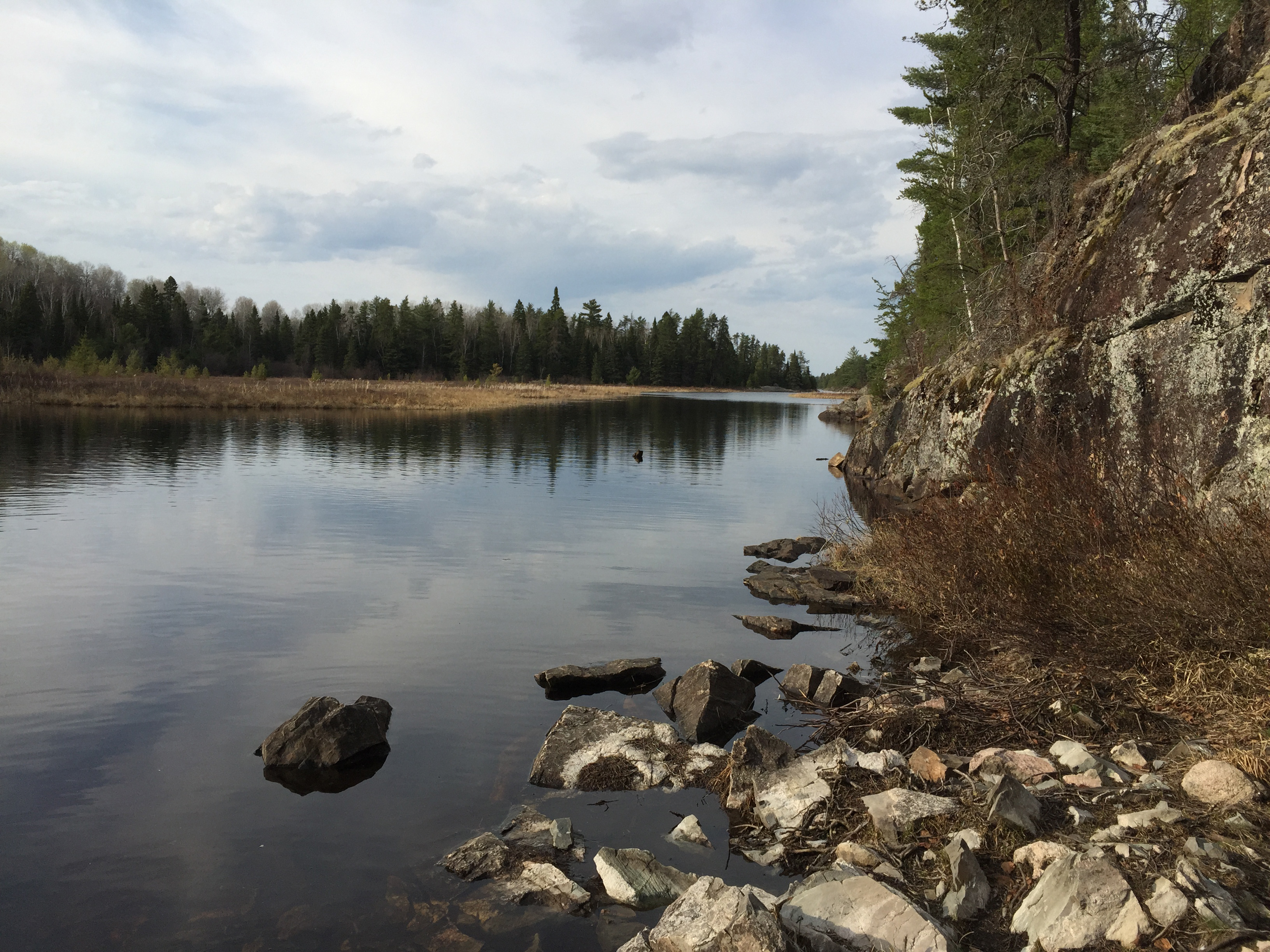
Preparing to get in your canoe, you look north from the south end of Fourtown Lake, from the start of the first portage leading back to Mudro Lake along Fourtown Creek (View is in spring - May 2015).
Fourtown Lake is a sizeable lake. Starting off at the south end of the lake, you leave the Fourtown Creek portage. From that portage you paddle northward staying along the east side of the lake, making a couple brief stops along the way. Along this route you pass several campsites (one even has a few white-tailed deer visiting it). It takes a little over an hour to reach the north end of the lake. This is where Moosecamp Creek flows into Fourtown Lake.
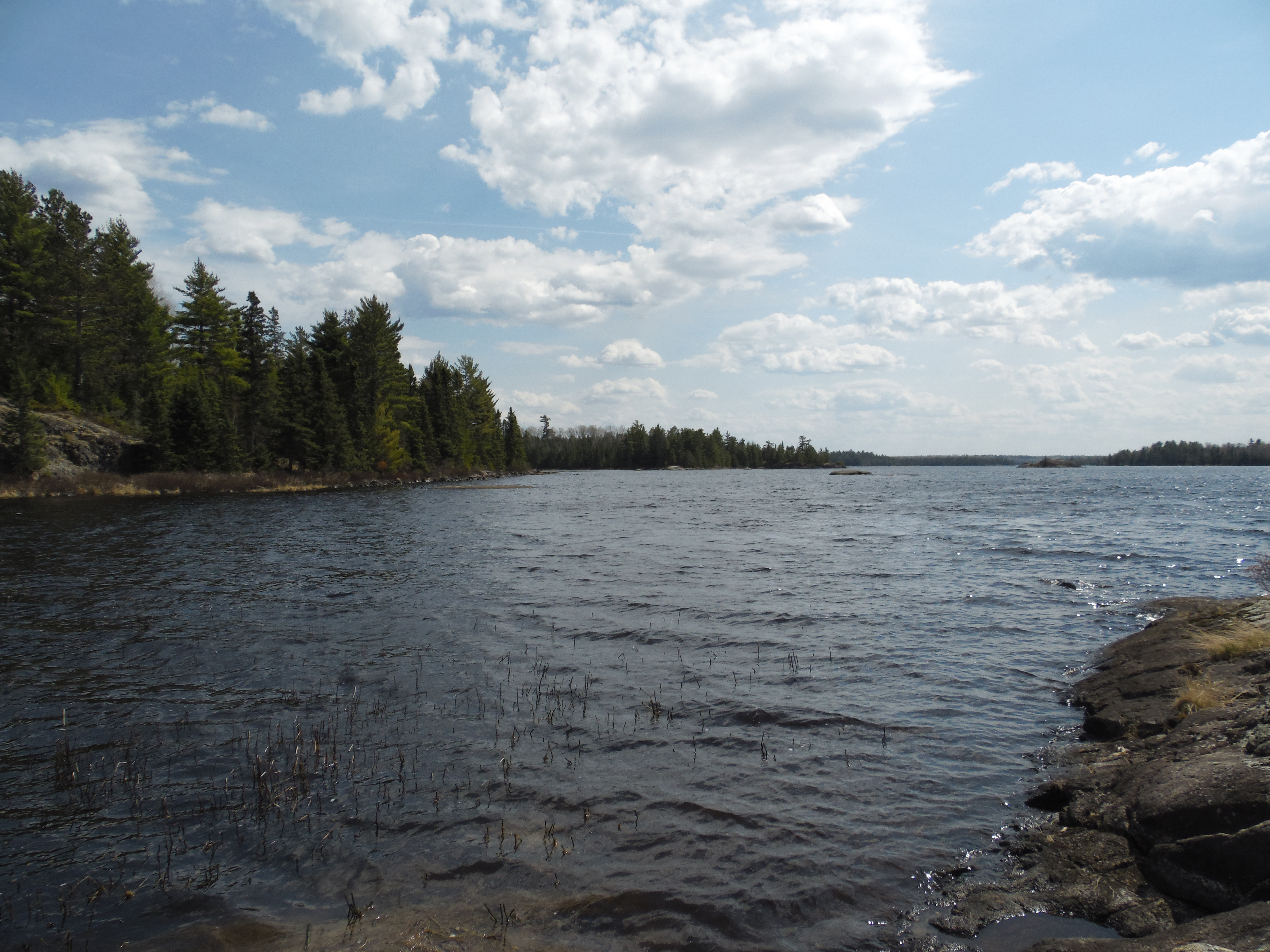
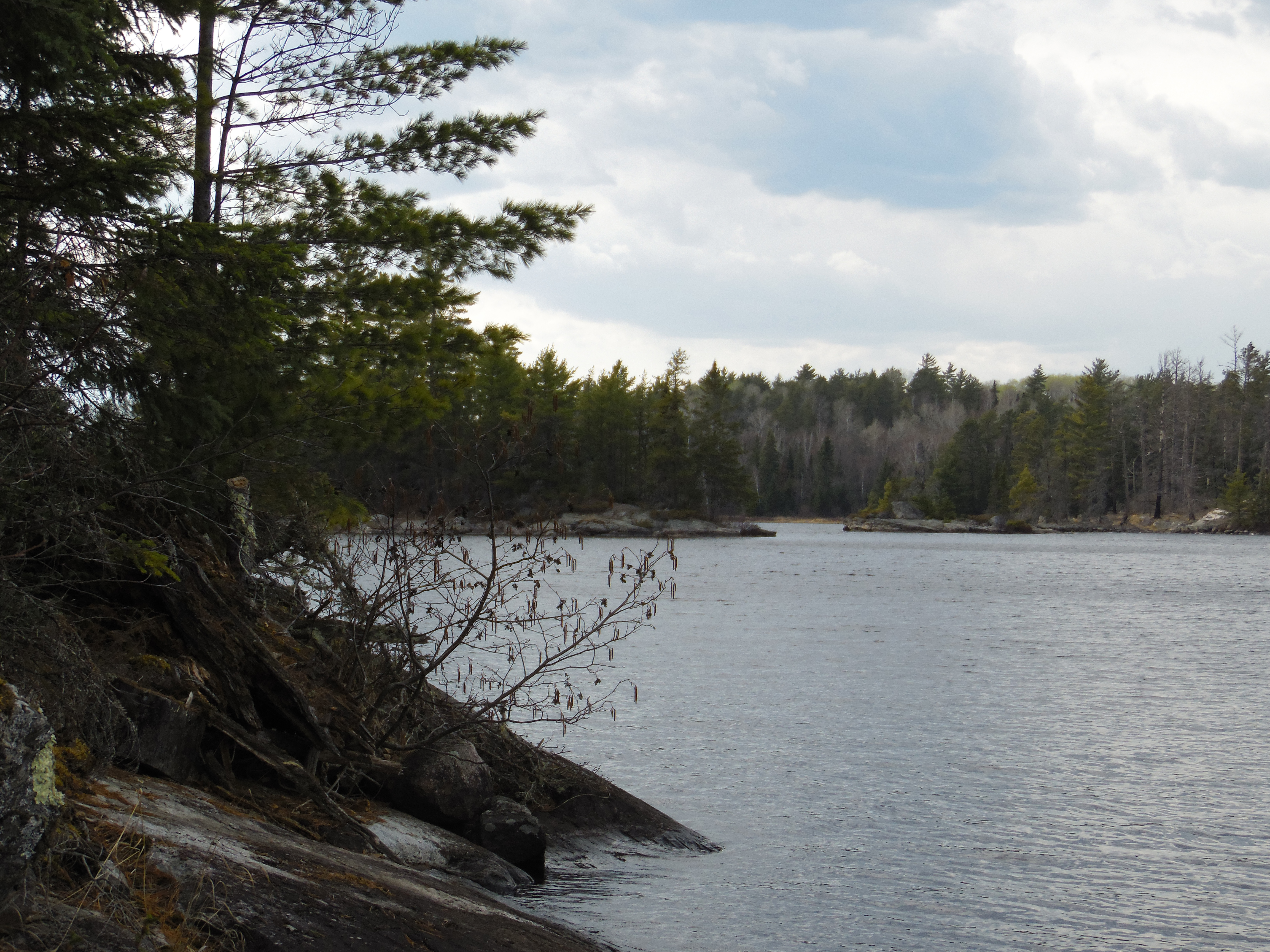
Peeking out from behind the pines looking toward the west. This is near the narrows around the middle of Fourtown Lake. The small bay you pulled your canoe into is just to the left. (View is in spring - May 2015)
The large island that forms the choke point of the narrows near the middle of the north/south point of Fourtown Lake. You are looking toward the west while standing on the eastern shoreline. (View is in spring - May 2015)
You spot this island just north of the narrow section of the lake along the east shoreline. It is about a quarter of a mile away. (View is in spring - May 2015)
Standing just west of the mouth of the unnamed creek (Moosecamp Creek?) that flows into the north part of Fourtown Lake from Moosecamp Lake. You are looking south down the eastern side of Fourtown Lake. (View is in spring - May 2015)
PADDLING FROM MOUTH OF MOOSECAMP CREEK TO FOURTOWN CREEK PORTAGE
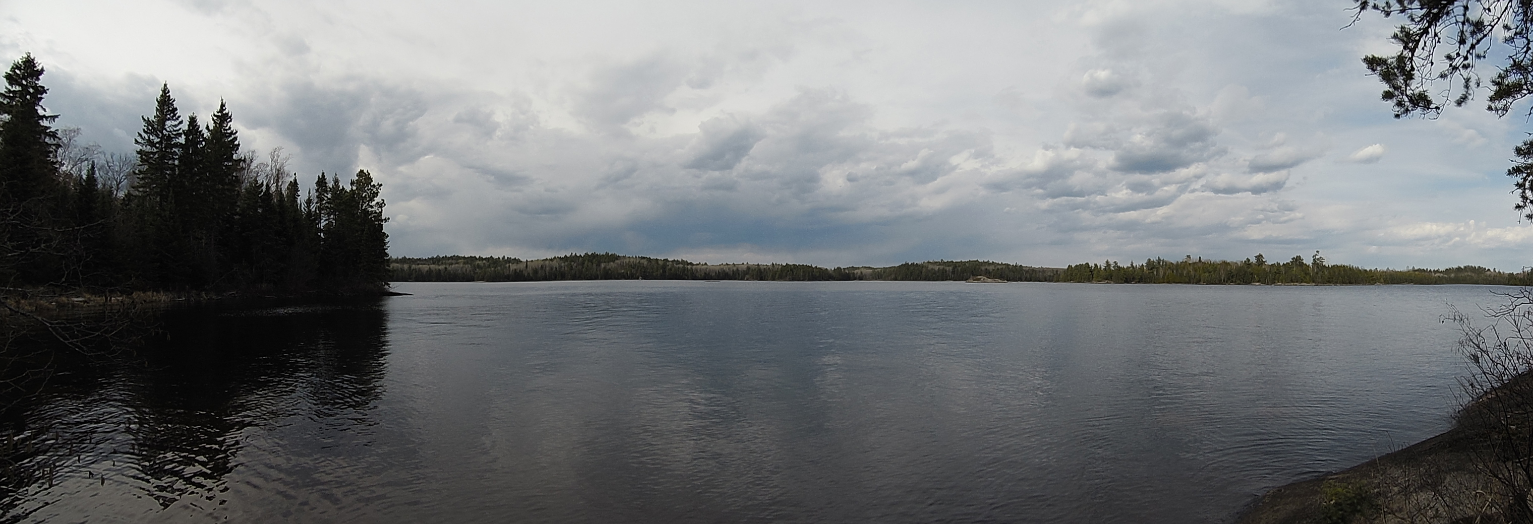
Moosecamp Creek flows into the northern most tip of Fourtown Lake. This is the view toward the south from the mouth of the creek.
Looking west through a channel between some islands. These islands are in the bay just east of the Boot Lake portage.
View of the north shoreline of the lake as seen from the west shore. There few large trees around Fourtown Lake, as the forest in these area was heavily logged in the early 1900's.
Northeast bay of Fourtown Lake.
A small rocky island in the northwest bay of Fourtown Lake. Extensive stretches of exposed rock are found along much of the lakes shoreline.
Route Connections for Fourtown Lake
From Fourtown Lake, you can portage to Boot Lake, Horse Lake (via two portages) or Fourtown Creek (which leads to Mudro Lake) over a series of three portages. You can also paddle up (Moosecamp) Creek to Moosecamp Lake. There is also an unmaintained portage between Fourtown Lake and Mudro Lake that leads to Alruss Lake. Alruss Lake is a designated trout lake. It is stocked regularly by the Minnesota Department of Natural Resources with brook trout.