Portage Length from Parking Lot: 30 rods (varies with water level)
Restroom at Entry Point: Yes
Entry Point 23 - Mudro Lake
Kawishiwi Ranger District
From the east end of Ely, beginning at the Kawishiwi Ranger District Station, drive 1/4 mile east on Highway 169 to Grant McMahan Boulevard. Turn left. Drive 2 1/4 miles until you reach the intersection with the Echo Trail (also known as Ely-Buycks Road or County Road 116). Take a right onto the Echo Trail. Follow the Echo Trail for about 8 miles to the turnoff to North Grassy Lake Road. The North Grassy Lake Road turnoff is just past the Fenske Lake Campground. Take a right onto North Grassy Lake Road. This is a gravel road. Drive with care as there are several sharp turns with limited sightlines. Follow this road just over 4 miles until you reach the junction with Cedar Lake Road. Turn left here and continue on North Grassy Lake Road. In about 1 1/4 miles arrive at the Mudro Lake Entry Point parking lot.
It is possible to camp on Picket Lake. Since that lake is not in the BWCA, you don't need a permit.
The portage from the parking lot to the water is easy if the water is high. If there are good water levels its about 30 rods. If the water is low, the portage more than doubles in length and the extended stretch of trail now passes through tall grass and semi-boggy terrain.
This is a popular entry point and provides two good route options. You can either head north or east from Mudro Lake. Heading north takes you up to Fourtown Lake. From there you can continue north up toward Crooked Lake or toward the west. Routes past Fourtown Lake are less traveled than routes to the east of Mudro Lake. East of Mudro Lake, your travels will take you toward Basswood Lake and the Basswood River. Horse Lake, a heavily visited lake, is to the northeast. From Horse Lake you can follow the Horse River to the Basswood River where you will see and portage around many spectacular rapids and waterfalls. The Basswood River is often a busy thoroughfare.
Click on the photos below to see the full resolution image - Use your browsers back button to close photo and return to this page.
There is the sign at intersection of the Echo Trail and North Grassy Road.
Entry Points 22 and 23 at Mudro Lake is another 1.2 miles.
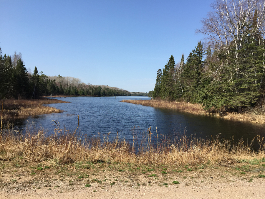
The gravel road condition is usually pretty good, with the usual ruts and washboard sections typical of these roads. It is easily passable in any passenger vehicle. The parking lot is actually on the eastern shore of Picket Lake. Mudro Creek flows from Picket Lake to Mudro Lake under the road.
The portage from BWCA Entry Point #22 or #23 is 30 rods long and nice and easy. It follows the north side of Mudro Creek. The creek flows out of the east side of Picket Lake and eventually into the west end of Mudro Lake. This creek is navigable along its entire length during good water levels.
During low water levels, the portage may double in length to reach a point in the creek that is deep enough to float your boat. Also, you may have to walk in the creek several times before reach Mudro Lake because there won't be enough water to float a canoe. This will greatly increase the time it takes to travel from the entry point to Mudro Lake.
Exploring the Entry Point
This video provides a walkaround of BWCA Entry Point 22 and 23 (June 22, 2025).
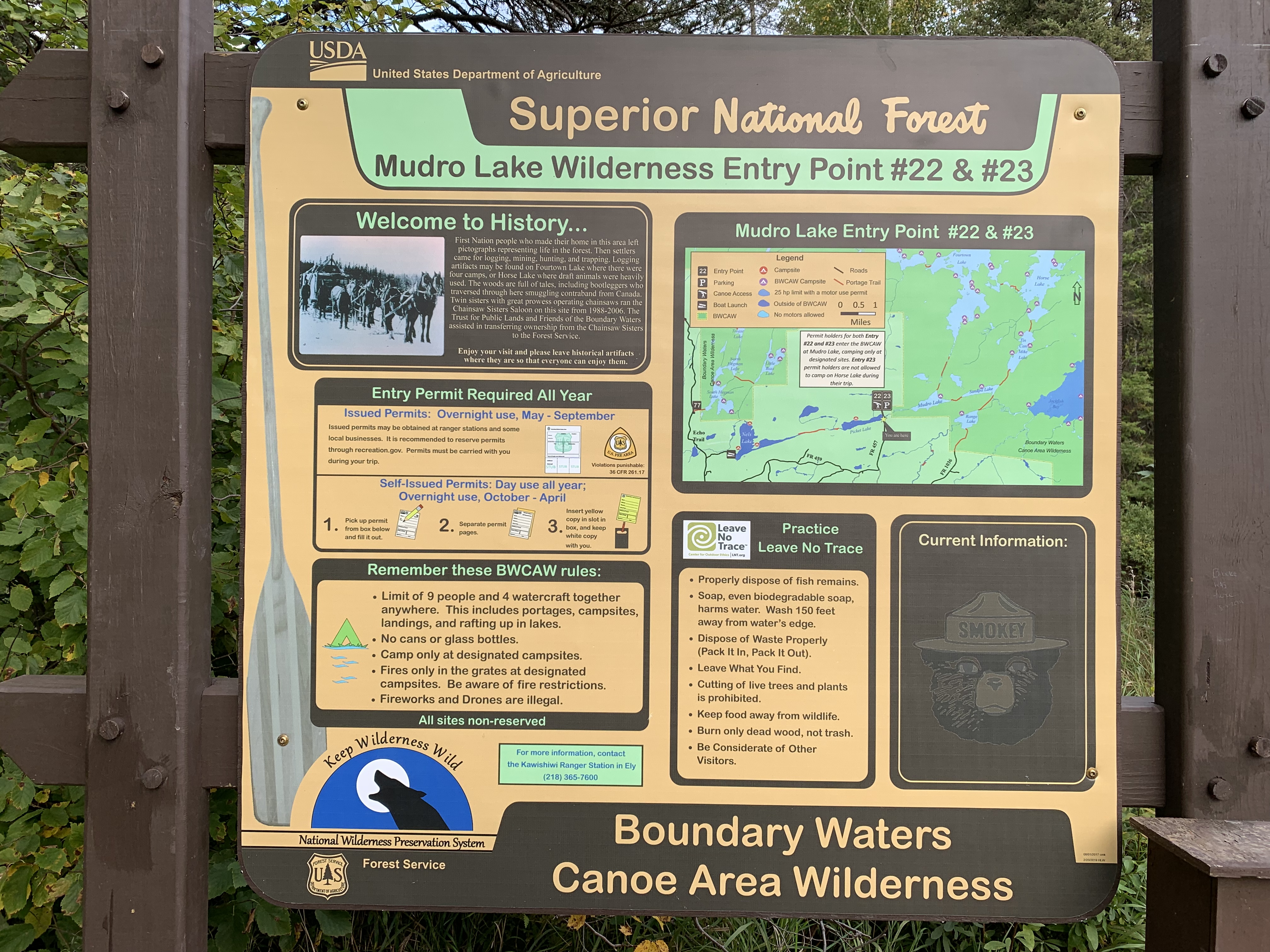
The information board at Entry Point 22 and 23.
The restroom is located in the parking lot.
You are looking west across Picket Lake while standing on North Grassy Lake Road. The parking area for Entry Points 22 and 23 is just to your right. The portage of 30 rods leading to the canoe landing, if you are going to Mudro Lake, is behind you over your right shoulder.
Portage from Parking Lot to Canoe Landing
Portage from the BWCA Entry Point 22 and 23 parking lot area to Mudro Creek landing during near normal water levels (June 22, 2025).
Taking the portage from the parking lot to Mudro Creek. The first half of the parking lot is on a maintained gravel trail. Because the water is low, the portage extends another 20 or 30 rods out through the marsh grass until reaching a point along the creek that is deep enough to float a loaded canoe. (See this portage in both directions here.) (September 8, 2019.)
Portage during Spring 2015 when water levels were high (May 2, 2015).
Now that you've reached the bank of the creek, visit:MUDRO CREEK