Wildlife Seen on Visit: Ornery Red Pine Squirrels (September 8, 2019), Lots of Bald Eagles (May 2, 2015), Bald Eagle (June 22, 2025)
Last Visited: June 22, 2025;
Previous Visit(s): September 8, 2019, May 2, 2015
Creek Elevation: Headwaters at Mudro Lake at 1370 feet. Mouth at Fourtown Lake at 1332 feet. Creek drops 38 feet over its entire course (about 38 feet per mile).
Note that (Fourtown Creek) may not be the official name of this stream running between Mudro Lake and Fourtown Lake.
The three portages along the creek in the gorge between Mudro Lake and Fourtown Lake, are all very rocky. The 30 rod portage nearest to Mudro Lake is particularly so, as it runs through a stone filled creek bed. Sections of these portages, particularly the first 30 rod portage (nearest Mudro Lake again), could be underwater during spring flooding or after heavy rains.
Bald eagles often congregate in the gorge during the springtime. There are some spectacular views to be had along these portages, especially along the middle portage.
There is a portage to Alruss Lake, but it is unmaintained and not shown on Boundary Waters maps. Alruss Lake is stocked by the Minnesota Department of Natural Resources with brook trout. The unmarked portage to this lake is near the south end of the 141 rod portage, on the east side of the creek opposite of the portage trail. It can be a little hard to find.
There is also an unmaintained and unmarked portage to Louis Lake. This portage is about 250 feet north of the Mudro Lake portage landing on the west side of (Fourtown Creek). Louis Lake is also regularly stocked by the Minnesota DNR with brook trout. Louis Lake used to be known as Jacob Lake. This portage is also rather discrete.
Traveling (Fourtown Creek) (downstream)
Click on the photos below to see the full resolution image - Use your browsers back button to close photo and return to this page.
A view of the portage landing at the Mudro Lake end of the 30 rod portage with slightly higher than normal water levels. This is the first of three portages between Mudro Lake and Fourtown Lake (June 22, 2025).
Start of the 30 rod portage from Mudro Lake to Fourtown Creek. This is heading downstream (to the north) towards Fourtown Lake. This was during a low water period. During high water this portage landing is much easier (not nearly as rocky). The portage follows the east edge of the creek bed and is extremely rocky (September 8, 2019).
The portage trail runs along the edge of a very stoney creek bed. During high water you may have to walk close the forest (or even in it). When the water is lower, you can walk right along the creek on this stone covered path. This particular portage is easier when the water is low, but the landings for the portage are better when the water is high. You can't have everything (June 22, 2025).
Older video of the portage shown during low water (September 8, 2019.)
Older video showing the same 30 rod portage at a different time of year. This is during high water (May 2, 2015).
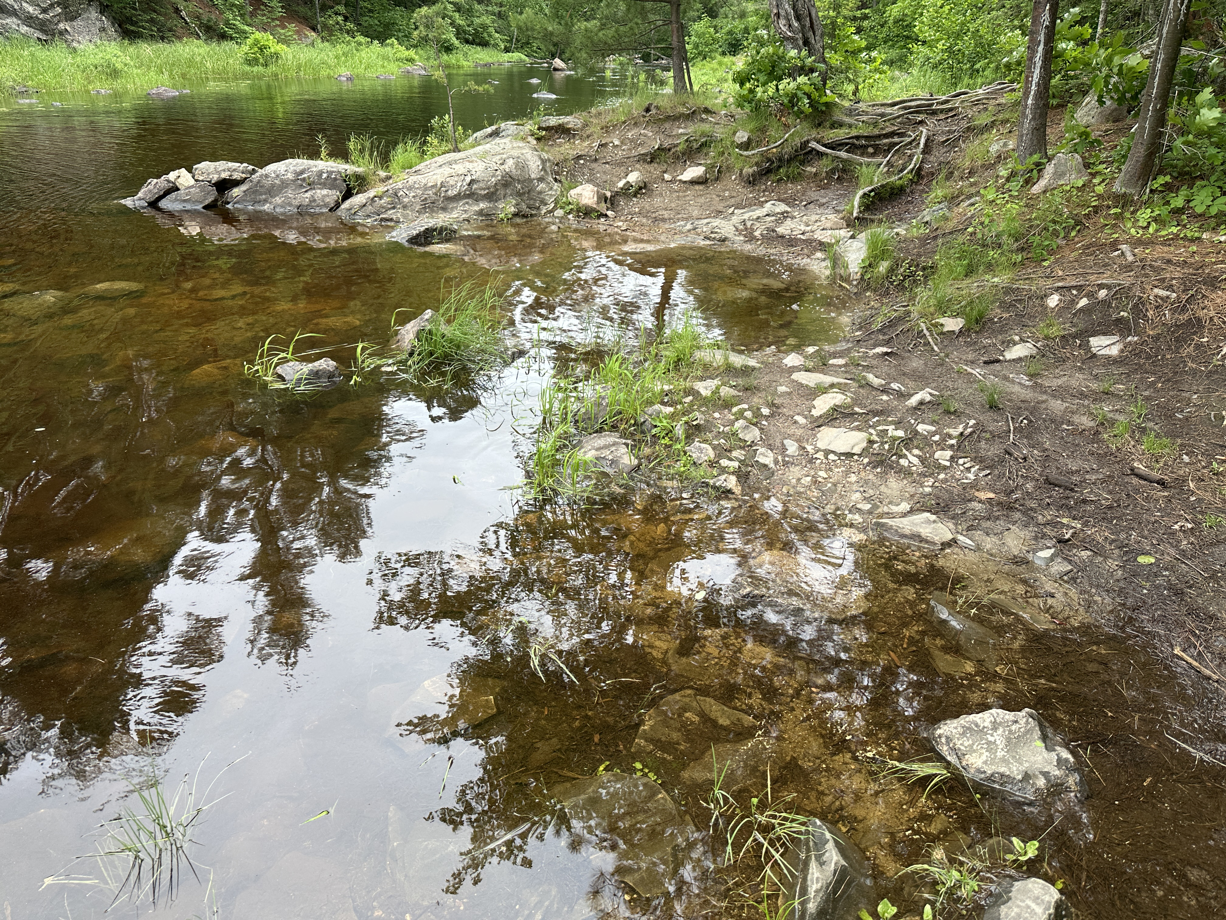
View south (upstream) of the rapids from the end of the 30 rod Mudro Lake portage. From here you paddle a short ways downstream (to your right) until you reach the start of the 141 rod portage (the middle portage). Note that the next portage is on the other side of the creek. This view is during normal to slightly high water levels (June 22, 2025).
View north (downstream) from the end of the 30 rod portage coming from Mudro Lake. From here you paddle a short ways until you reach the start of the 141 rod portage (the middle portage). Note that the next portage is on the other side of the creek. This view is during low water (September 8, 2019).
Almost same view as above (view shifted to right a bit), but this is during a period of high water (May 2, 2015).
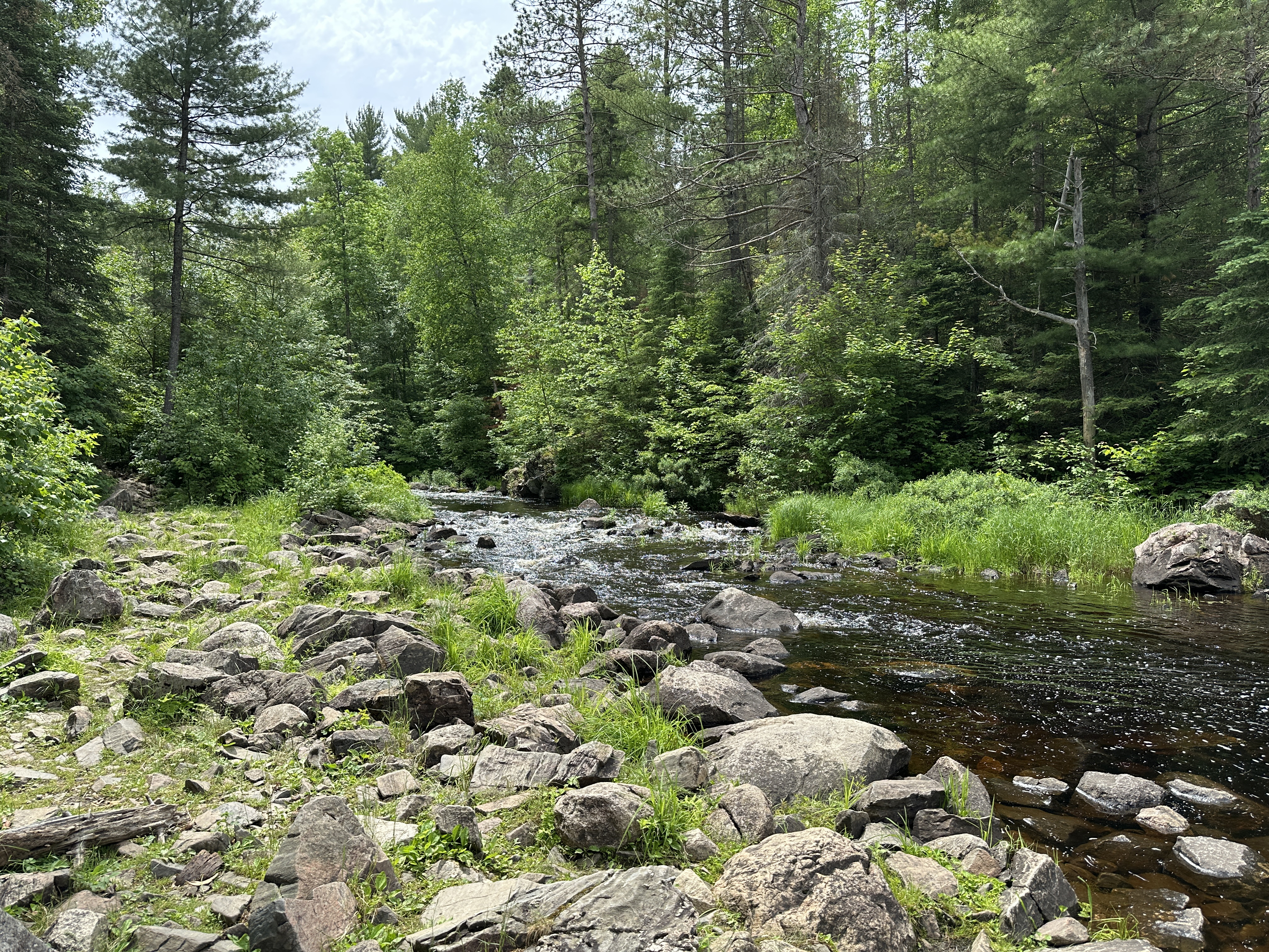
A short paddle (downstream to the north) from the 30 rod portage to the start of the 141 rod portage. Note that the southern most 30 rod portage is on the east side of the creek. The 141 rod (middle portage) is on the west side of the creek. There is another unmaintained portage to Alruss Lake that can be found on the other side of the creek (east side) from the 141 rod portage landing (June 22, 2025).
Older video of the footage shown above (May 2, 2015).
Portaging along (Fourtown Creek) heading north (downstream). This portage follows the west side of the creek and goes up steeply and then runs along the cliff face. Somewhat rocky in places. Steep drop back to the creek on the north end of the portage (June 22, 2025).
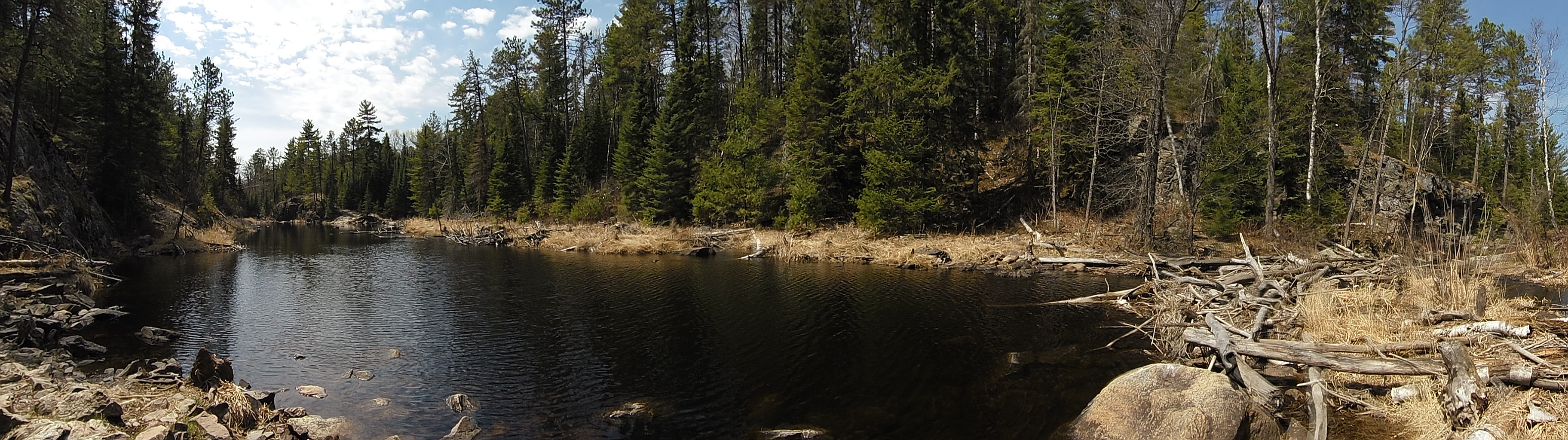
View up the valley from the south end of the fairly long (141 rods) middle portage (May 2, 2015).
Continuation of the paddle along Fourtown Creek from the 141 rod portage north (downstream) to the next 30 rod portage. This next portage will take you to the shore of Fourtown Lake. The next portage after this is back on the east side of the creek (May 2, 2015).
A rocky and hilly portage of 30 rods. This is the last portage you'll face along this creek. The canoe landing on the Fourtown Creek end (south end) is pretty good. The landing at Fourtown Lake (north end of this portage) is quite rocky. Not a terrible landing, sort of just below average if you will (May 2, 2015).
A look back up Fourtown Creek (towards the south) from the start of the northern most of the three portages along the creek. The other end of this portage is at Fourtown Lake (May 2, 2025).
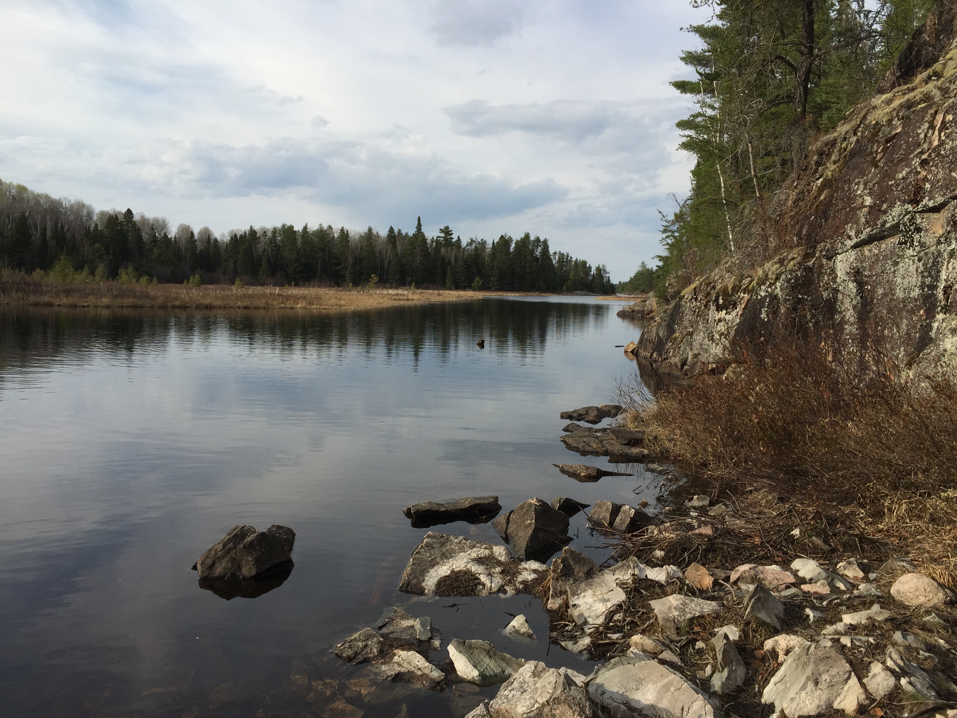
A look at Fourtown Lake after completing the three portages from Mudro Lake, along (Fourtown Creek). The view is to the north (May 2, 2015).
Traveling (Fourtown Creek) (upstream)
Click on the photos below to see the full resolution image - Use your browsers back button to close photo and return to this page.
Missing the section from Fourtown Lake to the downstream landing of the middle 141-rod portage along this route. Everything upstream from there all the way to Mudro Lake is shown below.
This is the 141-rod portage heading upstream in the direction of Mudro Lake. This is the middle of the three portages (and the longest) between Fourtown Lake and Mudro Lake along (Fourtown Creek) (June 22, 2025).
Paddling (Fourtown Creek) upstream from the 141-rod middle portage to the north end of the Mudro Lake portage (June 22, 2025).
Following the 30-rod portage from (Fourtown Creek) to the Mudro Lake landing (June 22, 2025).
Route Connections for (Fourtown Creek)
There are four portages along (Fourtown Creek) (three of which are shown on maps). The southern most portage, which is 30 rods long, is to Mudro Lake. The middle of the three portage, which is by far the longest at 141 rods, goes between two sections of (Fourtown Creek), bypassing an impassable area of rapids. The northern most portage takes you to the shore of Fourtown Lake. Also at the south end of the 141 rod portage (the middle portage) on the east side of the creek, is another unmarked portage that leads to Alruss Lake. This portage is unmaintained, but is used often enough to be easy to follow. The portage is rather steep. Another lake in the area is Louis Lake (once known as Jacob Lake), which is along the west side of (Fourtown Creek) requires a 50 rod steep climb along an unmaintained portage with an elevation gain of about 100 feet.