Gaskin Lake
Gunflint Ranger District
GASKIN LAKE CAMPSITES:
Campsite 1 (#627): On the island just south of the Jump Lake portage
Campsite 2 (#628): Second campsite east of the Winchell Lake portage along south shoreline
Campsite 3 (#629): First campsite east of the Winchell Lake portage along south shoreline
Campsite 4 (#630): First campsite west of the Jump Lake portage along north shoreline
Campsite 5 (#631): Second campsite west of the Jump Lake portage along north shoreline
Campsite 6 (#632): First campsite west of the Winchell Lake portage along south shoreline
Campsite 7 (#633): Second campsite east of the Henson Lake portage along north shoreline
Campsite 8 (#634): Located on the wide point about midway between the Henson Lake portage and the Winchell Lake portage
Campsite 9 (#635): First campsite to the east of the Henson Lake portage along the north shoreline
Campsite 10 (#636): Located southeast of the Henson Lake portage on the long point
A number of canoe routes intersect at Gaskin Lake with four portages into the lake, so the area can be relatively busy even though it is rather remote.
One of the oldest stands of white pine in the Boundary Waters lies along a thin stretch of land between Gaskin Lake and Winchell Lake just northwest of the portage to Winchell Lake. This stand of trees dates back to the early 1600's (about 400 years). Many have fallen down recently because of windstorms. Girth measurements of these trees is over 40 inches for some. Large cedars are also present in this area with some over 330 years old. Ancient white spruce and paper birch are also present in this area (Heinselman).
Logging was conducted in the forests around Gaskin Lake between 1954 and 1972. This was part of the Finn Lake Sale to Consolidated Paper Company of Wisconsin.
A logging road used to run along the west end of Gaskin Lake. This old road intersects the portage to Henson Lake. It was in use up until around 1972.
Water enters Gaskin Lake from a number of sources. A small creek flows into the western tip of the lake from the Otto Lakes. Another creek flows into the southernmost tip of the lake from Winchell Lake. And the stream from Icicle Lake flows into the southeastern bay of the lake. Gaskin Lake drains to the north into Jump Lake. The portage between Jump Lake and Gaskin Lake follows this creek.
Exploring Gaskin Lake
Click on the photos below to see the full resolution image - Use your browsers back button to close photo and return to this page.
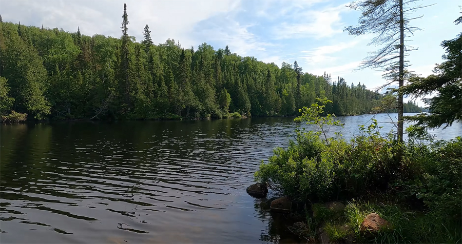
View of Gaskin Lake from the Horseshoe Lake portage landing.
Route Connections for Gaskin Lake
From Gaskin Lake, you can portage to Henson Lake, Horseshoe Lake, Jump Lake and Winchell Lake. You can also do a short bushwhack into Larsen Lake.
Return to Top of Page
|


