River Elevation: Headwaters in a bog near the town of Isabella, Minnesota. This is about one-half mile due west of Jouppi Lake at an elevation of about 1980 feet. Mouth at the Isabella River at about 1505 feet. Drop of 475 feet over 32 miles.
Water Clarity: N/A
ROUTES/PORTAGES FROM THE LITTLE ISABELLA RIVER:
To BWCA Entry Point 75: Walk the 33 rod portage
To Isabella River: Paddle In
Little Isabella River
Kawishiwi Ranger District
The river has its headwaters in a bog just southeast of the actual town of Isabella. The river flows through a number of lakes as it winds its way north to its confluence with the Isabella River in the BWCA. Lakes along its course include Flat Horn Lake, Grouse Lake and Dragon Lake. The entire river is about 32 miles in length. From BWCA Entry Point 75, it is about 3.5 miles downstream to the Isabella River.
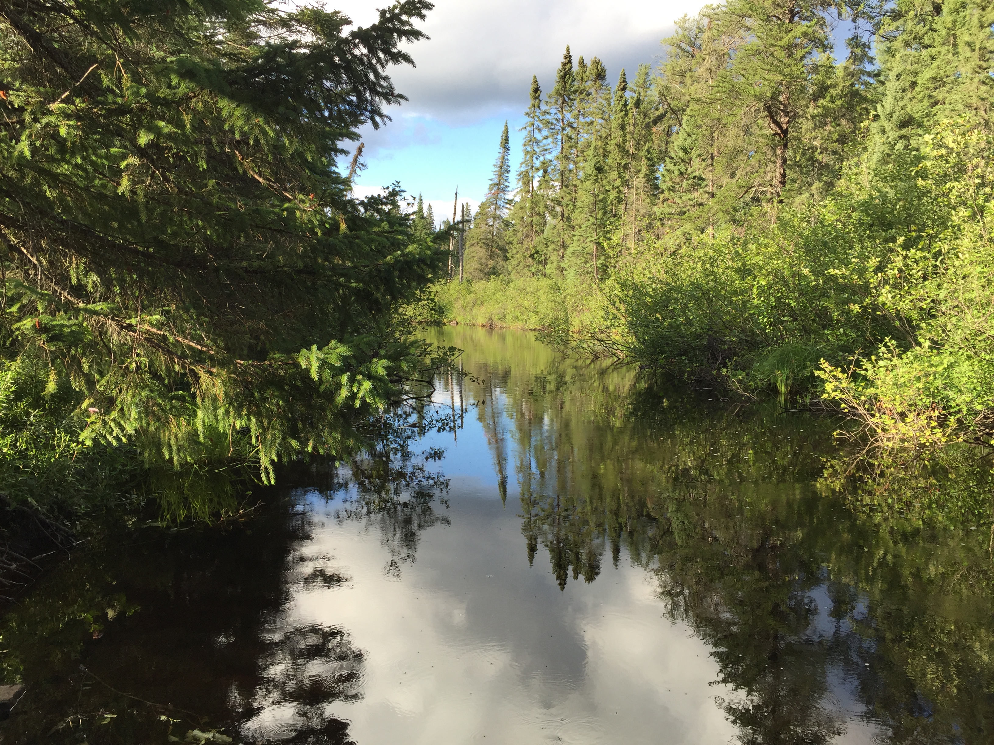
The Little Isabella River has dark water from the many bogs it flows through. There are three short portages between the entry point portage and the mouth of the river. The river has many twists and turns between the entry point and the Isabella River. Expect to encounter a beaver dam or two or three along this stretch.
Logging was conducted around 1945 in this area by the Tomahawk Timber Company.
References:
Beymer, Robert, Boundary Waters Canoe Area – Volume 1 – Western Region (Berkeley: Wilderness Press, 2006), 228, 230, 232, 238.
Pauly, Daniel, Exploring the Boundary Waters (Minneapolis: University of Minnesota Press, 2005), 211-215.
Paddling the Little Isabella River (downstream)
Click on the photos below to see the full resolution image - Use your browsers back button to close photo and return to this page.
You start here at the entry point landing and paddle generally north downstream. It is over three miles to the Isabella River.
Watching the Little Isabella River flow by from the entry point portage landing.
Route Connections for Little Isabella River
From the Little Isabella River, you can paddle into the Isabella River. You can also leave the BWCA by portaging to BWCA Entry Point 75.