Creek Length: From its source at a small pond/marsh near the Magnetic Rock Trail, Larch Creek flows about 4.8 miles to its mouth at Clove Lake.
Campsites: 0
Wildlife Seen on Visit: None
Last Visited: September 2, 2024; Previous Visit(s): September 4, 2022
Creek Elevation: Headwaters about 2.25 miles south along the east side of the Gunflint Trail near the Magnetic Rock hiking trail at an elevation of approximately 1,640 feet. Mouth at Clove Lake at an elevation of 1,460. Total creek length about 4.8 miles. Creek drops about 37 feet per mile.
Larch Creek could be named for a coniferous tree (pine). Larch trees are harvested for timber and turpentine. It also could take its name from the larch sawfly, which is native to tamarack bogs in the BWCA.
Water levels are almost never an issue along Larch Creek. It's is almost always navigable from the entry point landing down to Larch Lake. The creek can be quite narrow in spots. Larch Creek can also take on a pea green-like color late in the summer if the water levels in the creek are low. You should expect to do many beaver dam liftovers along the route down to Larch Lake. It's about 1.5 miles from the parking lot to Larch Lake. This route makes for good day trips or short weekend trips. The area that the creek flows through was burned by the 2007 Ham Lake fire. However there are still some good stands of trees along the creek, particularly as you get closer to Larch Lake. Larch Lake still has campsites that offer shade and were missed by the fire.
There are no loop options. All routes are out and back along Larch Creek.
Click on the photos below to see the full resolution image - Use your browsers back button to close photo and return to this page.
PADDLING LARCH CREEK IN THE DOWNSTREAM DIRECTION FROM BWCA ENTRY POINT 80 TO LARCH LAKE
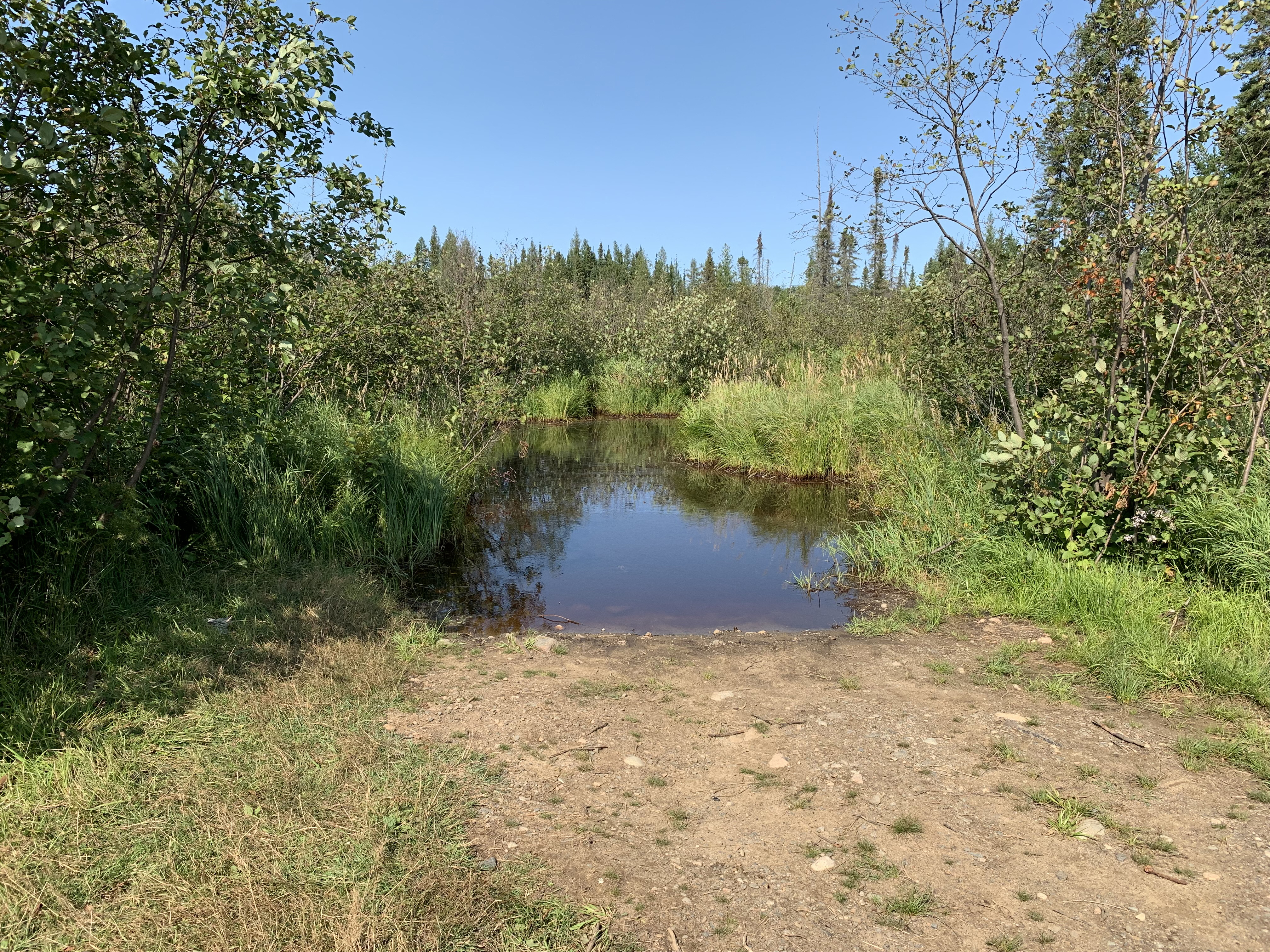
Larch Creek canoe landing that is just down the hill from the small BWCA Entry Point 80 parking lot.
Larch Creek canoe landing at BWCA Entry Point 80.
Counted nine beaver dam liftovers paddling from the Entry Point 80 landing to Larch Lake. The entire journey took a bit less than 45 minutes. There is no noticeable current. The greenish water fades as you get further downstream (September 2, 2024). Paddle Larch Lake -or- Explore Another Route
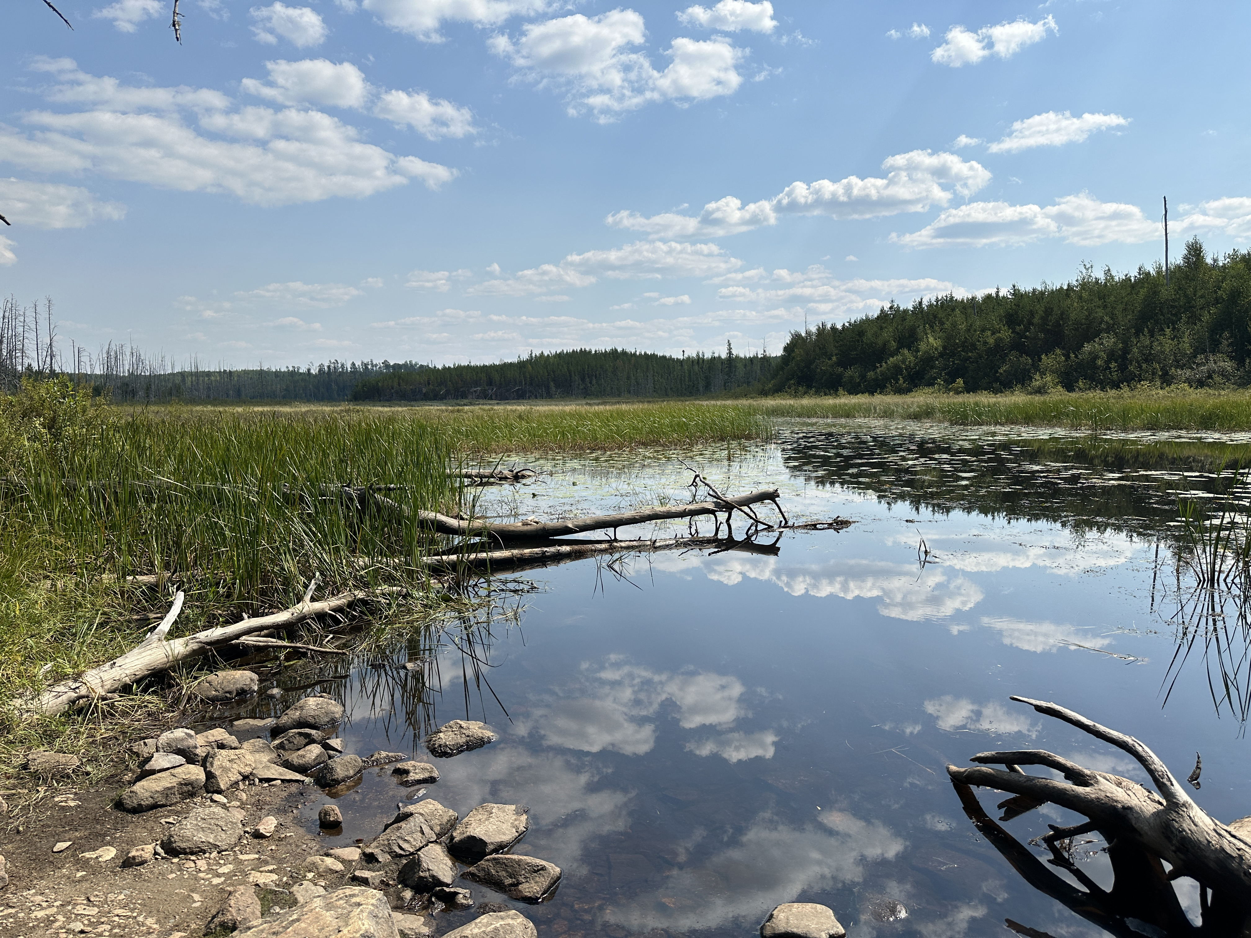
Larch Creek looking downstream in the direction of Clove Lake from the Clove Lake end of the Larch Lake to Clove Lake portage (September 2, 2024). Paddle into Clove Lake -or- Explore Another Route **********************************************END OF ROUTE***********************************************
PADDLING LARCH CREEK IN THE UPSTREAM DIRECTION FROM LARCH LAKE TO BWCA ENTRY POINT 80
There were nine beaver dams to push your canoe over on this trip. Never saw any of the beavers that built them. The water is very low. The green coloring in the water, that gets more noticeable as you paddle upstream, is caused by algae blooms due to stagnant water.
Larch Creek canoe landing that is just down the hill from the small BWCA Entry Point 80 parking lot. In the middle of the view is the culvert through which Larch Creek passes under the Gunflint Trail (County Road 12). Explore BWCA Entry Point 80 -or- Explore Another Route **********************************************END OF ROUTE***********************************************