Extortion Creek
» Display Extortion Creek Map
» Display scrollable USGS Topo Map of Extortion Creek
» Show Simple Extortion Creek Map
Nearest Entry Point: Cross Bay Lake #50 Fishing: Unknown, but probably northern pike
Maps: Fisher F-12; McKenzie #7 Creek Depth: Unknown
Fire History: Dawkins Creek Fire ???
Creek Length: From its source at Extortion Lake to its mouth at Cross Bay Lake, the creek is about 2 miles long.
Campsites: 0 Wildlife Seen on Visit: None
Last Visited: June 16, 2019 Creek Elevation: Headwaters at Extortion Lake at 1803 feet. Mouth at Cross Bay Lake at 1708 feet. Average of 47 feet per mile of elevation loss.
Water Clarity: N/A

ROUTES/PORTAGES FROM EXTORTION CREEK:
To Cross Bay Lake: Paddle In
To Extortion Lake: Virtually impassable bushwhack

Extortion Creek

Gunflint Ranger District

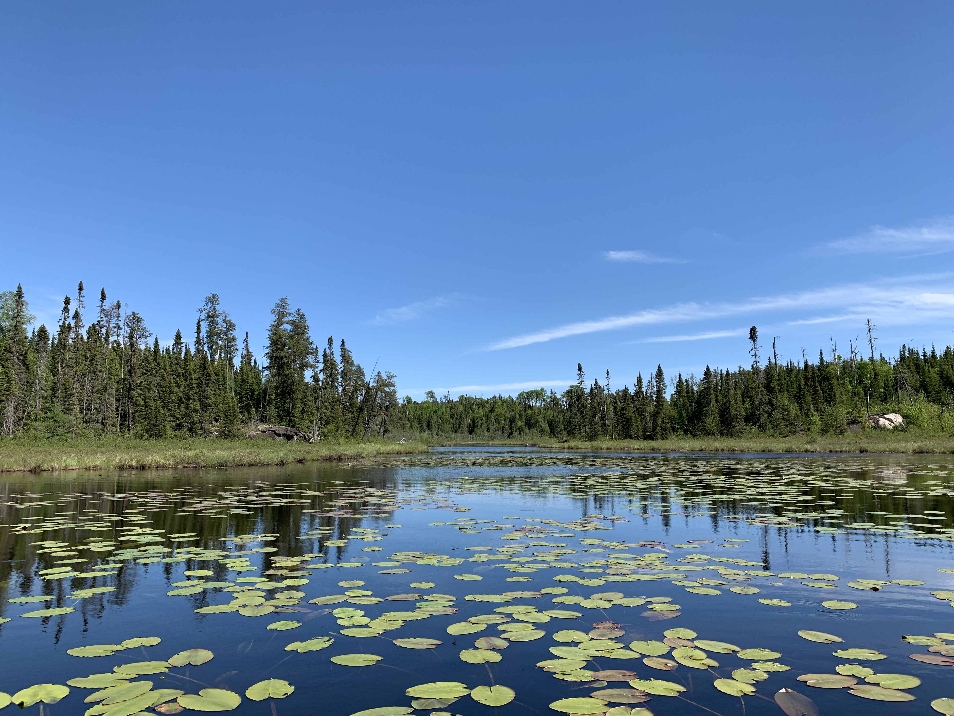
This scenic creek begins at Extortion Lake and flows about 2 miles before reaching its mouth at Cross Bay Lake. The creek can be paddled easily up to the first natural barrier. Further travel upstream would be very difficult.

A fairly recent fire left scars on the south bank of Extortion Creek close to where it flows into Cross Bay Lake. Haven't found any good references as to the cause of this fire. It is not part of the Ham Lake fire that occurred just northwest of here.

Extortion Creek is named for Extortion Lake of course. Extortion Lake is mentioned in the book Cabin Lessons: A Nail-by-Nail Tale by Spike Carlsen in Chapter 1. Mentions someone used to own 40 acres along the lake. No information on whether they were extortionists...

Extortion Lake (which is located just outside of the BWCA) is managed by the Minnesota DNR as a trout lake and is stocked with rainbow trout. Access to the lake is from the Gunflint Trail.

Traveling Extortion Creek

Routes to locations on Extortion Creek are shown below:
Paddling Extortion Creek downstream from the first natural barrier to Cross Bay Lake

Click on the photos below to see the full resolution image - Use your browsers back button to close photo and return to this page.

PADDLING EXTORTION CREEK DOWNSTREAM FROM THE FIRST NATURAL BARRIER TO CROSS BAY LAKE

Extortion Creek 1
Looking upstream at Extortion Creek from its mouth at Cross Bay Lake.


A quick paddle from the end of navigable water on Extortion Creek back downstream to its mouth at Cross Bay Lake.


Extortion Creek 2
This rock outcrop is about 1,100 feet upstream from the creeks mouth at Cross Bay Lake.


Extortion Creek 3
It's about a quarter-mile (80 rods) from Cross Bay Lake to this blockage. Travel upstream from this point would consist mostly of bushwhacking.

Route Connections for Extortion Creek

From Extortion Creek, you can paddle into Cross Bay Lake.

Return to Top of Page


PMA #1: Weeny PMA #4: Tick PMA #7: Pitfall PMA #10: Hairy
PMA #2: Canthook PMA #5: Spider PMA #8: Mugwump PMA #11: Weasel
PMA #3: Sundial PMA #6: Drag PMA #9: Humpback PMA #12: Fungus
- www.BWCAwild.com - All Rights Reserved.
All images, videos and text property of www.BWCAwild.com - No reuse without permission.
DISCLAIMER AND TERMS OF USE --- CONTACT US --- PRIVACY POLICY