TRAIL CONNECTIONS AND TRAILHEADS:
To Little Mayhew Lake: Walk the 160 rod portage (this portage may also offer access to Mayhew Lake, but haven't verified this yet)
Access to: Border Route Trail
Crab Lake Trail
Click on the photos below to see the full resolution image - Use your browsers back button to close photo and return to this page.
Gunflint Ranger District
To reach the Crab Lake Trail trailhead from Grand Marais, drive about 38-miles up the Gunflint Trail (Cook County Highway 12) to North Loon Lake Road. Take a right. Follow North Look Lake Road, a gravel road, for about 4,400 feet to the trailhead. This road has lots of twists and turns and a posted speed limit in some places of 10 mph.
The Crab Lake Trail is most easily described if you divide it into three section: Main Trail, Crab Lake Cut-Off and Crab Lake Spur.
Main Trail
The main trail starting at the trailhead on North Loon Lake Road is 1.72-miles in length and ends at a 'Y' junction near the very eastern end of Crab Lake. The main trail section starts about 125 feet up the road from the trailhead and then leaves the road to the right. It passes through a forest that was burned by the Ham Lake Fire in 2007. There are still some mature trees remaining in this area. After about 4,400 feet, the trail reaches the shore of Crab Lake. The trail now closely follows the lake until it reaches the 'Y' junction. This part of the trail is very flat and wide as it follows an old road. The trail can be a little wet in spots, especially in the spring.
Crab Lake Cut-Off
Once you reach the 'Y' junction, you can decide to go either left or right. Before you make your decision, note that you are entering the BWCA here (there is a sign). You must have a BWCA permit to be legal past the 'Y' junction. Going to the right will have you following the Crab Lake Spur trail (see below). If you head to the left at the 'Y' junction, you will be following the Crab Lake Cut-Off. The Crab Lake Cut-Off is the most direct route for reaching the Border Route Trail. It is also the shortest route if you are hiking to Bridal Falls (probably the main reason most folks hike this trail). The Crab Lake Cut-Off is about 0.65-miles long. At the north end it meets the Border Route Trail. The Crab Lake Cut-Off is a single-track hiking trail and is more difficult to walk than the main Crab Lake Trail. This part of the trail passes through forest heavily impacted by the 2007 Ham Lake Fire. To reach Bridal Falls, follow the Border Route Trail about 1-mile to the west. At that point, there is a spur trail (marked by a sign) that descends somewhat steeply to the base of the waterfall. It's worth the hike.
Crab Lake Spur
This trail connects up to the Border Route Trail about 0.9-miles to the east of the 'Y' junction. Go this direction to reach destinations such as Topper Lake, Sock Lake, Mucker Lake or South Lake. Much of this section of the trail was burned by the Ham Lake Fire too. This is a single-track hiking trail and more difficult to walk than the main part of the Crab Lake Trail.
Hiking the Crab Lake Trail (Loon Lake RoadTrailhead to the Border Route Trail via the Crab Lake Cut-Off)
Click on the photos below to see the full resolution image - Use your browsers back button to close photo and return to this page.
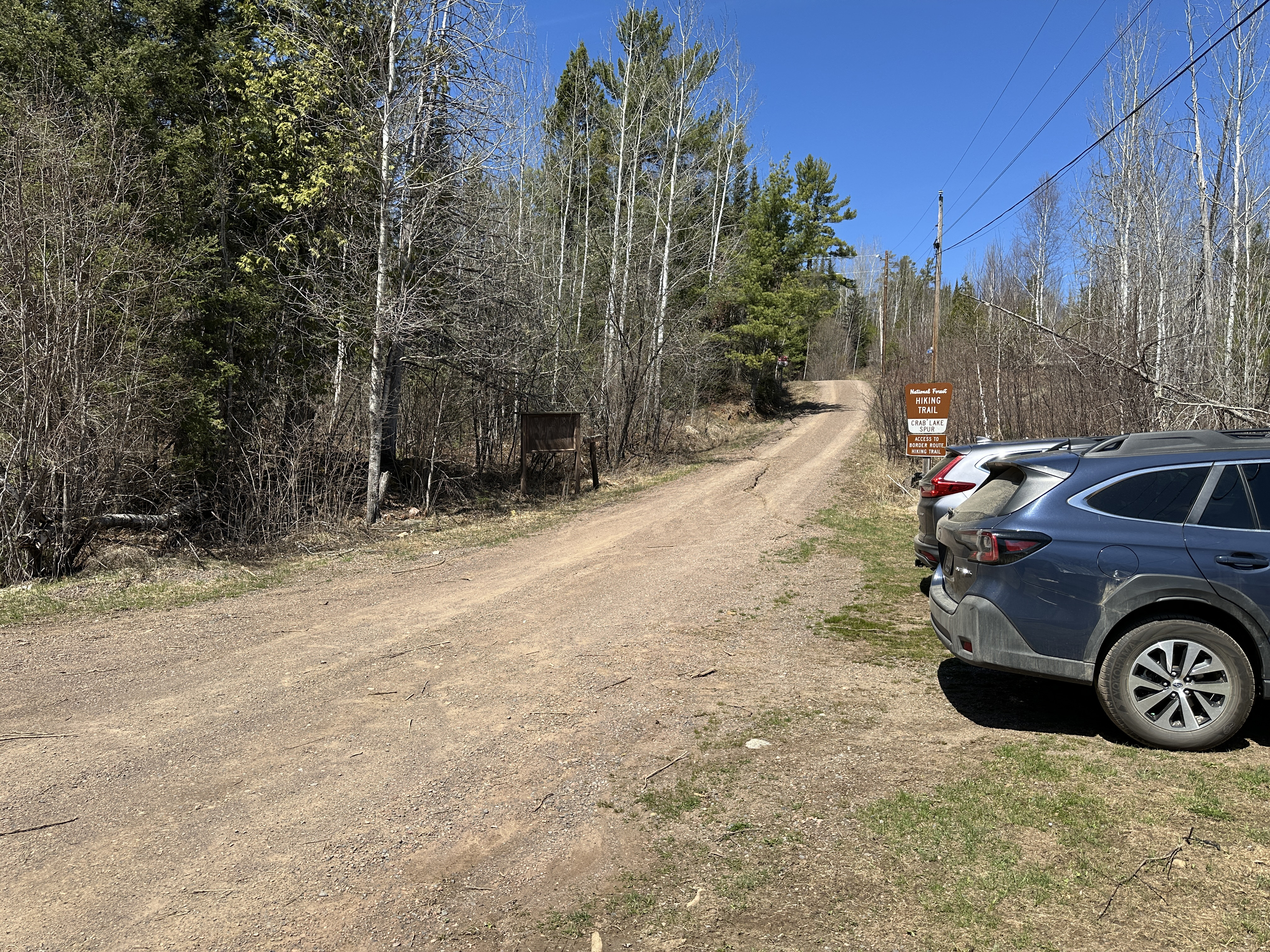
This is the Crab Lake Trail trailhead and parking lot. Follow the road about 125 feet past the sign to the start of the trail, which heads off to the right.
This video shows a virtual hike of the Crab Lake Trail up to the Crab Lake Cut-Off spur trail, and then the entire Crab Lake Cut-Off until it ends at the junction with the Border Route Trail in the Boundary Waters Canoe Area (BWCA). The Crab Lake Trail is mostly used as an access/spur trail of the Border Route Trail (BRT). At 1.72-miles from the trailhead, the Crab Lake Trail splits at a 'Y' intersection. This hike follows the western fork of the split (known as the Crab Lake Cut-Off) up to the BRT. The entire hike shown in this video is about 2.4-miles in length.
Various points of interest along the hike are detailed below:
00:00 - Begin hike from the Loon Lake Road parking lot. Trail follows Loon Lake Road for first 125 feet and then turns off to the right along an old jeep trail
00:40 - The Crab Lake Trail is now following an old road. It continues along this road for about 4,400 feet until reaching the south shore of Crab Lake. You are walking through an area that was burned by the 2007 Ham Lake fire
20:45 - View of the western end of Crab Lake. Trail closely hugs the shoreline of Crab Lake for the next 0.8-miles
26:15 - View of Crab Lake near the mid-lake pinch point where the lake is the most narrow
27:55 - Another view of Crab Lake. If you listen closely, you can hear the sound of rushing water. Directly across the lake from here is where the creek that drains Crab Lake has its outlet. This creek flows generally north for about 0.7-miles before tumbling over Bridal Falls. About 0.25-miles below the falls it flows into Gunflint Lake
32:05 - Another view of Crab Lake. This is near mid-lake
40:50 - Didn't verify it, but this is probably the landing for the 160-rod portage between the east end of Crab Lake and the eastern end of Little Mayhew Lake. Beyond this point, the Crab Lake Trail stops following the old road and is now a typical hiking trail
43:45 - Arrive at the Boundary Waters wilderness boundary. The trail becomes somewhat more difficult beyond this point
44:05 - Cross the creek that flows from Whisker Lake, which lies to the east, into the eastern end of Crab Lake
44:30 - Crab Lake Trail splits. If you are planning on visiting Bridal Falls (probably most common reason folks hike this trail), head to the left. Otherwise, either direction will bring you eventually to an intersection with the Border Route Trail. We head to the left for this hike. This new trail spur you are now on is known as the Crab Lake Cut-Off. It's the shortest way to get to the Border Route Trail via the Crab Lake Trail
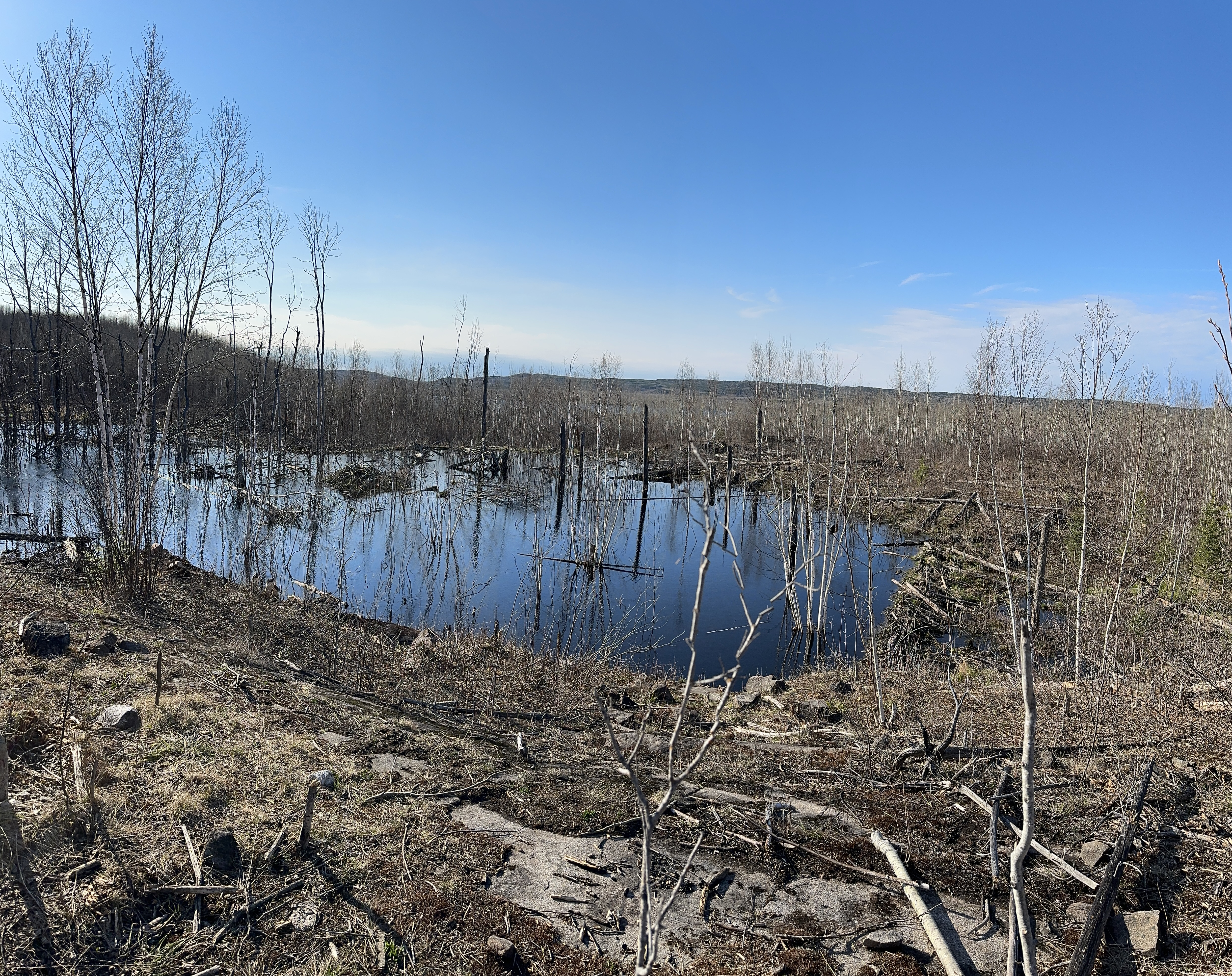
01:05:00 - Beaver pond overlook. A beaver dam and two beaver lodges are visible. Canada is visible in the far distance
01:07:05 - Intersection of the Crab Lake Trail Cut-Off and the Border Route Trail. End of the hike
This image is from the Crab Lake Cut-Off where it skirts around this beaver pond, near where it connects to the Border Route Trail. Beaver dam visible on the right side of the photo. Beaver lodge a bit left of center. The hills in the far distance are actually on the otherside of Gunflint Lake in Canada.
Hiking the Crab Lake Trail (Border Route Trail to the Loon Lake Road Trailhead via the Crab Lake Cut-Off)
This video shows a virtual hike of the entire Crab Lake Trail in the Boundary Waters Canoe Area (BWCA). The trail is a spur trail of the Border Route Trail (BRT). At 1.72-miles from the trailhead, the Crab Lake Trail splits at a 'Y' intersection. This hike follows the western fork of the split (known as the Crab Lake Cut-Off) up to the BRT. The entire hike is about 2.4-miles in length.
00:00 - Begin at the intersection of the Crab Lake Trail Cut-Off and the Border Route Trail.
01:15 - Beaver pond overlook. A beaver dam and two beaver lodges are visible. Canada is visible in the far distance. Much of this area was burned by the Ham Lake Fire in 2007
20:40 - Crab Lake Trail split. Heading left at this intersection will take you east until the Crab Lake Trail eventually rejoins the Border Route Trail. Turning to the right leads generally west back in the direction of Crab Lake and the trailhead on Loon Lake Road
21:00 - Cross the creek that flows from Whisker Lake, which lies to the east, into the eastern end of Crab Lake
21:30 - Arrive at the Boundary Waters wilderness boundary. At this point, the trail starts following an old road bed and is much easier to walk
23:25 - Didn't verify this while here, but this is probably the landing for the 160-rod portage between the east end of Crab Lake and the eastern end of Little Mayhew Lake. View of the eastern end of Crab Lake
32:30 - View of Crab Lake
35:35 - Another view of Crab Lake
37:45 - View of Crab Lake near the mid-lake pinch point where the lake is the narrowest
45:15 - Trail starts heading up a mild incline and peels away from the shoreline of Crab Lake. From here it's about 0.8-miles back to the trailhead. The trail isn't as flat through this section, but still easy going
48:15 - Further ahead you can see a grouse standing on the trail
01:01:15 - Reach North Loon Lake Road. Turn left and follow the road for about 125 feet to the trailhead parking lot. End of hike
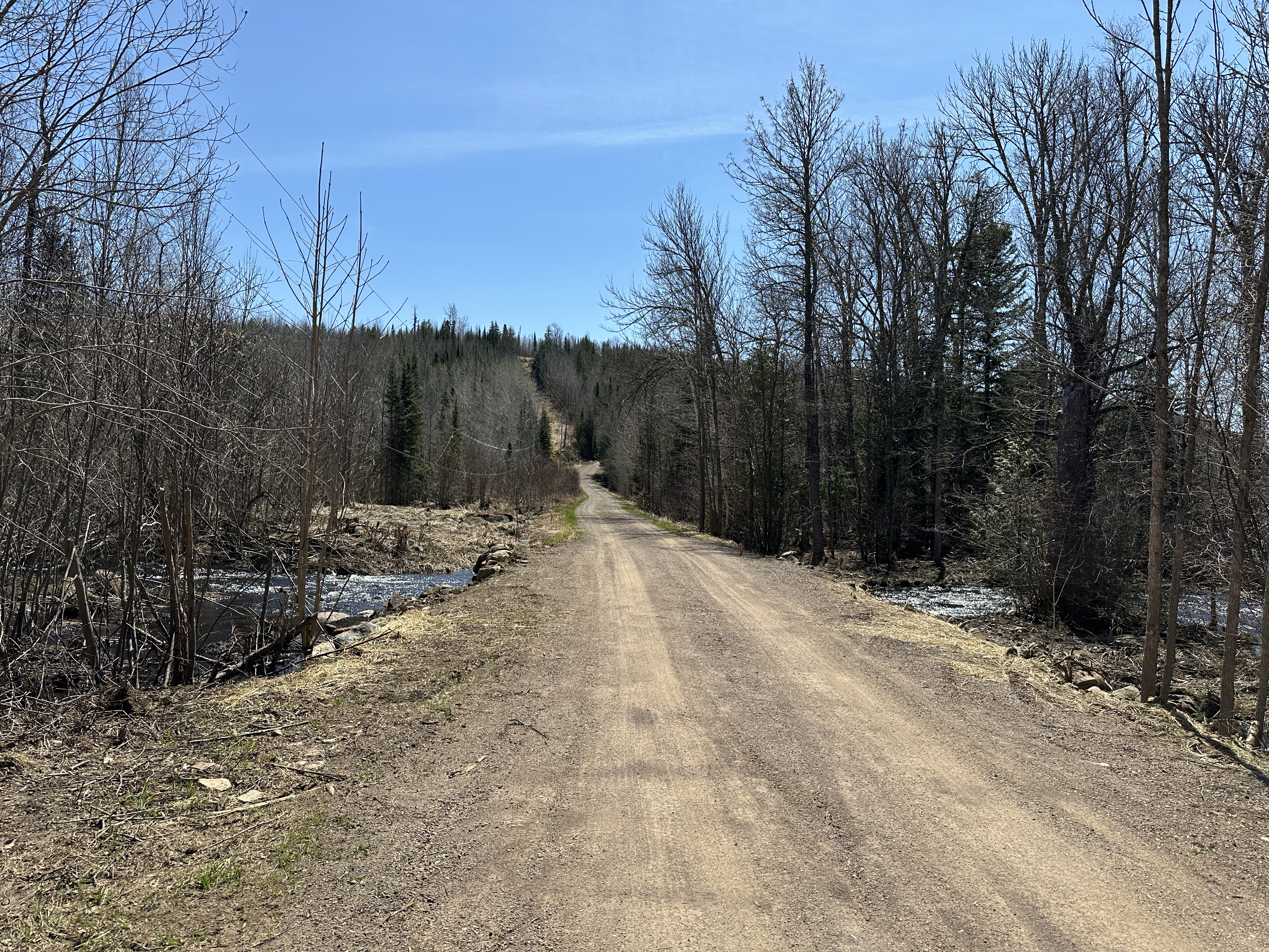
View down North Loon Lake Road from the trailhead.