TRAIL CONNECTIONS AND TRAILHEADS:
Trailhead: On the shore of Clearwater Lake
Clearwater Lake Palisades Trail
Click on the photos below to see the full resolution image - Use your browsers back button to close photo and return to this page.
Gunflint Ranger District
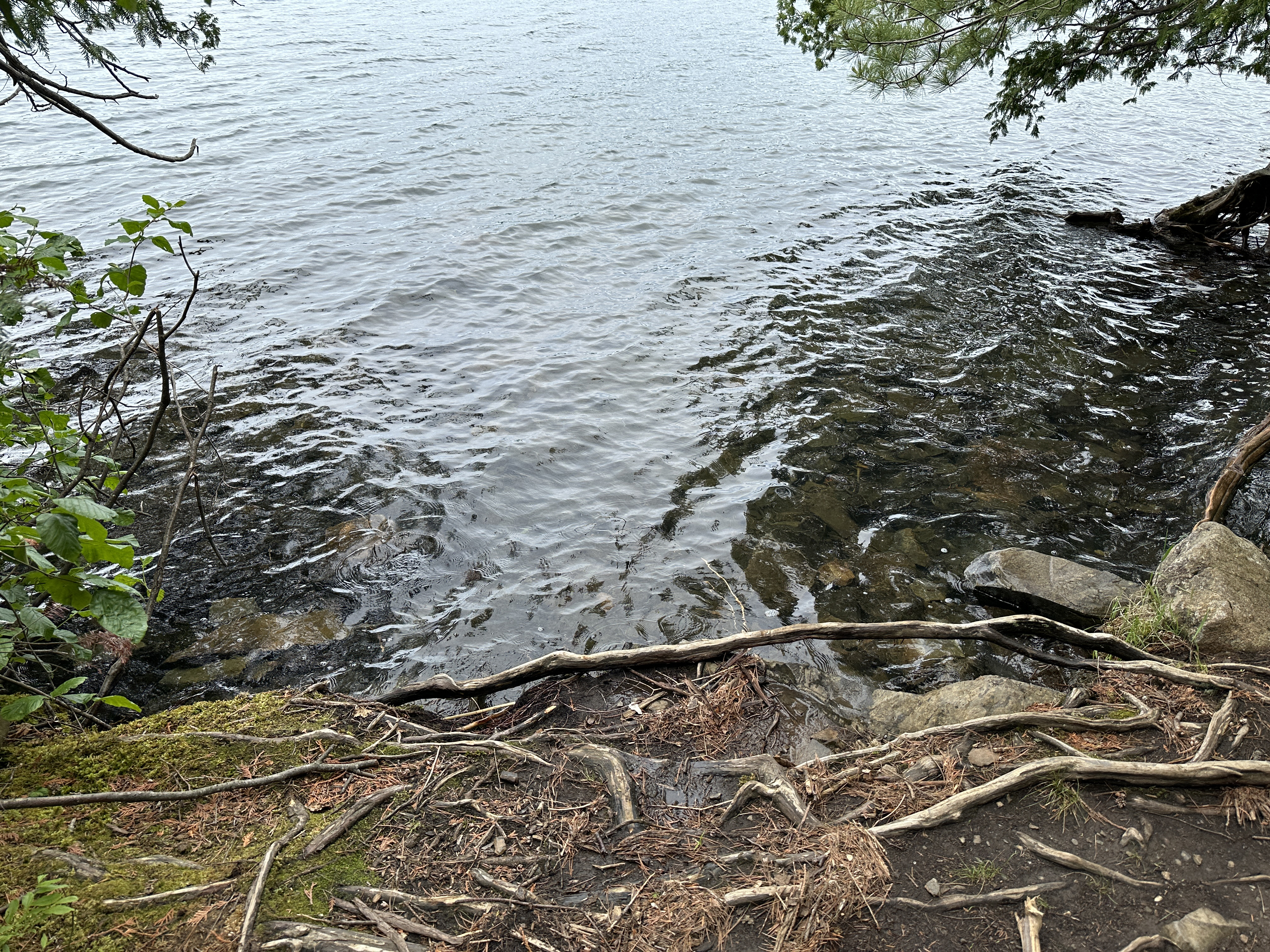
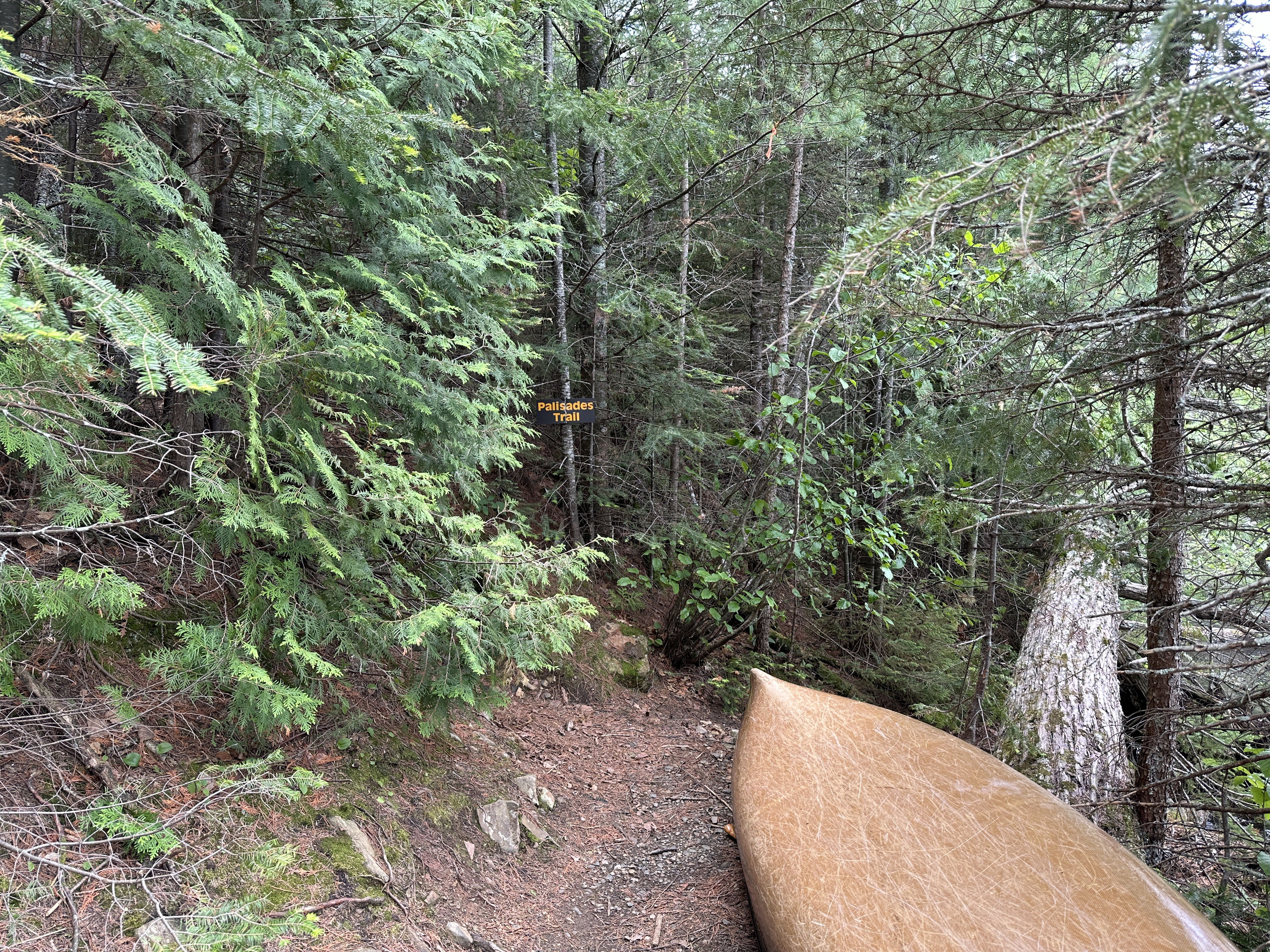
It's about a 15 to 20 minute paddle from the Clearwater Lake landing (BWCA Entry Point #62) to the trailhead landing. The landing for the Clearwater Palisade Trail is to the west of the actual palisade (cliff). It is a little hard to see from the water, but just paddle slowly along the shoreline toward the face of the palisade (headed east) and look for an opening in the trees. There is a sign that is hard to see from the water that says 'Palisades Trail'. The GPS location is: (48.07561, -90.350022)
From the shore, the trail immediately heads steeply up. This is a strenuous hike. You probably gain 150 feet of elevation in the first few minutes of the hike. After that it levels off a bit, but always continues upward. Eventually you'll start to get glimpses of the lake through the trees. You know you're close to the top at that point. The entire hike is 0.53-miles (one-way).
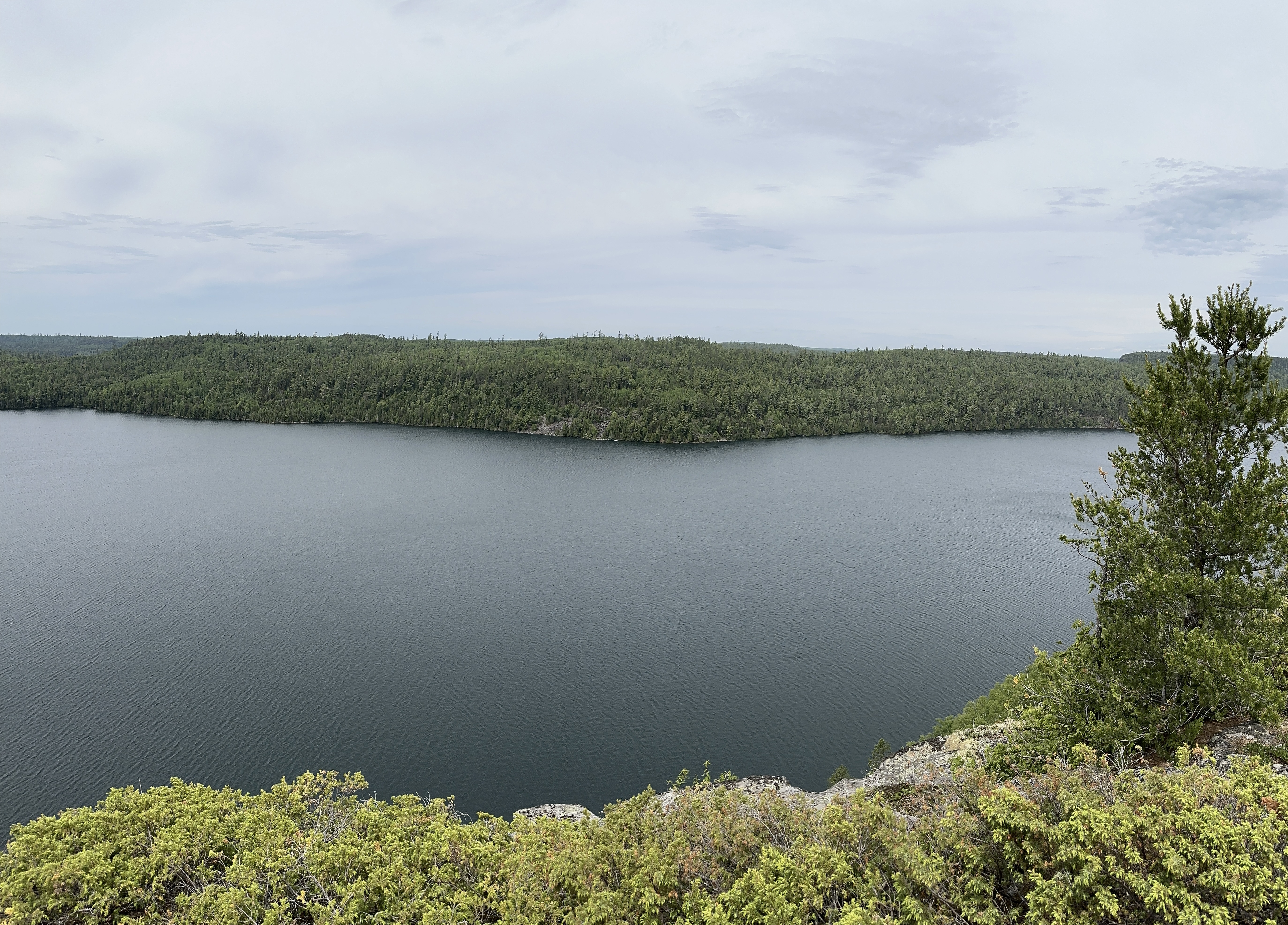
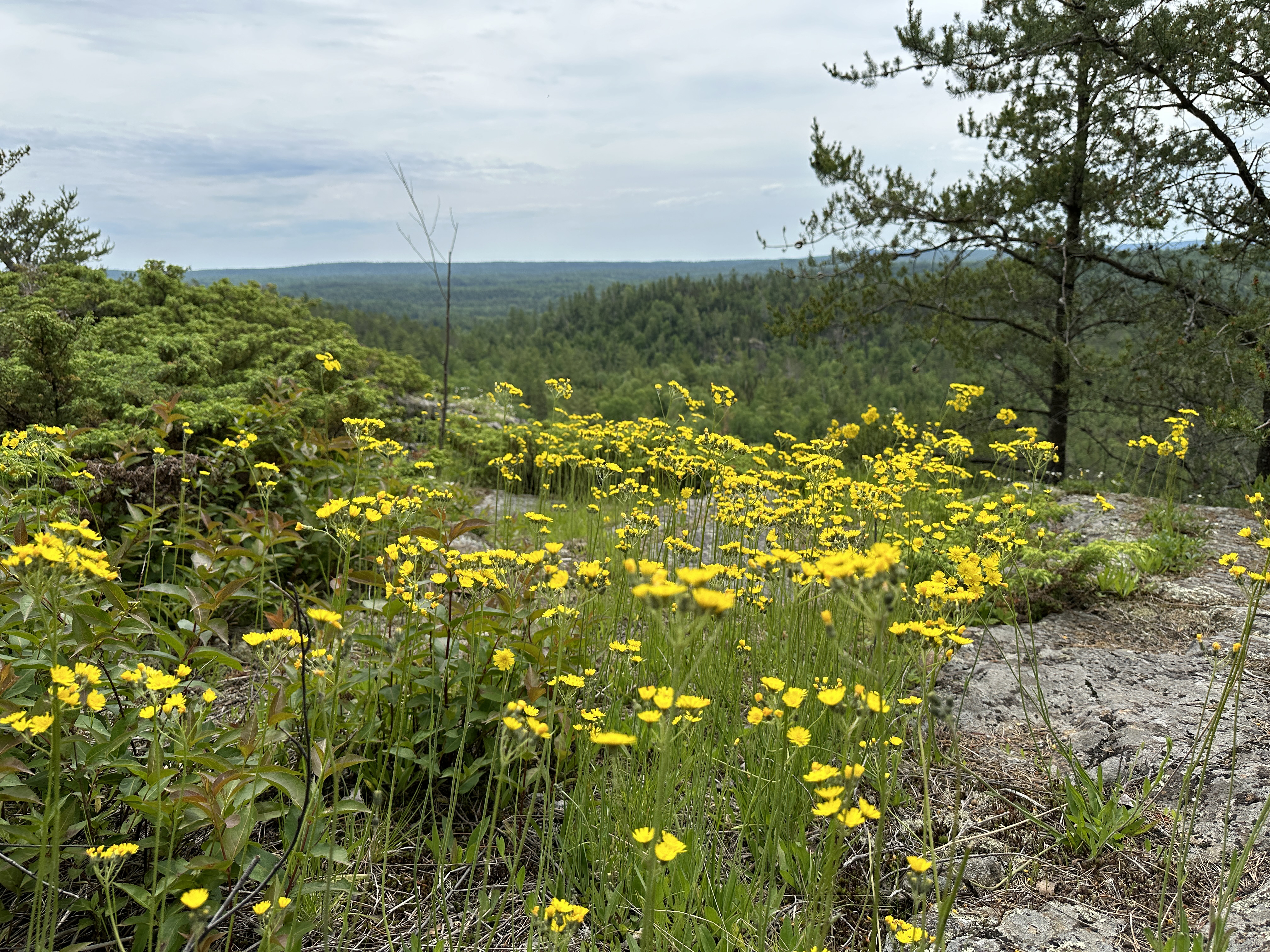
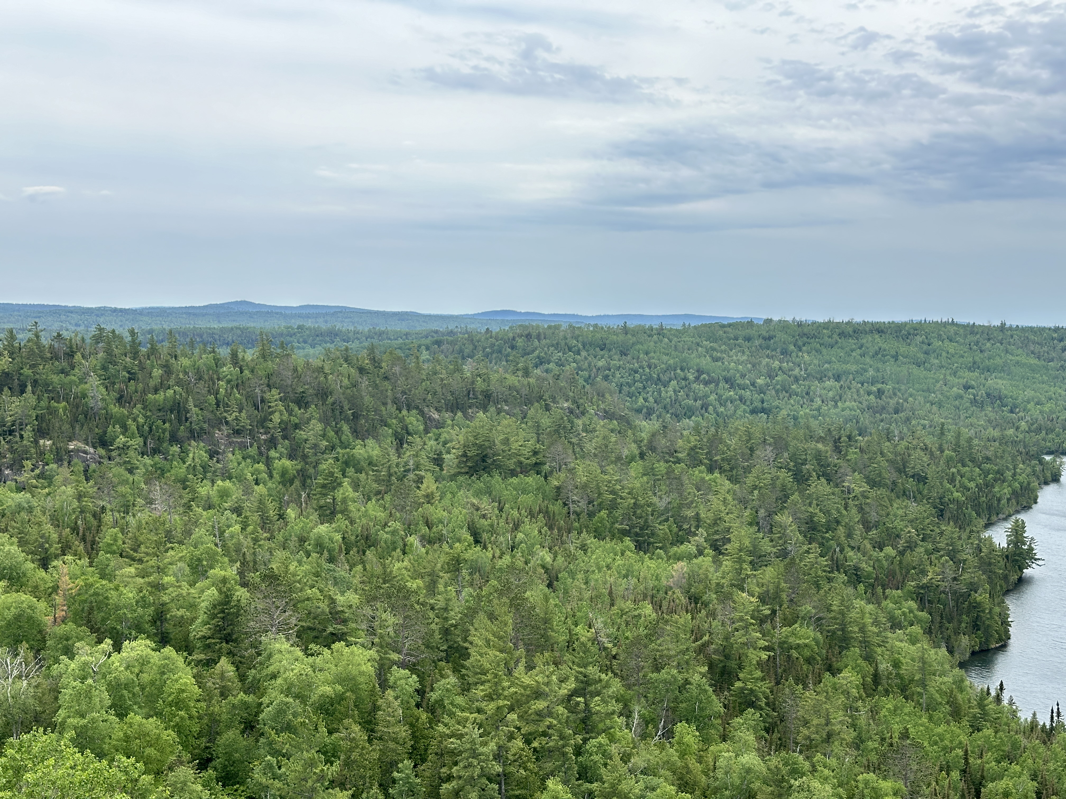
From the apex of the hike you can see most of Clearwater Lake, which is now just a little over 300 feet below. A line of hills is also visible to the west. No other lakes are visible.
Hiking the Clearwater Lake Palisades Trail
Click on the photos below to see the full resolution image - Use your browsers back button to close photo and return to this page.
Clearwater Palisades Trail: The trail is 0.53-miles long (one-way). It gains just over 300 feet in elevation.
The canoe landing at the trailhead.
There is a small clearing at the trailhead with room to store a few canoes. Sign marks the trail starting location.
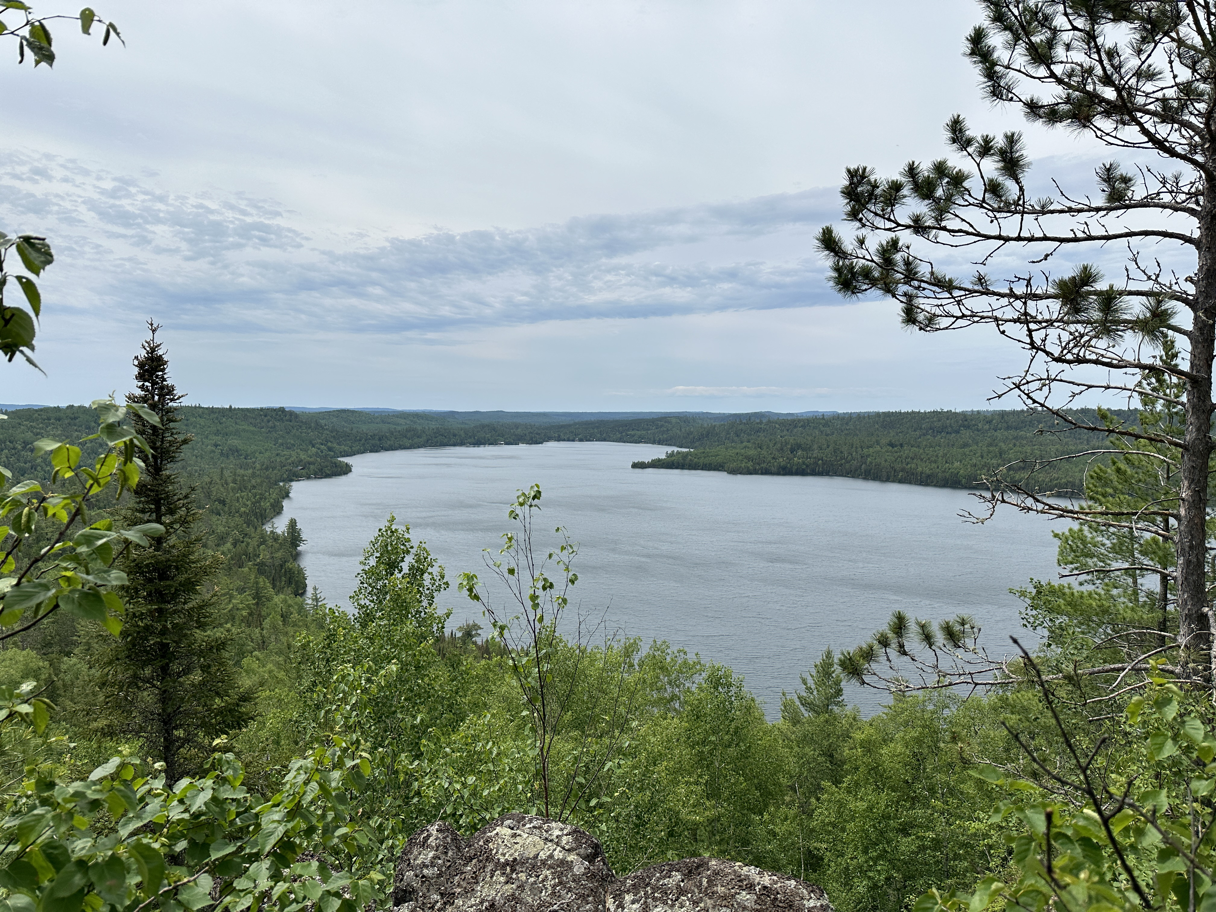
View to the southwest from the top of The Palisades of Clearwater Lake. Over to the far left is where the entry point landing is. Clearwater Historic Lodge is at the back of that bay on the far left.
Looking straight across the lake, more or less to the north. The Border Route Trail runs along some of that ridge line on the opposite shoreline. BWCA Campsite 685 is just right of that scree fall around that point.
This is towards the northeast.
View to the southwest.
Another view to the southwest. Fairly certain that highest hill in the distance is Honeymoon Bluff. It is about 3.5 miles away as the crow flies.
Looking west/southwest. The BWCA Entry Point 62 landing is just around that point in the center of your view. Clearwater Historic Lodge is in the far end of the lake, just left of center. The bay with the portage leading to Caribou Lake and Deer Lake is on the far left edge of the lake, near vertical center of the photo.