Spring Creek
Have not yet visited this Primitive Management Area lake. The information displayed on this page are notes used for planning a future trip to this area. Use the information on this page at your own risk.
Only the very northern end of this creek exists within the Sundial Lake Primitive Management Area. The lower stretches of this creek are navigable. The creek gets more difficult to travel the farther you proceed upstream from its mouth at the Beartrap River.
The upper reaches of Spring Creek is crossed by the Angleworm Lake portage/Angleworm Lake Trail.
The known fires in this region were the 1894 fires (possibly two of them) that are known as the Oriniack/Sioux River/Lac La Croix/Crooked Lake Complex and the Chad/Cummings/Lac La Croix/Crooked Lake Complex. In 1875 the Mule Creek/Sterling Lake/Sunday Lake/Crooked Lake Complex burned much of the area. Eleven years prior to that, in 1864, the Little Indian Sioux River/Lac La Croix/Crooked Lake Complex burned here. The oldest fire known to affect the area occurred in 1822 and is referred to as the Hook Lake/Hegman Lake/Crooked Lake Complex (Heinselman, 1999).
References:
Beymer, Robert, Boundary Waters Canoe Area – Volume 1 – Western Region (Berkeley: Wilderness Press, 2006), 120.
Heinselman, Miron, The Boundary Waters Wilderness Ecosystem (Minneapolis: University of Minnesota Press, 1999).
Traveling Spring Creek
Click on the photos below to see the full resolution image - Use your browsers back button to close photo and return to this page.
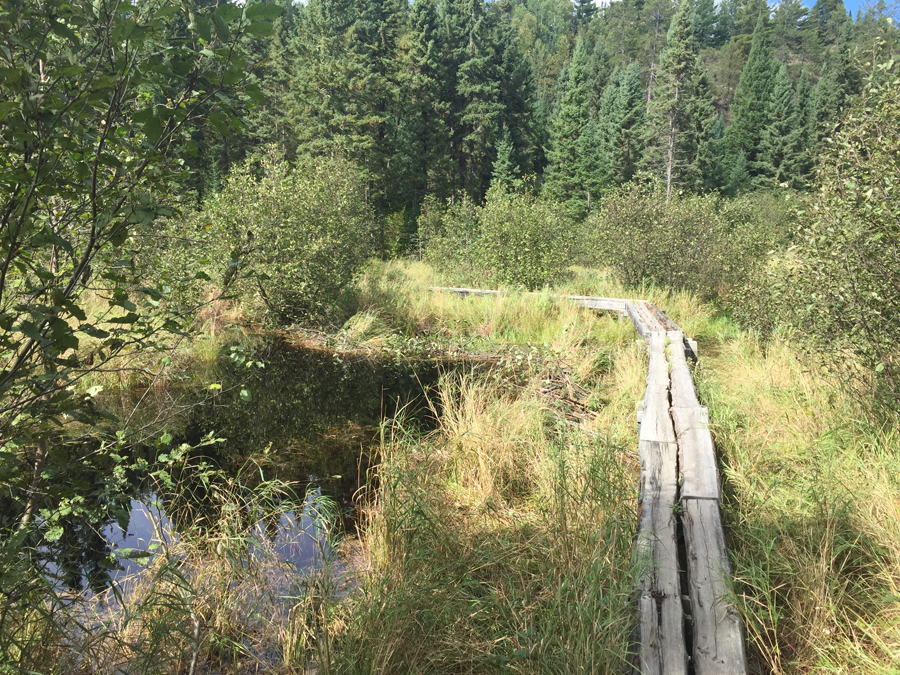
Spring Creek where the Angleworm Lake Trail crosses it on a board walkway.
It is possible to paddle upstream from the Beartrap River for about three miles through some very remote areas, by following Spring Creek. There will be a lot of beaver dams. The stream is otherwise very navigable through this stretch. Continuing upstream past the three mile mark, the creek will become increasingly difficult to travel.
|


