Entry Point 4 - Crab Lake
LaCroix Ranger District
To get to this entry point if coming from Tower, Minnesota along Minnesota Highway 1:
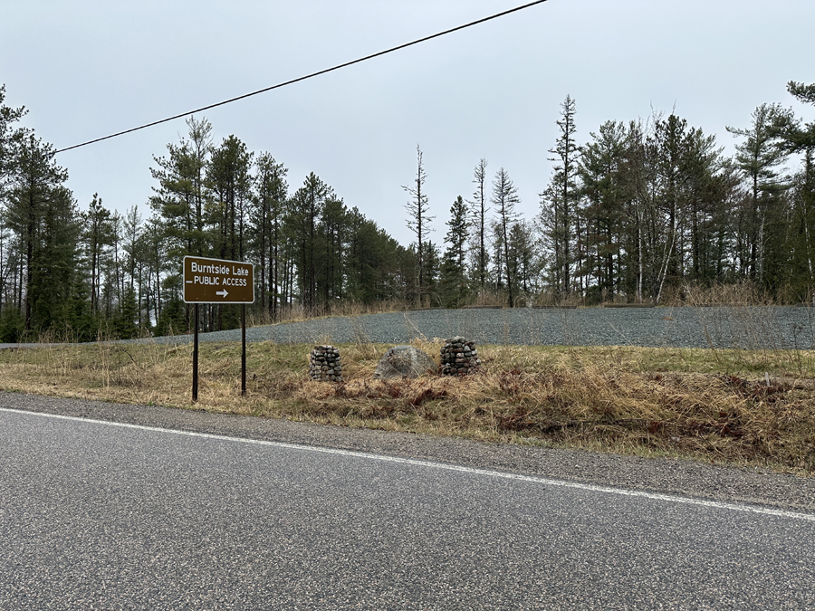
Drive about 18 miles east of Tower, MN along Minnesota Highway 1. In the tiny town of Burntside, take a left onto County Road 88 (Grant McMahan Blvd.). Follow Grant McMahan Road generally north for about 2.3-miles to Van Vac Road. Take another left. Head west on Van Vac Road for about 1.2-miles. Take a right at the sign for the Burntside Lake PUBLIC ACCESS. Drive 700 feet down the access road to the large BWCA Entry Point 4 parking lot. There is an overflow lot up the hill if the lot closest to the lake is full.
To get to this entry point if coming from Ely, Minnesota along Minnesota Highway 1:
Drive about 2.9-miles westbound on Minnesota Highway 1 starting from the west side of Ely, MN. In the little town of Burntside, take a right onto County Road 88 (Grant McMahan Blvd.). Follow Grant McMahan Road generally north for about 2.3-miles to Van Vac Road. Take a left. Head west on Van Vac Road for about 1.2-miles. Take a right at the sign for the Burntside Lake PUBLIC ACCESS. Drive 700 feet down the access road to the large BWCA Entry Point 4 parking lot. There is an overflow lot up the hill if the lot closest to the lake is full of vehicles.
From here, you must paddle about 2.7-miles to the west/northwest across Burntside Lake. This is a big lake so it can be rough on a windy day. You will need to navigate around a number of islands to reach the start of the 360 rod portage (that is just over a mile long) to Crab Lake. The portage can be a little hard to find because of all the winding through islands and the large size of Burntside Lake. It is about one-third mile northwest of Mocassin Island (which is named on most maps). Once at the portage, you should find it to be rather long, but not otherwise terribly difficult (a few rocky areas, a few ups and downs, and a few muddy spots, but standard fare for the BWCA).
Exploring the Entry Point
Click on the photos below to see the full resolution image - Use your browsers back button to close photo and return to this page.
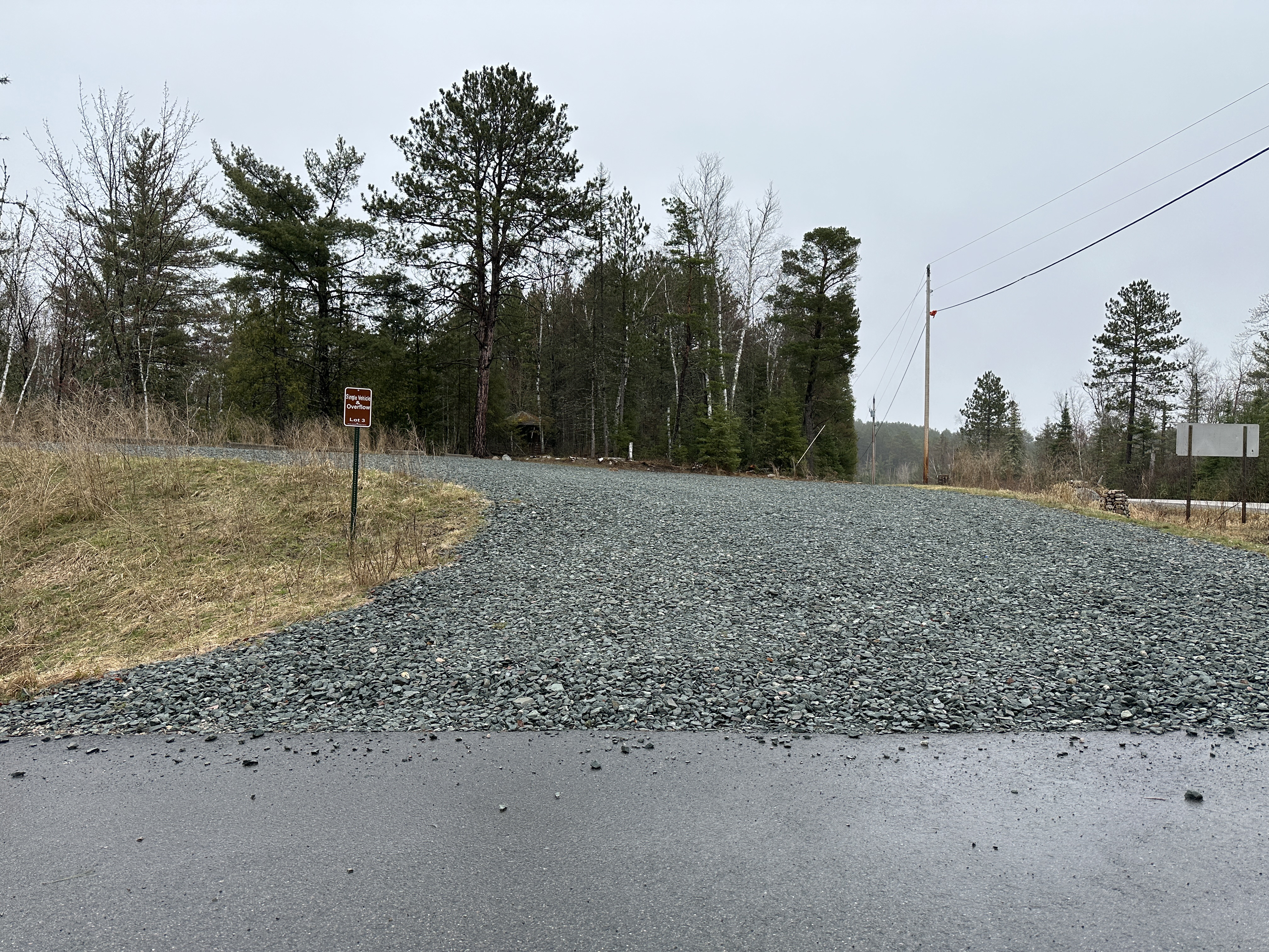
Sign along Van Vac Road indicating the way. You can see the overflow parking lot for this public access to the right of the sign across the ditch (May 1, 2024).
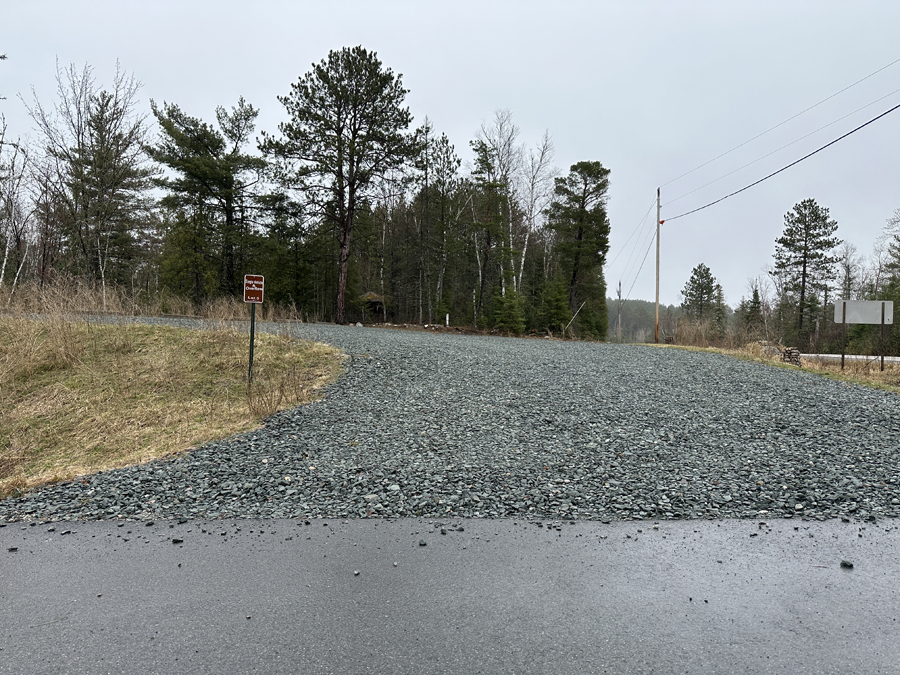
Entrance to the overflow parking area if the main lot down by the lake is full of vehicles (May 1, 2024).
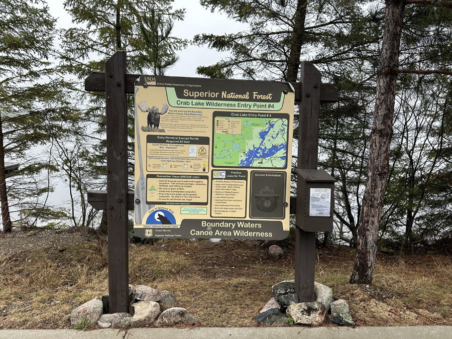
The bulletin board sign, ubiquitous at all BWCA entry points. If you just need a BWCA day permit, they are in the box on the right side of the bulletin board (May 1, 2024).
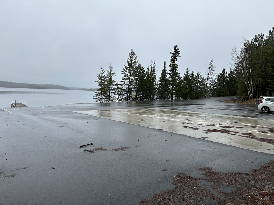
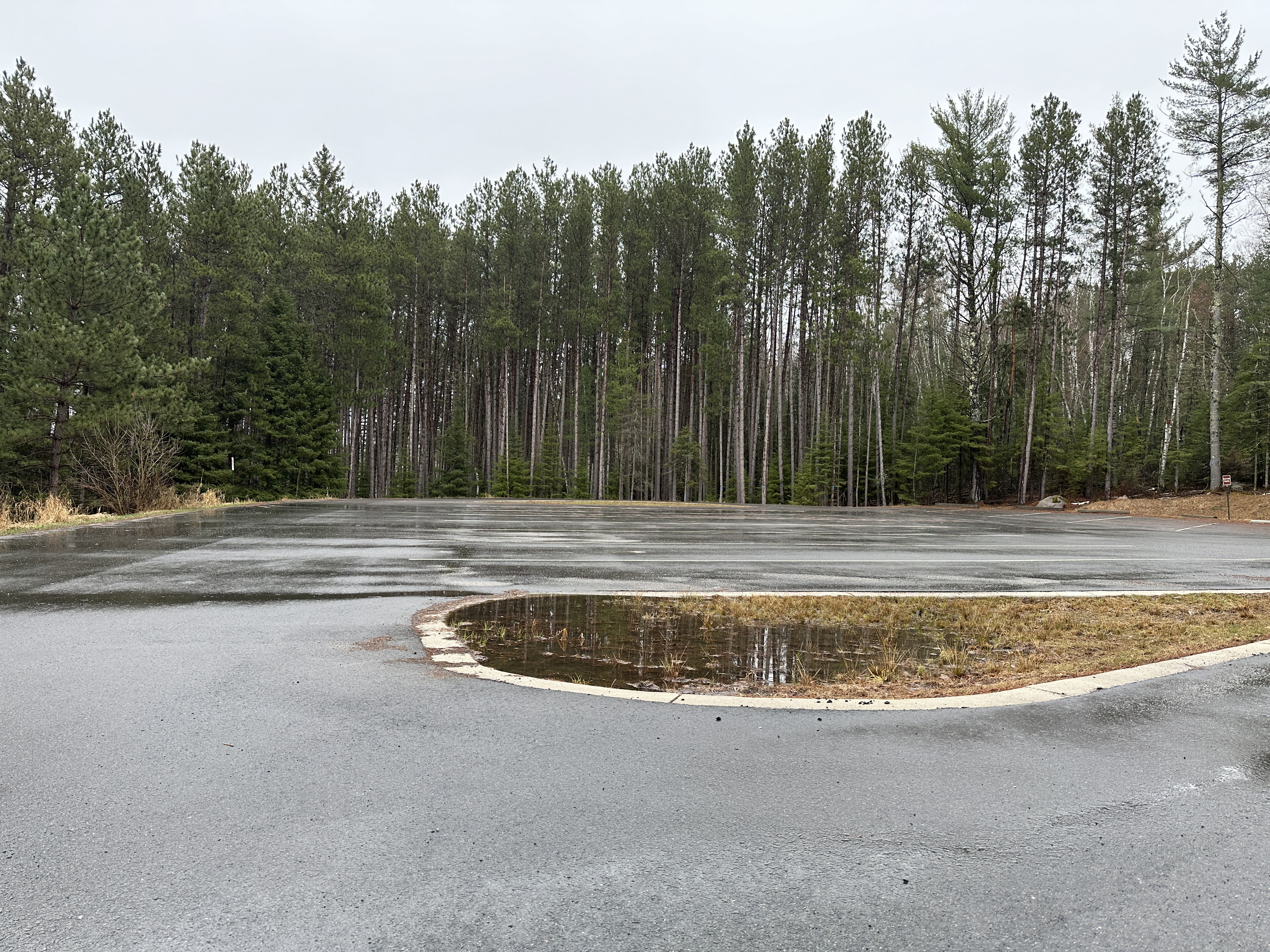
Large parking lot. Don't expect it to be this empty in mid-summer during the height of the canoeing season. There doesn't seem to be a restroom here, unless I missed it.
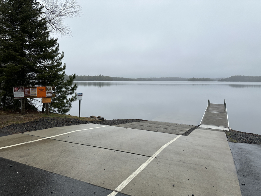
Boat landing (May 1, 2024).
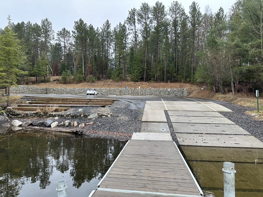
View of the parking lot from the end of the dock (May 1, 2024).

Another view of the parking lot (May 1, 2024).

This is a view to the east from the landing. You will be heading to the west if you are heading into the BWCA via the Crab Lake entry point (May 1, 2024).
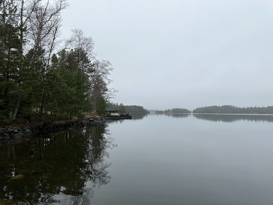
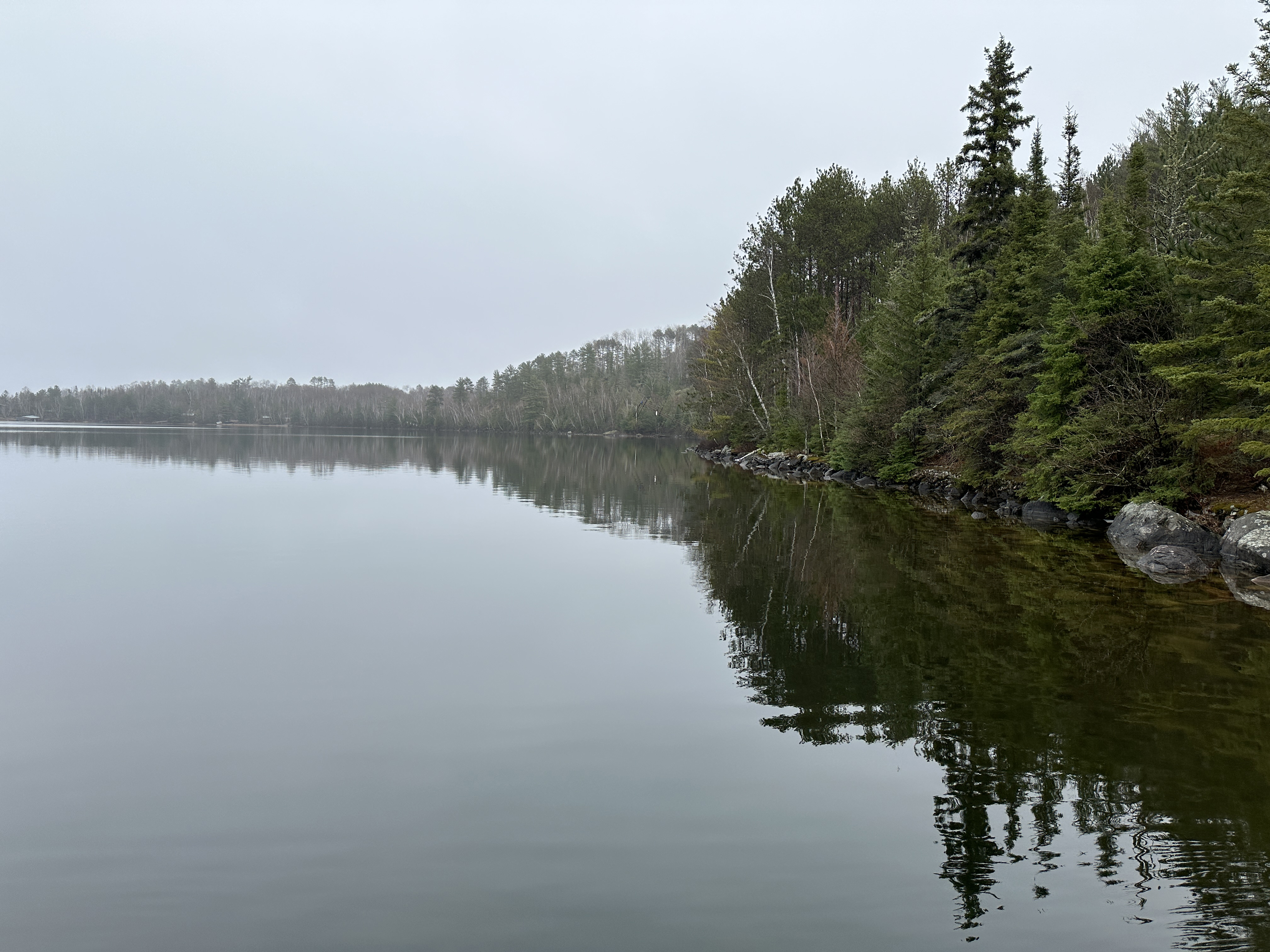
A look to the west. This is the direction you will be going to get to the Crab Lake portage. For a sense of distance, that island just right of the center of your view is about 0.7-miles away. The Crab Lake portage is two miles beyond that in roughly the same direction. On the days of your visit, hope for this lake to be a calm as you see it here (May 1, 2024).
Now that you've reached the shore of the lake, visit: BURNTSIDE LAKE
Return to List of BWCA Entry Points (sorted by Entry Point Name or by Entry Point #)
|