Fort Charlotte
Click on the photos below to see the full resolution image - Use your browsers back button to close photo and return to this page.
Fort Charlotte was built in 1789 on the shore of the Pigeon River at the western end of The Grand Portage. It's named after the queen of King George III of England. Here is a painting of Fort Charlotte and what it may have looked like at the height of the fur trade era.
Northwester's brought furs from the interior lakes to Fort Charlotte. These furs were brought through the wilderness using canoes of about 25 feet in length. From Fort Charlotte the furs were carried across The Grand Portage to Fort George on Lake Superior. This is a haul of 8.5 miles. Once the furs arrived at Fort George, they were further processed and packaged for transport eastward across the Great Lakes. The Montrealers using huge 36 foot canoes made this trip. Canoes were not portaged across The Grand Portage, only goods. From the eastern Great Lakes, the furs were mostly sent to Europe where wearing furs was all the rage during this period.
Fort Charlotte was still standing in 1793, but by 1823 a surveyor could hardly find any sign of the place. Major trading of furs ending in this area by 1803. The major fur trading route moved to the north near present day Thunder Bay, Canada.

Here is the canoe landing at Fort Charlotte on the U.S. side, at the head of another set of rapids. Do not continue past this landing, as the river turns into a raging cascade and torrent not far downriver from here. From Fort Charlottle, it is about 8.5 miles along The Grand Portage to Fort George on Lake Superior.
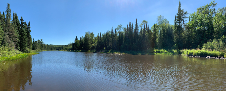
Looking upstream, you can see about one-third of a mile to the next river bend. This is a tranquil stretch of the Pigeon River. This is the view from the Fort Charlotte canoe landing.
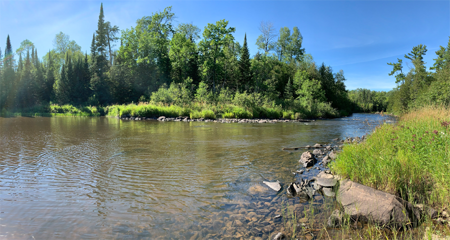
View downstream from the Fort Charlotte canoe landing. You don't want to continue past the place you are standing. Downstream of Fort Charlotte the river becomes progressively more fierce as it tumbles down several waterfalls and roars through countless stretches of rapids. The boundary of Grand Portage National Monument ends about where you see the river bend in the far distance on the right side of this image. The Cascades start about 1/2 mile downstream from there. They are the first major set of rapids beyond this point. The Cascades stretch for a good mile or so further downriver. Beyond those rapids, the Pigeon River is rarely tame, just occasionally less frothy. The river is a seemingly endless series of short flatwater sections punctuated by many Class 1 rapids. Also a major Class 2 or 3 stretch of rapids is mixed in every few miles or so.
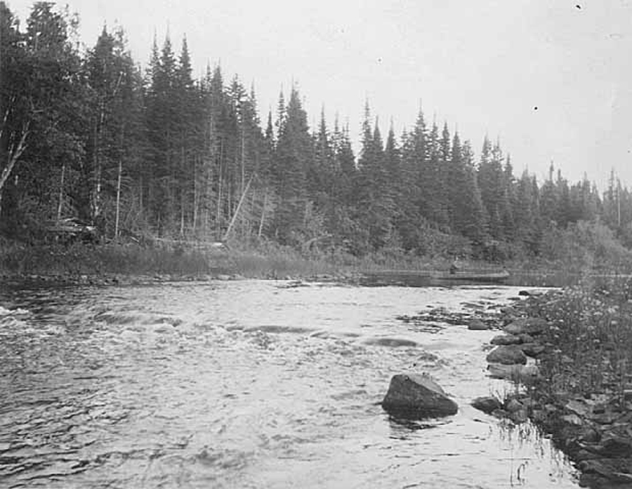
This image from 1922 was taken from the opposite shoreline (Canadian side). The modern day path from the river up to the Fort Charlotte Campground begins at the edge of the river, right behind the stern of that canoe.
Return to paddling on: PIGEON RIVER
Back to List of BWCA Places
|


