VISTA LAKE CAMPSITES:
Campsite 1: (#771) - On point on east shore of the south arm of lake
Campsite 2: (#772) - On west shore in the south arm of lake
Campsite 3: (#2058) - At the west end of the west arm of the lake
This lake has some traffic, mostly coming from the north. From the east traffic comes from the Morgan Lake entry point. However, that entry point only has a daily quota of one. Traffic from the south has to cross the brutal Little Trout Lake to Misquah Lake portage. That portage will deter most groups.
There are three campsites on this lake. The campsite on the point, on the east side of the south arm, will be deemed the best by most groups. The campsite on the west side of the south arm has a weird access. There is a really steep slope to climb to get to it. The third campsite is on the far end of the west arm of the lake. Mediocre campsite, but way off the main route if you are looking for a quiet place. Since Vista Lake is a popular destination for paddler starting from several different entry points, their is often competition for the campsites on this lake.
Most of the mature white pine was cut by the General Logging Company around Vista Lake between 1947 and 1953. These stands of white pine dated back to the fires of 1610, 1692 and the late 1750's. Access was to this area was along a road that ran along the north side of Vista Lake, crossing the Brule River where the current day Vista Lake-Horseshoe Lake portage is located. The road extended 3 1/2 miles to the west of that portage (Heinselman, 1999). Remnants of this logging road still exist. In fact the start of it can be found along the Lima Grade (Forest Road 1378) exactly one mile north of the BWCA Entry Point 45 - Morgan Lake parking lot. There is a small gravel road pullout at this point on the left (west) side of the road. This is 0.45 miles past the location where the Lima Grade crosses the Brule River. From the pullout along the Lima Grade, the old logging road headed off to the southwest. At about 900 feet down what remains of the road is where it crossed Poplar Creek. It gets hard to follow past that point, but traces of it are easily still visible on satellite photos of the area.
Vista Lake water sources include the creek flowing into the south end of the lake from Misquah Lake. From the west, a small creek drains into Vista Lake from Snack Lake. Jake Lake drains into Vista Lake from the east. Vista Lake is the headwaters of the Brule River. The Brule River flows out of Vista Lake to the north, visible along the Horseshoe Lake portage.
References:
Beymer, Robert, Boundary Waters Canoe Area – Volume 2 – Eastern Region (Berkeley: Wilderness Press, 2006), 96, 100, 102, 107, 109.
Heinselman, Miron, The Boundary Waters Wilderness Ecosystem (Minneapolis: University of Minnesota Press, 1999), 115.
Pauly, Daniel, Exploring the Boundary Waters (Minneapolis: University of Minnesota Press, 2005), 288.
Click on the photos below to see the full resolution image - Use your browsers back button to close photo and return to this page.
PADDLING FROM THE JAKE LAKE PORTAGE TO THE MISQUAH LAKE PORTAGE
This view is to the west from the Jake Lake portage landing of the eastern arm of Vista Lake.
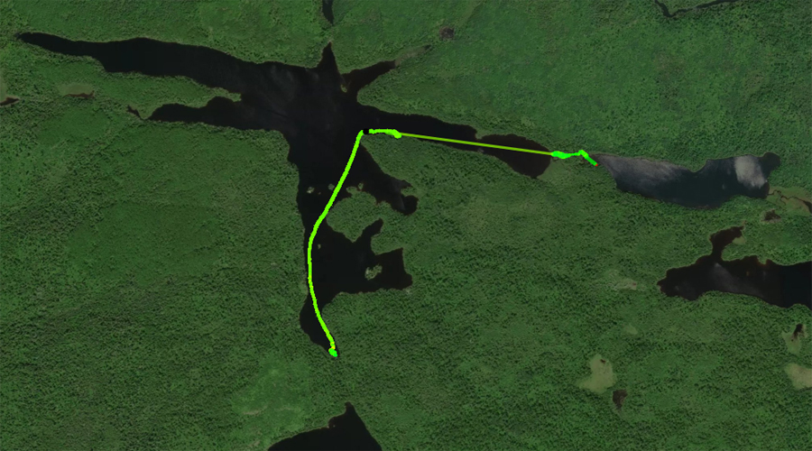
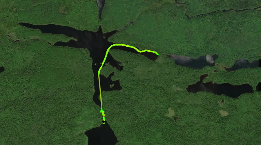
Crossing Vista Lake beginning at the Jake Lake portage and ending at the Misquah Lake portage. Lots of boulders along the portage path to step around. The landing on the Vista Lake side is pretty rough.
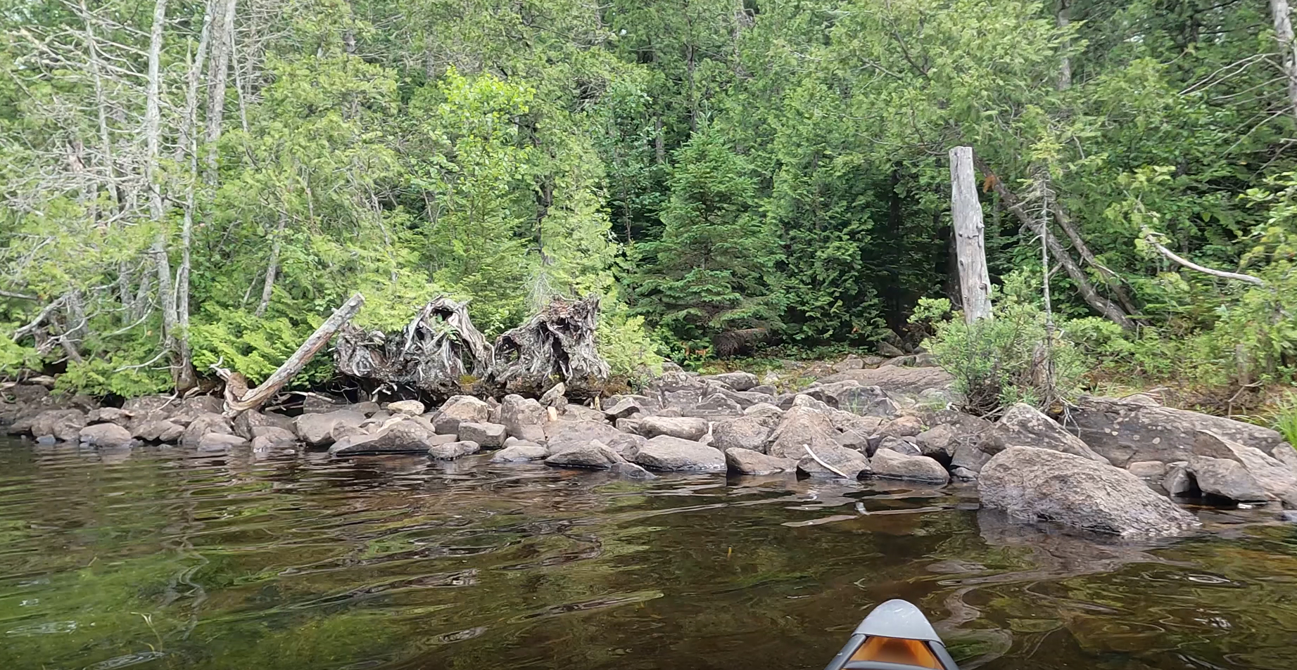
The imposing boulder heap that marks the start of this portage. Portage to Misquah Lake -or- Explore Another Route ***********************************************END OF ROUTE***********************************************
PADDLING FROM THE MISQUAH LAKE PORTAGE TO THE JAKE LAKE PORTAGE
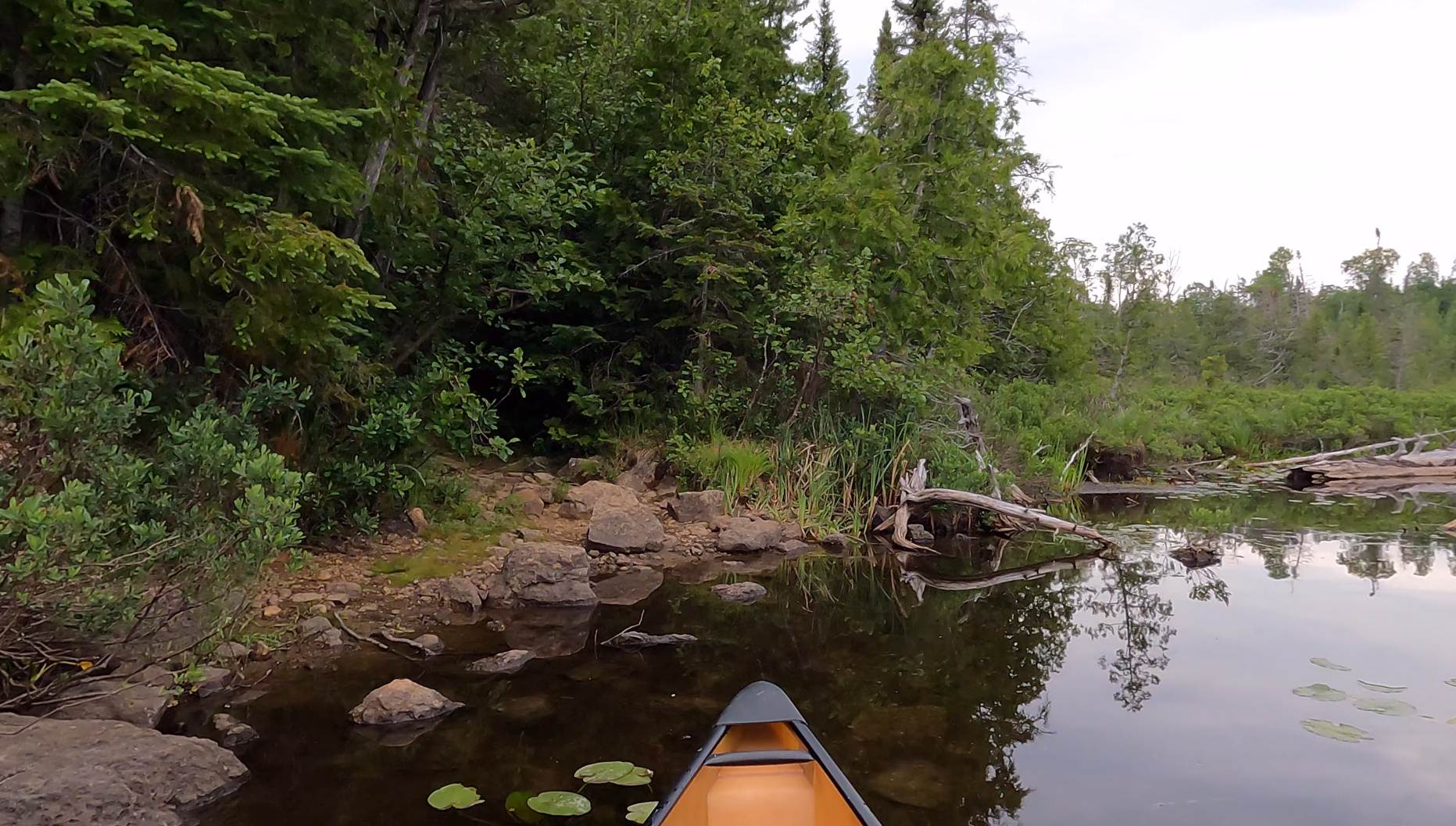
You'll have to do a bit of balancing and boulder hopping to load your boat before setting off along the route over to Jake Lake.
Starting at the Misquah Lake portage, travel north up the south arm of Vista Lake. At the point, turn to the east and paddle down the eastern arm of Vista Lake until reaching the Jake Lake portage.
Coming in for a landing at the Jake Lake portage. This portage is located at the far eastern end of the east arm of Vista Lake. Portage to Jake Lake -or- Explore Another Route ***********************************************END OF ROUTE***********************************************