Weasel Creek flows out of Weasel Lake. The creek takes a C-shaped course for about a mile before it empties into Pagami Creek.
Traveling along Weasel Creek gives a good contrast between burned forest and the forest that remained unscathed by the 2011 Pagami Creek Fire. This fire began very near to Weasel Creek. The fire never leapt over Weasel Creek so one side of the creek is burned while the other is intact.
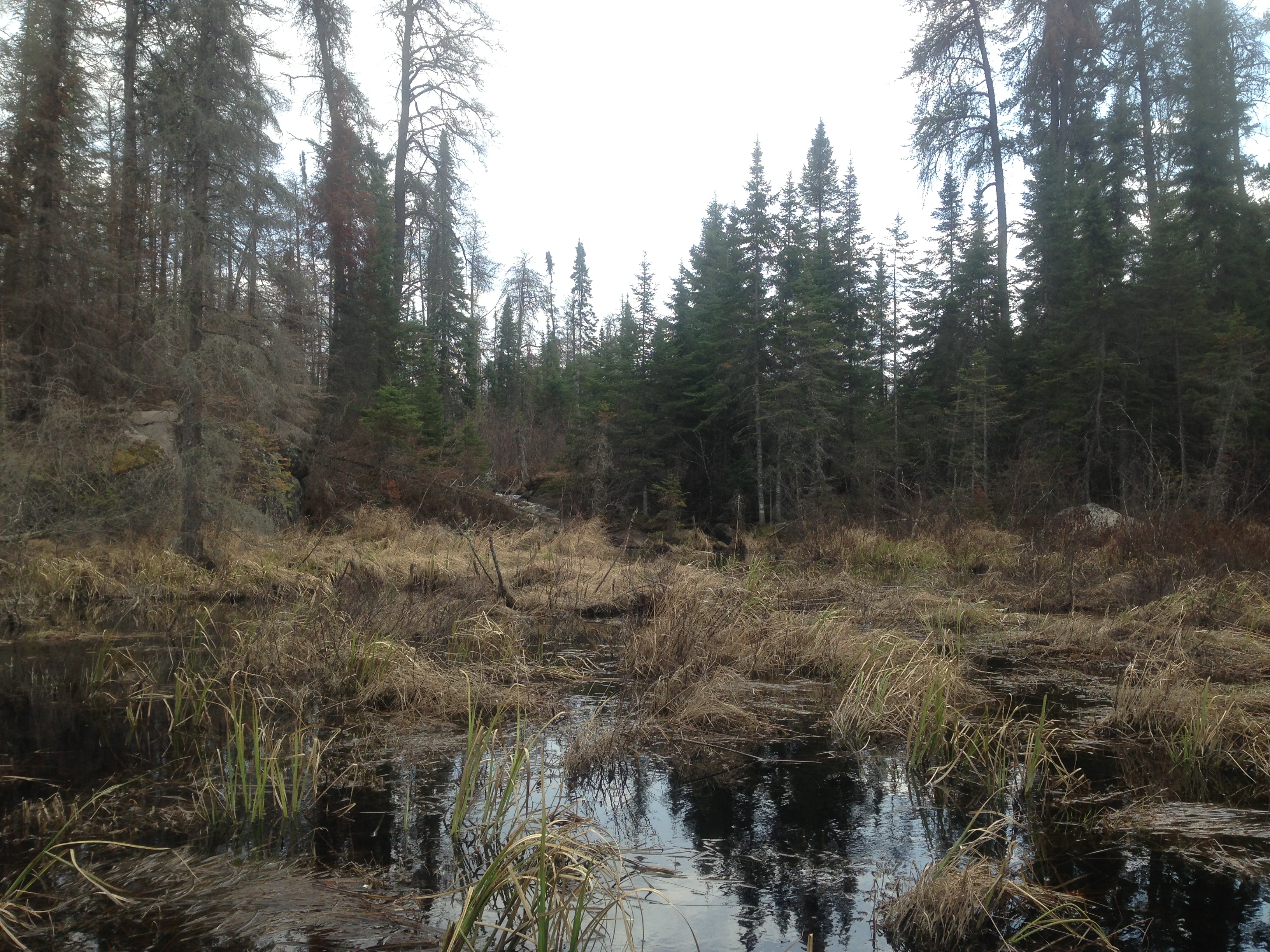
From its confluence with Pagami Creek, Weasel Creek is quite navigable except for the occasional beaver dam all the way up to the first rapids. Starting at these rapids, the first natural barrier along the creek, there is a long stretch that must be bushwhacked. Satellite images appear to show that the creek becomes navigable again as you get closer to Weasel Lake.
There seems to be a lot of moose activity in this area because tracks and moose tailings were everywhere along the creek starting above the first rapids.
In 1894 a fire affected this area. This fire started somewhere near Gabbro Lake and burned from Gabbro Lake up to Lake One, Lake Two and Lake Three.
Click on the photos below to see the full resolution image - Use your browsers back button to close photo and return to this page.
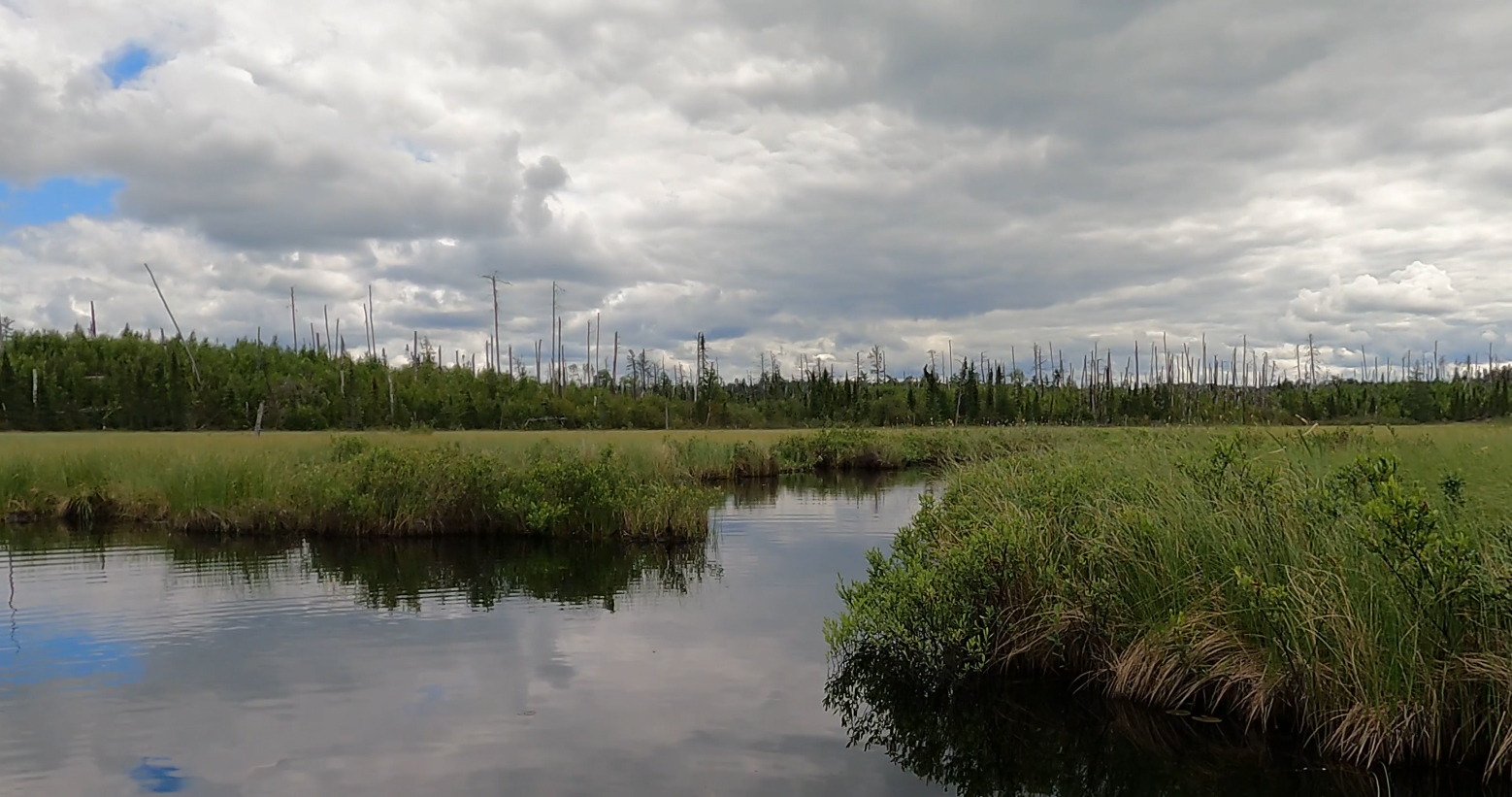
Mouth of Weasel Creek where it flows into Pagami Creek. View is upstream toward the southwest (June 14, 2021).
About a quarter-mile upstream from Pagami Creek, you look back from whence you came at Weasel Creek (May 17, 2014).
You have hopped two beaver dams on the lower reaches of Weasel Creek. Sometimes, if you get a good run at a dam in your canoe, you can get far enough over it without having to get out; you teeter and lurch your canoe to the other side of the dam . Weasel Creek has more current than Pagami Creek, but it is still a slow mover (May 17, 2014).
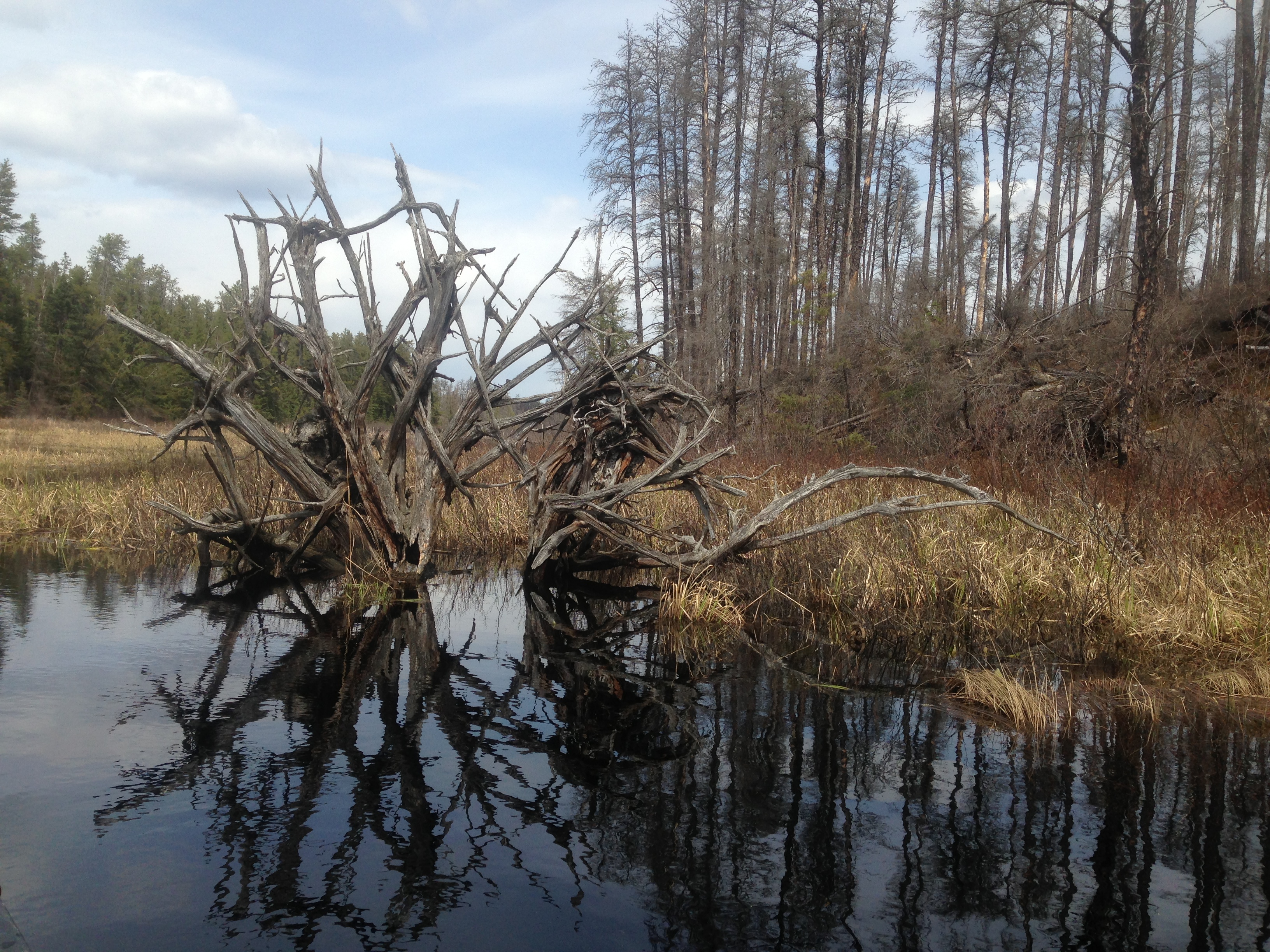
An interesting tree root formation you pass by along Weasel Creek. You look back downstream as you paddle by. You can see easily that the forest on the left (looking downstream) is unburned, while the forest on the right is completely burned out (May 17, 2014).
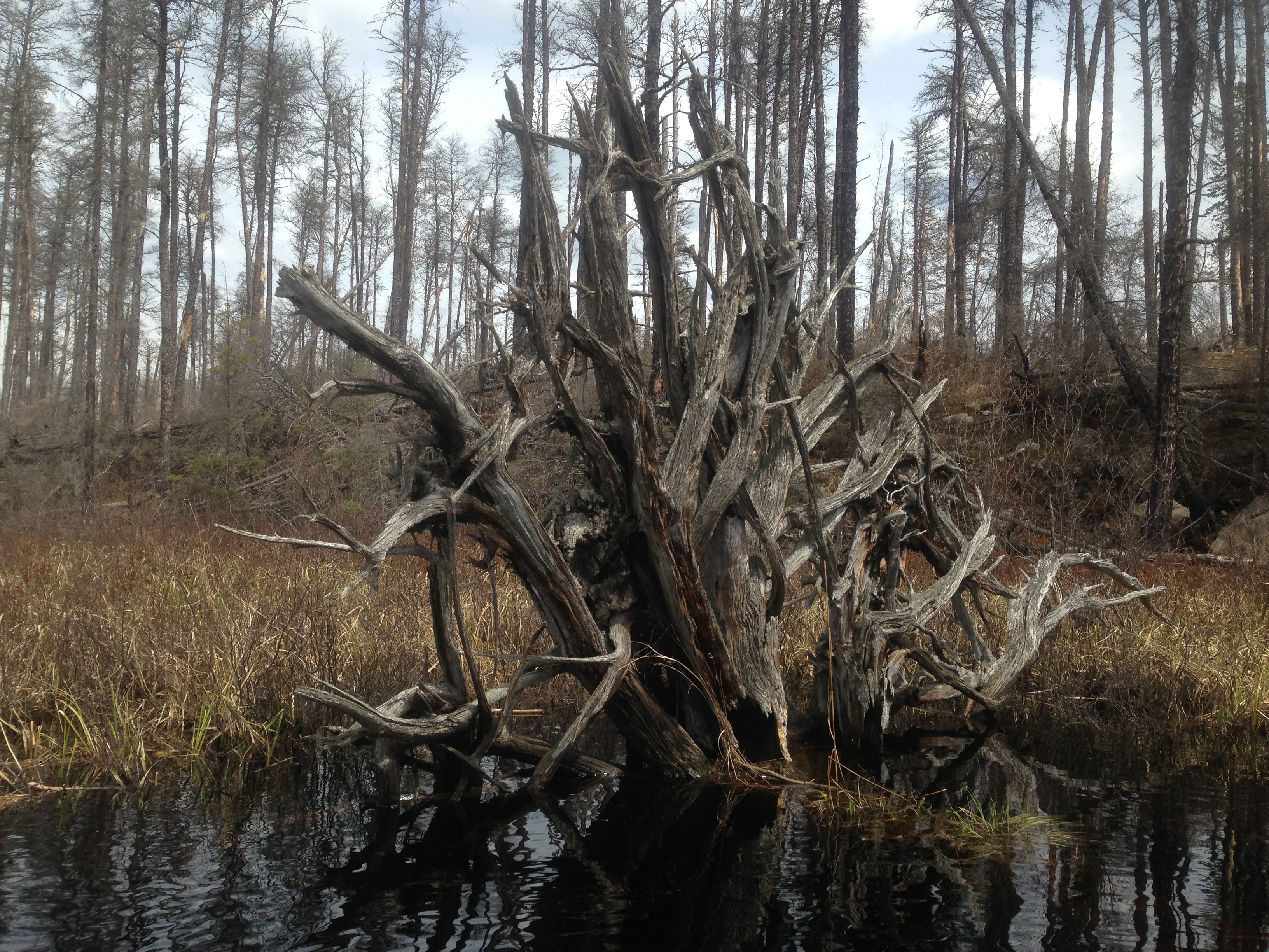
Close to the same image as above, but several years later (June 14, 2021). Notice how all the burned pine trees have lost their branches. Many of the tree skeletons have fallen too.
View of the root structure, but this time you are looking more east toward the forest. This is the burned side of the creek.
Starting at it's confluence with Pagami Creek, paddle upstream along Weasel Creek. You'll notice that the forest on your right (west) was not burned by the 2011 Pagami Creek Fire. The creek starts out wide and slowly gets narrower as you head upstream. You hit your first small beaver dam about five minutes after you begin. Further along, an odd tree trunk, what remains of what was once probably a very large tree, makes for a nice photo opportunity. You approach a second beaver dam, this one a little more robust, shortly after leaving the upended tree trunk. To get around this one, you have to paddle over toward the east side of it and do a liftover. After this second dam, continue along up Weasel Creek until you reach a small waterfall/rapids. This is still early in the spring, so you are probably experiencing good water levels for this creek. There isn't a solid landing here. You must dextrously extract yourself from your canoe and boulder hop across the rapids. After exiting canoe, explore the shoreline along the burned side (east) of the creek to see how far this unnavigable section goes. There are signs of moose evident on the ground in the form of tracks and pellets. Unfortunately this route is discovered to be quite difficult. Trek shows about the first 15 rods upstream from the waterfall. Just before turning around, you can see just not far beyond (maybe 8 rods) that the forest pulls back from the stream (video is old and grainy, so hard to see). This first difficult section of bushwhacking is about 15 to 20 rods in total length. This is probably the hardest stretch of bushwhacking you'll encounter along Weasel Creek between the waterfall and Weasel Lake itself (see newer video below - scroll down this web page). The reason it should be easier past this stretch is because the forest in this section comes right down to the edge of the creek. Beyond 20 rods or so upstream, the forest pulls back about 50 feet from the creek bank. Since this is spring, there are no leaves or underbrush, so its easier going than you can expect if you did this in summer. The entire bushwhack until you reach a navigable place along the creek again is just under 1/2 mile (160 rods). So reaching Weasel Lake is quite an endeavour.
Approaching a set of rapids or what could even be considered a small waterfall. The rapids are visible just left of the center of your view. It is possible (assuming good water levels) to paddle right up to the base of the rapids.
You nosed canoe right up into the rapids dead ahead and carefully stepped out onto the rocks. To the left of the rapids, it is fairly good footing conditions; the side that was burned by the fire. Across the rapids on the right, the forest was not consumed by the fire. Scouted another 250 feet or so upstream above these rapids before turning back. The creek is not navigable for that stretch. There was lots of signs that moose are pretty common in this area. The easy part of Weasel Creek comes to an end at these rapids. If you ever want to see Weasel Lake (and few have), you will have to work for it starting here.
About seven years later...back exploring Weasel Creek again
Paddling Weasel Creek (Upstream)
This is the same stretch of Weasel Creek that is shown in the earlier video found farther up this web page. This is now late spring, so water levels are lower. Also the waterfall at the end of the navigable stretch of the creek is down to just a trickle. The forest is recovering; many young trees now populate the shoreline. The beaver dam is still here.
Doing some scouting of the bushwhack from the waterfall to Weasel Lake...doesn't look easy
The bushwhack is substantially more difficult now for several reasons (compare to end of video shown above). One, its summer, so there are more leaves and undergrowth. Two, many small pine trees and bushes have taken root since the forest fire. Three, a lot of the burned trees have fallen down and added substantially to the ground clutter.
Traveling Weasel Creek (Downstream)
Following Weasel Creek from the waterfall (which is the first natural barrier along this stream) downstream to its mouth at Pagami Creek. There are usually a couple of beaver dams along this route.