Fishing: I fished, but got skunked. Fish finder was picking up fish. Saw fish in the shallows but not sure what species. Probably northern pike as they are in Rock Island Lake and the two lakes are connected.
Judd Lake is accessed by a modest bushwhack that parallels the creek connecting Judd Lake to Rock Island Lake. This creek and the bushwhack traverses a peat bog that is surrounded by a burned out forest; the result of the 2011 Pagami Creek Fire.
Old maps of this lake refer to it as Judd Lake. Many newer maps don't display a name for the lake.
There also used to be a maintained portage from Clearwater Lake to Judd Lake before the PMA status went into effect. However, I found no evidence of this portage trail; likely evidence was destroyed by the fire. This portage starts on the southwest shore of the lake near the rock outcrop with the large surviving pine tree. This old portage is visible on the 1952 Fisher No. 113 map and maps before the 1990's. It is shown on these maps as being 280 rods long. Recent posts of BWCA.com indicate that the trail is still evident, but covered by many fallen trees because of the fire. The trail is probably easier to find from the Clearwater Lake end. This old portage trail intersects another really old trail that used to wind through this area too. This other trail extended from the north end of Gabbro Lake, along Clearwater Lake and had its eastern terminus at Lake Three (western most tip). Part of this trail between Gabbro Lake and Lake Three intersected the old 280 rod portage, ran along it for about 100 rods, and then broke off again.
Judd Lake is a small, but very deep lake. It measured 40 feet with a depth finder out in the middle. This is almost twice as deep as Rock Island Lake which according to the Minnesota DNR LakeFinder survey is 21 feet in depth. Judd Lake has some interesting features. There are several gigantic burned pines along the shore that have twisted and gnarled geometries. A large, still green pine juts up towards the sky on the southwest corner of the lake. Almost the entire shoreline is burned exposing huge rocks; some cracked and scorched by the heat of the fire. The fish finder picked up plenty of fish on the scanner; also saw several fish swirling in the shallows. The Minnesota DNR Lake Finder fish survey recorded good sized northern pike in Rock Island Lake. Since the two lakes are connected, at least during high water, it stands to reason there are at least northern pike in Judd Lake.
It appears from ground level that Judd Lake is just a deep section of what was once a larger lake composed of what remains of Judd Lake and Rock Island Lake today. The peat bog is the area that has filled in between these two lakes. Only a creek connection remains between the lakes now.
In 1894 a fire affected this area. This fire started somewhere near Gabbro Lake and burned from Gabbro Lake up to Lake One, Lake Two and Lake Three.
Click on the photos below to see the full resolution image - Use your browsers back button to close photo and return to this page.
The approach to Judd Lake is from Lake Two and then through Rock Island Lake. Check the Rock Island Lake page for details of how to get to Judd Lake.
Bushwhack to Judd Lake
You are paddling across Rock Island Lake to the mouth of the creek, which flows from Judd Lake to Rock Island Lake.
You begin the bushwhack in the upstream direction along a muddy creek from Rock Island Lake, heading toward Judd Lake. You stay to the left of the creek as it flows through the peat bog. It is obvious from this vantage point that this creek is not navigable because of the low water. Sticking your paddle in the mud, you find that the mud is deep enough to completely sink the entire length of your paddle. The best time to visit this area would be the spring. You could probably just paddle this creek that time of year.
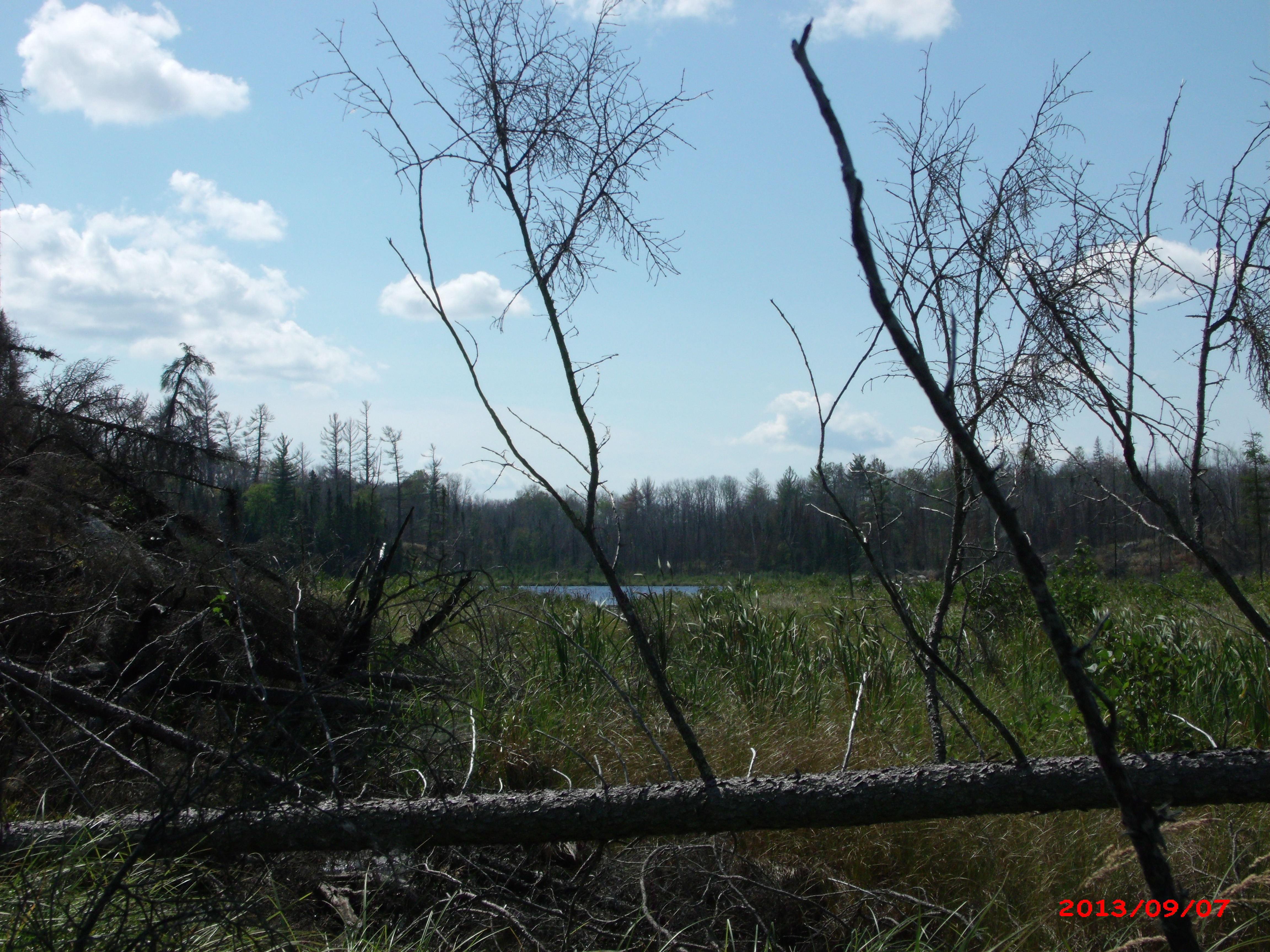
Your first view of Judd Lake about halfway through the bushwhack from Rock Island Lake. The muddy creek that connects Judd Lake and Rock Island Lakes is on your right. You make a canoe bridge to cross to the otherside of the creek at one point. The mud in the creek is too deep to step in. Laying the canoe across the creek and walking across it makes getting to the other side of the creek easy.
Continuing the crossing of the peat bog between Rock Island Lake and Judd Lake. You find the ground to be very spongy, so it is fairly tiring pulling the canoe.
With a final push, you complete the bushwhack to Judd Lake.
Exploring Judd Lake
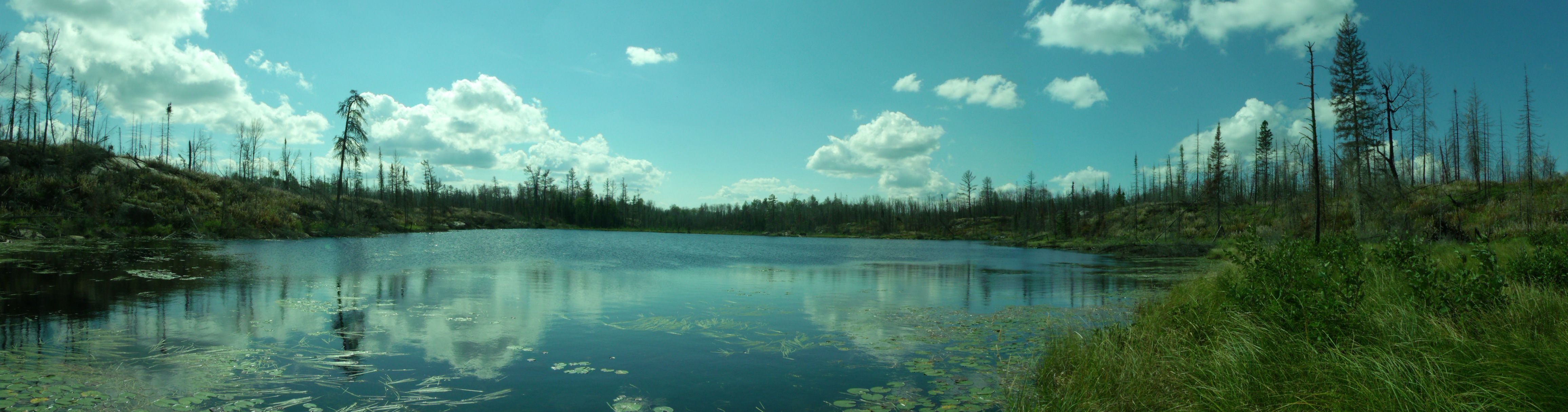
Your initial view of the entirety of Judd Lake. Here you are looking toward the south, standing just to the left of the creek mouth that flows to toward Rock Island Lake.
View down the west shoreline while standing at the north end of the lake next to the creek.
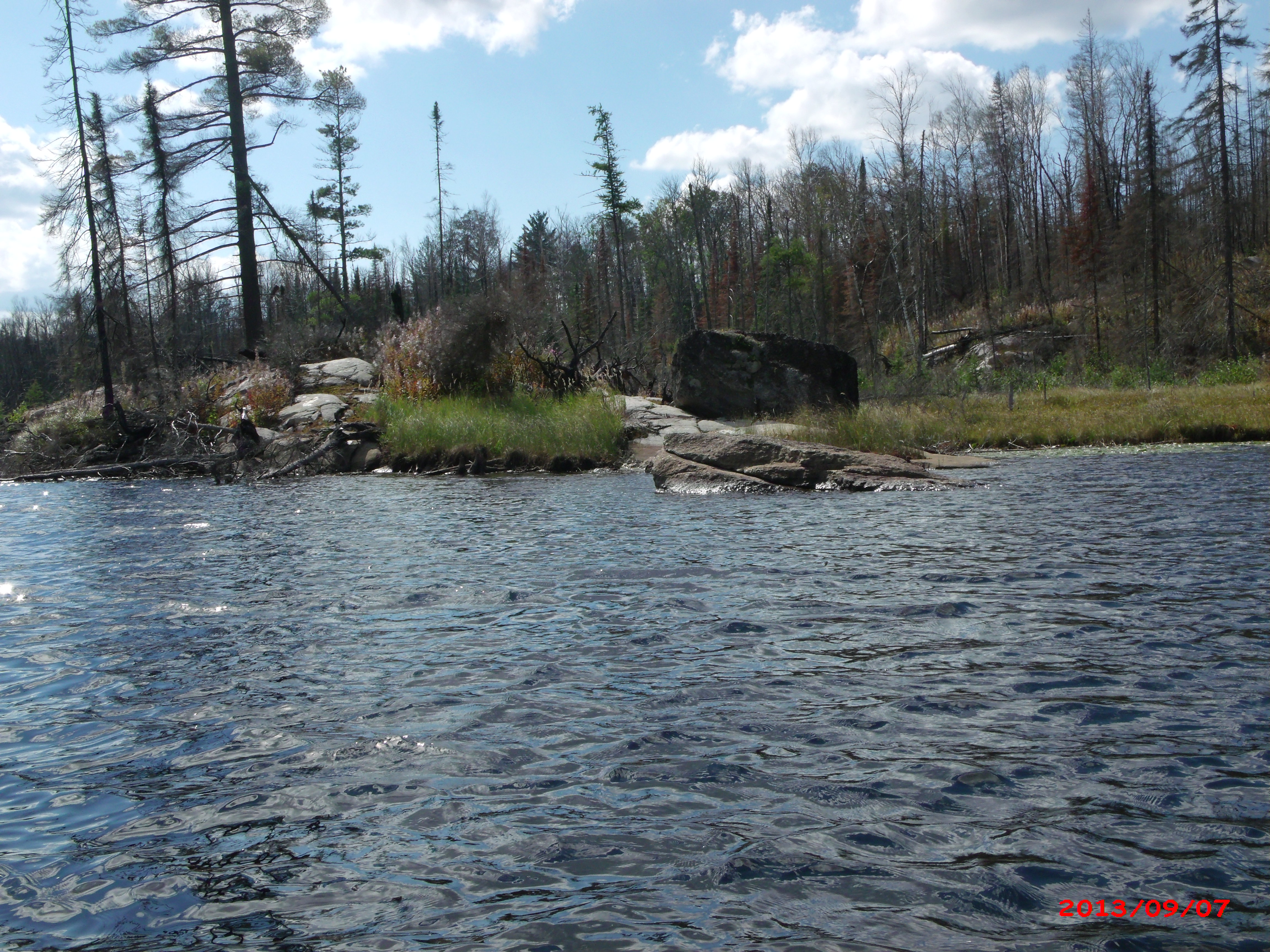
Looking straight east. This is from north end of the lake where the creek flows out. The creek is visible in the foreground flowing off to your left toward Rock Island Lake.
A view down the eastern shoreline of Judd Lake. Again, the viewpoint is from the north end of the lake next to the creek.
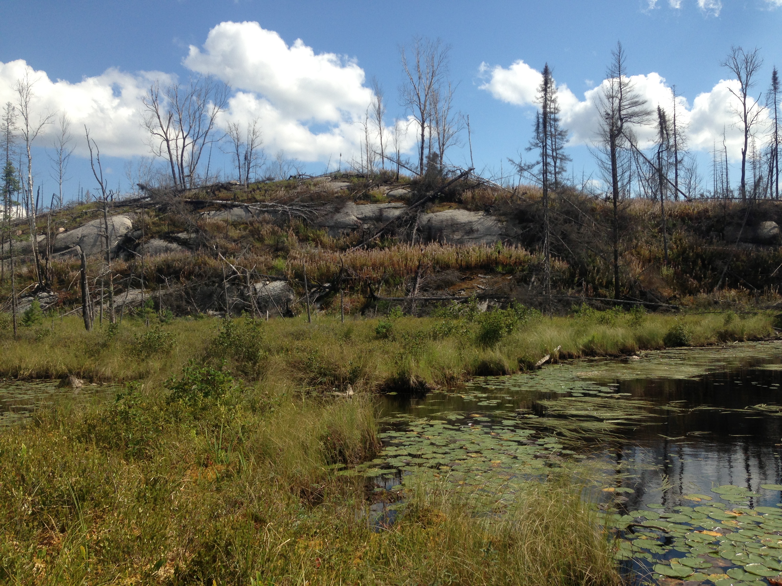
Taking a look at Judd Lake after finishing up that bushwhack from Rock Island Lake. Walking across peat bog is hard work as the ground is very spongy. Here you are standing right next to the creek outlet from Judd Lake. This creek drains Judd Lake into Rock Island Lake.
Paddling around the little lake, you explore the its southeast corner. There used to be a portage in this area to Clearwater Lake. The 2011 Pagami Creek Fire likely destroyed most of the portage.
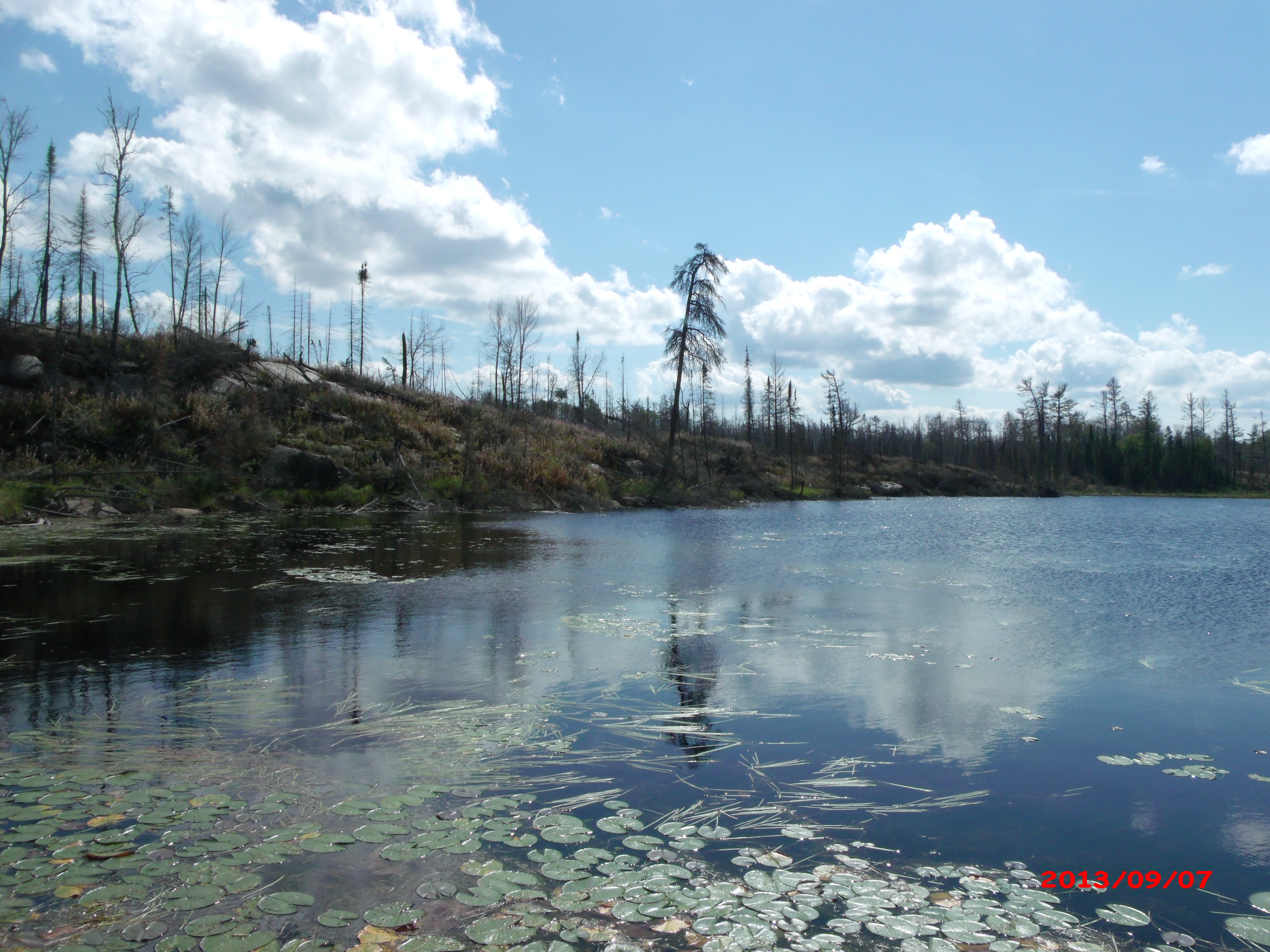
As you paddle the northern end of Judd near the creek outlet, you see a number of fish swirling in the lily pads, particularly along the shore near the creek.
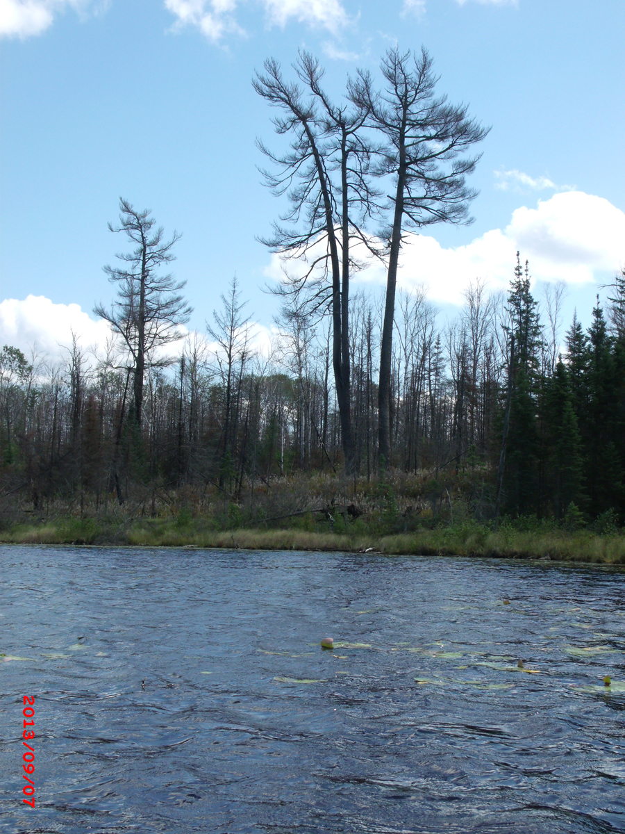
A trio of large pines that didn't survive the Pagami Creek Fire in 2011 are obvious along the southeast shore of Judd Lake.
This trio of less fortunate pines marks the southeast corner of the lake. Seen from farther out on the lake.
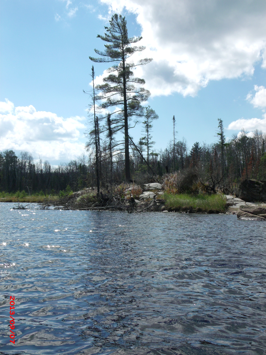
Being on a jut of land that sticks out into Judd Lake likely saved this big pine tree from destruction by the fire. The old portage trail that went to Clearwater Lake starts/ends near this rock outcrop and pine tree. Could not locate it from this end on last visit.
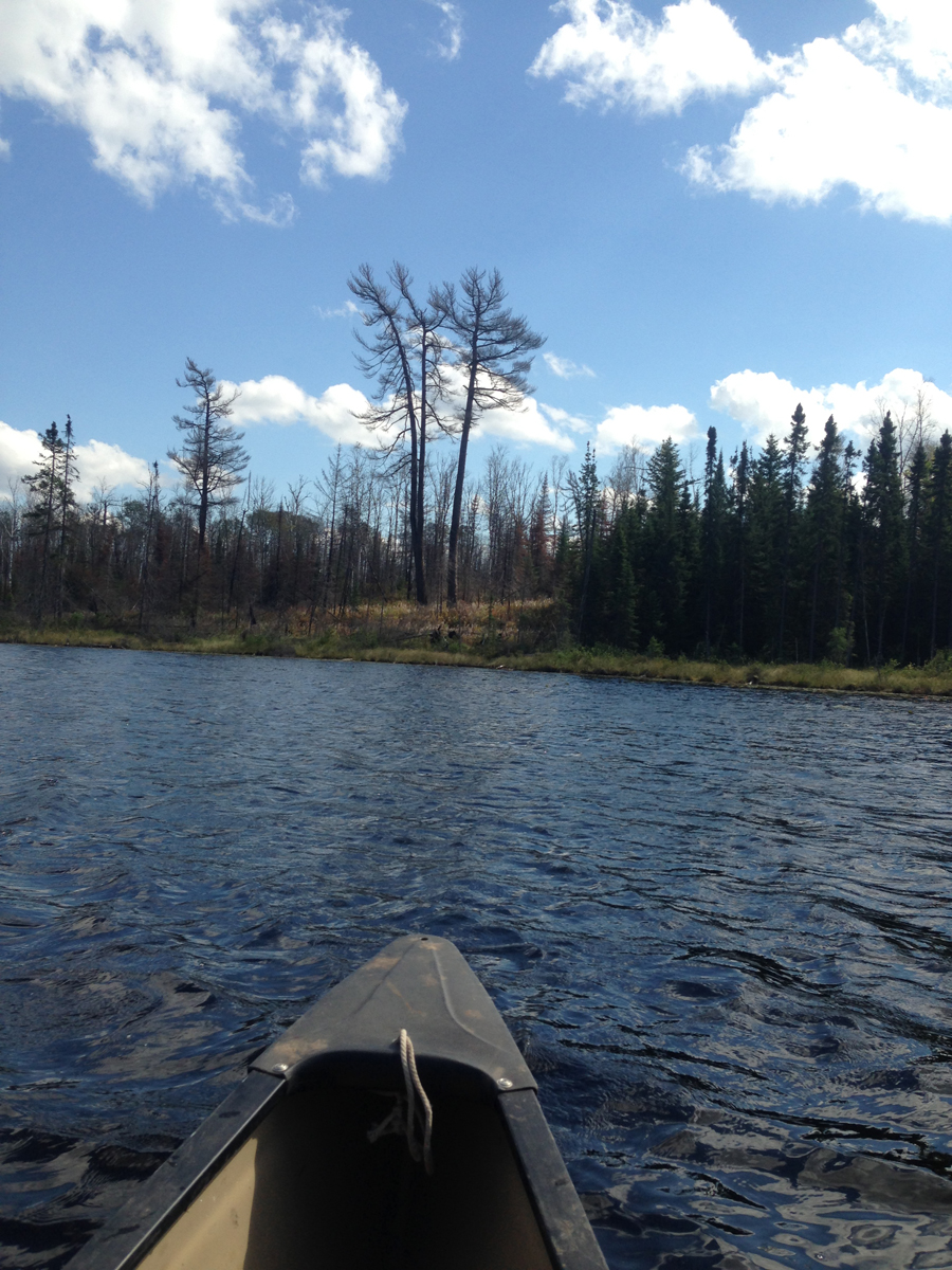
This viewpoint is from the south end of the lake. You are looking toward the northeast.
Looking toward the southwest corner of the lake. View is from the canoe out in the middle of the lake. The "lone survivor pine".
Another look at this lucky pine tree. Southwest shore of Judd Lake.
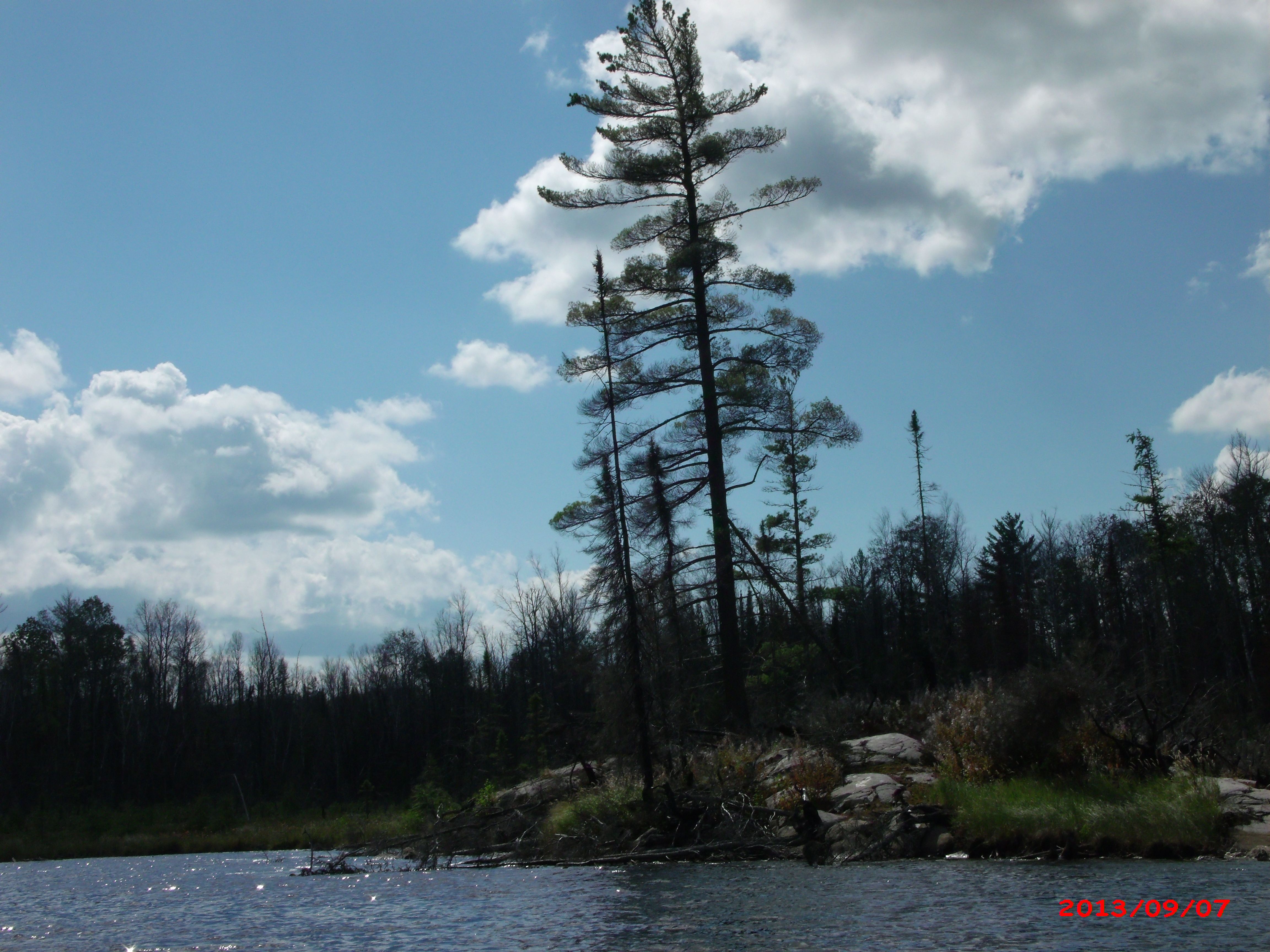
Notice this large somewhat rectangular boulder that is located on the shoreline just to the right and behind of that lone, surviving pine. It is blackened from the 2011 Pagami Creek Fire.