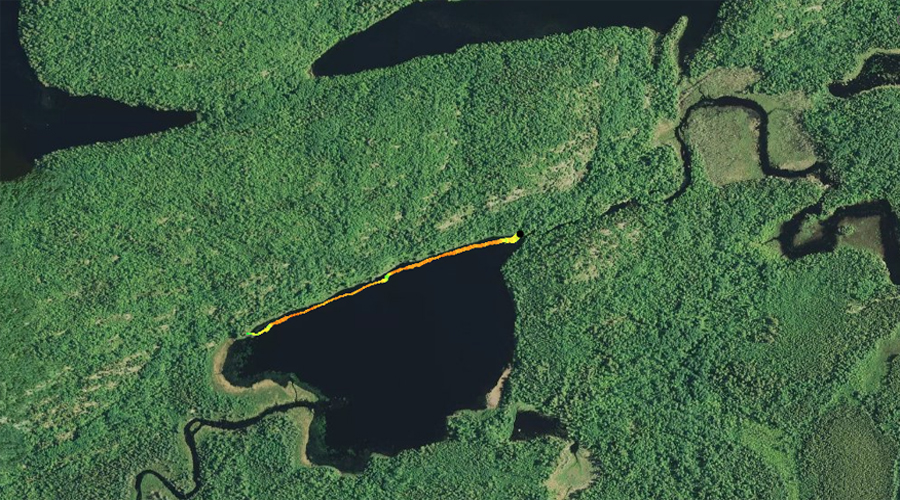
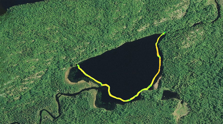
RANGE LAKE CAMPSITES: Campsite 1 (#1126): Campsite in northwest corner of lake - Only campsite on the lake
This is a dead end lake at the end of a fairly long portage. The portage is easy though. Range Lake has thick groves of lilypads and other water-based vegetation along most of its shoreline. The western shoreline of the lake is particularly marshy. Some respectable cliffs can be seen near the start of the portage to Sandpit Lake.
There are two portages leading to Range Lake. The portage from Sandpit Lake is as flat as a pancake and is about as easy as a 160 rod portage can be. This portage was previously the location of a railroad track that was used back in the logging era. The portage from Sandpit Lake is also intersected by another portage coming from the Range River. This portage intersection is only about 15 rods from Sandpit Lake. The Range River can be followed to the east until it flows into Basswood Lake (Jackfish Bay). There is one portage along the Range River that is obvious, but isn't shown on most BWCA maps. There is possibly (or was) another portage shown on maps that leads out to the Cloquet Line Road from Range Lake, but did not find it (didn't look that hard for it though).
A section of the Swallow and Hopkins Railroad used to run along the eastern and north shoreline of Range Lake. From there the track followed the route of the current portage to Sandpit Lake. The railroad crossed the Range River just downstream of where it flows out of Range Lake. This railroad was built near the beginning of the 20th century.
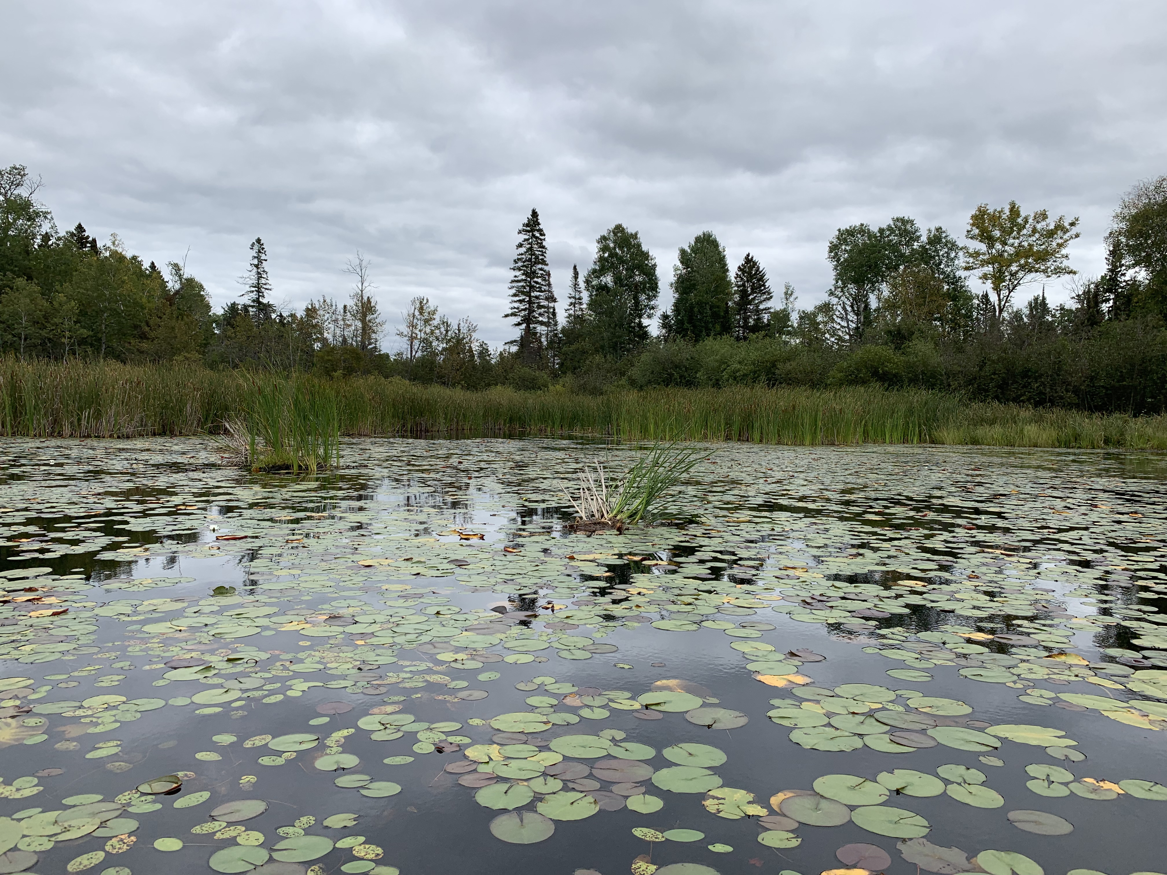
The Range River flows into the west side of Range Lake into an area covered by lilypads and floating bog. The creek flows out the opposite side of the lake. A lovely set of rapids can be seen just after the creek leaves Range Lake, along the portage to Sandpit Lake.
The campsite on Range Lake is not used a lot and it is a bit overgrown. If you camp here you have the entire lake to yourself. This is a dead end route (few will take the portage out to Cloquet Line Road), so should be a quiet place to camp.
Fishing for northern pike in this lake seems promising.
References:
Pauly, Daniel, Exploring the Boundary Waters (Minneapolis: University of Minnesota Press, 2005), 151.
Click on the photos below to see the full resolution image - Use your browsers back button to close photo and return to this page.
PADDLING FROM THE SANDPIT LAKE PORTAGE TO THE LAKES ONLY CAMPSITE
View of Range Lake from the start of the portage to Sandpit Lake. This view is to the west. The Range River flows out of the lake, just out of your view to the left.
North shoreline of Range Lake looking to the west.
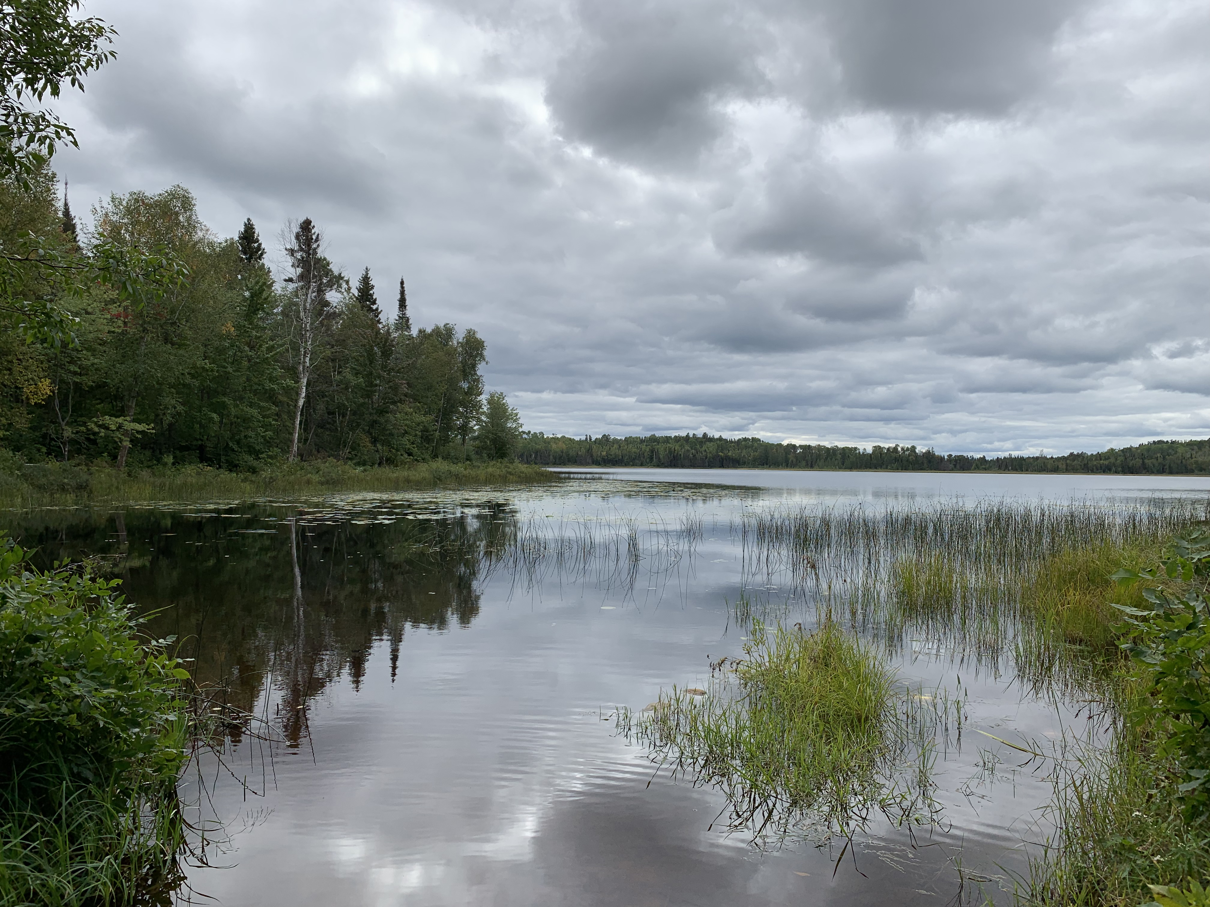
Beginning at the Sandpit Lake portage, paddle counterclockwise around Range Lake. This stretch of paddling takes you along the entire north shore of the lake, until you reach the campsite near the west end.
Just to the right of center of your view you can see a small point sticking out into the lake. This is the location of the campsite which is not super easy to see from the lake.
This point (on your right) helps make the location of the lakes only campsite easy to determine. The best place to park your canoe is right at your feet in this little bay, which is on the east side of the point. Visit the Campsite -or- Explore Another Route ***********************************************END OF ROUTE***********************************************
PADDLING FROM THE CAMPSITE COUNTERCLOCKWISE AROUND LAKE TO THE SANDPIT LAKE PORTAGE
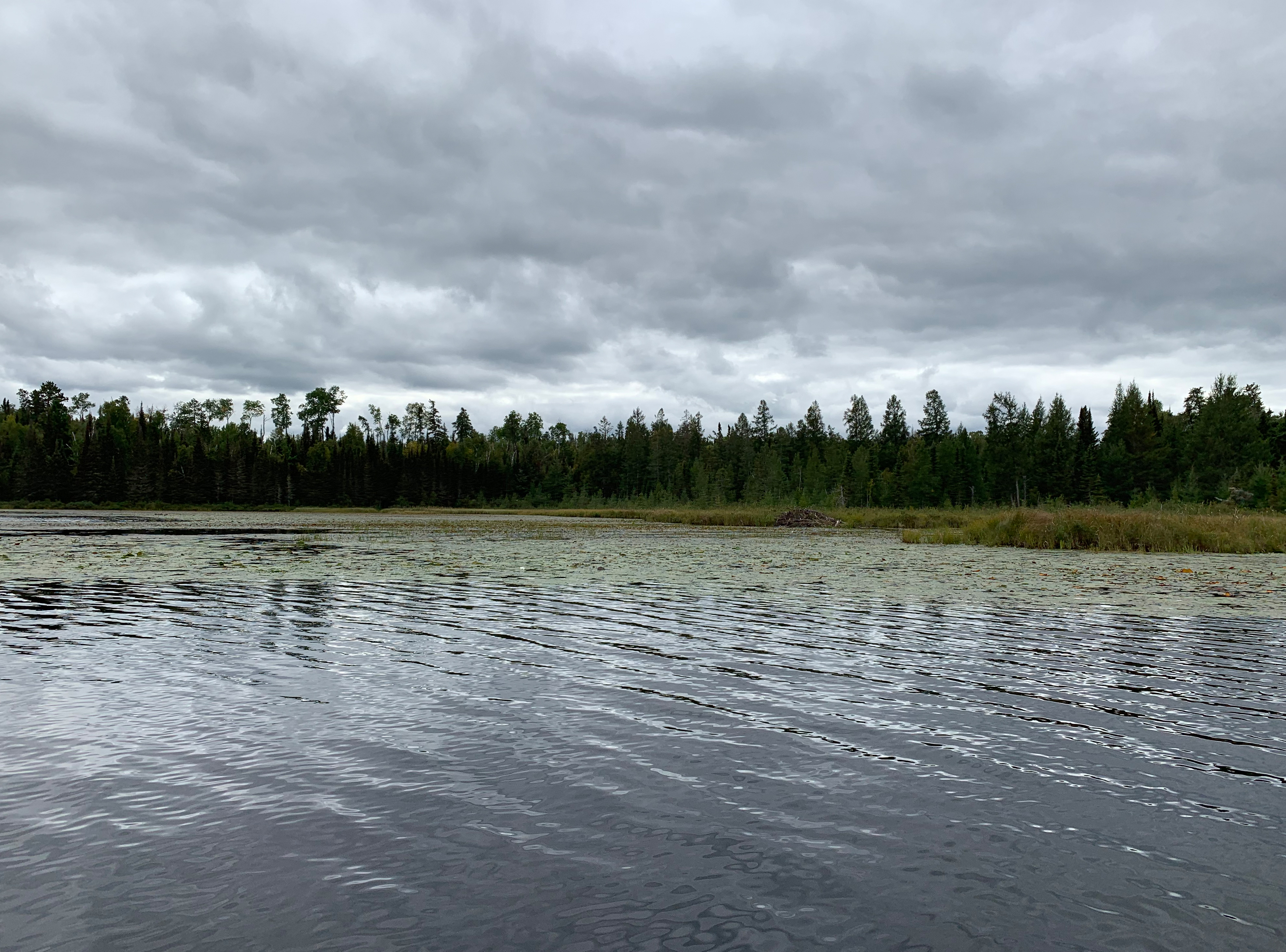
Looking south along west shore of lake. That beaver lodge, just to the right of the center of your view, is the approximate location of where the Range River flows into the western side of Range Lake.
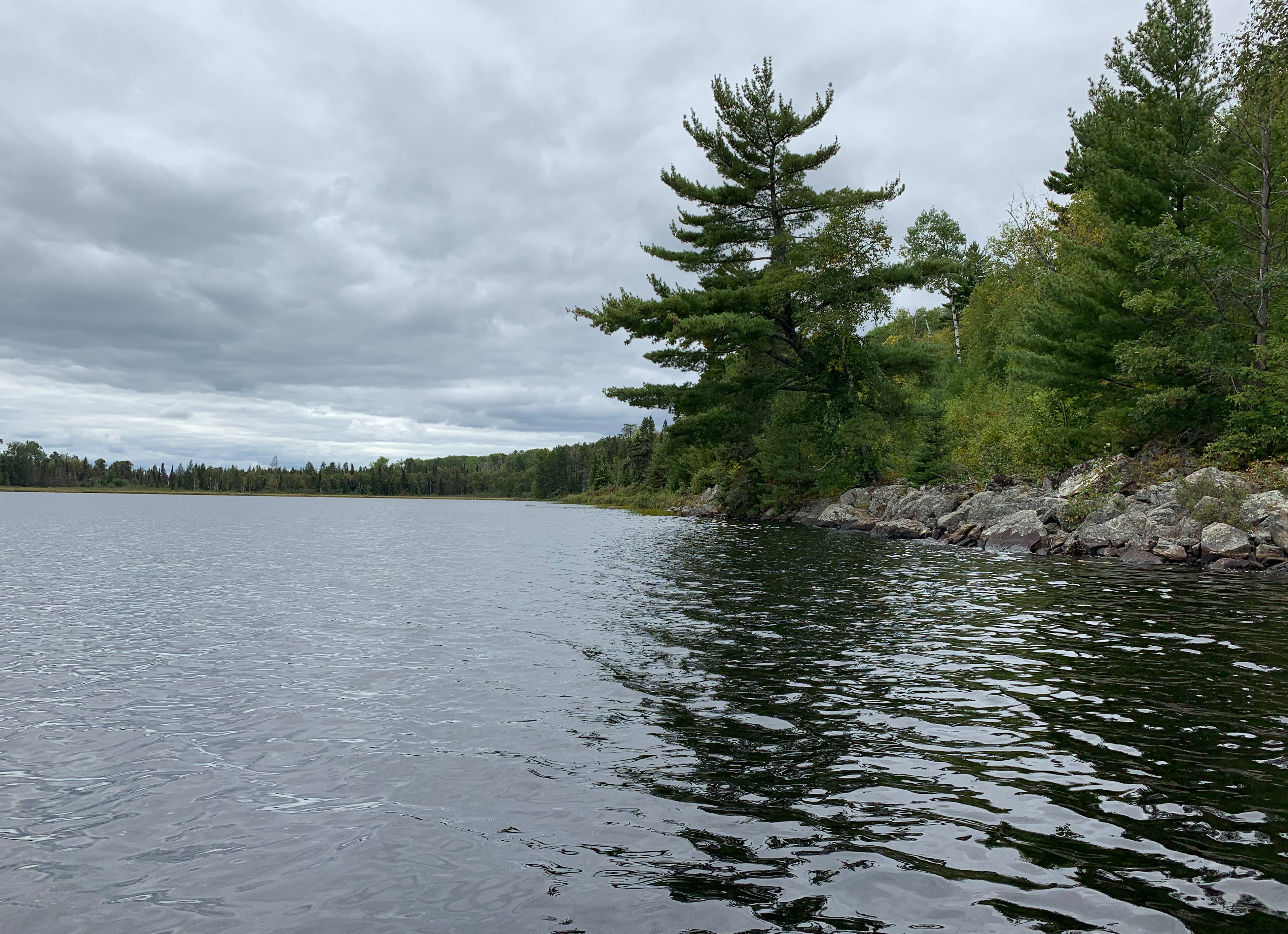
Starting at the lakes only campsite, continue counterclockwise around Range Lake until you get back to the Sandpit Lake portage, which is in the northeast corner of the lake.
Cattail and lilypads in the southeast corner of Range Lake.
Looking north along the eastern shore of Range Lake. Some cliffs are visible just left of center, which rise above the approximate location of the Sandpit Lake portage landing.
This is where the Range River flows out of Range Lake. The Sandpit Lake portage landing is visible to the far left of your view. Portage to Sandpit Lake -or- Explore Another Route ***********************************************END OF ROUTE***********************************************
Route Connections for Range Lake
From Range Lake, you can portage to the Range River or Sandpit Lake. To reach the Range River, follow the Sandpit Lake portage, but perhaps 20 rods from Sandpit Lake, there is an intersection. Take the 10 rod portage at this point. The Range River can be paddled to Basswood Lake (Jackfish Bay). There is one set of rapids along this route. There is an obvious portage for these rapids, but this portage is not shown on most maps of the BWCA.