River Length: From its source at Brule Lake to its mouth at the Brule River, the stream is about 15.0 miles long. It empties into the Brule River just after it passes under the Gunflint Trail (County Road 12). Only about the upper 8 miles of the river are within the BWCA.
Campsites: 0
Wildlife Seen on Visit: Waterfowl
Last Visited: July 24, 2020
Creek Elevation: Headwaters at Brule Lake at 1834 feet. Mouth at the Brule River at about 1580 feet. Average of 17 feet per mile of elevation loss.
Water Clarity: N/A
ROUTES/PORTAGES FROM THE SOUTH BRULE RIVER:
To Bower Trout Lake (downstream from Marshall Lake): Walk the 91 rod portage
To Brule Lake (upstream): Walk the 55 rod portage
To BWCA Entry Point 43 (from Bower Trout Lake): Walk the 80 rod portage
To Dugout Lake (upstream and downstream): Paddle In
To Marshall Lake (upstream from Bower Trout Lake): Walk the 91 rod portage
To Marshall Lake (downstream): Walk the 30 rod portage
To Skidway Lake (downstream): Walk the 33 rod portage
To Skidway Lake (upstream): Paddle In
To Swan Lake (upstream): Walk the 30 rod portage
To Swan Lake (downstream): Walk the 281 rod portage
To Vernon Lake (downstream): Walk the 55 rod portage
To Vernon Lake (upstream): Walk the 281 rod portage
South Brule River
Gunflint Ranger District
The South Brule River begins at Brule Lake and passes through a number of lakes before exiting the BWCA, where it flows out of the east end of Bower Trout Lake. About 7 miles or so downstream to the east of Bower Trout Lake, the South Brule River flows into the Brule River, of which it is a major tributary. Interestingly, the Brule River does not start at Brule Lake, but rather at Vista Lake. The name "Brule" comes from the French word for "burnt".
There are no other routes off of the South Brule River. Starting at Bower Trout Lake, you must go all the way to Brule Lake before other route options become available. In general this whole route is lightly traveled, especially east and downriver of Swan Lake. The BWCA Entry Point 43 on Bower Trout Lake only allows a quota of one permitted group per day.
There are no campsites on the South Brule River, but there are a number of places to camp on lakes along the route. Bower Trout Lake has two sub-par campsites. There is one more campsite on Marshall Lake. Upstream from Marshall Lake there is a fairly long stretch where there are no campsites. The next lake with campsites is Swan Lake, which has three. Swan Lake is a popular lake, so don't count on finding a campsite here. Upstream of Swan Lake, you must cross a fairly long portage of 281 rods. This portage isn't difficult, other than its length. Vernon Lake offers two more campsites. Finally the eastern most bay of Brule Lake has four campsites, if all the sites on Vernon Lake are taken.
Fishing along the South Brule River is mediocre. In Bower Trout Lake, Marshall Lake, Dugout Lake and Skidway Lake there are northern pike and a few walleye. Marshall Lake and Bower Trout Lake also have some smallmouth bass. Swan Lake, which is very deep at 122 feet, does not have lake trout in sufficient numbers to create a fishery. The lake has walleye, smallmouth bass and a few larger than average northern pike. Vernon Lake has decent northern pike and smallmouth bass fishing.
All the portages between Bower Trout Lake and Brule Lake are in good shape. There are no really difficult portages along this route. There is one long one between Vernon Lake and Swan Lake.
All the lakes along this route between Bower Trout Lake and Swan Lake were logged until the early 1930's. Logging operations were supported by a rail spur operated by the General Logging Company. This railway ran along the north side of the South Brule River and ended at the north campsite on Swan Lake (Heinselman, 1999).
The area around the South Brule River was subjected to a prescribed burn in September/October of 2016. The intentional ignition was performed to reduce fuel created by the July 4, 1999 windstorm. The burn area extends from Dugout Lake and Iota Lake on the east to about the middle of a north/south line extended through Lac Lake on the west. The burn area starts about 1/2 mile south of the South Brule River and goes north up to nearly Little Trout Lake. Another burn area extends from the west end of Little Trout Lake up along the west side of Misquah Lake, which may be part of this same prescribed burn. See Lux Lake Prescribed Burn. A natural fire burned some of the shoreline in 1995, where the South Brule River passes through Skidway Lake and Dugout Lake.
References:
Beymer, Robert, Boundary Waters Canoe Area – Volume 2 – Eastern Region (Berkeley: Wilderness Press, 2006), 91, 94, 103, 111.
Heinselman, Miron, The Boundary Waters Wilderness Ecosystem (Minneapolis: University of Minnesota Press, 1999).
Click on the photos below to see the full resolution image - Use your browsers back button to close photo and return to this page.
Your trip along the South Brule River begins at Bower Trout Lake. The river passes through this lake from west to east. Your first encounter with the South Brule River will likely be right before you reach the Marshall Lake portage. The river flows into Bower Trout Lake just to the east of the portage.
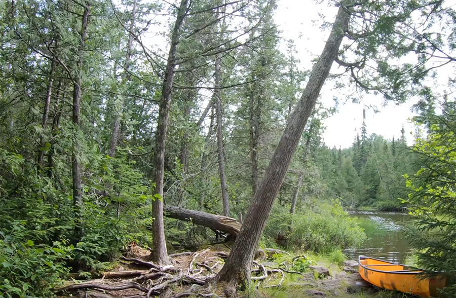
The mouth of the South Brule River at Bower Trout Lake. This is located just east of the Marshall Lake portage in the western end of the lake. This is the largest of the several channels of the river that enter the lake. The other channels are somewhat hidden by brush and grass growing along the shoreline.
This dock is at the start of the portage between Bower Trout Lake and Marshall Lake.
To continue along the route of the South Brule River, you must cross the portage from Bower Trout Lake to Marshall Lake. The portage is in pretty good shape.
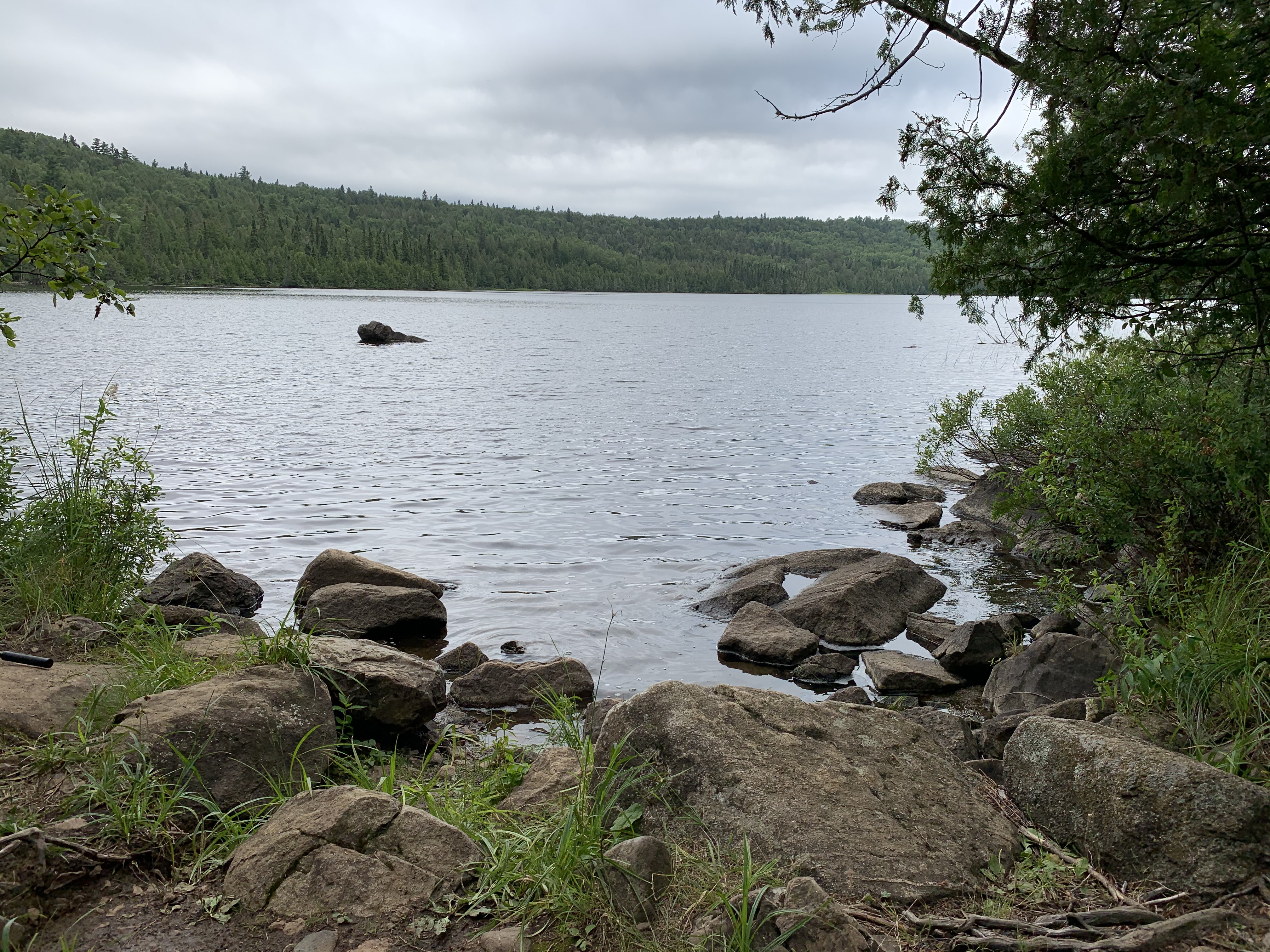
View of Marshall Lake. The South Brule River passes through the lake from west to east. To continue travel up the South Brule River, head right (west) from here over to the South Brule River (Dugout Lake) portage on the west end of the lake. Brule Mountain (visible far left) rises above the south shoreline of Marshall Lake.
Paddling from the Bower Trout Lake portage west along the north shore of Marshall Lake, until you reach the portage to the South Brule River (Dugout Lake).
The portage from Marshall Lake to the South Brule River (heading upstream toward Dugout Lake) begins just north of where the river flows into the lake. There is a campsite near here, just to the south of the portage. This is the last campsite you'll see until you reach Swan Lake.
Portage from Marshall Lake to the South Brule River (just downstream of Dugout Lake).
A short portage of 30 rods gets you to the start of this scenic stretch of the South Brule River.
Betweeen the Marshall Lake portage and Dugout Lake, there are two tiny sets of rapids. If the water is low, these short stretches of faster water can be troublesome due to the shallowness of the river and all the submerged boulders. You may have to get out and walk your canoe through the water.
The second set of mini-rapids (the boulder garden) with Dugout Lake visible beyond them.
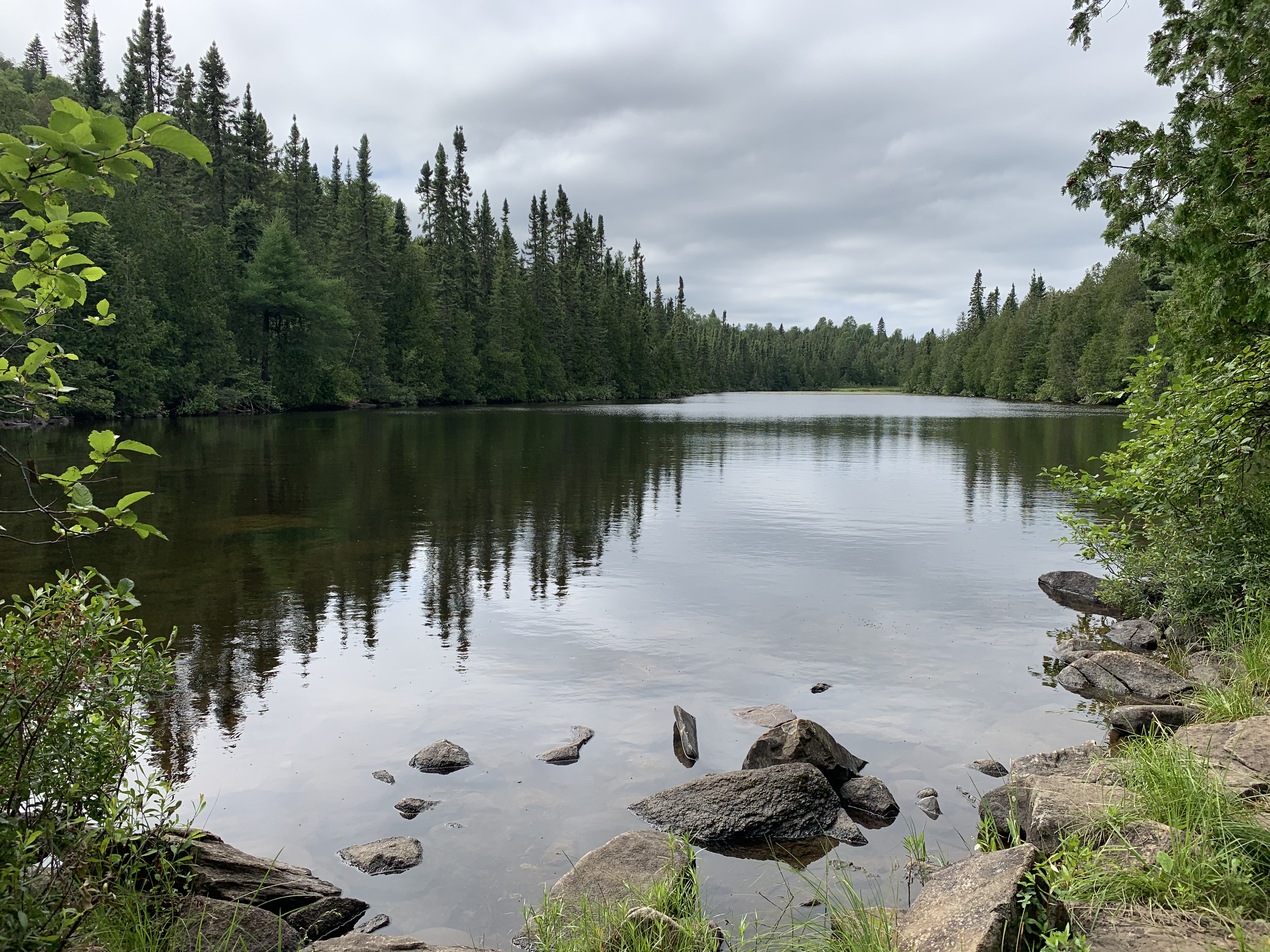
Paddling across Dugout Lake. This is a shallow lake with a good opportunity to see some wildlife.
North end of Dugout Lake, just before entering the short section of the South Brule River that separates Skidway Lake and Dugout Lake.
This is a short and shallow section of the South Brule River that flows between Dugout Lake and Skidway Lake. Watch out for submerged boulders and logs as you paddle upstream from Dugout Lake toward Skidway Lake.
Paddling from the south end of Skidway Lake to the north end of the lake. At the north end of Skidway Lake, you'll find the portage that takes you further upstream to the next section of the South Brule River.
Start of the portage from Skidway Lake when heading upstream to another navigable section of the South Brule River.
A short portage from Skidway Lake to the South Brule River. This is the 33 rod portage on your map.
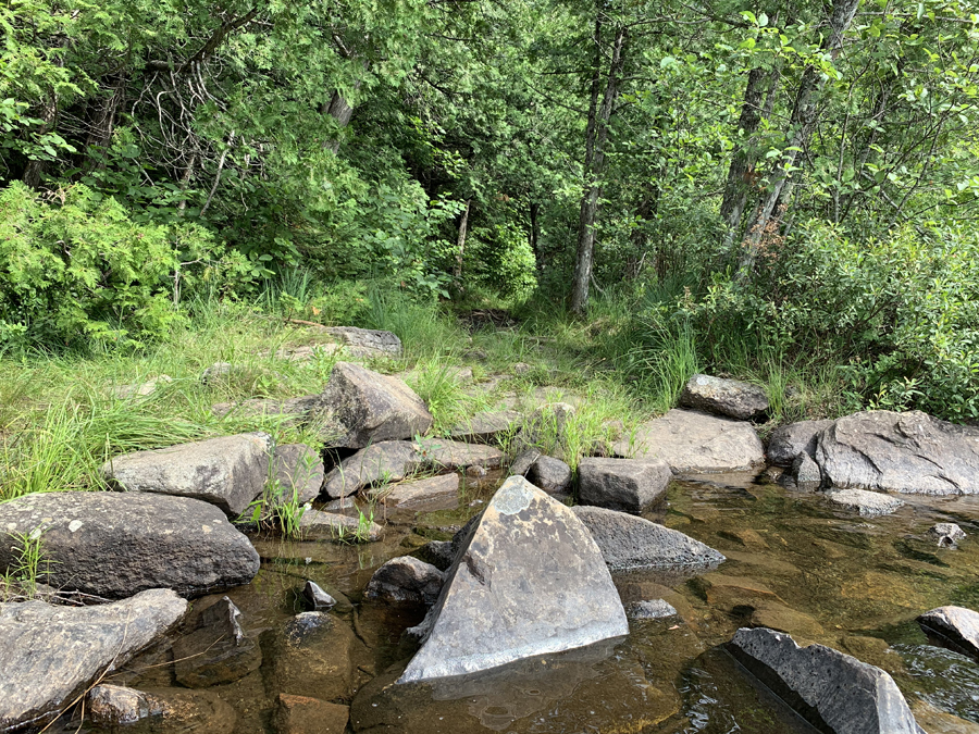
South Brule River looking upstream from the end of the 33 rod portage. Pretty decent landing spot.
Traveling the South Brule River from the Skidway Lake portage, upstream to the South Brule River portage.
This is the beginning of the South Brule River to South Brule River portage. This is the middle of the three portages between Skidway Lake and Swan Lake. It's 36 rods long.
Portaging from the South Brule River in the upstream direction back into the South Brule River. This is the middle of the three portages along the river between Swan Lake and Skidway Lake.
Back again to the South Brule River. Landing on this end is a bit rougher with a pile of boulders to wrestle your canoe over.
Paddling the South Brule River from the South Brule River portage upstream to the Swan Lake portage.
Start of the portage to Swan Lake from the South Brule River.
Portaging from the South Brule River to Swan Lake. This is a 30 rod portage.
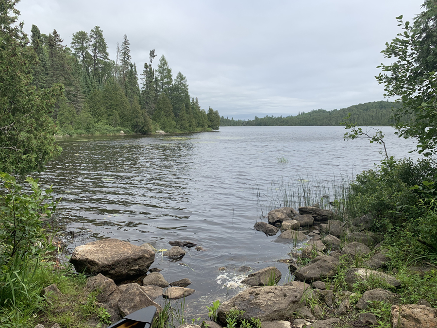
Arrival at Swan Lake.
Additional photos and video will be added soon (in 2021) for the Swan Lake to Brule Lake stretch of the South Brule River.
Traveling the South Brule River (Downstream)
Click on the photos below to see the full resolution image - Use your browsers back button to close photo and return to this page.
Start of the portage from Swan Lake to the South Brule River. Clear water and a solid bottom, combined with shallow water, make for a very nice canoe landing spot.
Portage is a flat 30 rods in length. There is one small mudhole near the South Brule River end of the portage. The rest of the portage just has a few tree roots and an occasional rock to step over.
Canoe landing on the South Brule River end of the portage. A few rocks. The bottom is mostly solid with a bit of silt that you'll stir up to cloud the water. The depth of the water is quite shallow making it easy to stand in.
Paddling from the Swan Lake portage downstream to the South Brule River portage. A scenic stretch of the river.
The water isn't deep, but there are lots of boulders here. Portage starts on the left side of the river.
Portaging from the South Brule River downstream back into the South Brule River. This portage is quite level. It's flatness keeps it from draining well, so there is a lot of muddy spots scattered along its length.
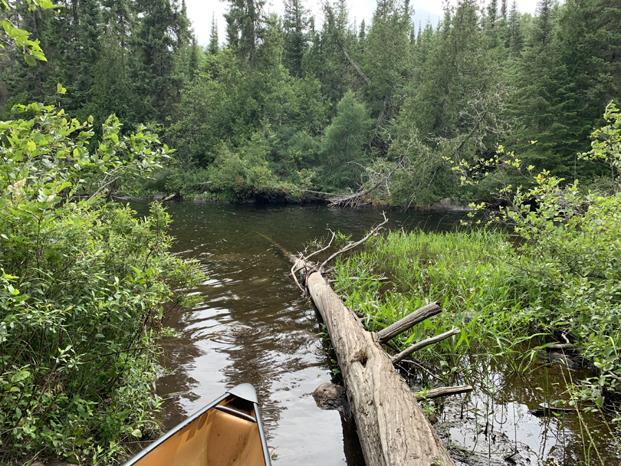
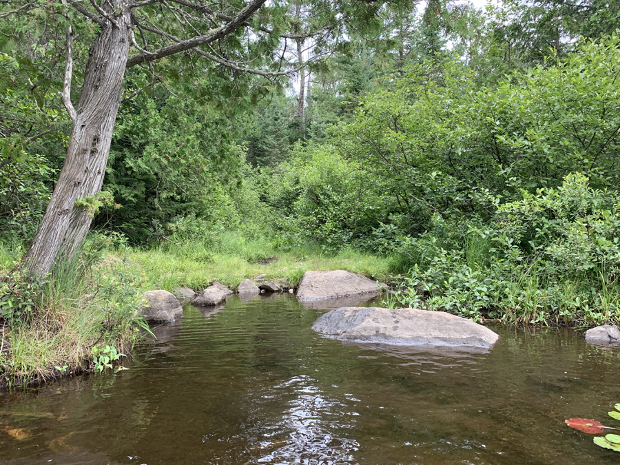
You are back at the South Brule River. If you balance on the log you can probably unload/load two canoes at the same time here. Some boulders to hang up on as you head out into the river. Otherwise, the water isn't deep at the landing and the substrate is fairly firm.
Paddling downstream from the South Brule River portage to the Skidway Lake portage. This is a wider section of the river. From the west end of this stretch, you can get some nice views of Brule Mountain in the distance. As you approach the Skidway Lake portage, you must navigate through a boulder field to get up to the canoe landing.
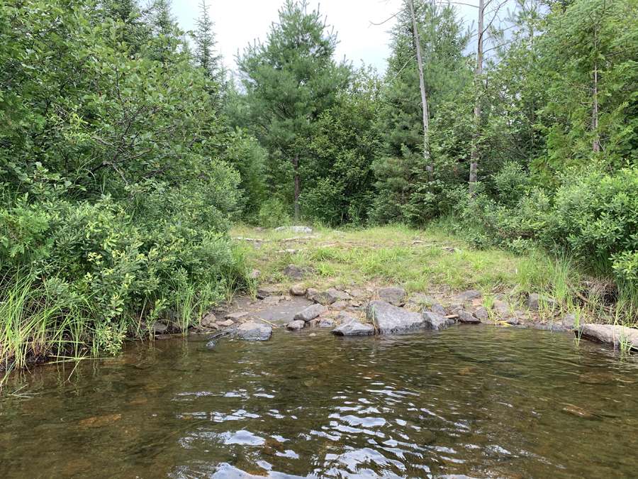
Shallow water approach to the Skidway Lake portage. Once you get to shore, its a really nice start to the portage. Water isn't deep at all and the river bottom is solid.
Portaging from the South Brule River downstream to Skidway Lake. A few rocky spots, a bit brushy and very little mud to cake your boots with.
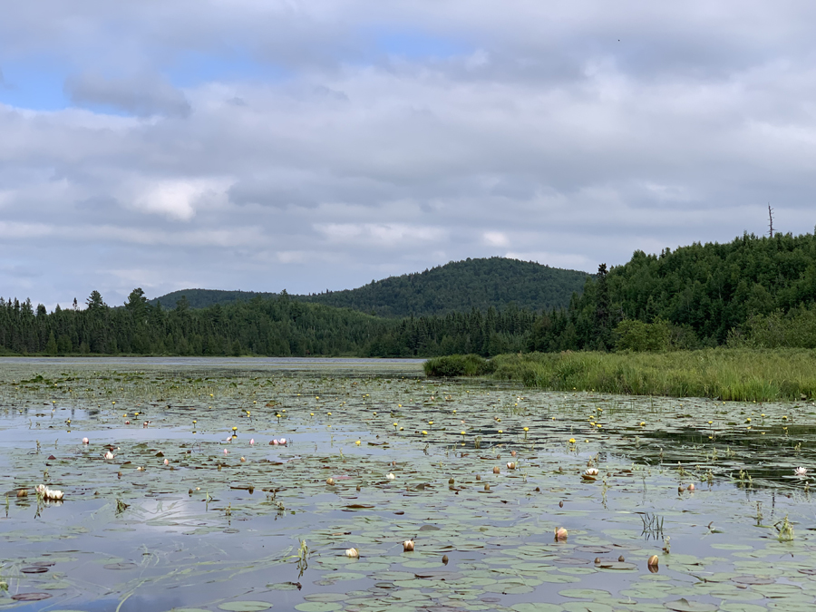
West end of Skidway Lake. The footing here is good on account of shallow water and only a few boulder obstructions. This western bay is quite beautiful with all the water lilies in bloom in summertime.
Skidway Lake feels more like you never left the river. The shallow marshy lake is habitat to lots of waterfowl. Beavers are active in this area. More views of Brule Mountain from the western end of Skidway Lake.
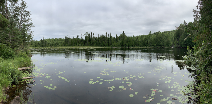
Paddling the short stretch of the South Brule River from Skidway Lake downstream to Dugout Lake. The river isn't very deep through this channel, so you may get stuck on underwater obstructions a time or two, depending on water levels. The river flows out into the lily pad choked northern end of Dugout Lake.
Brule Mountain as seen from an area thick with lily pads in the north end of Dugout Lake.
Paddling Dugout Lake from near Skidway Lake downstream toward the Marshall Lake portage. Dugout Lake ends as you approach a shoal of rocks that the river flows over in a short set of riffles. It may require pulling your canoe through by hand, if the water level is too low.
Between Dugout Lake and Marshall Lake, you must navigate through two small areas of fast water mined with dark colored rocks below the surface. You may have to get out of your canoe and wade through these short stretches. There are no portages here.
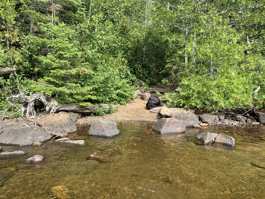
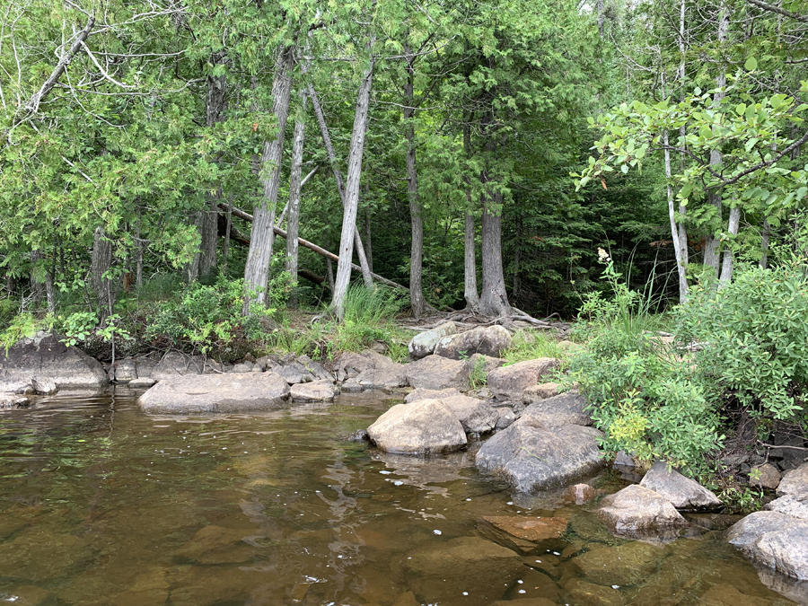
A couple subsurface boulders off shore to dodge as you come into this landing. Landing itself has several submerged boulders, but a hard bottom. You can park a canoe at the large foreground boulder and rock hop to the large rock next to shore.
This is an easy portage. No obstacles worth mentioning. Just haul your stuff across it.
Rock and more rocks at this end. Slippery too with algae. The lake is not deep here at the landing, so you can stand in the water.
Paddling along the south shore of Marshall Lake from the Dugout Lake portage (South Brule River) to the Bower Trout Lake portage. You will pass by the campsite located just south of the Dugout Lake portage, soon after you start paddling.
Both of the portage landings on Marshall Lake are rocky. This portage landing is a little easier to work with than the one leading to Dugout Lake on the west end of the lake.
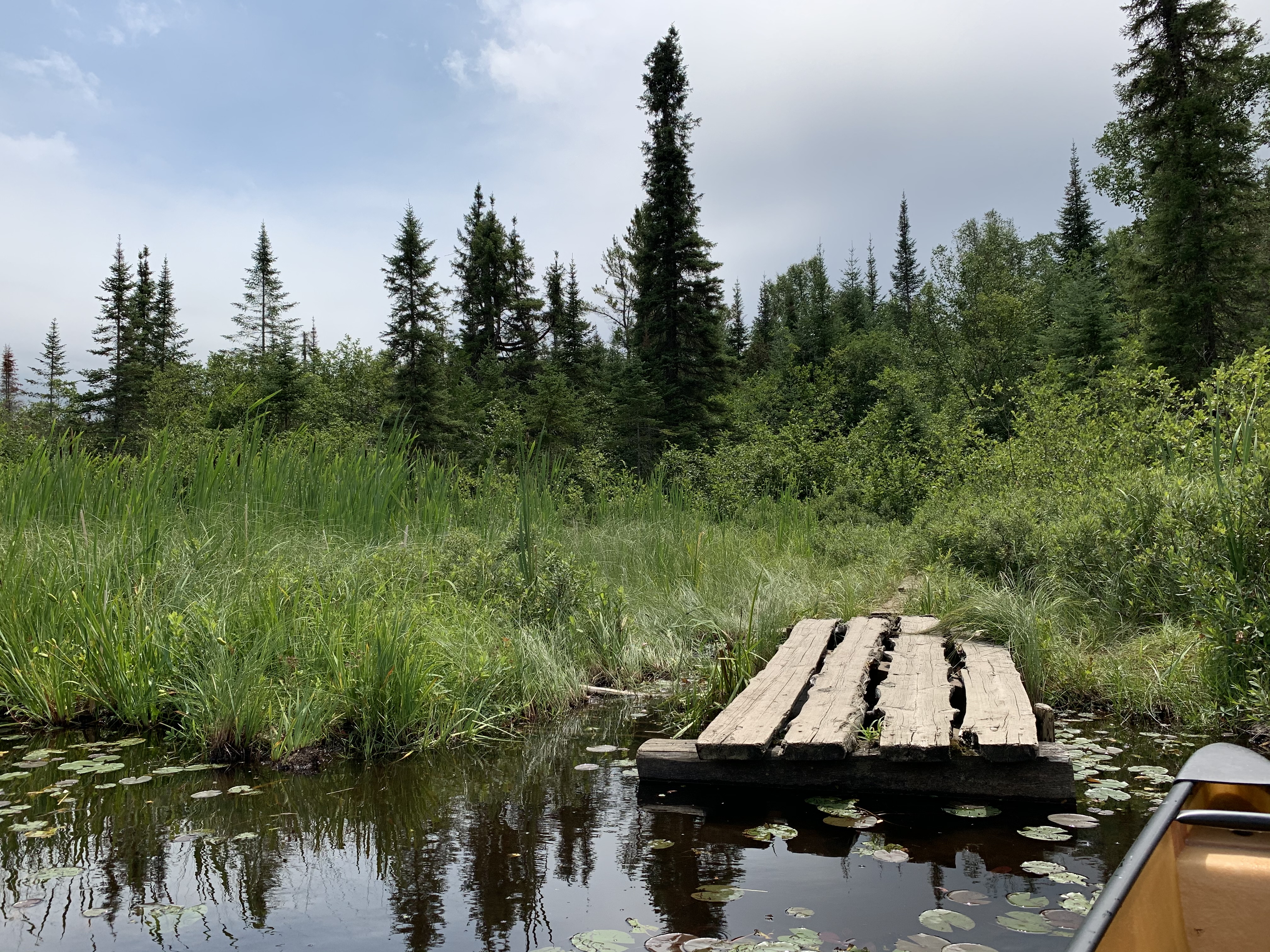
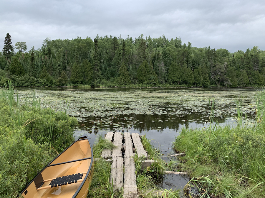
This portage heads up very gently, gaining about 60 feet of elevation from Marshall Lake to the top of a small hill. It then descends about 60 feet in a similary easy manner to the swampy shoreline found at the western end of Bower Trout Lake. Here you will find an old dock from which to launch your canoe.
West end of Bower Trout Lake. An old dock (beware protruding nails!) facilitates access to the lake through the soggy marsh.
Paddling Bower Trout Lake from the Marshall Lake portage to BWCA Entry Point 43 landing. Along the way, pass the location where the South Brule River flows into the lake, which is just east of the Marshall Lake portage. Paddle down to nearly the east end of Bower Trout Lake, where the South Brule River exits the lake, then turn and paddle to the entry point landing along the northeast shoreline.
Additional photos and video will be added soon (in 2021) for the Brule Lake to Swan Lake stretch of the South Brule River.