ROUTES/PORTAGES FROM DUGOUT LAKE:
To Marshall Lake (after short paddle along the South Brule River): Walk the 30 rod portage
To Skidway Lake (after short paddle along the South Brule River): Paddle In
To South Brule River (downstream): Paddle In
To South Brule River (upstream): Paddle In
Dugout Lake
Gunflint Ranger District
Dugout Lake is just a wide section of the South Brule River. That river flows into the north end of Dugout Lake and passes out of the south end of the lake. There are two sets of very small rapids between Dugout Lake and Marshall Lake that don't have a portage. Sometimes, when the water levels are down, these riffles require exiting the canoe and walking through the water.
Dugout Lake is rather marshy. The lake is only 8 feet deep. However, it does have fish in it. The river current would certainly keep it from freezing out in winter.
Brule Mountain makes a scenic backdrop for the lake. It can be seen to the southeast from most of Dugout Lake.
The South Brule River, a tributary of the Brule River, flows into Marshall Lake just south of the portage on the west end of the lake. The river exits the lake at the far eastern end, just south of the portage to Bower Trout Lake.
A small creek flows into the east side of the lake from Iota Lake. Another little stream flows into the northwest part of Dugout Lake. This stream comes from Swede Lake and Abita Lake. Abita Lake has the third highest elevation of any lake in Minnesota. Redeye Lake has the highest elevation (which is located just south of the east end of Winchell Lake and due west of State Lake). Second place belongs to tiny Bulb Lake which is just east of Abita Lake. Bulb Lake drains into Abita Lake via a small creek, so it certainly has a higher elevation.
An old railroad used to run through the forest close to the east shoreline of Dugout Lake. This rail line ended at Swan Lake at a logging camp. That logging camp is now a BWCA campsite (the one on the very north end of the lake). This railway was a spur of a larger rail system owned by the General Logging Company. Operations ceased on this railway in the 1930's (Heinselman).
The area around this lake was subjected to a prescribed burn in September/October of 2016. The intentional ignition was performed to reduce fuel created by the July 4, 1999 windstorm. The burn area extends from Dugout Lake and Iota Lake on the east, to about the middle of a north/south line extended through Lac Lake on the west. The burn area starts about 1/2 mile south of the South Brule River and goes north up to nearly Little Trout Lake. Another burn area extends from the west end of Little Trout Lake up along the west side of Misquah Lake, which may be part of this same prescribed burn. See Lux Lake Prescribed Burn. Another fairly small natural fire burned along the shores of Dugout Lake in 1995 (Beymer, 2006).
Click on the photos below to see the full resolution image - Use your browsers back button to close photo and return to this page.
PADDLING FROM SOUTH BRULE RIVER UPSTREAM INTO THE SOUTH BRULE RIVER (TOWARD SKIDWAY LAKE)
The South Brule River flows out the south end of Dugout Lake, over this rocky section of riffles. It is difficult to get through here without walking your canoe, if the water level is low.
The opportunity to spot wildlife is high on Dugout Lake. Lots of waterfowl especially. You enter Dugout Lake by threading your way through a shallow set of rapids. This small rapids has lots of dark colored rocks just below the surface. The dark coloring of the rocks make them hard to see of course. After you get past the mini-rapids, continue generally north up the lake, keeping more to the lakes western shoreline. You exit the lake by again entering the South Brule River. The short section of river between Dugout Lake and Skidway Lake is also shallow. The current through this channel is barely noticeable and doesn't impede progress much.
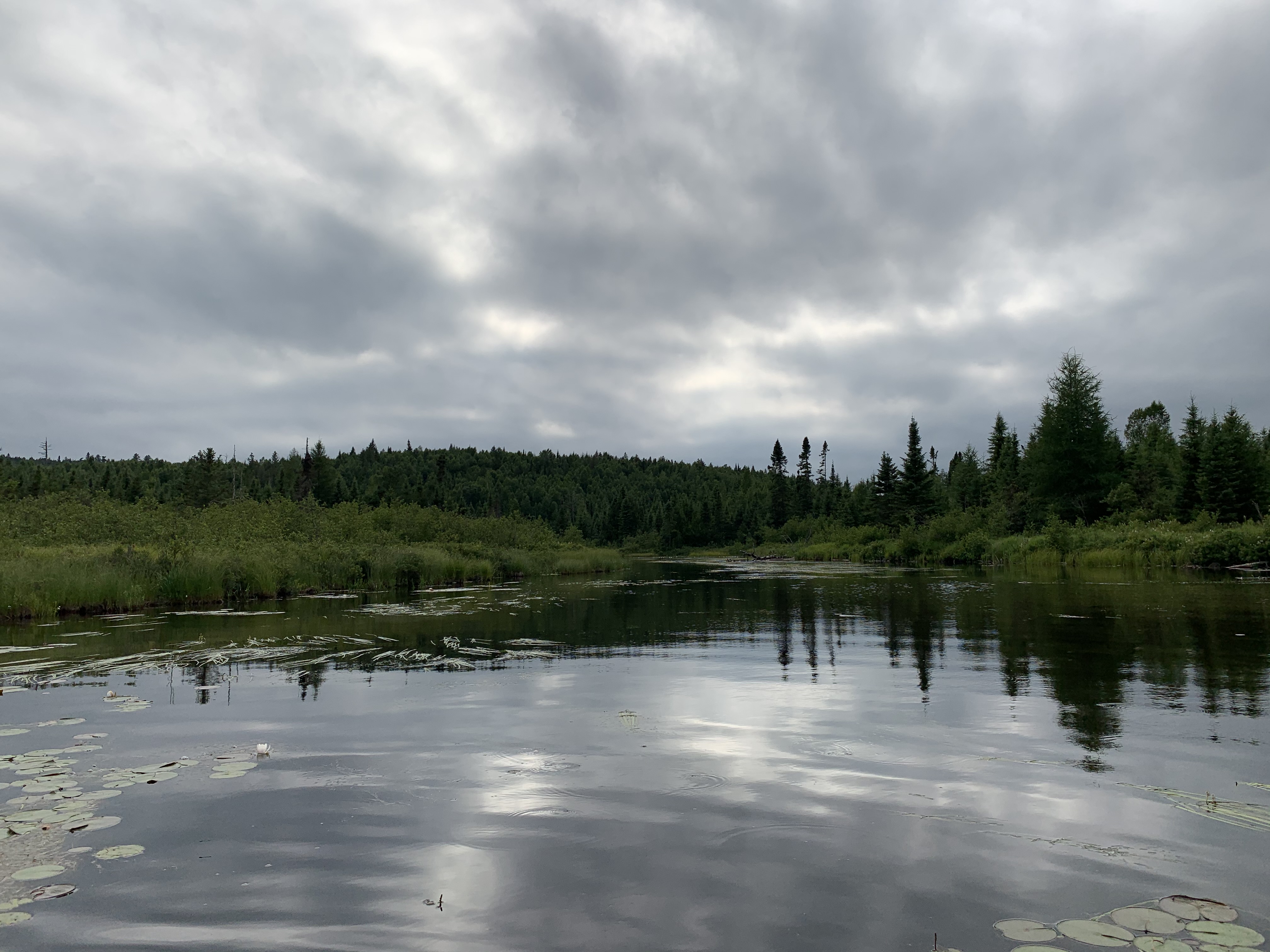
The north end of Dugout Lake. In the middle of your view is where you re-enter the South Brule River (heading upstream toward Skidway Lake).
PADDLING FROM SOUTH BRULE RIVER DOWNSTREAM TO THE SOUTH BRULE RIVER (TOWARD MARSHALL LAKE)
Looking north just east of where the South Brule River flows into Dugout Lake.
Paddling from the north end of Dugout Lake, downstream to the south end of the lake. Dugout Lake separates two stretches of the South Brule River.
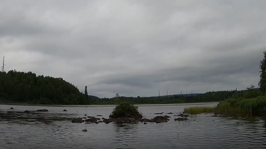
This view is to the southeast. You are in the north end of Dugout Lake. The hill in the distance is one of the three peaks making up Brule Mountain.
Route Connections for Dugout Lake
From Dugout Lake you can portage to Marshall Lake, after you paddle a short stretch of the South Brule River downstream of Dugout Lake. You can also paddle into Skidway Lake, after you paddle a short section of the South Brule River upstream to Skidway Lake.