ROUTES/PORTAGES FROM SKIDWAY LAKE:
To Dugout Lake: Paddle In (after a very short section along the South Brule River)
To the South Brule River: Walk the 33 rod portage
Skidway Lake
Gunflint Ranger District
A skidway is an elevated contraption used for sliding logs into the water. The lake probably gets its name from this device. There was a spur of the General Logging Company's railroad running along the east side of Skidway Lake. This rail line continued west to the north side of Swan Lake. This railway shut down in the 1930's (Heinselman).
The area around this lake was subjected to a prescribed burn in September/October of 2016. The intentional ignition was performed to reduce fuel created by the July 4, 1999 windstorm. The burn area extends from Dugout Lake and Iota Lake on the east to about the middle of a north/south line extended through Lac Lake on the west. The burn area starts about 1/2 mile south of the South Brule River and goes north up to nearly Little Trout Lake. Another burn area extends from the west end of Little Trout Lake up along the west side of Misquah Lake, which may be part of this same prescribed burn. See Lux Lake Prescribed Burn. A relatively small natural fire burned some of the shoreline of Skidway Lake in 1995.
A small creek, navigable for the first one-tenth mile, flows into Skidway Lake just east of the South Brule River portage. This creek comes from Lac Lake. The South Brule River flows into the west end of Skidway Lake and flows out the lakes eastern end toward Dugout Lake. Skidway Lake is just a wide, shallow section of the river. There is a 14 foot deep hole right below the rapids where the South Brule River flows into the lake. Perhaps a good place to try a few casts...
The brief section of river between Skidway Lake and Dugout Lake is shallow. During low water you may have to walk your canoe through part of this area.
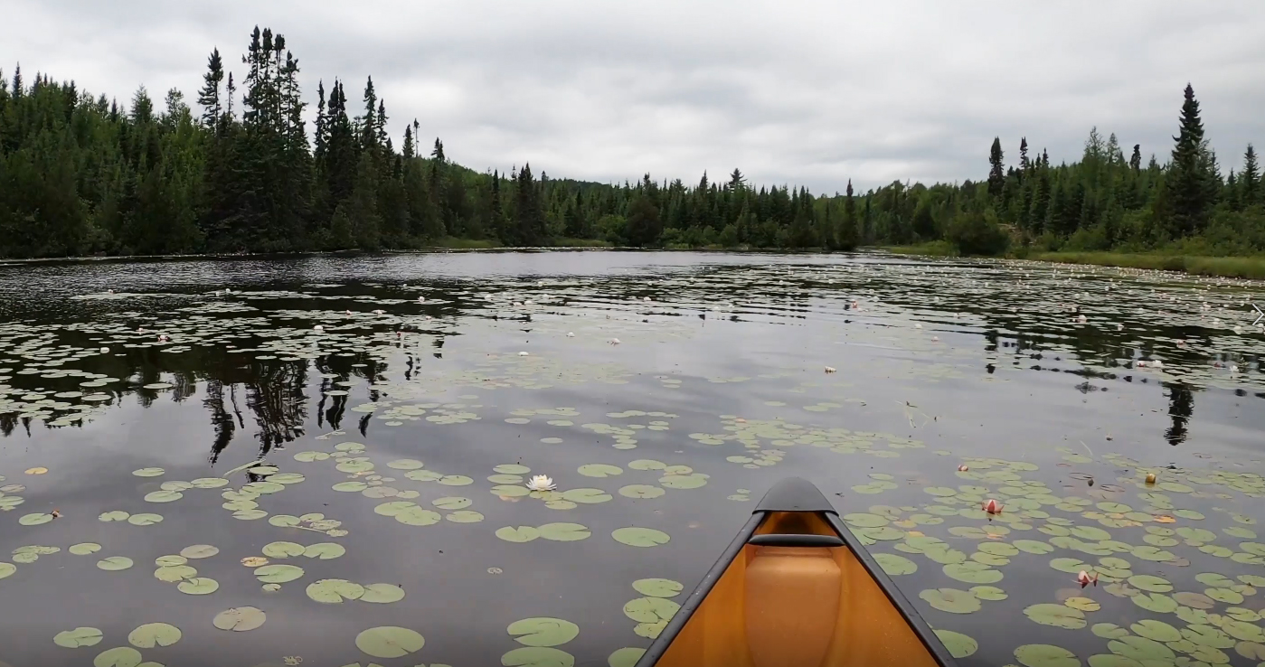
The western bay of Skidway Lake is quite scenic as it is covered with lily pads. They are in full bloom in June, July and August. Distant views of Brule Mountain can also be seen from this end of the lake.
References:
Beymer, Robert, Boundary Waters Canoe Area – Volume 2 – Eastern Region (Berkeley: Wilderness Press, 2006), 91, 94, 103, 111.
Pauly, Daniel, Exploring the Boundary Waters (Minneapolis: University of Minnesota Press, 2005), 284.
Click on the photos below to see the full resolution image - Use your browsers back button to close photo and return to this page.
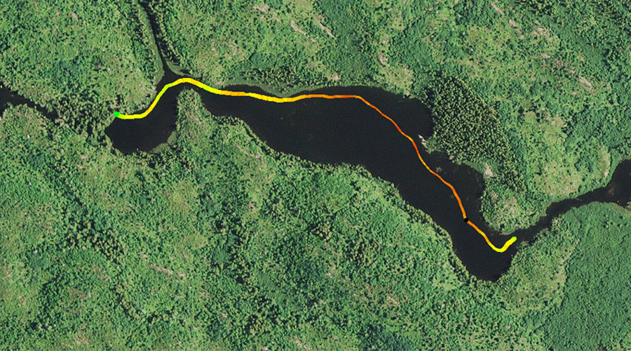
PADDLING FROM DUGOUT LAKE UPSTREAM TO THE SOUTH BRULE RIVER PORTAGE
Heading westbound around the middle part of Skidway Lake. The north side of the lake seems to have the majority of the lily pads. Not sure if this is because the south side of the lake gets less sunlight (blocked by the trees along that shoreline), or because the part of the lake along the southern shoreline tends to be a little bit deeper.
From the channel between Skidway Lake and Dugout Lake, paddle in a westerly direction staying closer to the north side of the lake. There is no discernable current as you travel upstream through the lake. The small bay at the west end of the lake contains your destination, the South Brule River portage.
On approach to the South Brule River portage near the west end of the lake. Portage to the South Brule River -or- Explore Another Route **********************************************END OF ROUTE***********************************************
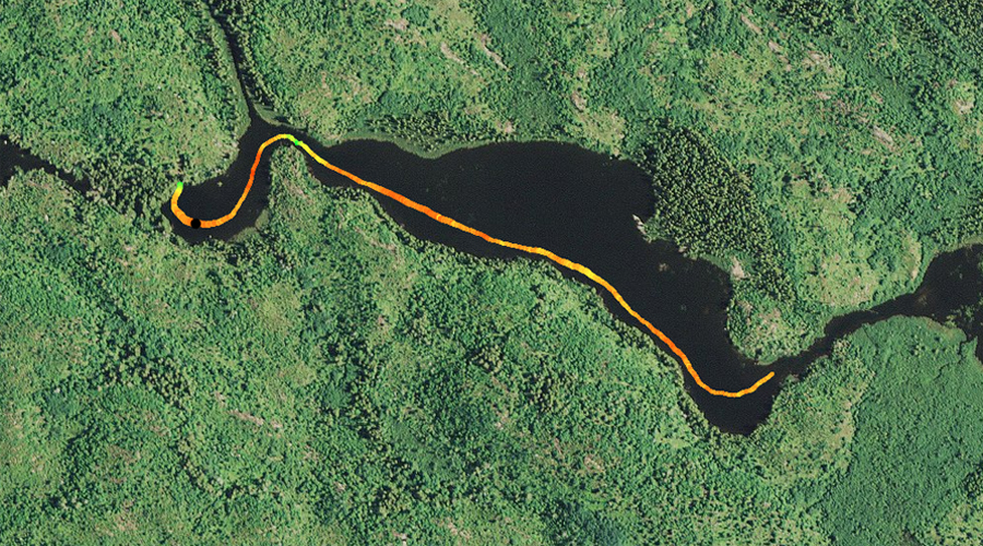
PADDLING FROM THE SOUTH BRULE RIVER PORTAGE DOWNSTREAM TO DUGOUT LAKE
View of the western bay of Skidway Lake. In summer it is filled with flowering lily pads.
This stretch of paddling begins at the portage to the South Brule River at the western end of the lake. You paddle through the west bay of the lake, which often has a lot of flowering aquatic vegetation in it by the time summer rolls around. As you round the bend and start to head east out of the western bay, you are shown a wonderful view of Brule Mountain rising up above the far end of the lake. Continue east/southeast along the south shoreline. You may see some beavers swimming or feeding in the shallows. You end the crossing of Skidway Lake at its eastern end as you enter the South Brule River, heading downstream toward Dugout Lake.
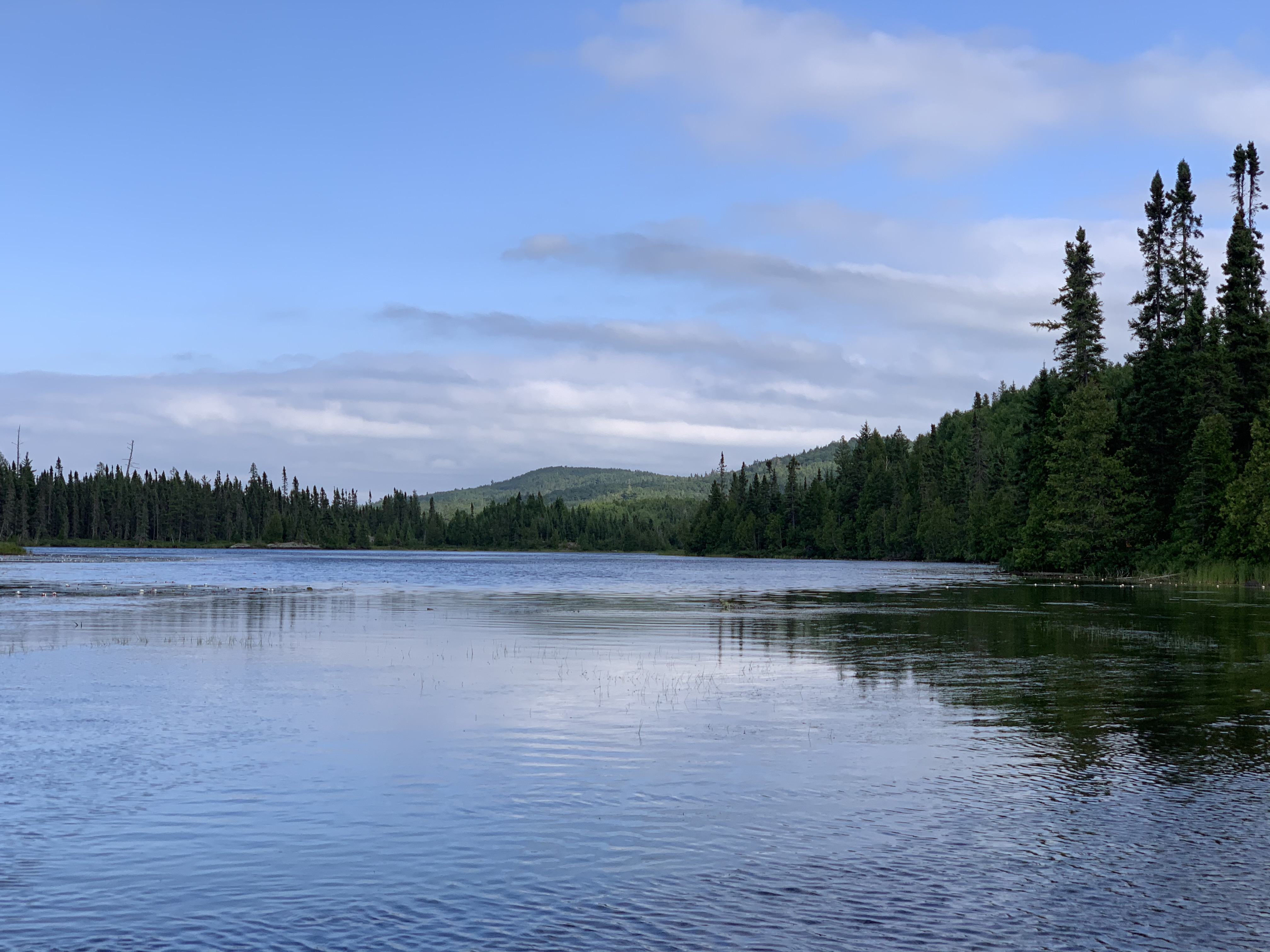
Looking to the southeast toward Brule Mountain. The summit is about 1.5 miles away, as the crow flies, from this vantage point. Paddle into Dugout Lake -or- Explore Another Route **********************************************END OF ROUTE***********************************************
Route Connections for Skidway Lake
From Skidway Lake you can portage upstream to the South Brule River. You can also paddle into Dugout Lake heading downstream after passing through a very short section of the South Brule River.