MISQUAH LAKE CAMPSITE: Campsite 1 (#773): On campsite on this lake
The lake gets it's name from the Ojibwe word for "red". The red comes from the red granite rock formations found in this area of the BWCA (Pauly, 2005).
The forest around Misquah Lake contains few large trees. The area was impacted by the 1999 July 4th windstorm. However, many decades before that, this area was extensively logged. Most of this logging was for white pine and it occurred in the 1940's and 1950's. The intervening time is not long enough for the big trees to make a comeback. Loggers accessed this area from the road that ran along the north side of Vista Lake. From the end of this road they cut the area toward the south, which is along the west sides of both Vista Lake and Misquah Lake (Heinselman, p. 115). The logging access road crossed at the current day location of the Vista Lake-Horseshoe Lake portage.
There also seems to be evidence of a small fire along the southwestern shore of Misquah Lake. There was a prescribed burn in this area that extended north a ways from Little Trout Lake in 2016, but the description of that burn does not include Misquah Lake. See the Little Trout Lake page for more information.
To the east of Misquah Lake is Gaskin Mountain which is easily visible while you paddle around the lake. It reaches an elevation of 2,245 feet, about 250 feet above Misquah Lake itself. The extremely tough portage between Misquah Lake and Little Trout Lake is made difficult because it goes over the western flank (a sub-peak actually) of Gaskin Mountain. The portage is also very rocky in places. The other portage from Vista Lake is much shorter, but it is still fairly tough with plenty of rocks on that trail too.
There seems to be a small population of large lake trout in Misquah Lake according to the Minnesota DNR fishing surveys.
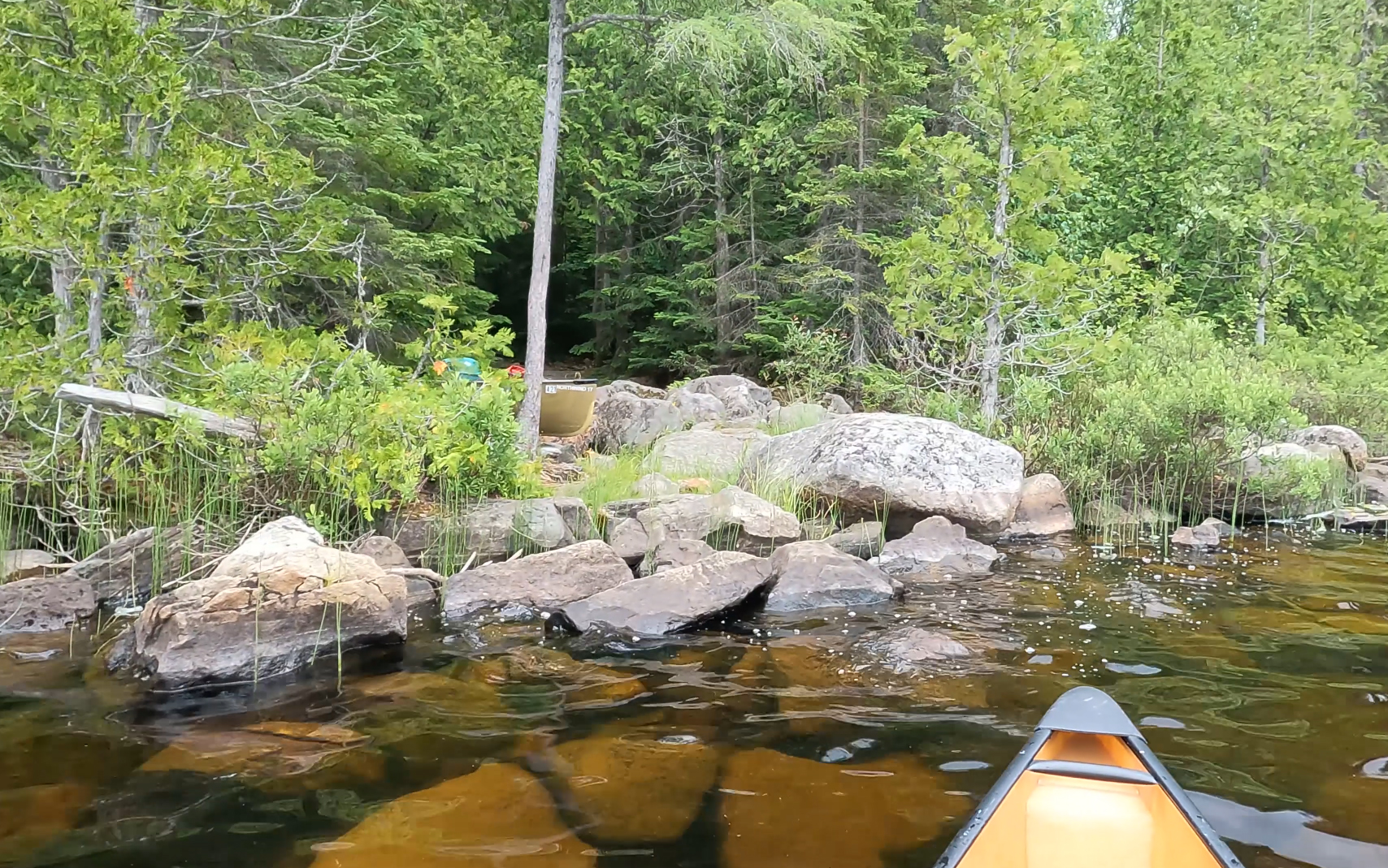
The one campsite on Misquah Lake is rather poor.
Misquah Lake seems to have no inlets. Water from the lake flows out of a little creek down to Vista Lake.
References:
Beymer, Robert, Boundary Waters Canoe Area – Volume 2 – Eastern Region (Berkeley: Wilderness Press, 2006), 96, 100, 102.
Pauly, Daniel, Exploring the Boundary Waters (Minneapolis: University of Minnesota Press, 2005), 286, 288.
Click on the photos below to see the full resolution image - Use your browsers back button to close photo and return to this page.
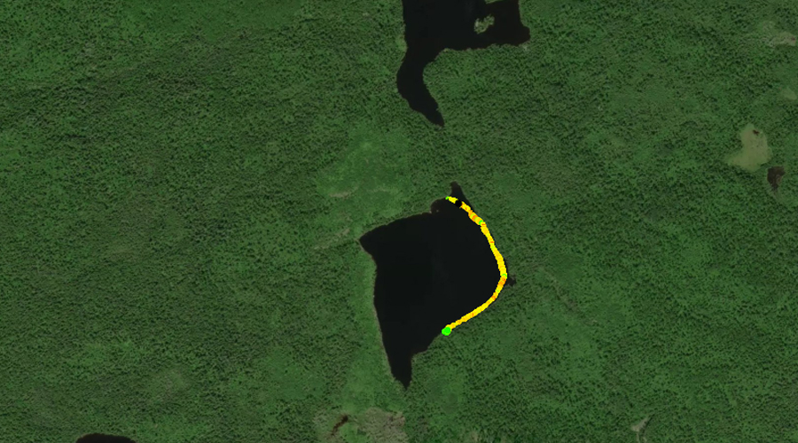
PADDLING FROM THE VISTA LAKE PORTAGE TO BWCA CAMPSITE 773
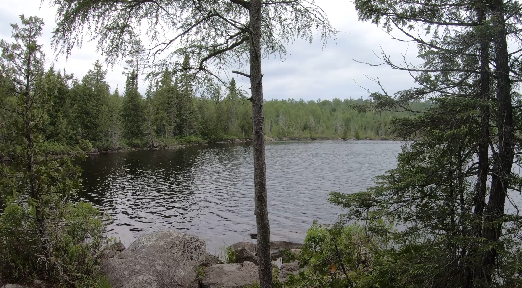
A look at much of Misquah Lake as seen from the Vista Lake portage landing.
Paddling Misquah Lake from the Vista Lake portage to the lakes only campsite. From the portage, following the shoreline clockwise. Route explores from north end of Misquah Lake and down the eastern shoreline beneath the slopes of Gaskin Mountain.
PADDLING FROM BWCA CAMPSITE 773 TO THE LITTLE TROUT LAKE PORTAGE
Peering to the north from the campsite on the southeast shore of Misquah Lake.
A short paddle from the Misquah Lake campsite, south along the eastern shoreline to the Little Trout Lake portage. Portage to Little Trout Lake -or- Explore Another Route ***********************************************END OF ROUTE***********************************************
PADDLING FROM THE LITTLE TROUT LAKE PORTAGE TO THE VISTA LAKE PORTAGE
South end of Misquah Lake as seen from the start of the Little Trout Lake portage.
View of the portage landing as you pull away from it.
From the Little Trout Lake portage near the south end of Misquah Lake, we follow the western shoreline north until arriving at the Vista Lake portage. Views of Gaskin Mountain to the right (east) along the route.
South view along west shoreline of Misquah Lake. This view is from the Vista Lake portage landing. Portage to Vista Lake -or- Explore Another Route ***********************************************END OF ROUTE***********************************************
Route Connections for Misquah Lake
From Misquah Lake you can portage to Little Trout Lake or Vista Lake. The portage to Little Trout Lake is challenging.