FRENCH LAKE CAMPSITES: Campsite 1 (#490): Campsite on the north shoreline of the lake
Campsite 2 (#491): Just east of the Powell Lake portage
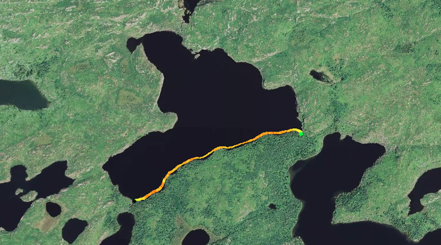
French is a fairly sizeable and rather open lake of considerable depth. The lakes in this area receive relatively few visitors and the portages headed west toward Virgin Lake are a bit rougher than average (Beymer, 2006). It is about the seventh deepest lake entirely within the BWCA. Only lake trout inhabit this lake and they don't seem to be too abundant. There are two campsites. The campsite on the north shore of the lake is a campsite of last resort, no trees, windswept and somewhat overgrown. The south shore of French Lake escaped the 2006 Cavity Lake Fire, but the rest of the lakes shoreline didn't. The western shoreline of French Lake has some interesting cliffs, including a cliff with a large rock overhanging the water on the western point. This cliff is easily visible from almost anywhere on the lake.
The portage to Seahorse Lake is short and uphill. The portage to Gillis Lake is also very easy and nearly flat. The Fern Lake to French Lake portage is level, but a bit overgrown and the path is also a bit rougher. The portage to Peter Lake is long, at 132 rods, but it is downhill, especially as you near Peter Lake. Drops 55 feet of elevation between French Lake and Peter Lake. The Powell Lake portage from French Lake is slightly uphill near French Lake and then level for the remaining portion. It is only 33 rods.
French Lake has portages to many different lakes. Even so, it is not a heavily visited lake. The route north of French Lake into Seahorse Lake has very low visitor traffic. Traffic to the west into Powell Lake or Peter Lake is not much higher. Most groups don't go past Gillis Lake. If you do plan to head west over to Gabimichigami Lake, the Peter Lake route is the easiest.
Seahorse Lake feeds French Lake from the north via the Chub River. French Lake appears to be where the Chub River ends. Another creek flows out the southern tip of French Lake into Fern Lake. There is no hydrological drainage from French Lake into Gillis Lake, Powell Lake or Peter Lake.
References:
Beymer, Robert, Boundary Waters Canoe Area – Volume 2 – Eastern Region (Berkeley: Wilderness Press, 2006), 61, 156, 158, 161.
Pauly, Daniel, Exploring the Boundary Waters (Minneapolis: University of Minnesota Press, 2005), 330, 333.
Click on the photos below to see the full resolution image - Use your browsers back button to close photo and return to this page.
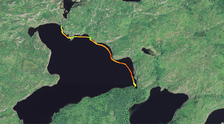
PADDLING FROM THE FERN LAKE PORTAGE TO THE GILLIS LAKE PORTAGE
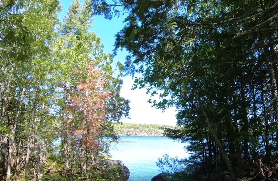
Approaching French Lake from the Fern Lake portage. Looking to the north across the lake.
Beginning at the Fern Lake portage, hug the south shore of French Lake, making the slow bend along that shoreline toward the east, eventually arriving at the portage to Gillis Lake. The water along the south shore of French Lake is fairly shallow. This is the only shoreline of the lake that still retains a mature forest. The shoreline around the rest of the lake was scorched by the Cavity Lake Fire.
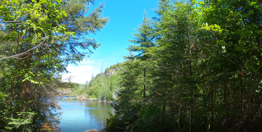
The east end of French Lake from the Gillis Lake portage. Portage to Gillis Lake -or- Explore Another Route **********************************************END OF ROUTE***********************************************
PADDLING FROM THE GILLIS LAKE PORTAGE TO THE SEAHORSE LAKE PORTAGE
View from the forlorn, windblasted and barren campsite along the middle of the north shore of French Lake. Here you are looking toward the south at the distant and still forested southern shoreline of French Lake.
On a breezy day with the wind blowing from the south, paddling from the Gillis Lake portage to the Seahorse Lake portage. You paddle along the north shore of French Lake, making a pitstop at the lousy campsite found about the middle of that shoreline. From the campsite, continue westward along the northern shoreline and finally pull up to the Seahorse Lake portage. The Chub River pours into the lake just to the left of the portage over a series of rapids and a small waterfall.
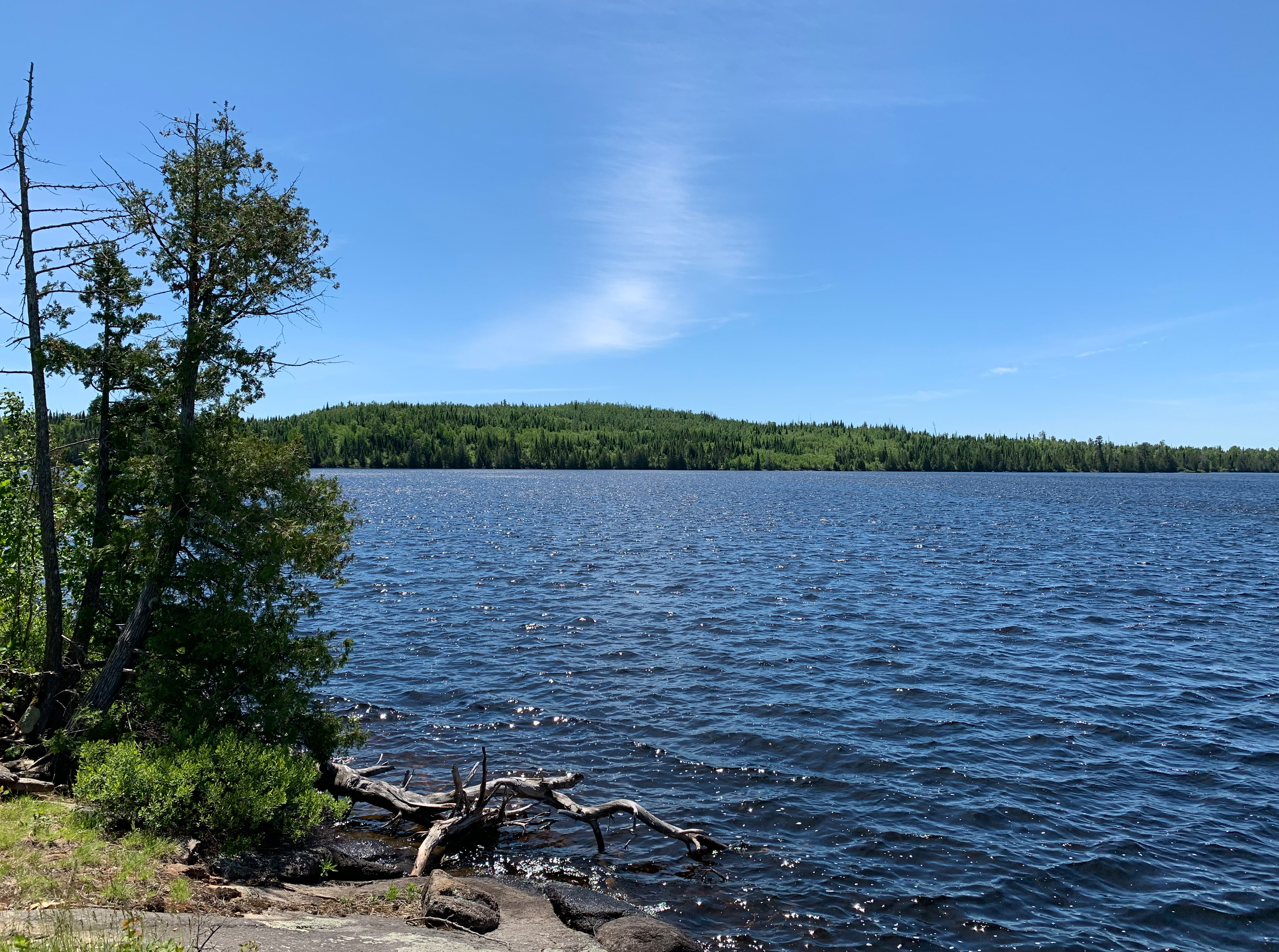
A look at the northwest bay of French Lake. View is almost straight west from the Seahorse Lake portage.
Gazing straight south from the Seahorse Lake portage. You can see the forested south shoreline in the far distance just left of center. To the right of center is the barren west shoreline of French Lake. Portage to Seahorse Lake -or- Explore Another Route **********************************************END OF ROUTE***********************************************