Note: Swollen Ankle Creek is not an official name (thus the name is in parenthesis). This is an important creek for traveling between three lakes in the Hairy Lake Primitive Management Area. So instead of refering to it as "unnamed creek" which is unwieldy, adopted the name Swollen Ankle Creek for use on this website. Swollen Ankle Lake could be the source of this waterway or the unnamed lake just south of Swollen Ankle Lake. That unnamed lake will be referred to as (Sore Foot) Lake on this website.
TRAVELING FROM LUCKY PAY LAKE UPSTREAM FARTHER INTO THE HAIRY LAKE PMA
(Swollen Ankle) Creek mouth. From here it's just under a mile of travel to the unnamed lake just south of Swollen Ankle Lake. From that unnamed lake, it's a short bushwhack north into Swollen Ankle Lake. Going south it's about one-third of a mile to Yogi Lake.
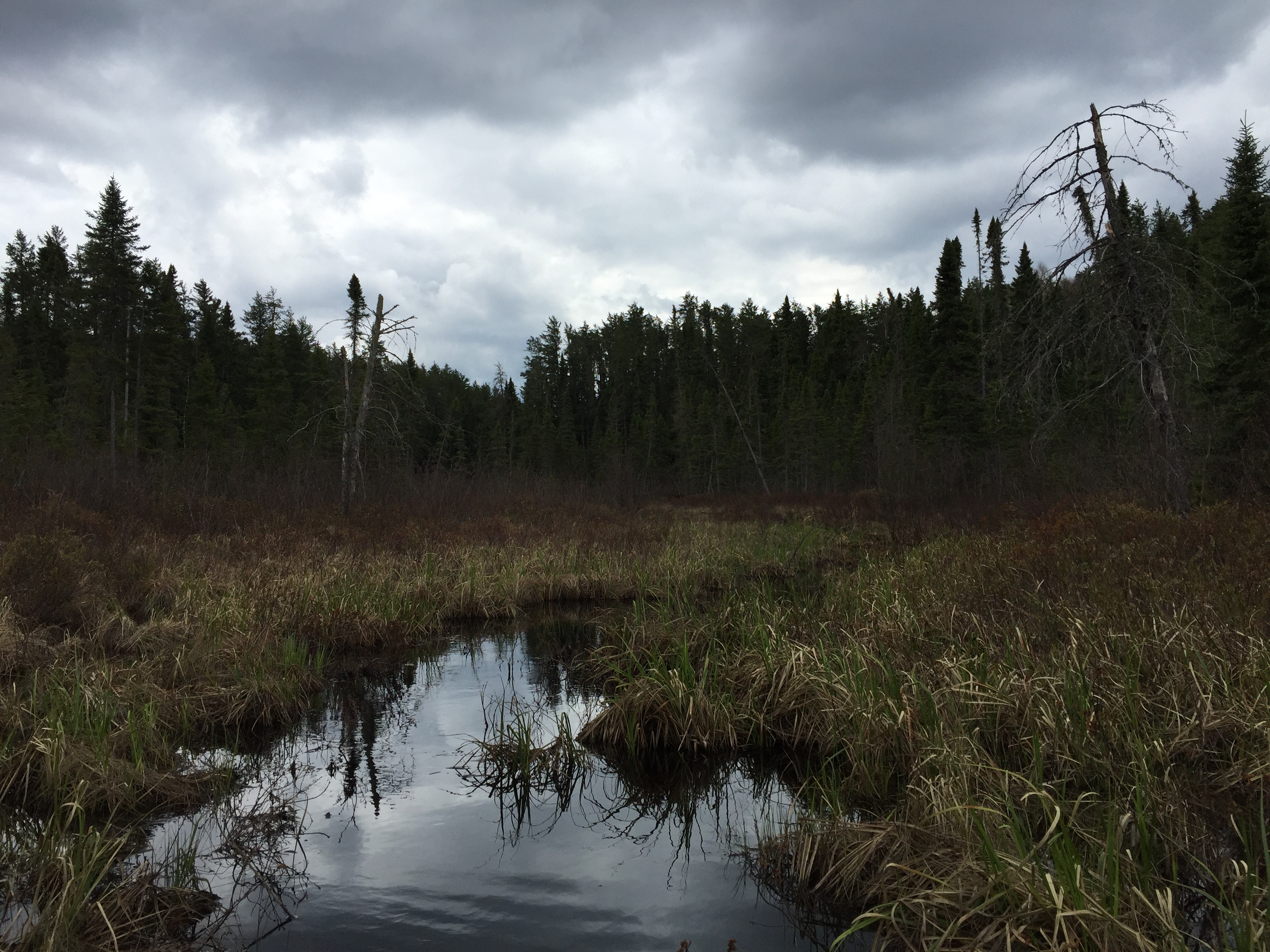
View of the creek and the surrounding wetlands and forest just south of Lucky Pay Lake. It takes a little effort, but it is possible to mostly paddle through this area.
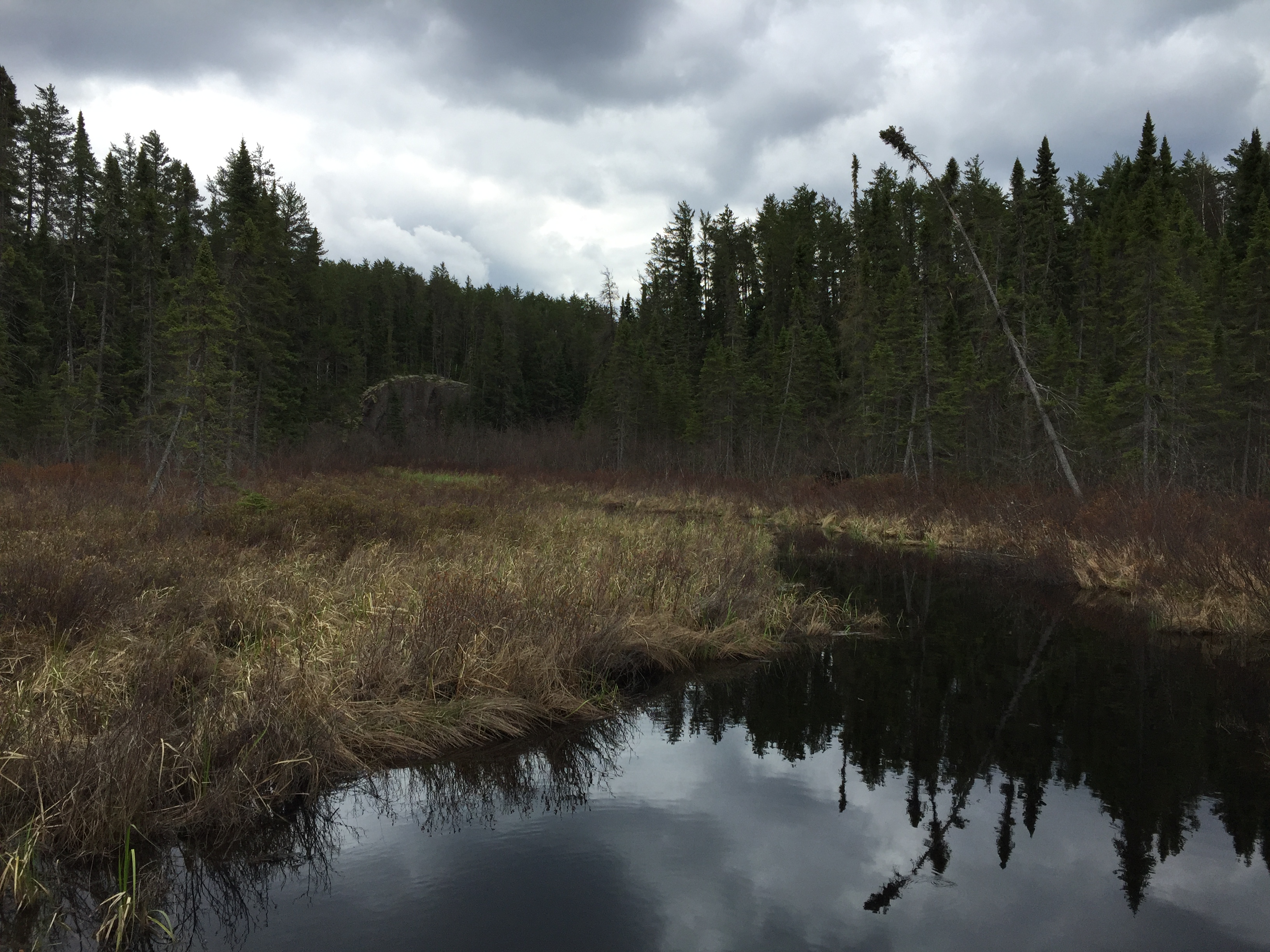
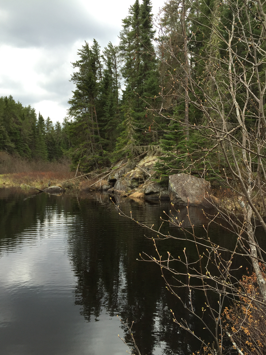
(Swollen Ankle) Creek about 600 feet upstream from Lucky Pay Lake. Looking back downstream.
(Swollen Ankle) Creek about 600 feet upstream from Lucky Pay Lake. This view is upstream. The cliff that rises above a small pond is visible and makes a good landmark. You will definitely feel like you are "away from civilization" if you visit this spot.
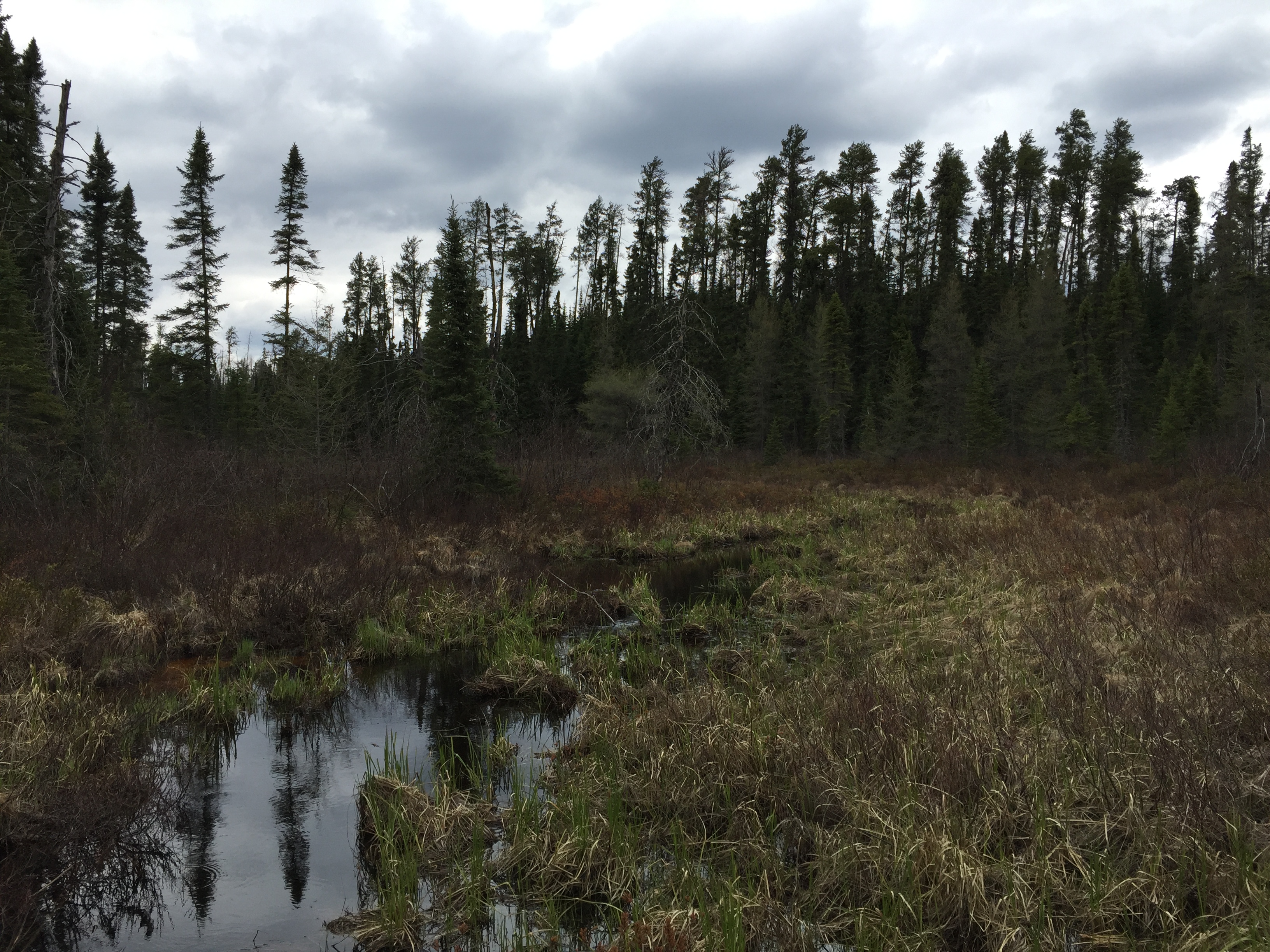
These are early May water levels. The route is probably more difficult in late summer with lower water and more undergrowth. The creek flows through a wide valley bordered by a peat bog with heavy forest on the more distant higher ground. For about the first 1,000 feet upstream, you encounter few obstructions and are able to paddle with little difficulty. Soon the creek begins to narrow and becomes shallower. The water level of the creek is determined by beaver dams, so expect the unexpected. The first beaver dam upstream of Lucky Pay Lake creates a wide area along the creek. From that beaver dam a cliff is now visible in the distance. You liftover the small beaver dam in a single bound and continue paddling. Paddling is easier for a short ways, since that last beaver dam raised the water in this stretch of the creek. The easy going doesn't last long though and the creek becomes clogged up by these mini-islands of floating peat bog with dried grass sprouting out of them. The cliff in the distance gets slowly closer. Eventually you can't move the canoe through the peat bog islands. To get through, you step on each individual peat bog island and do the peat bog hop. These islands sink under your weight, but have just enough buoyancy to keep you afloat until you step onto the next one, assuming you don't linger too long; all the while using the canoe and the canoe paddle to support the rest of your weight to minimize the weight being applied to each peat bog islet. The water is waist deep (and pretty cool as it is early spring). So don't take an unintentional swim. Eventually you leap between enough peat bog islands to make it to another small beaver dam. This is the second dam. From this little beaver dam, another short paddle gets you to a more lavish beaver dam. This is beaver dam number three and it is holding back a large pond. This pond is visible on the McKenzie #7 Map. The cliff you have been seeing for a while is directly across this pond, along its southeast shoreline. Slide your gear over the beaver dam and rip off some quick paddle strokes to cross the pond. This feels like crossing Big Sag after bumbling along the creek to this point. Just below the cliff, hook a right and re-enter the creek. You quickly become crestfallen as the creek disappears into a thicket where the forest edge comes right down to the creek (no peat bog here). Time to consult the map...
With no way to paddle any further, exit the canoe and start walking along the creek. It's actually fairly easy going. After a short ways, cross the creek as the other side looks much more walkable...and it is. Forest is oddly quite open for a stretch, with no undergrowth to speak of. Pine trees grow here (their needles creates more acidic soil). Also a hillock rises up here creating more shade. Both the shade and the less accommodating soil may prevent the undergrowth, but who knows. There may be what one could consider a faint trail here along the forest edge. After passing through the wooded section, the peat bog encroaches again. However, the creek is now too shallow to paddle, so you will have to continue bushwhacking.
(Note: From the end of this video, it is about 350 more feet of bushwhacking until the creek opens up and the water will become navigable again. From there it will require little effort to reach an unnamed lake, which is referred to as (Sore Foot) Lake on this website. From that lake you can quite easily reach Swollen Ankle Lake to the north (another short bushwhack). Going south is harder from that lake, but following a creek along that route will eventually get you to Yogi Lake.)
Another view of (Swollen Ankle) Creek about 600 feet upstream from Lucky Pay Lake.
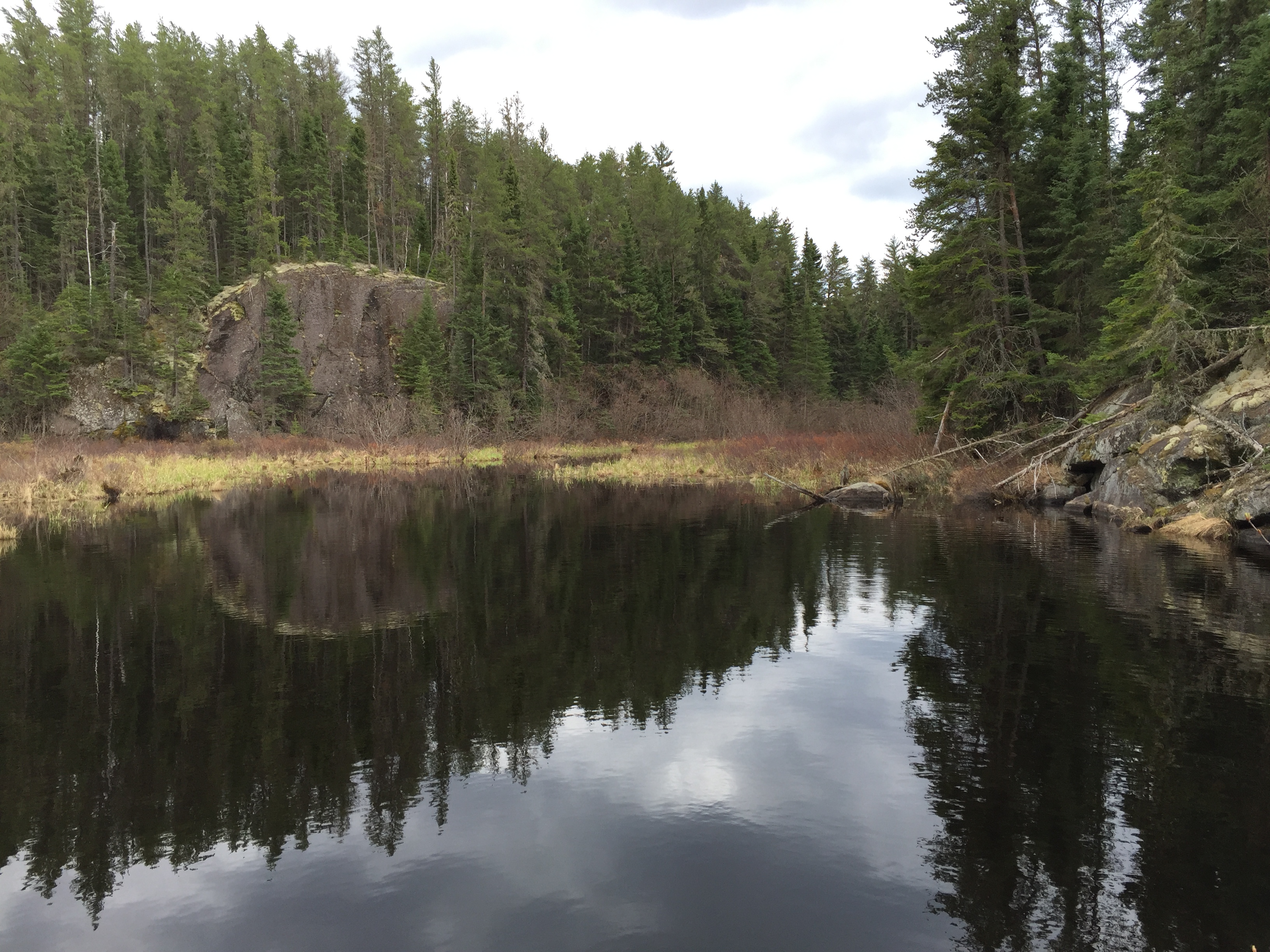
The pond with the cliff. This pond is visible on the McKenzie #7 map to give an idea of the location of this view. This is about 1,000 feet upstream from Lucky Pay Lake. A beaver dam holds back the water of this pond. You'll have to lift your gear over it.
East side of the pond.
The west side of the pond.
You can see the creek in the center of your view flowing into the southeast corner of the pond below the right side of the cliff. That is where you must head next to continue traveling upstream.
Perhaps another 200 feet or so upstream of the pond, you come to this impenetrable mass of brush that blocks the stream going forward. The forest at this point has encroached down to the edge of the stream. This is where the going gets a bit tougher. It's not terribly difficult walking and as long as you keep the creek in sight, you should have no difficulty with route finding. You will have to bushwhack along the stream through the forest from this point, for about 300 feet (roughly 20 rods). Once you clear the forest, the stream will still be unnavigable and you will have to keep walking.
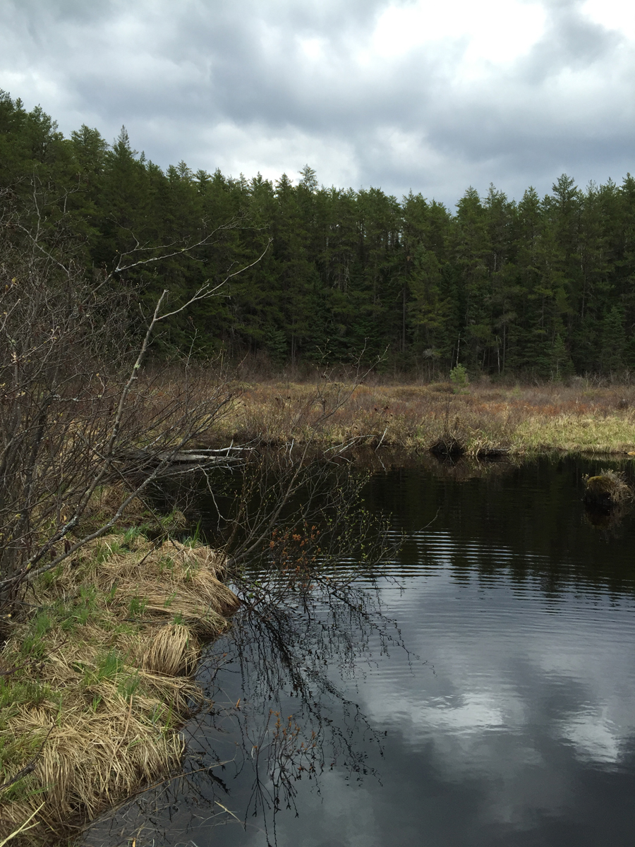
You have cleared the forest, but your bushwhacking efforts aren't done yet. About 150 feet ahead the brush will diminish and the creek will continue through peat bog which should be a little easier walking. About 200 feet after that you should reach navigable water.
The exact GPS coordinates of this photo are: 48.0321194, -90.791030