River Depth: Over 5 feet in places through this section
Fire History: 2011, 1875 and 1863-64
River Length: From its source at Kawishiwi Lake to its mouth at Fall Lake, the river is 75 miles long including 33 miles of distance for the 18 lakes it flows through. The Kawishiwi River drainage covers and area of 1,230 square miles.
Campsites: None
Wildlife Seen on Visit: Many Bald Eagle
Last Visited: May 25, 2015
River Elevation: Headwaters at Kawishiwi Lake at 1643 feet. Mouth at Fall Lake at 1319 feet. From Kawishiwi Lake to Square Lake the river drops one foot of elevation from 1643 feet to 1642 feet
This section of the Kawishiwi River passes through forest that was affected by the 2011 Pagami Creek Fire. Beginning at Square Lake, portage 20 rods into the Kawishiwi River. You can skip this portage by paddling to the left of it on Square Lake, lifting over a beaver dam, and navigating the river bend. The portage may be easier.
The name of this river comes from the Ojibway language. Kawishiwi translates roughly to mean "the river of beaver lodges".
After a short paddle downstream from the 20 rod portage, you come to a 5 rod portage at a small waterfall. You can actually see the 5 rod portage from the 20 rod portage and vice versa. The landing above the waterfall is a little bit tricky as the water is deep and there are no great places to wedge the canoe to make it steady. Below the waterfall is a smooth, sandy landing. The little waterfall is pretty and occasionally you can see fish trying to jump up it (like you see on the National Geographic Channel of salmon in Alaska, but these aren't salmon...). There are often bald eagles in this area (probably because of the fish). Might be a good spot to cast out a lure to see if anything is biting.
Shortly below the waterfall, another small creek flows into the Kawishiwi River as it bends to the left (north). This little unnamed creek flows from Short Lake which lies about a mile or so to the southeast.
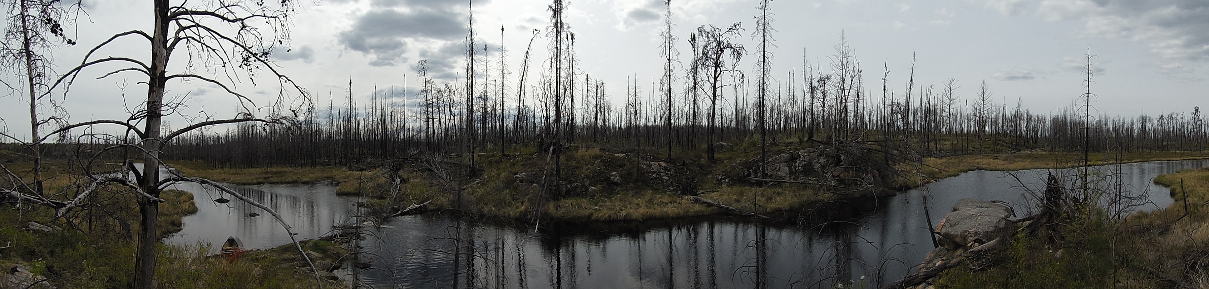
Continuing to paddle along downstream, there is soon a large cliff on the left side of the river. Not far past the cliff was a beaver dam that required a liftover (as of 2015).
After the beaver dam, there is a small "run" of fast water as the Kawishiwi River constricts while passing through some rocks and boulders. The "safe" area for your canoe is narrow through this run, so be on the lookout. The young river soon opens up as it enters Kawasachong Lake.
Traveling the Kawishiwi River from Square Lake to Kawasachong Lake (downstream)
Click on the photos below to see the full resolution image - Use your browsers back button to close photo and return to this page.
Start of the portage that goes from Square Lake back into the Kawishiwi River (headed downstream).
Walking the 20 rod portage from Square Lake to the Kawishiwi River, where you can resume traveling downstream.
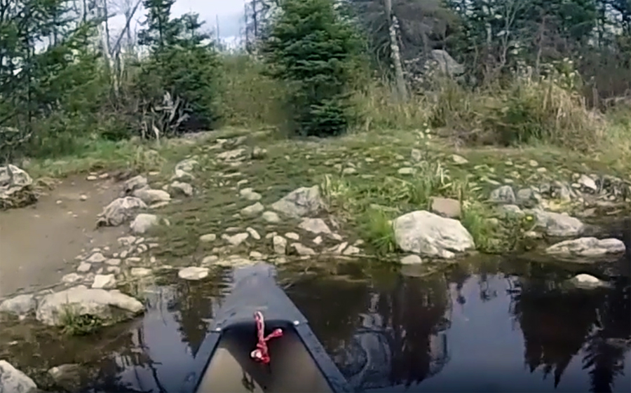
Looking downstream at the Kawishiwi River from the end of the 20 rod portage that leads back to Square Lake. The 5 rod (waterfall portage), is vagulely visible just to the right of your center of vision. If another group of paddlers was standing at that portage, it would be evident from this vantage point. The river actually is navigable to your left if you don't want to do the 20 rod portage. If you elect to skip the portage, you will have to liftover a beaver dam (most likely) and deal with some mild current.
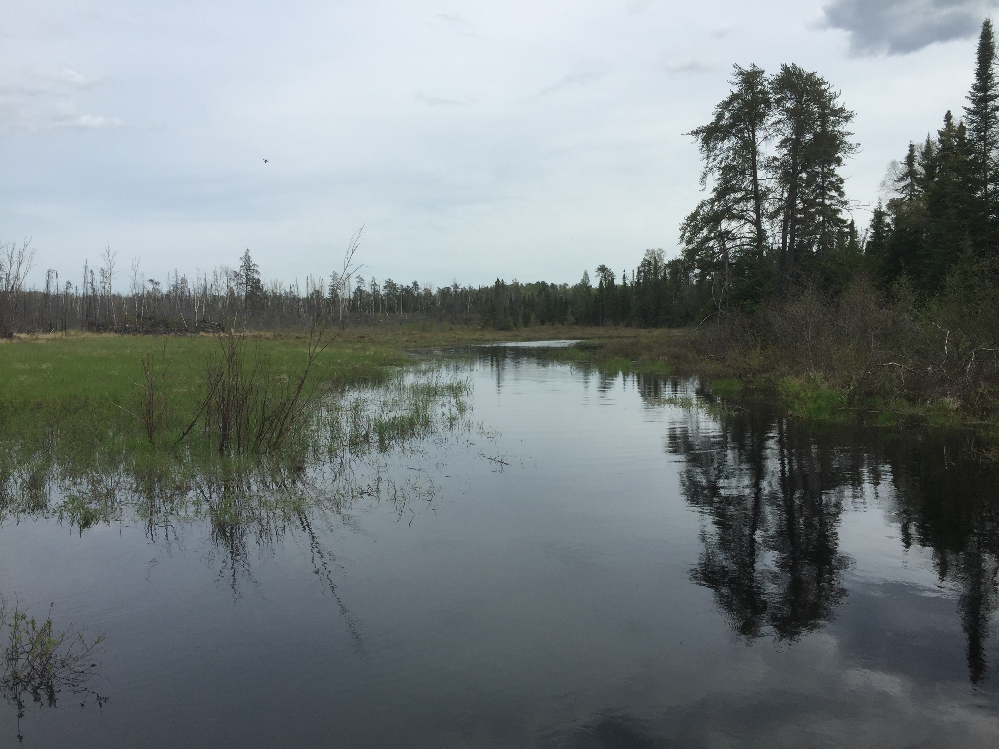
A short paddle down the Kawishiwi River from the Square Lake portage to the 5 rod portage that bypasses a tiny waterfall.
The 5 rod portage along the Kawishiwi River between Square Lake and Kawasachong Lake. This portage is a short ways downstream from the Square Lake portage. This portage bypasses a little waterfall.
From the downstream end of the 5 rod portage, you take in a nice view of the waterfall.
Shortly after the point where the creek flows in, you paddle by this cliff formation on the left side of the river.
Leaving the little waterfall behind, you continue along the Kawishiwi River, downstream. Shortly thereafter, the river bends sharply left. You pass the location where a creek flows into the river (about 4:10 mark in video). This creek arises out of Short Lake and Wantonwan Lake beyond.
A short ways downstream from the cliffs, you come to a beaver dam that requires a liftover. There is a good canoe pull out area on the right, as you are headed in the downstream direction toward Kawasachong Lake.
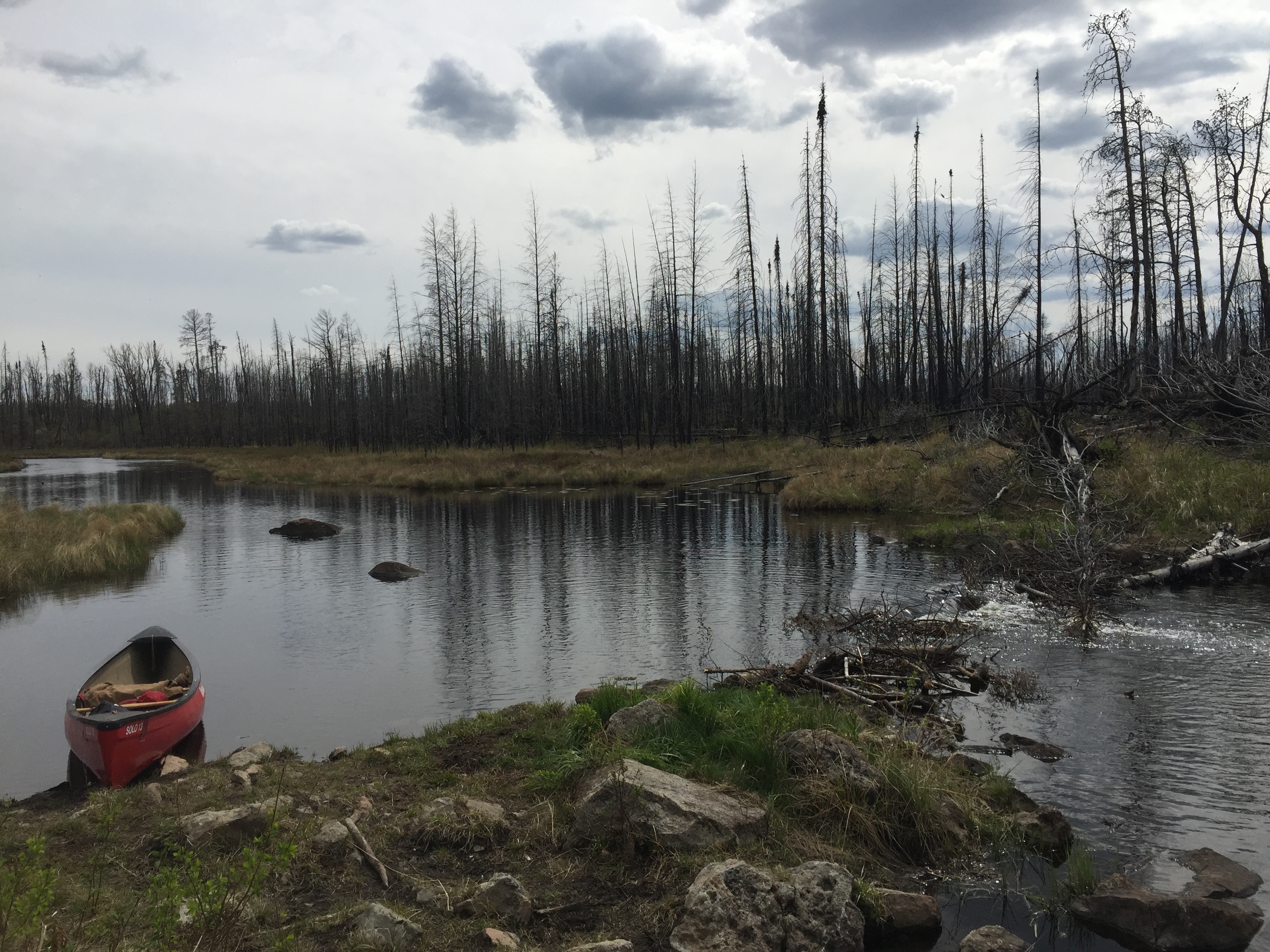
Pausing to watch the river flow over the beaver dam.
A good place to take a short break before making the final push into Kawasachong Lake.
Route Connections for Kawishiwi River (between Square Lake and Kawasachong Lake)